

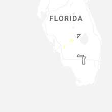
Hail Map for Monday, April 6, 2026

Number of Impacted Households on 4/6/2026
0
Impacted by 1" or Larger Hail
0
Impacted by 1.75" or Larger Hail
0
Impacted by 2.5" or Larger Hail
Square Miles of Populated Area Impacted on 4/6/2026
0
Impacted by 1" or Larger Hail
0
Impacted by 1.75" or Larger Hail
0
Impacted by 2.5" or Larger Hail
Cities Most Affected by Hail Storms of 4/6/2026
| Hail Size | Demographics of Zip Codes Affected | ||||||
|---|---|---|---|---|---|---|---|
| City | Count | Average | Largest | Pop Density | House Value | Income | Age |
Hail and Wind Damage Spotted on 4/6/2026
Filter by Report Type:Hail ReportsWind Reports
States Impacted
MississippiMississippi
| Local Time | Report Details |
|---|---|
| 3:57 PM CDT | A swath of straight-line winds was evident via high resolution planet satellite imagery that occurred with a line of severe thunderstorms east of pleasant grove and nor in wayne county MS, 85.2 miles NW of Mobile, AL |
Connect with Interactive Hail Maps