

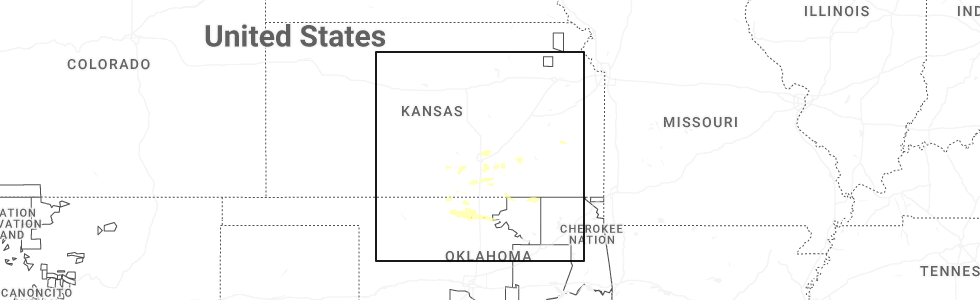
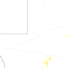
Hail Map for Thursday, June 18, 2026
Number of Impacted Households on 6/18/2026
0
Impacted by 1" or Larger Hail
0
Impacted by 1.75" or Larger Hail
0
Impacted by 2.5" or Larger Hail
Square Miles of Populated Area Impacted on 6/18/2026
0
Impacted by 1" or Larger Hail
0
Impacted by 1.75" or Larger Hail
0
Impacted by 2.5" or Larger Hail


Cities Most Affected by Hail Storms of 6/18/2026
| Hail Size | Demographics of Zip Codes Affected | ||||||
|---|---|---|---|---|---|---|---|
| City | Count | Average | Largest | Pop Density | House Value | Income | Age |
| Belle Plaine, KS | 1 | 1.75 | 1.75 | 29 | $73k | $49.8k | 39.6 |
| Anthony, KS | 1 | 1.75 | 1.75 | 11 | $45k | $26.1k | 44.9 |
Hail and Wind Damage Spotted on 6/18/2026
Filter by Report Type:Hail ReportsWind Reports
States Impacted
West Virginia, Kansas, Louisiana, New York, Kentucky, Mississippi, Virginia, Oklahoma, Georgia, Vermont, New Hampshire, South Carolina, Massachusetts, North Carolina, Florida, Maine, Alabama, Arkansas, South Dakota, New Mexico, California, TexasWest Virginia
| Local Time | Report Details |
|---|---|
| 8:00 AM EDT | Tree in roadway on wv-41 (5034 stanaford road in fayette county WV, 46.2 miles SE of Charleston, WV |
| 8:05 AM EDT | Several trees down in harman are in randolph county WV, 17.5 miles E of Elkins, WV |
| 8:05 AM EDT | Several trees dow in wyoming county WV, 45.5 miles S of Charleston, WV |
| 8:05 AM EDT | Over 900 residents without power due to tree damage. several concentrated areas of outages with time estimated based on rada in webster county WV, 40 miles SW of Elkins, WV |
| 8:08 AM EDT | Tree down blocking river roa in summers county WV, 57.2 miles SE of Charleston, WV |
| 8:15 AM EDT | Several trees down in the mcgraws communit in wyoming county WV, 47.9 miles SSE of Charleston, WV |
| 8:20 AM EDT | Multiple trees down in sophia... helen and coal city communitie in raleigh county WV, 48.3 miles SSE of Charleston, WV |
| 8:25 AM EDT | Over 300 power outages due to tree damage. time estimated based on radar. there were three concentrated area in randolph county WV, 16.9 miles ESE of Elkins, WV |
| 8:30 AM EDT | Over 2000 residents without power from tree damage. time estimated based on rada in raleigh county WV, 56.1 miles SSE of Charleston, WV |
| 8:30 AM EDT | Corrects previous tstm wnd dmg report from 4 e piney view. tree in roadway on wv-41 (5034 stanaford road in fayette county WV, 46.2 miles SE of Charleston, WV |
| 8:30 AM EDT | Tree down covering anvil rock lan in greenbrier county WV, 48.1 miles NW of Roanoke, VA |
| 8:35 AM EDT | Trees and lines down on farley branch r in raleigh county WV, 58 miles SSE of Charleston, WV |
| 8:35 AM EDT | Several areas of concentrated power outages from storm damage. over 2000 residents without power. time estimated based on rada in randolph county WV, 3.7 miles S of Elkins, WV |
| 8:35 AM EDT | Lines down on old nicholas road. time is estimated by rada in nicholas county WV, 48.2 miles ESE of Charleston, WV |
| 8:35 AM EDT | Tree damage resulting in approximately 40 customers without powe in nicholas county WV, 55.7 miles ESE of Charleston, WV |
| 8:36 AM EDT | Lines down on hominy falls road. time is estimated by rada in nicholas county WV, 50.5 miles ESE of Charleston, WV |
| 8:40 AM EDT | Around 700 residents without power from two concentrated areas. time estimated based on rada in raleigh county WV, 54.2 miles SSE of Charleston, WV |
| 8:40 AM EDT | Over 600 residents without power due to storm damage. there are a few concentrated areas. time estimated based on rada in wyoming county WV, 54.7 miles S of Charleston, WV |
| 8:47 AM EDT | Large tree down on matoaka roa in mercer county WV, 68.9 miles W of Roanoke, VA |
| 8:49 AM EDT | Tree down on athens roa in mercer county WV, 61.3 miles W of Roanoke, VA |
| 9:04 AM EDT | Power line down along wolfe bottom roa in mercer county WV, 69.9 miles NE of Bristol, TN |
| 9:17 AM EDT | Tree down blocking one lane of traffic near the intersection of new hope and surface hill roa in mercer county WV, 71.2 miles W of Roanoke, VA |
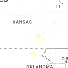
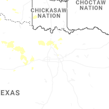
Kansas
| Local Time | Report Details |
|---|---|
| 7:10 AM CDT | Half Dollar sized hail reported near Iola, KS, 17.3 miles N of Chanute, KS, report via social media. |
| 9:08 AM CDT | Quarter sized hail reported near Mulvane, KS, 15.2 miles SSE of Wichita, KS, report from mping: quarter (1.00 in.). |
| 10:18 AM CDT | Quarter sized hail reported near Haysville, KS, 10.8 miles S of Wichita, KS |
| 2:59 PM CDT | Quarter sized hail reported near Anthony, KS, 52.1 miles SW of Wichita, KS |
| 3:04 PM CDT | Quarter sized hail reported near Anthony, KS, 53.2 miles SW of Wichita, KS, report from mping: quarter (1.00 in.). |
| 3:05 PM CDT | Ping Pong Ball sized hail reported near Anthony, KS, 53.2 miles SW of Wichita, KS, several photos from social media and broadcast media of hail quarter to ping pong ball size. time estimated from radar. |
| 3:08 PM CDT | Golf Ball sized hail reported near Anthony, KS, 53.2 miles SW of Wichita, KS |
| 5:29 PM CDT | Quarter sized hail reported near Conway Springs, KS, 22.9 miles SW of Wichita, KS, time estimated from radar. |
| 6:26 PM CDT | Quarter sized hail reported near Belle Plaine, KS, 20 miles S of Wichita, KS |
| 6:29 PM CDT | Half Dollar sized hail reported near Belle Plaine, KS, 20.6 miles S of Wichita, KS, quarter size hail with a few half dollar size hailstones. time estimated from radar. |
| 6:29 PM CDT | Quarter sized hail reported near Belle Plaine, KS, 20.6 miles S of Wichita, KS |
| 6:31 PM CDT | Quarter sized hail reported near Belle Plaine, KS, 21.1 miles SSE of Wichita, KS, time estimated from radar. |
| 6:31 PM CDT | Golf Ball sized hail reported near Belle Plaine, KS, 20.7 miles S of Wichita, KS, many half dollar size stones on the ground with a few golf ball size stones observed. time estimated from radar. |
Louisiana
| Local Time | Report Details |
|---|---|
| 7:14 AM CDT | Social media report of powerlines... trees and fences down in lakeshore village. possible tornad in st. tammany county LA, 26.9 miles NE of New Orleans, LA |
| 7:25 AM CDT | Trees downed in avery estates in slidell. possible tornad in st. tammany county LA, 29.6 miles NE of New Orleans, LA |
| 8:24 AM CDT | Picture on social media showed water in cars parked along brownswitch in slidel in st. tammany county LA, 31.4 miles NE of New Orleans, LA |
| 8:26 AM CDT | Significant flooding in crossgates neighborhood in slidell. water encroaching on home in st. tammany county LA, 31.5 miles NE of New Orleans, LA |
| 8:40 AM CDT | A picture on social media showed powerlines downed by thunderstorm winds along highway 43 in st. tammany county LA, 34 miles NNE of New Orleans, LA |
| 11:30 AM CDT | Tree fell on a car on hwy 21 and fairgrounds... in bus in st. tammany county LA, 46.9 miles NNE of New Orleans, LA |
New York
| Local Time | Report Details |
|---|---|
| 8:58 AM EDT | Several reports of large trees down near delevan. social media report. time estimated by rada in cattaraugus county NY, 34.6 miles SE of Buffalo, NY |
| 9:30 AM EDT | Downed tree causing the road to be closed on ny 19 near canal street in the town of belfas in allegany county NY, 51.8 miles SE of Buffalo, NY |
| 9:46 AM EDT | Multiple reports of trees and wires down across the town of palmyr in wayne county NY, 54.8 miles W of Syracuse, NY |
| 9:53 AM EDT | Multiple reports of trees and wires down across the town of friendshi in allegany county NY, 60.3 miles SE of Buffalo, NY |
| 10:03 AM EDT | Multiple reports of trees down across the town of sci in allegany county NY, 67.4 miles SE of Buffalo, NY |
| 10:08 AM EDT | Multiple reports of trees down... and trees and wires down across the town of clyd in wayne county NY, 36.6 miles W of Syracuse, NY |
| 10:12 AM EDT | Tree down on road with powerlines. near mill road hopkins road intersection. radar-estimated tim in steuben county NY, 78.6 miles ESE of Buffalo, NY |
| 10:13 AM EDT | A couple of trees down on propert in wayne county NY, 30.9 miles WNW of Syracuse, NY |
| 10:18 AM EDT | Multiple reports of trees and wires down across the town of hanniba in oswego county NY, 28.7 miles NW of Syracuse, NY |
| 10:27 AM EDT | Trees and wires down in waterloo at larsen road... chadwick drive... and stark street as per county dispatch fee in seneca county NY, 37.4 miles WSW of Syracuse, NY |
| 10:31 AM EDT | Large tree split and fell into yard and partly onto a hous in onondaga county NY, 12.8 miles NW of Syracuse, NY |
| 10:35 AM EDT | Wires down with arcing. terrace lane... as per county dispatch feed. radar-estimated tim in steuben county NY, 70.6 miles SW of Syracuse, NY |
| 10:38 AM EDT | Multiple reports of trees and wires down across the town of schroeppe in oswego county NY, 16.4 miles NNW of Syracuse, NY |
| 10:42 AM EDT | Multiple reports of trees and wires down across the town of independenc in allegany county NY, 78.5 miles SE of Buffalo, NY |
| 10:45 AM EDT | Trees down with vehicle fire... dundee area as per county dispatch feed. radar-estimated tim in yates county NY, 55.9 miles SW of Syracuse, NY |
| 10:45 AM EDT | Fire from tree down on powerlines at residence along tucker road... nearby tree down blocking bonny hill road. radar-estimated tim in steuben county NY, 79.7 miles SW of Syracuse, NY |
| 10:48 AM EDT | Multiple reports of trees and wires down across the tow in oswego county NY, 16.4 miles NNE of Syracuse, NY |
| 10:50 AM EDT | Tree down on leaking propane tank with possible damage to building on reading road. county dispatch feed... radar-estimated tim in yates county NY, 56.5 miles SW of Syracuse, NY |
| 10:55 AM EDT | Large tree down... then path through vineyard... many secured vineyard posts and vines were snapped in a west to east directio in yates county NY, 56.1 miles SW of Syracuse, NY |
| 10:55 AM EDT | At least a couple trees down in tyrone... including on roadwa in schuyler county NY, 64 miles SW of Syracuse, NY |
| 10:55 AM EDT | Tree down blocking road in cayuga county NY, 24.7 miles WSW of Syracuse, NY |
| 11:15 AM EDT | Lines down on henry street as per county dispatch feed. radar-estimated tim in schuyler county NY, 60.1 miles SW of Syracuse, NY |
| 11:25 AM EDT | Tree and wires down on blackcreek roa in madison county NY, 13 miles ENE of Syracuse, NY |
| 11:30 AM EDT | Tree and wires dow in onondaga county NY, 14.6 miles NW of Syracuse, NY |
| 11:38 AM EDT | Many trees sheared and one structure with roof damag in cortland county NY, 31.2 miles S of Syracuse, NY |
| 11:38 AM EDT | Multiple trees down in cortland... especially along greenbush st and rte 28 in cortland county NY, 31.1 miles S of Syracuse, NY |
| 11:38 AM EDT | Tree down on hous in cortland county NY, 31.1 miles S of Syracuse, NY |
| 11:38 AM EDT | Three large trees fell on three cars across suny cortland. one of the trees also knocked over a light post and damaged a fenc in cortland county NY, 31.8 miles S of Syracuse, NY |
| 11:39 AM EDT | Trees and wires down near fall creek and college ave... numerous other wires down throughout ithaca area as per county dispatch fee in tompkins county NY, 45.8 miles SSW of Syracuse, NY |
| 11:40 AM EDT | Multiple pictures of fallen trees on cars... buildings... over roads that are across cortland ny. reports taken from social medi in cortland county NY, 31.1 miles S of Syracuse, NY |
| 11:40 AM EDT | Multiple pictures of fallen trees on cars... buildings... over roads that are across cortland ny. reports taken from social medi in cortland county NY, 31.1 miles S of Syracuse, NY |
| 11:40 AM EDT | Tree snapped and fell on vehicle. windshield and sunroof of the vehicle were broke in cortland county NY, 30.4 miles S of Syracuse, NY |
| 11:50 AM EDT | Lines down with arcing along homewood avenue as per county dispatch feed. radar-estimated tim in chemung county NY, 75.2 miles SSW of Syracuse, NY |
| 11:52 AM EDT | Wires down on roadwa in oneida county NY, 52.2 miles ENE of Syracuse, NY |
| 12:05 PM EDT | Trees and wires down on roa in chenango county NY, 30.8 miles SE of Syracuse, NY |
| 12:07 PM EDT | Tree down on williams r in madison county NY, 27.8 miles ESE of Syracuse, NY |
| 12:07 PM EDT | Downed tree and wires closing both lanes on union st between rosendale rd and balltown r in schenectady county NY, 2.7 miles ESE of Schenectady, NY |
| 12:15 PM EDT | Tree down on roadway... at dunham road and highway 80. radar-estimated tim in chenango county NY, 37.3 miles SE of Syracuse, NY |
| 12:15 PM EDT | Large tree on robert williams r in otsego county NY, 62.1 miles SE of Syracuse, NY |
| 12:17 PM EDT | Trees and wires dow in herkimer county NY, 58.2 miles ENE of Syracuse, NY |
| 12:20 PM EDT | Trees dow in herkimer county NY, 56.9 miles WNW of Schenectady, NY |
| 12:25 PM EDT | Tree down on roa in otsego county NY, 65.6 miles WSW of Schenectady, NY |
| 12:56 PM EDT | Tree down on east main st near hooper r in broome county NY, 51.7 miles NNW of Scranton, PA |
| 12:56 PM EDT | Wires down in yar in otsego county NY, 53.9 miles W of Schenectady, NY |
| 12:58 PM EDT | Tree down on beaver s in otsego county NY, 51 miles W of Schenectady, NY |
| 12:59 PM EDT | Tree down on new york route 28 between austin pond road and stork road in the town of johnsbur in warren county NY, 59.9 miles N of Schenectady, NY |
| 1:01 PM EDT | Tree and wires down on a hous in clinton county NY, 19.7 miles NW of Burlington, VT |
| 1:04 PM EDT | Tree and wires down... partially into roadway. highway 8 and county road 3 in chenango county NY, 62 miles SE of Syracuse, NY |
| 1:05 PM EDT | Tree down blocking both lanes. highway 206 and west juliand hill road intersectio in chenango county NY, 53.3 miles SSE of Syracuse, NY |
| 1:08 PM EDT | Tree... powerlines... and power pole down across squirrel hill roa in chenango county NY, 56.3 miles SSE of Syracuse, NY |
| 1:10 PM EDT | Tree down on east stree in broome county NY, 49.5 miles NNW of Scranton, PA |
| 1:10 PM EDT | Tree and wires down on heller roa in otsego county NY, 37.6 miles W of Schenectady, NY |
| 1:10 PM EDT | Tree down on roadwa in otsego county NY, 40.1 miles W of Schenectady, NY |
| 1:12 PM EDT | Trees and wires down on furman mills roa in chenango county NY, 39.6 miles ESE of Syracuse, NY |
| 1:16 PM EDT | Large tree down on hudson street in warrensburg leading to a road closur in warren county NY, 48.1 miles N of Schenectady, NY |
| 1:19 PM EDT | Tree down near intersection of ouaquaga road and hawkins roa in broome county NY, 50.5 miles N of Scranton, PA |
| 1:19 PM EDT | Tree down w/ wires on the groun in montgomery county NY, 13.9 miles NW of Schenectady, NY |
| 1:21 PM EDT | Tree down on route 50 southbound near rock street in saratoga spring in saratoga county NY, 20.8 miles NNE of Schenectady, NY |
| 1:21 PM EDT | Tree down on harold s in broome county NY, 47.9 miles N of Scranton, PA |
| 1:31 PM EDT | Tree down blocking roa in montgomery county NY, 32.4 miles W of Schenectady, NY |
| 1:31 PM EDT | Tree down on car in parking lot between clifton park village road and old plank road. photo from social medi in saratoga county NY, 9.6 miles ENE of Schenectady, NY |
| 1:43 PM EDT | Multiple downed and snapped tree and metal siding ripped off structures near the corner of county route 31 and big burch hill road in granville... ny. trained spotter s in washington county NY, 47.6 miles NE of Schenectady, NY |
| 1:44 PM EDT | Corrected time of report. trees and wires down across road near intersection of south grimes hill road and state highway 2 in washington county NY, 47 miles NE of Schenectady, NY |
| 1:44 PM EDT | Tree on vehicle with live wires with people in vehicle... unknown injurie in otsego county NY, 40.2 miles WSW of Schenectady, NY |
| 1:46 PM EDT | Tree down on overlook d in delaware county NY, 64.1 miles WSW of Schenectady, NY |
| 1:55 PM EDT | Tree down on roa in delaware county NY, 60.6 miles WSW of Schenectady, NY |
| 1:56 PM EDT | Wires were downed on route 372 between stevenson road and county route 60 near the town of cambridg in washington county NY, 31 miles ENE of Schenectady, NY |
| 1:59 PM EDT | Tree down/snappe in montgomery county NY, 13.3 miles NW of Schenectady, NY |
| 2:01 PM EDT | Trees and wires down across roa in washington county NY, 47 miles NE of Schenectady, NY |
| 2:04 PM EDT | Tree down on wire in schenectady county NY, 0.5 miles WSW of Schenectady, NY |
| 2:06 PM EDT | Large tree down on a house on schauber road in ballston lak in saratoga county NY, 8.5 miles NNE of Schenectady, NY |
| 2:10 PM EDT | Large tree and power lines down on evergreen avenue between grooms road and teakwood drive in clifton gardens. power out in the are in saratoga county NY, 8.4 miles ENE of Schenectady, NY |
| 2:14 PM EDT | A member of the public called and reported siding ripped off of a house and several downed branches at a residence in waterford near the intersection of guideboard road in saratoga county NY, 11.3 miles E of Schenectady, NY |
| 2:15 PM EDT | Storm damage reported in saratoga county NY, 8.4 miles ENE of Schenectady, NY |
| 2:18 PM EDT | Tree down in west end park off columbia street in cohoe in albany county NY, 12.1 miles ESE of Schenectady, NY |
| 2:20 PM EDT | Multiple trees down around colcheste in delaware county NY, 60.4 miles NNE of Scranton, PA |
| 2:30 PM EDT | Tree down/snapped on property on evergreen r in rensselaer county NY, 16.9 miles ESE of Schenectady, NY |
| 2:36 PM EDT | Large tree down at the intersection of knox blvd and ny 23 in saratoga county NY, 11 miles ENE of Schenectady, NY |
| 2:47 PM EDT | Tree down on roa in delaware county NY, 60.7 miles SW of Schenectady, NY |
| 2:53 PM EDT | Tree down on route 43 near higgins road in the town of sand lak in rensselaer county NY, 19.8 miles SE of Schenectady, NY |
| 3:20 PM EDT | Tree down blocking roa in rensselaer county NY, 24.5 miles ESE of Schenectady, NY |
| 3:55 PM EDT | Tree down on dugway road in the town of austerlit in columbia county NY, 40.5 miles SSE of Schenectady, NY |
Kentucky
| Local Time | Report Details |
|---|---|
| 9:05 AM EDT | West of intersection wires completely down obstructing the roa in jefferson county KY, 24.1 miles N of Louisville, KY |
| 9:09 AM EDT | Trees downed from thunderstorm winds. delayed report. time estimated from rada in shelby county KY, 30.4 miles NE of Louisville, KY |
Mississippi
| Local Time | Report Details |
|---|---|
| 8:05 AM CDT | Tree damage reported on cemetery roa in harrison county MS, 60.7 miles NE of New Orleans, LA |
| 8:13 AM CDT | Tree down blocking traffic on star road just north of coke road in brando in rankin county MS, 12.7 miles ESE of Jackson, MS |
| 9:00 AM CDT | Trees on house. occupants were rescue in hancock county MS, 58.9 miles NE of New Orleans, LA |
| 11:40 AM CDT | Wlox viewer reported trees down near bendale near the stone county border. time and location estimate in george county MS, 49.3 miles WNW of Mobile, AL |
| 12:05 PM CDT | The weatherflow mesonet in gulfport measured a thunderstorm wind gust of 78 mp in harrison county MS, 65.2 miles ENE of New Orleans, LA |
| 12:30 PM CDT | A tree fell on a power line near ridge street in ackerma in choctaw county MS, 23.1 miles WSW of Starkville, MS |
| 1:30 PM CDT | Tree debris from live oaks... branches up to 2 inch diamete in hancock county MS, 48.6 miles ENE of New Orleans, LA |
Virginia
| Local Time | Report Details |
|---|---|
| 9:30 AM EDT | Winds from strong showers blew a tree down on enterprise lane at the intersection with n scenic highwa in bland county VA, 65 miles W of Roanoke, VA |
| 9:53 AM EDT | Strong winds from showers downed a tree near the intersection of nemmo road and saunders roa in bedford county VA, 12.2 miles E of Roanoke, VA |
| 9:54 AM EDT | Winds from strong showers blew a tree down on whistler drive near the intersection with old mill roa in roanoke county VA, 9.5 miles SW of Roanoke, VA |
| 12:10 PM EDT | Corrects previous tstm wnd dmg report from 2 ne vernon hill. tree dow in halifax county VA, 58.4 miles SE of Roanoke, VA |
| 12:20 PM EDT | Tree dow in halifax county VA, 58.4 miles SE of Roanoke, VA |
| 12:27 PM EDT | Thunderstorm wind blew a tree down on greens folly road between avondale dr and fan park driv in halifax county VA, 66.8 miles ESE of Roanoke, VA |
| 12:30 PM EDT | Thunderstorm winds downed a tree on james d hagood highway near the intersection with bethel/scottsburg roa in halifax county VA, 68.6 miles N of Raleigh, NC |
| 12:33 PM EDT | Thunderstorm winds downed a tree on clover road near the charlotte county borde in halifax county VA, 72.5 miles SW of Richmond, VA |
| 12:40 PM EDT | Large tree branches down. roofing metal torn off building and in the road. community is outside clearing the street in halifax county VA, 72.7 miles ESE of Roanoke, VA |
| 12:50 PM EDT | The 911 call center reported a tree down near the intersection of allgood road and highway 92 in chase city. time estimated from rada in mecklenburg county VA, 69.8 miles SW of Richmond, VA |
| 12:56 PM EDT | Corrects previous tstm wnd dmg report from 6 ese ringgold. tree dow in halifax county VA, 62.9 miles SE of Roanoke, VA |
| 1:14 PM EDT | Tree dow in halifax county VA, 62.9 miles SE of Roanoke, VA |
| 2:00 PM EDT | Member of public reported a large downed pine tree in their yard. a picture showed the tree to be rotted near the bas in greensville county VA, 52 miles S of Richmond, VA |
| 3:00 PM EDT | Several trees down between dungannon and nickelsvill in scott county VA, 19.2 miles NW of Bristol, TN |
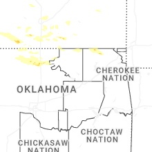
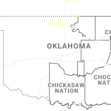
Oklahoma
| Local Time | Report Details |
|---|---|
| 9:05 AM CDT | Nowata mesone in nowata county OK, 47.8 miles NNE of Tulsa, OK |
| 9:40 AM CDT | Powerlines down south of lamont on us 6 in grant county OK, 70.5 miles S of Wichita, KS |
| 9:47 AM CDT | Half Dollar sized hail reported near Pond Creek, OK, 73.3 miles SSW of Wichita, KS, report from mping: half dollar (1.25 in.). |
| 12:38 PM CDT | Quarter sized hail reported near Pond Creek, OK, 73.3 miles SSW of Wichita, KS, report from mping: quarter (1.00 in.). |
| 12:44 PM CDT | Quarter sized hail reported near Lamont, OK, 69.9 miles S of Wichita, KS |
| 12:50 PM CDT | Wind damage at railroad crossing. the time of the damage is unknow in grant county OK, 74.7 miles SSW of Wichita, KS |
| 12:54 PM CDT | Half Dollar sized hail reported near Pond Creek, OK, 74.7 miles SSW of Wichita, KS |
| 1:48 PM CDT | Quarter sized hail reported near Billings, OK, 75.7 miles S of Wichita, KS, report from mping: quarter (1.00 in.). |
| 4:26 AM CDT | Storm damage reported in tillman county OK, 41.4 miles NW of Wichita Falls, TX |
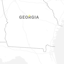
Georgia
| Local Time | Report Details |
|---|---|
| 11:58 AM EDT | Trees reported down off elmtree driv in cherokee county GA, 26.4 miles NNW of Atlanta, GA |
| 12:09 PM EDT | Trees reported down off palm stree in cherokee county GA, 29.1 miles NNW of Atlanta, GA |
| 12:11 PM EDT | Trees reported down off butterworth road and knox bridge hw in cherokee county GA, 32.8 miles NNW of Atlanta, GA |
| 12:14 PM EDT | Trees reported down near lower union hill road and thomas roa in cherokee county GA, 29.8 miles N of Atlanta, GA |
| 12:17 PM EDT | Trees reports down off pin oak plac in cherokee county GA, 34.1 miles N of Atlanta, GA |
| 12:17 PM EDT | Trees reported down near reinhardt college parkway and lower burris roa in cherokee county GA, 37.3 miles N of Atlanta, GA |
| 12:20 PM EDT | Trees reported down off little refuge roa in cherokee county GA, 38.7 miles NNW of Atlanta, GA |
| 12:22 PM EDT | Trees down off creighton roa in cherokee county GA, 37.9 miles N of Atlanta, GA |
| 3:26 PM EDT | Broadcast media reports tree down on home on 800 block of crockett dr in columbus. no injurie in muscogee county GA, 29.9 miles ESE of Auburn, AL |
| 3:26 PM EDT | Broadcast media reports a tree down on bradley park dr near bristol blvd in columbu in muscogee county GA, 29.8 miles E of Auburn, AL |
| 3:45 PM EDT | Em reports tree down on powerlines along the 300 block of gilbert r in talbot county GA, 52.7 miles ENE of Auburn, AL |
| 3:45 PM EDT | Em reports tree down near 400 block of deer trail r in talbot county GA, 49.7 miles E of Auburn, AL |
| 3:50 PM EDT | A tree was downed onto greene settlement roa in jones county GA, 65.9 miles SE of Atlanta, GA |
| 3:52 PM EDT | Power lines down across the road near 1980 low ground road. power outages were reported in the area. time determined from radar dat in effingham county GA, 18.7 miles NW of Savannah, GA |
| 3:52 PM EDT | Em reports tree down at 1700 block of chestnut grove r in talbot county GA, 51.9 miles ENE of Auburn, AL |
| 3:56 PM EDT | Tree down along highway 8 in tift county GA, 44.5 miles W of Douglas, GA |
| 4:00 PM EDT | Emergency manager reports a tree down near the intersection of old buckhead road and lions club roa in morgan county GA, 55.9 miles E of Atlanta, GA |
| 4:05 PM EDT | Department of transportation reports a tree down near the intersection of highway 100 and hill haven roa in meriwether county GA, 52.4 miles SSW of Atlanta, GA |
| 4:07 PM EDT | A two foot diameter pine tree fell near the intersection of highway 119 and reedsville road. the downed tree blocked all lanes of travel. time determined from radar dat in effingham county GA, 32 miles NNW of Savannah, GA |
| 4:08 PM EDT | Public reports tree down on sunnyside rd near thomasto in upson county GA, 59.2 miles S of Atlanta, GA |
| 4:09 PM EDT | Em reported a power line down on the 2000 block of gugel street. time determined from radar dat in chatham county GA, 1.8 miles WNW of Savannah, GA |
| 4:10 PM EDT | A large tree branch was downed on garner stree in upson county GA, 56.5 miles S of Atlanta, GA |
| 4:20 PM EDT | Emergency manager reports tree down along log cabin roa in baldwin county GA, 76.8 miles ESE of Atlanta, GA |
| 4:22 PM EDT | Em reports several trees down on the south side of concord near eppinger rd... spring rd... and brazier and hollondville r in pike county GA, 46.1 miles S of Atlanta, GA |
| 4:25 PM EDT | Emergency manager reports tree down along pearl driv in baldwin county GA, 78 miles ESE of Atlanta, GA |
| 4:30 PM EDT | Public reports tree down near the intersection of highway 117 and doyle taylor roa in laurens county GA, 63.9 miles N of Douglas, GA |
| 4:35 PM EDT | Tree down on powerline in fayette county GA, 25.8 miles S of Atlanta, GA |
| 4:45 PM EDT | Department of transportation reports a tree down near the intersection of highway 77 and interstate 2 in greene county GA, 63.9 miles W of Augusta, GA |
| 4:47 PM EDT | Broadcast met relayed report of tree down on i285 s near i2 in fulton county GA, 5.8 miles W of Atlanta, GA |
| 4:50 PM EDT | Nws employee reports several trees down in roadway on i285 near bouldercrest rd southeas in dekalb county GA, 6.6 miles SE of Atlanta, GA |
| 4:50 PM EDT | Tree on powerlines closing road. time estimated with rada in henry county GA, 14.3 miles SE of Atlanta, GA |
| 4:55 PM EDT | Two trees were downed in piedmont park... one onto a buildin in fulton county GA, 2.3 miles NNE of Atlanta, GA |
| 4:55 PM EDT | A large tree fell partially on a home and a fence near hawthorne circl in henry county GA, 15.1 miles SE of Atlanta, GA |
| 5:00 PM EDT | Public called in with report of tree down on powerlines on e atlanta rd near glenloch pkw in henry county GA, 14.3 miles SE of Atlanta, GA |
| 5:00 PM EDT | Tree down on apartments. time estimated with rada in fulton county GA, 2.4 miles NNW of Atlanta, GA |
| 5:00 PM EDT | A large tree fell onto power lines... blocking candler roa in dekalb county GA, 7.2 miles ESE of Atlanta, GA |
| 5:50 PM EDT | Emergency manager reports a tree down near the intersection of bostwick highway and apalachee roa in morgan county GA, 50.7 miles E of Atlanta, GA |
| 5:55 PM EDT | Large branches dow in richmond county GA, 5.6 miles SSW of Augusta, GA |
| 5:59 PM EDT | Viewer reported to local media a tree fell on her vehicle on tailboard way in martine in columbia county GA, 7.5 miles WNW of Augusta, GA |
| 6:31 PM EDT | Tree down on ga 57 near the intersection of poole r in long county GA, 45.7 miles SW of Savannah, GA |
| 6:35 PM EDT | Public reports trees down along fulton roa in muscogee county GA, 42.8 miles E of Auburn, AL |
| 6:38 PM EDT | Public reports trees down along jenkins roa in muscogee county GA, 42.8 miles E of Auburn, AL |
| 6:40 PM EDT | Broadcast media reports several trees in the cedar pointe neighborhoo in muscogee county GA, 43.3 miles E of Auburn, AL |
| 7:05 PM EDT | Report of tree across the highwa in chattooga county GA, 37.7 miles S of Chattanooga, TN |
| 7:50 PM EDT | Fire department reports tree down near mcmath mill road and james hart roa in sumter county GA, 78.1 miles ESE of Auburn, AL |
| 8:00 PM EDT | Department of transportation reports a tree down near the intersection of highway 26 and highway 240. time estimated based on rada in macon county GA, 80.5 miles ESE of Auburn, AL |
| 8:12 PM EDT | Multiple trees were downed along klopfer roa in monroe county GA, 64.2 miles SSE of Atlanta, GA |
| 8:20 PM EDT | Public reports multiple trees snapped and downed along the end of rivermist roa in monroe county GA, 65.1 miles SE of Atlanta, GA |
| 8:30 PM EDT | Social media photo of a tree uprooted onto a parked vehicle from the audubon are in dougherty county GA, 79.3 miles N of Tallahassee, FL |
| 8:31 PM EDT | Several trees down in the albany are in dougherty county GA, 78.7 miles W of Douglas, GA |
| 8:55 PM EDT | Trees and power lines were downed on whipporwill lane at phillips roa in putnam county GA, 69 miles SE of Atlanta, GA |
| 8:55 PM EDT | Em reports tree down on 212 near the county line. tornado damage possibl in baldwin county GA, 68.9 miles SE of Atlanta, GA |
| 9:10 PM EDT | Public reports two large trees down along crooked creek roa in putnam county GA, 73 miles ESE of Atlanta, GA |
| 10:27 PM EDT | Report of some trees down and power outages in early count in early county GA, 75.7 miles NNW of Tallahassee, FL |
| 10:55 PM EDT | 511ga reports fallen trees on sr 377 eastbound at sr 11 in lee county GA, 83.5 miles WNW of Douglas, GA |
| 11:15 PM EDT | Tree down near hawkinstow in baker county GA, 57.4 miles N of Tallahassee, FL |
| 11:20 PM EDT | Tree down in the warwick are in worth county GA, 66.9 miles WNW of Douglas, GA |
| 11:50 PM EDT | Couple of power poles leaning in sylveste in worth county GA, 58.5 miles W of Douglas, GA |
| 11:54 PM EDT | Tree down in the shingler are in worth county GA, 55.7 miles W of Douglas, GA |
| 12:59 AM EDT | 511ga reports fallen trees on sr 125 eastbound at parker chapel r in berrien county GA, 33.9 miles WSW of Douglas, GA |
| 3:47 AM EDT | Fire department reports multiple trees down along a quarter mile stretch of mcmath mill roa in sumter county GA, 78.1 miles ESE of Auburn, AL |
| 7:01 AM EDT | 511ga reports trees down on sr107 at river road east of fitzgeral in ben hill county GA, 23.3 miles NW of Douglas, GA |
Vermont
| Local Time | Report Details |
|---|---|
| 1:35 PM EDT | Tree down on munger stree in addison county VT, 30.4 miles S of Burlington, VT |
| 2:00 PM EDT | Trees and powerlines dow in addison county VT, 28 miles SSE of Burlington, VT |
| 2:08 PM EDT | Trees and powerlines dow in rutland county VT, 58.7 miles NE of Schenectady, NY |
| 2:10 PM EDT | Tree down in power lines on chandler road in northfield. time estimated by rada in washington county VT, 34.6 miles SE of Burlington, VT |
| 2:12 PM EDT | Large tree snapped. several other trees also sustained damag in rutland county VT, 55.8 miles SSE of Burlington, VT |
| 2:20 PM EDT | Reports of at least one tree down which knocked down powerline in washington county VT, 40.9 miles ESE of Burlington, VT |
| 2:22 PM EDT | Downed power lines. time estimated from rada in washington county VT, 40.6 miles ESE of Burlington, VT |
| 2:28 PM EDT | Numerous powerlines blown dow in orange county VT, 41.5 miles SE of Burlington, VT |
| 2:38 PM EDT | Downed/snapped trees and structural damage of barn/shed in bridgewater/woodstock reported via social media. time estimated from rada in windsor county VT, 67.7 miles SSE of Burlington, VT |
| 2:40 PM EDT | Tree and power lines down on route 313 at route 7a in arlingto in bennington county VT, 43.4 miles ENE of Schenectady, NY |
| 2:51 PM EDT | Emergency services responding to multiple downed trees and wires throughout the community. time estimated from rada in windsor county VT, 70 miles SE of Burlington, VT |
| 2:51 PM EDT | Video showing numerous trees uprooted with extensive damage to a wooden fenc in windsor county VT, 70.8 miles SE of Burlington, VT |
| 2:53 PM EDT | Trees and utility lines down on us route 7 at barbers pond road in powna in bennington county VT, 36.7 miles E of Schenectady, NY |
| 3:00 PM EDT | Hartford fire dept reported downed powerlines near brookside drive as well as a significant area of uprooted/broken trees. one tree fell into a garage on christian stre in windsor county VT, 70.9 miles SE of Burlington, VT |
| 3:18 PM EDT | Multiple trees and power lines down throughout the town of dummersto in windham county VT, 68.1 miles E of Schenectady, NY |
| 3:23 PM EDT | Tree and wires down on dorsch hill in westminste in windham county VT, 73.4 miles ENE of Schenectady, NY |
| 3:25 PM EDT | Tree down on wires on old ledge road in the town of westminste in windham county VT, 75.1 miles ENE of Schenectady, NY |
New Hampshire
| Local Time | Report Details |
|---|---|
| 3:05 PM EDT | Chaser measured recent wind gust of 64 mph in claremont on a handheld anemomete in sullivan county NH, 87.3 miles SSE of Burlington, VT |
| 3:05 PM EDT | Multiple trees and power lines down on red water brook road in claremon in sullivan county NH, 85.6 miles SSE of Burlington, VT |
| 3:05 PM EDT | Trees and wires down. time estimated from rada in grafton county NH, 82 miles SE of Burlington, VT |
| 3:10 PM EDT | Large tree down across moss flower rd. time estimated from rada in grafton county NH, 81.1 miles SE of Burlington, VT |
| 3:10 PM EDT | Tree and wires down blocking west bath rd in the area of pettyboro rd in bath. time estimated by rada in grafton county NH, 65.1 miles ESE of Burlington, VT |
| 3:15 PM EDT | Trees and wires down. time estimated from rada in sullivan county NH, 85.2 miles SE of Burlington, VT |
| 3:20 PM EDT | Trees and wires down blocking dunham road. time estimated by rada in sullivan county NH, 87.5 miles ENE of Schenectady, NY |
| 3:20 PM EDT | Trees down on jabe meadow roa in sullivan county NH, 81.1 miles ENE of Schenectady, NY |
| 3:20 PM EDT | Tree down blocking chaffee lane in langdon... n in sullivan county NH, 81.4 miles ENE of Schenectady, NY |
| 3:25 PM EDT | Trees and wires dow in cheshire county NH, 78.8 miles ENE of Schenectady, NY |
| 3:30 PM EDT | Trees dow in sullivan county NH, 92.5 miles ENE of Schenectady, NY |
| 3:30 PM EDT | Wires down blocking old north groton road in rumney... n in grafton county NH, 79.8 miles W of Portland, ME |
| 3:30 PM EDT | Trees and wires down blocking ryder corner road in the area of north roa in sullivan county NH, 92.4 miles SE of Burlington, VT |
| 3:35 PM EDT | Tree down blocking nh-103b in sunape in sullivan county NH, 93.6 miles SE of Burlington, VT |
| 3:37 PM EDT | Trees down cady lan in cheshire county NH, 77.5 miles E of Schenectady, NY |
| 3:43 PM EDT | Tree and wires down blocking brook rd in new hampto in belknap county NH, 72.6 miles W of Portland, ME |
| 3:43 PM EDT | Bristol fire reporting multiple trees and powerlines down in the area of hemlock brook rd. time estimated by rada in grafton county NH, 73.9 miles W of Portland, ME |
| 3:43 PM EDT | Tree on house... power lines down across the road. time estimated from rada in cheshire county NH, 85 miles E of Schenectady, NY |
| 3:45 PM EDT | Large tree down on cheshire rd. time estimated from rada in cheshire county NH, 84.5 miles NNW of Providence, RI |
| 3:48 PM EDT | Several trees down on orchard lane in gilsum. time estimated by rada in cheshire county NH, 86.2 miles E of Schenectady, NY |
| 3:50 PM EDT | Trees and power lines down on court st in keene. time estimated by rada in cheshire county NH, 83.9 miles E of Schenectady, NY |
| 3:50 PM EDT | Trees dow in cheshire county NH, 87.7 miles E of Schenectady, NY |
| 3:53 PM EDT | Wires down blocking nh-3a in franklin. time estimated by rada in merrimack county NH, 71.4 miles W of Portland, ME |
| 3:55 PM EDT | Large tree down. barely missed a hous in cheshire county NH, 79.8 miles NNW of Providence, RI |
| 3:55 PM EDT | Tree and wires down blocking bay rd in sanbornton. time estimated by rada in belknap county NH, 64.6 miles W of Portland, ME |
| 3:55 PM EDT | Tree down blocking hunkins hill rd in sanbornton. time estimated by rada in belknap county NH, 66.8 miles W of Portland, ME |
| 4:00 PM EDT | Trees and wires down blocking peverly rd in northfield. time estimated by rada in merrimack county NH, 69.8 miles WSW of Portland, ME |
| 4:00 PM EDT | Trees and wires down on west main stree in hillsborough county NH, 87.7 miles NNW of Providence, RI |
| 4:03 PM EDT | Wires down blocking parade rd in meredith. time estimated by rada in belknap county NH, 66.3 miles W of Portland, ME |
| 4:05 PM EDT | Trees down in east sandwic in carroll county NH, 57.2 miles W of Portland, ME |
| 4:08 PM EDT | Tree and wires down blocking nh-11 in gilford. time estimated by rada in belknap county NH, 54.3 miles W of Portland, ME |
| 4:10 PM EDT | Trees and wires dow in hillsborough county NH, 78.1 miles NNW of Providence, RI |
| 4:20 PM EDT | Tree and wires down blocking nh-129 in the area of nh-107 in gilmanton. time estimated by rada in belknap county NH, 58.4 miles WSW of Portland, ME |
| 4:23 PM EDT | Tree and wires down on emery road. time estimated by rada in hillsborough county NH, 76.6 miles NNW of Providence, RI |
| 4:23 PM EDT | Power lines down blocking nh-124. time estimated by rada in hillsborough county NH, 72.2 miles NNW of Providence, RI |
| 4:25 PM EDT | Social media report of tree completely blocking the northbound lane of nh-13. time estimated by rada in hillsborough county NH, 82.7 miles N of Providence, RI |
| 4:25 PM EDT | Tree down blocking nh-28 in the area of emerson drive in alton. time estimated by rada in belknap county NH, 50.2 miles WSW of Portland, ME |
| 4:36 PM EDT | Trees down on wires. trees blocking roa in strafford county NH, 51.7 miles WSW of Portland, ME |
| 4:47 PM EDT | Trees down blocking wilsons crossing road in auburn... nh. time estimated by rada in rockingham county NH, 72.4 miles SW of Portland, ME |
| 4:53 PM EDT | Tree down blocking roberts road in strafford. time estimated by rada in strafford county NH, 49 miles WSW of Portland, ME |
| 4:55 PM EDT | Several trees and powerlines down in derry. time estimated by rada in rockingham county NH, 73 miles N of Providence, RI |
| 5:04 PM EDT | Tree down completely blocking north lowell road in the area of camelot road. time estimated by rada in rockingham county NH, 69 miles N of Providence, RI |
| 5:05 PM EDT | 18-inch diameter white pine snapped and partially blocking corinthian drive and a driveway in salem. time estimated by rada in rockingham county NH, 70.9 miles N of Providence, RI |
| 5:17 PM EDT | Portsmouth fd responding to multiple calls for trees down blocking roads. time estimated by rada in rockingham county NH, 48.8 miles SSW of Portland, ME |
South Carolina
| Local Time | Report Details |
|---|---|
| 3:20 PM EDT | Aiken em reported tree fell and downed power lines near the entrance to citizens park at woodvale l in aiken county SC, 16.4 miles ENE of Augusta, GA |
| 4:19 PM EDT | Jasper county warning point reported a tree down at the 10000 block of cotton hill roa in jasper county SC, 35.7 miles N of Savannah, GA |
| 4:27 PM EDT | Tree fell on power lines causing a fire at the woodland terrace condo in richland county SC, 67.3 miles ENE of Augusta, GA |
| 4:27 PM EDT | Bluffton fire reported a tree down at 3090 bluffton parkway... partially blocking the roadway. time determined from radar dat in beaufort county SC, 16.7 miles NE of Savannah, GA |
| 4:32 PM EDT | Jasper county warning point reported a tree down at old house road and honey hill circl in jasper county SC, 28.9 miles NNE of Savannah, GA |
| 4:55 PM EDT | Hampton county warning point reported a tree down at highway 21 near pocotaligo roa in hampton county SC, 44.3 miles NNE of Savannah, GA |
| 4:57 PM EDT | Hampton county warning point reported a tree down at river road and le creuset roa in beaufort county SC, 44.7 miles NNE of Savannah, GA |
| 5:00 PM EDT | Tree down near the intersection of hendersonville highway and lowcountry highway. the tree was blocking one lane of traffic. time determined from radar dat in colleton county SC, 47.2 miles NNE of Savannah, GA |
| 5:09 PM EDT | A tree was reported down near the interesection of cane branch road and lucky road blocking both lanes of traffic. time determined from radar dat in colleton county SC, 52.9 miles WSW of Charleston, SC |
| 5:20 PM EDT | South carolina highway patrol reported a tree down on confederate highwa in colleton county SC, 56.1 miles WSW of Charleston, SC |
| 5:38 PM EDT | 5-6 trees down near 1900 block of sunrise road. tree down on house in the 3500 block of clatty far in colleton county SC, 45.1 miles W of Charleston, SC |
| 5:38 PM EDT | Tree down on rehoboth road and rhode driv in colleton county SC, 31.3 miles WSW of Charleston, SC |
| 5:46 PM EDT | Em reported trees down near 6187 bears bluff road. time estimated using radar dat in charleston county SC, 37.9 miles SSW of Charleston, SC |
| 5:50 PM EDT | Power line reported down near at the 5800 block of chisolm road. time estimated using radar dat in charleston county SC, 33.4 miles S of Charleston, SC |
| 5:53 PM EDT | Em reported a tree down on campbell road near highway 61. time estimated from radar dat in dorchester county SC, 23 miles WSW of Charleston, SC |
| 6:00 PM EDT | Em reported a tree on powerlines at the 9500 block of dorchester road with power outages. time estimated from radar dat in dorchester county SC, 19.4 miles SSW of Charleston, SC |
| 6:01 PM EDT | Dorchester county emergency management reported a tree down at appian way and lynn haven cour in dorchester county SC, 20.7 miles SSW of Charleston, SC |
| 6:03 PM EDT | North augusta police report tree fell across two cars and took out a power line at chalet n c in aiken county SC, 3.2 miles NNE of Augusta, GA |
| 6:03 PM EDT | Aiken county em reports multiple trees down in the beech island area... including atomic rd at psa rd... horsecreek rd... storm branch rd... and willston rd at church r in aiken county SC, 3.8 miles E of Augusta, GA |
| 6:06 PM EDT | Em reported power lines down at the 2100 block of falcon roa in charleston county SC, 19.8 miles S of Charleston, SC |
| 6:08 PM EDT | Tree fell in front of police officers car at lee drive and janson st. time estimated from rada in aiken county SC, 7.4 miles ENE of Augusta, GA |
| 6:08 PM EDT | Aiken county em reports multiple trees down in the gloverville and warrenville areas... including pine st at augusta rd... flint dr at lee dr... anthony dr at augusta r in aiken county SC, 9.1 miles ENE of Augusta, GA |
| 6:14 PM EDT | Aiken county em reports tree down on stanley dr in new ellento in aiken county SC, 17.4 miles ESE of Augusta, GA |
| 6:14 PM EDT | Aiken county em reports multiple trees down around aiken... including old friar rd... crossroads park dr... and powderhouse rd at audubon dr se. power pole snapped on p in aiken county SC, 17.7 miles NE of Augusta, GA |
| 6:17 PM EDT | Em reported a tree down at 13 26th avenue on isle of palms. damage was likely associated with an outflow boundary. time estimated from radar dat in charleston county SC, 31.1 miles SSE of Charleston, SC |
| 6:36 PM EDT | Scdps reports tree down across plum branch rd northwest of edgefiel in edgefield county SC, 25.4 miles NNW of Augusta, GA |
| 6:40 PM EDT | Aiken county em reports trees down on columbia hwy n at musketeer rd in monetta... and wire rd in batesbur in aiken county SC, 32.6 miles NE of Augusta, GA |
| 7:03 PM EDT | Minor tree damage reported with brief 60 mph wind gusts estimate in lexington county SC, 50.4 miles NE of Augusta, GA |
| 7:19 PM EDT | Richland county emergency management reports trees down on residences at 838 adger rd and 620 howard st in columbia. time estimated from rada in richland county SC, 67.1 miles ENE of Augusta, GA |
| 7:25 PM EDT | Richland county emergency management reports trees down on powerlines and residence at truman st near calk s in richland county SC, 67.7 miles NE of Augusta, GA |
| 7:25 PM EDT | Richland county emergency management reports tree down on a residence at the 5000 block of knightner s in richland county SC, 66.6 miles NE of Augusta, GA |
| 7:41 PM EDT | Richland county emergency management reports trees down in southeastern richland county including 1228 vanboklen rd and 1515 wash level rd. time estimated from rada in richland county SC, 62.1 miles NW of Charleston, SC |
| 7:52 PM EDT | Trained spotter reports power outage and trees down in the are in sumter county SC, 63.8 miles NNW of Charleston, SC |
Massachusetts
| Local Time | Report Details |
|---|---|
| 3:24 PM EDT | Large limb down blocking school street in cheshir in berkshire county MA, 43.4 miles ESE of Schenectady, NY |
| 3:40 PM EDT | Tree down on wires on mc allister street in pittsfiel in berkshire county MA, 41.6 miles ESE of Schenectady, NY |
| 3:43 PM EDT | Branch down on wires on lakeway drive at burbank park in the city of pittsfiel in berkshire county MA, 41.5 miles SE of Schenectady, NY |
| 3:47 PM EDT | Tree down on bartlett avenue in the city of pittsfiel in berkshire county MA, 43.2 miles SE of Schenectady, NY |
| 3:49 PM EDT | Tree down on wires on eunice williams drive. report relayed by amateur radi in franklin county MA, 68.7 miles E of Schenectady, NY |
| 3:50 PM EDT | Tree down on wires on march road. report relayed by amateur radi in franklin county MA, 62.6 miles ESE of Schenectady, NY |
| 3:50 PM EDT | Tree down on wires abbott street. report relayed by amateur radi in franklin county MA, 69.8 miles ESE of Schenectady, NY |
| 3:50 PM EDT | Multiple trees down on beacon street. report relayed by amateur radi in franklin county MA, 70.3 miles ESE of Schenectady, NY |
| 4:10 PM EDT | Tree down on wires on old winchester road. report relayed by amateur radi in franklin county MA, 76.1 miles NW of Providence, RI |
| 4:20 PM EDT | Tree down on wires on farley road. report relayed by amateur radi in franklin county MA, 74.2 miles NW of Providence, RI |
| 4:25 PM EDT | Numerous trees down in the winchendon area... some of which are blocking road in worcester county MA, 67.9 miles NNW of Providence, RI |
| 4:40 PM EDT | Large tree down on wires on new ipswich road at the intersection with simonds road. report relayed by amateur radi in middlesex county MA, 64 miles NNW of Providence, RI |
| 5:05 PM EDT | Uprooted and snapped trees on route 7 in sheffield. ma based on photo in berkshire county MA, 56.5 miles SSE of Schenectady, NY |
| 5:06 PM EDT | Tree down on wires on campbell street. report relayed by amateur radi in worcester county MA, 49.3 miles NW of Providence, RI |
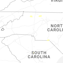
North Carolina
| Local Time | Report Details |
|---|---|
| 3:28 PM EDT | A large tree fell across middle swamp rd near the intersection of black mingle r in gates county NC, 38.9 miles WSW of Virginia Beach, VA |
| 3:48 PM EDT | Tree down near the gates county lin in camden county NC, 27.8 miles SW of Virginia Beach, VA |
| 5:06 PM EDT | 911 call center reported a tree down off of old county home road in the dobson area of north carolin in surry county NC, 73 miles SW of Roanoke, VA |
| 5:10 PM EDT | 911 call center reported a tree down at the intersection of rockford street and old highway 601 in mount airy north carolin in surry county NC, 72.5 miles SW of Roanoke, VA |
| 5:10 PM EDT | 911 call center reported a tree down off of old county home road in the dobson area of north carolin in surry county NC, 73.2 miles SW of Roanoke, VA |
| 5:15 PM EDT | 911 call center reported a tree down at the intersection of rockford street and old highway 601 in the mount airy are in surry county NC, 67.2 miles SW of Roanoke, VA |
| 5:15 PM EDT | 911 call center reported a tree down at the intersection of lambert farm trail and rockford street in mount airy north carolin in surry county NC, 71.6 miles SW of Roanoke, VA |
| 5:16 PM EDT | 911 call center reported a tree down at the intersection of rockford street and smith road in mount airy north carolin in surry county NC, 71 miles SW of Roanoke, VA |
| 5:32 PM EDT | 911 call center reported a tree down at the 6000 block of u.s. highway 21 in wilkes county north carolin in wilkes county NC, 71 miles E of Bristol, TN |
| 6:02 PM EDT | 911 call center reported a tree down off croom davis road in the dobson area of surry county north carolin in surry county NC, 76.6 miles N of Charlotte, NC |
| 6:15 PM EDT | 911 call center reported a treen hanging over the roadway north of elkin in surry county north carolin in surry county NC, 73.6 miles N of Charlotte, NC |
| 6:15 PM EDT | Tree was reported down by the 911 call center at the intersection of perch road and grassy creek road in surry county north carolin in surry county NC, 72.9 miles SSW of Roanoke, VA |
| 6:17 PM EDT | 911 call center reported a tree down across the highway at exit 24 on u.s. highway 52 in the pilot mountain area of surry county north carolin in surry county NC, 69.2 miles SSW of Roanoke, VA |
| 6:17 PM EDT | 911 call center reported a tree down across the highway at exit 27 on u.s. highway 52 northbound near the pilot mountain state park are in surry county NC, 70.4 miles SSW of Roanoke, VA |
| 6:19 PM EDT | Corrects previous tstm wnd dmg report from 1 se roaring gap. 911 call center reported a tree down at the 6000 block of u.s. highway 21 in wilkes county north carolin in wilkes county NC, 71 miles E of Bristol, TN |
| 6:19 PM EDT | 911 call center reported a tree that fell on a power line at the intersection of pinnacle hotel road and shoals road in surry county north carolin in surry county NC, 72.6 miles SSW of Roanoke, VA |
| 6:37 PM EDT | 911 call center reported a tree down in the 1300 block of north friendship road in stokes county virgini in stokes county NC, 67.6 miles SSW of Roanoke, VA |
| 6:37 PM EDT | 911 call center reported a tree down at the 1800 block of mountain view road in stokes county north carolin in stokes county NC, 69.1 miles SSW of Roanoke, VA |
| 6:37 PM EDT | 911 call center reported a tree down at the 1500 block of hawkins road in stokes county north carolin in stokes county NC, 67.3 miles SSW of Roanoke, VA |
| 7:08 PM EDT | Multiple trees down across the city of rockingha in richmond county NC, 63 miles ESE of Charlotte, NC |
| 7:12 PM EDT | Multiple trees down across the city of hamlet including tree on hous in richmond county NC, 68.7 miles ESE of Charlotte, NC |
| 7:25 PM EDT | Multiple trees down across marston... n in richmond county NC, 73 miles ESE of Charlotte, NC |
| 7:25 PM EDT | Multiple trees down along hoffman rd... in marston... n in scotland county NC, 75.6 miles SW of Raleigh, NC |
| 7:50 PM EDT | Tree down on n sycamore st & elm s in moore county NC, 62.5 miles SW of Raleigh, NC |
| 7:56 PM EDT | Tree in roadway cranes creek rd & us 1 hw in moore county NC, 48.8 miles SW of Raleigh, NC |
| 7:58 PM EDT | Tree fell on car at a whataburger on southern rd... causing very minor damage. also damaged a fenc in moore county NC, 61 miles SW of Raleigh, NC |
| 8:03 PM EDT | Awos station kpob pope af in cumberland county NC, 47.5 miles SSW of Raleigh, NC |
| 8:05 PM EDT | Large tree in roadway blocking road furr rd & pine dr vas in moore county NC, 53.4 miles SW of Raleigh, NC |
| 8:13 PM EDT | Tree down on powerline in cumberland county NC, 52.2 miles SSW of Raleigh, NC |
| 8:13 PM EDT | Tree on power lines and trees in roadway... near cranes creek rd in carthag in moore county NC, 49.2 miles SW of Raleigh, NC |
| 8:14 PM EDT | Tree on house on coley dr. injuries un in cumberland county NC, 50.8 miles SSW of Raleigh, NC |
| 8:14 PM EDT | Tree down near blue st/ murchison r in cumberland county NC, 51.3 miles SSW of Raleigh, NC |
| 8:16 PM EDT | Tree on house and roof caved in. morganton r in cumberland county NC, 52.2 miles SSW of Raleigh, NC |
| 8:20 PM EDT | Tree down near w rowan s in cumberland county NC, 52.1 miles SSW of Raleigh, NC |
| 8:25 PM EDT | Large tree down near e baltimore ave pinebluf in moore county NC, 65.5 miles SW of Raleigh, NC |
| 8:26 PM EDT | Tree down near jasper r in moore county NC, 60.2 miles WSW of Raleigh, NC |
| 8:30 PM EDT | Large tree down along lobelia r in moore county NC, 49.7 miles SW of Raleigh, NC |
| 8:35 PM EDT | Tree down on roadway near spies rd in sta in moore county NC, 64.1 miles WSW of Raleigh, NC |
| 8:40 PM EDT | Tree on car in tro in montgomery county NC, 51.1 miles E of Charlotte, NC |
| 8:55 PM EDT | A few trees down in the jordan road and u.s. 421 are in chatham county NC, 38 miles WSW of Raleigh, NC |
| 9:00 PM EDT | Downed power pole along hodges chapel roa in harnett county NC, 28.9 miles S of Raleigh, NC |
| 9:18 PM EDT | Tree down on powerlines on us 11 in wayne county NC, 43.5 miles ESE of Raleigh, NC |
| 9:20 PM EDT | Received about 20 reports of trees and power lines down throughout the county... especially the southern and western parts of the count in wayne county NC, 42.8 miles SE of Raleigh, NC |
| 9:21 PM EDT | Trees down in road way near e nc 55 hwy/kelly springs r in wayne county NC, 53.5 miles SE of Raleigh, NC |
| 9:34 PM EDT | Tree down on power lines on long s in stanly county NC, 36.7 miles ENE of Charlotte, NC |
| 9:35 PM EDT | Trees down on s best s in wayne county NC, 47 miles SE of Raleigh, NC |
| 9:36 PM EDT | Trees down on powerlines off old hwy 11 in wayne county NC, 50.1 miles SE of Raleigh, NC |
| 9:37 PM EDT | Tree down in roadway on treece r in stanly county NC, 32.9 miles ENE of Charlotte, NC |
| 9:56 PM EDT | Tree down on nc hwy 5 in franklin county NC, 29.7 miles NE of Raleigh, NC |
| 9:56 PM EDT | Tree down on firetower r in franklin county NC, 34.3 miles NE of Raleigh, NC |
Florida
| Local Time | Report Details |
|---|---|
| 3:40 PM EDT | Ema reported a tree down on a house along ne 140th street close to fort mccoy. time of event estimated from rada in marion county FL, 66.1 miles NNW of Orlando, FL |
| 5:15 PM EDT | Report of lines and trees down just off of panda bear lan in flagler county FL, 60.1 miles N of Orlando, FL |
| 5:20 PM EDT | Tree reported down along turtle creek drive. time estimated from rada in st. johns county FL, 39.7 miles SSE of Jacksonville, FL |
| 5:20 PM EDT | 911 reported a tree down along wicks branch road. time estimated from rada in st. johns county FL, 40.9 miles SSE of Jacksonville, FL |
| 5:45 PM EDT | Report of a tree down on a house at redmill driv in flagler county FL, 61.4 miles SSE of Jacksonville, FL |
| 9:55 PM CDT | Fhp reports tree down in the road near sr 20 and hickory s in walton county FL, 7.3 miles N of Miramar Beach, FL |
| 9:59 PM CDT | Social media report of tree down along walton roa in walton county FL, 28.7 miles NNE of Miramar Beach, FL |
| 10:00 PM CDT | Social media report of a couple of trees down around town in de funiak spring in walton county FL, 27.8 miles NNE of Miramar Beach, FL |
| 10:08 PM CDT | Trees reported down along hwy 20 east of freepor in walton county FL, 17.2 miles ENE of Miramar Beach, FL |
| 10:40 PM CDT | Blown transformer on carters circle in greenhea in washington county FL, 40.8 miles ENE of Miramar Beach, FL |
| 11:34 PM CDT | A couple of trees down have been reported along highway 7 in calhoun county FL, 50.3 miles W of Tallahassee, FL |
Maine
| Local Time | Report Details |
|---|---|
| 4:37 PM EDT | Multiple trees down blocking youngs ridge road in acton... me. time estimated by rada in york county ME, 35.3 miles W of Portland, ME |
| 4:37 PM EDT | Multiple trees and powerlines down completely blocking east main street in denmark. time estimated by rada in oxford county ME, 34.4 miles NW of Portland, ME |
| 4:38 PM EDT | Multiple trees and wires down. time estimated from rada in oxford county ME, 34.7 miles NW of Portland, ME |
| 4:50 PM EDT | Tree down blocking gore rd in oxford. time estimated by rada in oxford county ME, 35.1 miles NNW of Portland, ME |
| 5:12 PM EDT | Tree down blocking the intersection of line road and quaker ridge road. time estimated by rada in androscoggin county ME, 39.9 miles N of Portland, ME |
| 5:15 PM EDT | Tree down on wires on brattle street. time estimated by rada in york county ME, 40.8 miles SW of Portland, ME |
| 5:51 PM EDT | Large tree came down and blocked the road... and took down communication lines. time estimated from rada in piscataquis county ME, 33.5 miles NW of Bangor, ME |
| 6:04 PM EDT | Tree into powerlines... lines dow in penobscot county ME, 16.9 miles NW of Bangor, ME |
| 6:08 PM EDT | Tree down on powerlines blocking roa in penobscot county ME, 14.1 miles WSW of Bangor, ME |
| 6:11 PM EDT | Tree down blocking route in penobscot county ME, 4 miles E of Bangor, ME |
| 6:14 PM EDT | Tree down into powerline in penobscot county ME, 6.2 miles N of Bangor, ME |
| 6:54 PM EDT | Tree branch into utility line in penobscot county ME, 20.1 miles NNE of Bangor, ME |
| 7:00 PM EDT | Tree down into powerline in penobscot county ME, 19.1 miles WNW of Bangor, ME |
| 7:00 PM EDT | Tree down into the roa in piscataquis county ME, 34.5 miles NW of Bangor, ME |
| 7:17 PM EDT | Tree into the powerline in washington county ME, 73.8 miles NE of Bangor, ME |
| 7:37 PM EDT | Tree that came down onto a campe in penobscot county ME, 25.2 miles W of Bangor, ME |
| 8:23 PM EDT | Tree that came down and took down the wire in penobscot county ME, 21.5 miles WNW of Bangor, ME |
Alabama
| Local Time | Report Details |
|---|---|
| 5:01 PM CDT | Tree down from the enterprise area... closer to fort rucke in dale county AL, 78 miles NNE of Miramar Beach, FL |
| 5:12 PM CDT | Police scanner reported a large tree down on del rio terrac in dale county AL, 81 miles S of Auburn, AL |
| 5:15 PM CDT | Police scanner reported a tree down on cr-10 in dale county AL, 71.9 miles NNE of Miramar Beach, FL |
| 5:17 PM CDT | Dispatch reported a tree down near timber rd that may be resting on a powerlin in dale county AL, 79.6 miles S of Auburn, AL |
| 6:55 PM CDT | Trees down on moffett r in mobile county AL, 8.7 miles WNW of Mobile, AL |
| 8:11 PM CDT | Tree down on stephenson roa in geneva county AL, 58.6 miles NNE of Miramar Beach, FL |
| 8:21 PM CDT | Trees down on green jordan r in baldwin county AL, 17.6 miles NE of Mobile, AL |
| 8:45 PM CDT | Scattered trees down in northern henry count in henry county AL, 66.5 miles S of Auburn, AL |
| 8:45 PM CDT | Tree down on county road 4 in geneva county AL, 65.6 miles NNE of Miramar Beach, FL |
| 9:00 PM CDT | Tree down on highway 431 near the henry county lin in houston county AL, 87.4 miles NW of Tallahassee, FL |
| 9:02 PM CDT | Tree down along highway 8 in geneva county AL, 58.5 miles NNE of Miramar Beach, FL |
| 9:10 PM CDT | Tree down near rice road and cook roa in houston county AL, 74.3 miles NE of Miramar Beach, FL |
| 9:10 PM CDT | Scattered trees down in southern henry count in henry county AL, 84.3 miles NW of Tallahassee, FL |
| 9:17 PM CDT | Tree down in cowart in houston county AL, 80.5 miles NW of Tallahassee, FL |
| 9:18 PM CDT | Tree down along sanitary dairy roa in houston county AL, 80.1 miles NW of Tallahassee, FL |
Arkansas
| Local Time | Report Details |
|---|---|
| 5:48 PM CDT | Downed tree at intersection of waldron and grand ave; time estimated by rada in sebastian county AR, 2.9 miles E of Fort Smith, AR |
South Dakota
| Local Time | Report Details |
|---|---|
| 7:02 PM MDT | Storm damage reported in butte county SD, 68.8 miles N of Rapid City, SD |
| 7:39 PM MDT | Storm damage reported in meade county SD, 66.7 miles NNE of Rapid City, SD |
| 7:50 PM MDT | Storm damage reported in meade county SD, 62.6 miles NNE of Rapid City, SD |
| 7:52 PM MDT | Storm damage reported in meade county SD, 66.7 miles NNE of Rapid City, SD |
| 8:42 PM MDT | Storm damage reported in meade county SD, 89.2 miles NE of Rapid City, SD |
| 8:59 PM MDT | Storm damage reported in ziebach county SD, 85.5 miles NW of Pierre, SD |
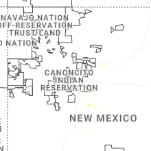
New Mexico
| Local Time | Report Details |
|---|---|
| 7:19 PM MDT | Wunderground site knmmount22; coincided with a 30 degree temp drop and 0.91 inches of rai in torrance county NM, 51.4 miles SSE of Albuquerque, NM |
California
| Local Time | Report Details |
|---|---|
| 7:40 PM PDT | Mesonet station lib11 meyers3400-upland in el dorado county CA, 45 miles SSW of Reno, NV |
Texas
| Local Time | Report Details |
|---|---|
| 4:05 AM CDT | Mesonet station pklt2 possum kingdom state par in palo pinto county TX, 71.6 miles S of Wichita Falls, TX |
| 4:15 AM CDT | Facebook report of trees down on devils hollow roa in palo pinto county TX, 74.9 miles SSE of Wichita Falls, TX |
| 4:54 AM CDT | Storm damage reported in wichita county TX, 4.9 miles N of Wichita Falls, TX |
Connect with Interactive Hail Maps