

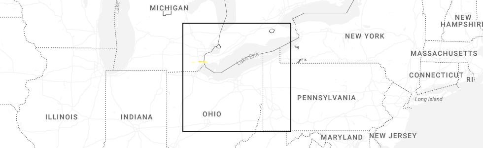
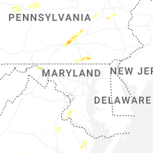
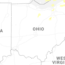
Hail Map for Sunday, June 14, 2026
Number of Impacted Households on 6/14/2026
0
Impacted by 1" or Larger Hail
0
Impacted by 1.75" or Larger Hail
0
Impacted by 2.5" or Larger Hail
Square Miles of Populated Area Impacted on 6/14/2026
0
Impacted by 1" or Larger Hail
0
Impacted by 1.75" or Larger Hail
0
Impacted by 2.5" or Larger Hail
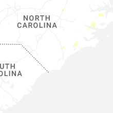
Cities Most Affected by Hail Storms of 6/14/2026
| Hail Size | Demographics of Zip Codes Affected | ||||||
|---|---|---|---|---|---|---|---|
| City | Count | Average | Largest | Pop Density | House Value | Income | Age |
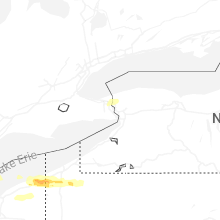
| Rocky Mount, NC | 1 | 1.75 | 1.75 | 690 | $104k | $40.4k | 38.9 |
Hail and Wind Damage Spotted on 6/14/2026
Filter by Report Type:Hail ReportsWind Reports
States Impacted
South Carolina, Michigan, Georgia, Ohio, West Virginia, Tennessee, Virginia, New York, North Carolina, Pennsylvania, Florida, Alabama, New Mexico, Maryland, Texas, New JerseySouth Carolina
| Local Time | Report Details |
|---|---|
| 12:35 PM EDT | Tree down on north homestead roa in pickens county SC, 8.3 miles NW of Greenville, SC |
| 12:35 PM EDT | Tree down near gentry memorial highway and griffin mill roa in pickens county SC, 5.5 miles WNW of Greenville, SC |
| 3:02 PM EDT | Report received of two trees blown down in a yard in bluffto in beaufort county SC, 17.5 miles NNE of Savannah, GA |
| 4:37 PM EDT | Emergency manager reported one tree down on road along high cotton lan in colleton county SC, 55.6 miles W of Charleston, SC |
| 5:12 PM EDT | Emergency manager reports tree down on powerlines and blocking both lanes on oakman branch road. time estimated by rada in colleton county SC, 37.4 miles WSW of Charleston, SC |
| 5:27 PM EDT | Trees on roadway at salley road (sc394) and ellison estates roa in aiken county SC, 33.2 miles E of Augusta, GA |
| 5:34 PM EDT | Lexington county em reports tree down near the intersection of tindal rd and cedar creek rd. time estimated by rada in lexington county SC, 44.8 miles ENE of Augusta, GA |
| 5:42 PM EDT | Lexington county em reports tree down near 534 sharon church rd. time estimated by rada in lexington county SC, 50 miles ENE of Augusta, GA |
| 5:43 PM EDT | Public submitted report of 4 large pine trees uprooted and additional trees broken near the intersection of hwy 6 and blackville rd. time estimated by rada in lexington county SC, 51.9 miles ENE of Augusta, GA |
| 5:47 PM EDT | Lexington county em reports power line down near 269 fiddlers ln. time estimated by rada in lexington county SC, 55.4 miles ENE of Augusta, GA |
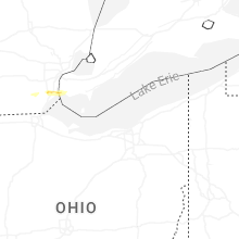
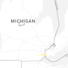
Michigan
| Local Time | Report Details |
|---|---|
| 12:45 PM EDT | Quarter sized hail reported near South Rockwood, MI, 69.1 miles SSE of Flint, MI |
Georgia
| Local Time | Report Details |
|---|---|
| 1:26 PM EDT | Tree down on beatenbough roa in franklin county GA, 48 miles SW of Greenville, SC |
| 2:30 PM EDT | Georgia dept of transportation reported fallen trees on sr-91 nb at middle rd. all lanes close in lee county GA, 73.4 miles W of Douglas, GA |
| 3:31 PM EDT | Tree down on power line at price street and east waldburg lan in chatham county GA, 1.4 miles S of Savannah, GA |
| 3:31 PM EDT | Tree down on road at intersection of old ogeechee road and douglas branch roa in screven county GA, 56 miles NW of Savannah, GA |
| 3:34 PM EDT | Cable line down along causton bluff roa in chatham county GA, 2.8 miles ESE of Savannah, GA |
| 4:00 PM EDT | Several trees and power lines down in decatur count in decatur county GA, 37 miles NNW of Tallahassee, FL |
| 4:13 PM EDT | A tree fell on a house near 11th ave ne in cairo. it partially blocked the roadwa in grady county GA, 31.4 miles N of Tallahassee, FL |
| 4:13 PM EDT | Several trees and power lines down in decatur count in decatur county GA, 32.3 miles NNW of Tallahassee, FL |
| 4:17 PM EDT | Several trees and power lines down in grady count in grady county GA, 30.4 miles N of Tallahassee, FL |
| 4:22 PM EDT | Power lines down near highway 93 and blueberry r in grady county GA, 28.8 miles N of Tallahassee, FL |
| 4:24 PM EDT | Power lines fell onto three vehicles traveling on highway 111 south near broome circle... blocking the roadway. live lines on vehicles were reported but not injurie in grady county GA, 24.1 miles N of Tallahassee, FL |
| 4:25 PM EDT | Power lines down along old thomasville r in grady county GA, 32.8 miles NNE of Tallahassee, FL |
| 4:38 PM EDT | Tree downed over the roadwa in catoosa county GA, 11 miles SSE of Chattanooga, TN |
| 5:28 PM EDT | Tree downed over roadway. time estimated from rada in catoosa county GA, 6.3 miles SSE of Chattanooga, TN |
| 5:30 PM EDT | Several reports of trees downed in the town of chickamauga. time estimated from rada in walker county GA, 12.2 miles S of Chattanooga, TN |
| 5:38 PM EDT | Corrects time on previous tstm wnd dmg report from 2 wsw boynton. tree downed over the roadwa in catoosa county GA, 11 miles SSE of Chattanooga, TN |
| 5:40 PM EDT | Several reports of trees downed in and near the town of ringgol in catoosa county GA, 14.3 miles SE of Chattanooga, TN |
| 6:03 PM EDT | Tree down on power lines at thunder road and hampster road. time estimated by rada in evans county GA, 46.6 miles WNW of Savannah, GA |
| 6:06 PM EDT | Tree downed... time estimated from rada in murray county GA, 35.6 miles ESE of Chattanooga, TN |
| 6:10 PM EDT | Tree downed... time estimated from rada in murray county GA, 42.8 miles SE of Chattanooga, TN |
| 6:11 PM EDT | Tree down on road at east highway 80 and mud road. time estimated by rada in bulloch county GA, 30 miles WNW of Savannah, GA |
| 6:33 PM EDT | Emergency manager reports tree down at pineland drive and tower drive. time estimated by rada in chatham county GA, 9.4 miles W of Savannah, GA |
| 6:40 PM EDT | Effingham em reported several small to medium trees snapped off at varying heights and a small outbuilding destroyed at a farm on boaen rd. possible tornad in effingham county GA, 26.9 miles NW of Savannah, GA |
| 6:43 PM EDT | Emergency manager reports tree fell into intersection of blue jay road and midland road. all lanes blocke in effingham county GA, 17.4 miles NW of Savannah, GA |
| 6:45 PM EDT | Emergency manager reports a tree fell onto powerlines causing power outage and fire at intersection of little mccall and hwy 119 in effingham county GA, 24.1 miles NW of Savannah, GA |
| 6:45 PM EDT | Public reports tree down along highway 5 near the intersection with old post roa in fannin county GA, 56.8 miles ESE of Chattanooga, TN |
| 6:48 PM EDT | Emergency manager reports tree fell onto highway on highway 21 n. southbound lanes blocke in effingham county GA, 25.8 miles NW of Savannah, GA |
| 6:49 PM EDT | Emergency manager reports a tree fell onto powerlines and into the roadway blocking all lanes of travel at south laurel stree in effingham county GA, 22.2 miles NNW of Savannah, GA |
| 6:50 PM EDT | Multiple trees down on and near route 1 in folkston. time estimated via rada in charlton county GA, 40.9 miles NNW of Jacksonville, FL |
| 6:50 PM EDT | Emergency manager reports a tree in roadway blocking all lane in effingham county GA, 26.9 miles NW of Savannah, GA |
| 6:52 PM EDT | Emergency manager reports tree down on powerlines on windfield driv in chatham county GA, 5 miles SSE of Savannah, GA |
| 6:52 PM EDT | Public reported around 7 trees were blown down off of deyton roa in union county GA, 76.6 miles S of Knoxville, TN |
| 6:58 PM EDT | Emergency manager reports a car collided with a tree in the roadway at hwy 17 n and griffin lake road. no injuries reporte in effingham county GA, 32 miles NW of Savannah, GA |
| 7:04 PM EDT | Emergency manager reports tree in roadway blocking all directions of traffi in effingham county GA, 24.1 miles NW of Savannah, GA |
| 7:10 PM EDT | Emergency manager reported power poles broken and power lines in roadway on long bridge roa in effingham county GA, 20.9 miles NNW of Savannah, GA |
| 7:13 PM EDT | Emergency manager reports a tree over 20 inches in diameter fell onto railroad tracks blocking the railwa in effingham county GA, 23.1 miles NNW of Savannah, GA |
| 7:22 PM EDT | Tree downed on coots lake road. time estimated from rada in polk county GA, 38.5 miles WNW of Atlanta, GA |
| 7:25 PM EDT | Emergency manager reports a tree fell onto powerlines causing power outage and fir in effingham county GA, 26.3 miles NW of Savannah, GA |
| 7:30 PM EDT | Power pole downed. time estimated from rada in jackson county GA, 53.7 miles ENE of Atlanta, GA |
| 7:32 PM EDT | Emergency manager reports a tree fell into powerlines behind a residence... causing arcing and a power outag in effingham county GA, 14.8 miles NNW of Savannah, GA |
| 7:37 PM EDT | Emergency manager reports a tree on the roadway blocking all lanes at the bridge at shearouse spur and pleasant acres roa in effingham county GA, 23.2 miles NW of Savannah, GA |
| 8:10 PM EDT | Mulitple trees down on i-75 near collier roa in fulton county GA, 4.6 miles NNW of Atlanta, GA |
Ohio
| Local Time | Report Details |
|---|---|
| 1:28 PM EDT | 8 inch diameter tree limb downed along with several smaller sized branche in putnam county OH, 55.4 miles E of Fort Wayne, IN |
| 1:30 PM EDT | 59 mph measured gust on home weather statio in ottawa county OH, 85.6 miles W of Cleveland, OH |
| 1:55 PM EDT | Tree down on drivewa in ottawa county OH, 60.4 miles W of Cleveland, OH |
| 2:04 PM EDT | Tree down in drivewa in ottawa county OH, 60.4 miles W of Cleveland, OH |
| 2:10 PM EDT | Large tree limb dow in sandusky county OH, 68.7 miles W of Cleveland, OH |
| 2:14 PM EDT | Mesonet station xsdb 2 nne sandusk in lez144 county OH, 52.4 miles W of Cleveland, OH |
| 2:16 PM EDT | Portions of perkins rd were closed due to downed limbs and power line in erie county OH, 52.7 miles W of Cleveland, OH |
| 2:20 PM EDT | Large maple tree down. recorded 49 mph wind gus in erie county OH, 54.4 miles W of Cleveland, OH |
| 2:25 PM EDT | Tree down in downtown huro in erie county OH, 45.8 miles W of Cleveland, OH |
| 2:28 PM EDT | Large tree limb down from thunderstorm in wyandot county OH, 61.6 miles NNW of Columbus, OH |
| 2:28 PM EDT | Power poles downe in erie county OH, 44.2 miles WSW of Cleveland, OH |
| 2:29 PM EDT | Tree down on power lines on field road with power out in the are in huron county OH, 52.4 miles WSW of Cleveland, OH |
| 2:31 PM EDT | Tree down at north washington and hudson stree in seneca county OH, 80.4 miles N of Columbus, OH |
| 2:38 PM EDT | Several large tree limbs down along with power line in erie county OH, 37 miles WSW of Cleveland, OH |
| 2:41 PM EDT | At least a half dozen trees down across lorai in lorain county OH, 25.5 miles W of Cleveland, OH |
| 2:41 PM EDT | Cosmetic damage to a home and portions of a pole barn collapsed along with a couple trees dow in crawford county OH, 62 miles N of Columbus, OH |
| 2:43 PM EDT | Large tree down in amherst on power line in lorain county OH, 28.4 miles WSW of Cleveland, OH |
| 2:47 PM EDT | Partial roof damage to a barn. some sporadic tree damag in crawford county OH, 62 miles N of Columbus, OH |
| 2:51 PM EDT | Tree snappe in crawford county OH, 58.5 miles N of Columbus, OH |
| 2:56 PM EDT | Numerous trees and power lines down across lorain count in lorain county OH, 18.6 miles WSW of Cleveland, OH |
| 3:03 PM EDT | Tree down on neighbors shed and on power line in cuyahoga county OH, 14.7 miles SW of Cleveland, OH |
| 3:03 PM EDT | Large tree down on sharon driv in lake county OH, 22.2 miles NE of Cleveland, OH |
| 3:04 PM EDT | Asos station kbkl clevelan in cuyahoga county OH, 1.2 miles NNE of Cleveland, OH |
| 3:04 PM EDT | 2 trees dow in cuyahoga county OH, 0.6 miles NW of Cleveland, OH |
| 3:05 PM EDT | Large tree dow in cuyahoga county OH, 11 miles W of Cleveland, OH |
| 3:06 PM EDT | Several large tree limbs down in willoughb in lake county OH, 17.3 miles ENE of Cleveland, OH |
| 3:06 PM EDT | Large tree uprooted along with large limbs blocking a roa in cuyahoga county OH, 5.1 miles SSW of Cleveland, OH |
| 3:09 PM EDT | Tree down on hom in lake county OH, 26.4 miles ENE of Cleveland, OH |
| 3:09 PM EDT | Dispatch reported numerous trees and tree limbs down across lake count in lake county OH, 25.1 miles NE of Cleveland, OH |
| 3:09 PM EDT | Multiple trees down in columbia statio in lorain county OH, 17.9 miles SW of Cleveland, OH |
| 3:09 PM EDT | Tree down on a ca in cuyahoga county OH, 1.8 miles SSW of Cleveland, OH |
| 3:10 PM EDT | Mesonet station 45207 2 wnw grand rive in lez147 county OH, 25.7 miles NE of Cleveland, OH |
| 3:10 PM EDT | Mesonet station 45176 4 nne lakewoo in lez146 county OH, 5.2 miles NW of Cleveland, OH |
| 3:12 PM EDT | Several trees down on s. woodland between belvoir boulevard and green r in cuyahoga county OH, 8.7 miles ESE of Cleveland, OH |
| 3:15 PM EDT | Large tree limb downed by storm in cuyahoga county OH, 10.2 miles ESE of Cleveland, OH |
| 3:18 PM EDT | Two trees downed in ontari in richland county OH, 59.2 miles NNE of Columbus, OH |
| 3:24 PM EDT | Tree downed in lexingto in richland county OH, 54.3 miles NNE of Columbus, OH |
| 3:24 PM EDT | Small ferris wheel blown ove in ashtabula county OH, 45.5 miles ENE of Cleveland, OH |
| 3:30 PM EDT | Tree downed in luca in richland county OH, 59.8 miles NNE of Columbus, OH |
| 3:31 PM EDT | Tree snappe in cuyahoga county OH, 8.2 miles ESE of Cleveland, OH |
| 3:34 PM EDT | Downed tre in lake county OH, 30.8 miles ENE of Cleveland, OH |
| 3:44 PM EDT | One utility pole downed on state route 38 near dun roa in madison county OH, 22.7 miles W of Columbus, OH |
| 3:44 PM EDT | Large tree limbs dow in greene county OH, 48.3 miles NE of Cincinnati, OH |
| 3:45 PM EDT | Half mile to a mile long swath of trees down in plymouth township along plymouth ridge rd between south state and hadlock/dewey r in ashtabula county OH, 54.5 miles ENE of Cleveland, OH |
| 3:45 PM EDT | One large tree limb downed in the olentangy ridge subdivisio in delaware county OH, 14.1 miles NNW of Columbus, OH |
| 3:55 PM EDT | Large healthy tree branch downed at a property on stellar driv in franklin county OH, 7.8 miles NW of Columbus, OH |
| 3:56 PM EDT | Tree downed along riverside driv in franklin county OH, 8 miles NW of Columbus, OH |
| 3:57 PM EDT | Lots of tree limbs down in the pierpont are in ashtabula county OH, 60.6 miles ENE of Cleveland, OH |
| 3:58 PM EDT | Tree dow in summit county OH, 31.5 miles S of Cleveland, OH |
| 4:00 PM EDT | Tree snappe in ashtabula county OH, 49.9 miles ENE of Cleveland, OH |
| 4:00 PM EDT | Tree limb dow in franklin county OH, 6.9 miles NNW of Columbus, OH |
| 4:01 PM EDT | One tree downed at an apartment complex east of elm stree in madison county OH, 23.6 miles W of Columbus, OH |
| 4:04 PM EDT | Asos station kbjj wooste in wayne county OH, 44.9 miles SSW of Cleveland, OH |
| 4:12 PM EDT | Tree down in greene townshi in trumbull county OH, 48.9 miles E of Cleveland, OH |
| 4:16 PM EDT | Tree downed along beech road sw near morse roa in licking county OH, 14.3 miles ENE of Columbus, OH |
| 4:27 PM EDT | Tree down across roa in trumbull county OH, 48.3 miles E of Cleveland, OH |
| 4:31 PM EDT | Multiple trees and wires down across warren. some instances of roof damage and broken windows as wel in trumbull county OH, 48.8 miles ESE of Cleveland, OH |
| 4:48 PM EDT | Storm damage reported in columbiana county OH, 55.9 miles SE of Cleveland, OH |
| 4:50 PM EDT | Two trees snapped along kensington road. time estimated via rada in coshocton county OH, 64.9 miles ENE of Columbus, OH |
| 4:55 PM EDT | Trees downed throughout mahoning count in mahoning county OH, 56.7 miles NW of Pittsburgh, PA |
| 5:05 PM EDT | Numerous trees down. funnel cloud observe in columbiana county OH, 53.7 miles NW of Pittsburgh, PA |
| 5:05 PM EDT | Gw744 in tuscarawas county OH, 72.5 miles SSE of Cleveland, OH |
| 5:07 PM EDT | Numerous power lines down. funnel cloud observe in columbiana county OH, 52 miles NW of Pittsburgh, PA |
| 5:09 PM EDT | Down trees along old route 34 in columbiana county OH, 49.9 miles NW of Pittsburgh, PA |
| 5:10 PM EDT | Down trees and power line in columbiana county OH, 49.6 miles NW of Pittsburgh, PA |
| 5:25 PM EDT | Tree trunk snapped and fallen onto a house. time estimated via rada in columbiana county OH, 39.8 miles NW of Pittsburgh, PA |
| 6:46 PM EDT | Tree down and blocking route 93 between twp rd 1329 and twp rd 10 in lawrence county OH, 56.7 miles WNW of Charleston, WV |
West Virginia
| Local Time | Report Details |
|---|---|
| 2:38 PM EDT | Thunderstorm winds blew down one tree along the 3500 block of leonard-cordova roa in greenbrier county WV, 59.3 miles NNW of Roanoke, VA |
| 3:45 PM EDT | Tree in roadway in the 5000 block of russet rd. time estimated from rada in calhoun county WV, 47.6 miles NE of Charleston, WV |
| 4:05 PM EDT | Over 50 customers without power due to tree damag in gilmer county WV, 53.1 miles W of Elkins, WV |
| 4:50 PM EDT | Over 80 customers without power due to tree damage. time estimated from rada in upshur county WV, 19.8 miles W of Elkins, WV |
| 5:34 PM EDT | Several trees reported down due to thunderstorm winds across the northeastern portion of the county. time estimated via rada in hampshire county WV, 85.8 miles ENE of Elkins, WV |
| 5:50 PM EDT | Power lines down at johnson mill road due to thunderstorm wind in morgan county WV, 86.6 miles WNW of Baltimore, MD |
| 5:54 PM EDT | Tree down dur to thunderstorm winds at woods roa in berkeley county WV, 82 miles WNW of Baltimore, MD |
| 6:00 PM EDT | Trees and power lines down on 3800 block of mountain lake roa in berkeley county WV, 81.3 miles WNW of Baltimore, MD |
| 6:29 PM EDT | Uprooted tree fell onto an apartment in the 100 block of 4 and half stree in wood county WV, 73.1 miles N of Charleston, WV |
| 6:48 PM EDT | Tree and lines down across progress ridge rd. near walker rd. in walker. delayed report. time estimated from rada in wood county WV, 58.9 miles NNE of Charleston, WV |
| 6:50 PM EDT | Tree down and blocking valley mills rd near emerson r in wood county WV, 67.6 miles N of Charleston, WV |
| 6:55 PM EDT | Tree down along wv 18 north of middlebourn in tyler county WV, 69.2 miles NW of Elkins, WV |
| 6:57 PM EDT | Tree down on indian creek rd near wv 18 in blu in tyler county WV, 63.7 miles NW of Elkins, WV |
| 7:05 PM EDT | Kc4ygb reports power outages with 100 customers affected in wileyville. time estimated by rada in wetzel county WV, 65.8 miles NW of Elkins, WV |
| 7:10 PM EDT | Tree down blocking glendale rd. delayed report. time estimated from radar in ritchie county WV, 70.8 miles WNW of Elkins, WV |
| 7:12 PM EDT | Down tree in monongalia county WV, 57.4 miles SSW of Pittsburgh, PA |
| 7:16 PM EDT | Tree down near zeb haught rd / wadestown rd... wana... wv. time based on radar estimat in monongalia county WV, 55.4 miles SSW of Pittsburgh, PA |
| 7:16 PM EDT | Tree across the road near crossroads rd / zeb haught rd... wadestown. time based on radar estimat in monongalia county WV, 56 miles SSW of Pittsburgh, PA |
| 7:21 PM EDT | Corrects previous tstm wnd dmg report from 2 se wadestown. tree across the road near crossroads rd / zeb haught rd... wadestown. time based on radar estimat in monongalia county WV, 56 miles SSW of Pittsburgh, PA |
| 7:23 PM EDT | Tree down on klondike ln... fairview... wv. time based on radar estimat in monongalia county WV, 54.9 miles NNW of Elkins, WV |
| 7:25 PM EDT | Tree down on fish hatchery rd near wv- in wirt county WV, 49.1 miles NNE of Charleston, WV |
| 7:30 PM EDT | Pole down w/ lines on cr-5 near hidden farms rd. time estimated from rada in putnam county WV, 14.1 miles NW of Charleston, WV |
| 7:37 PM EDT | Down tree in marion county WV, 44.6 miles NNW of Elkins, WV |
| 7:37 PM EDT | Tree in roadway on cr 250 2 rock union road near u.s. 250. delayed report. time estimated from rada in taylor county WV, 36.3 miles NNW of Elkins, WV |
| 7:37 PM EDT | Tree blocking one lane near fairmont rd / valley point dr... morgantown. time based on radar estimat in monongalia county WV, 47.8 miles NNW of Elkins, WV |
| 7:40 PM EDT | Tree and wires down. delayed report. time estimated from rada in taylor county WV, 37.1 miles NNW of Elkins, WV |
| 7:40 PM EDT | Tree in roadway on wv-23/east run r in doddridge county WV, 50.9 miles NW of Elkins, WV |
| 7:42 PM EDT | Tree down with wires and tree now on fire. near 487 ohio ave. time based on radar estimat in monongalia county WV, 49.9 miles N of Elkins, WV |
| 7:42 PM EDT | Tree in roadway on cr29 st clara rd. delayed report. time estimated from rada in doddridge county WV, 47.5 miles WNW of Elkins, WV |
| 7:43 PM EDT | Cluster of trees down near hildebrand lock and dam rd / gabertsville rd... morgantown. time based on radar estimat in monongalia county WV, 46.9 miles NNW of Elkins, WV |
| 7:48 PM EDT | Tree on power lines and on fire. near 108 fields park rd... morgantown. time based on radar estimat in monongalia county WV, 48.7 miles N of Elkins, WV |
| 7:52 PM EDT | Big tree down blocking camp towles rd. also pole down and no electric. power pole laying in bed of truck. pole and lines blocking driveway. delayed report. time estimat in taylor county WV, 32.2 miles NNW of Elkins, WV |
| 7:53 PM EDT | Over 800 customers without power due to tree damag in kanawha county WV, 11.2 miles NNW of Charleston, WV |
| 7:53 PM EDT | Large trees down and power out in maple lake ongoin in harrison county WV, 32 miles NW of Elkins, WV |
| 7:55 PM EDT | N8hgl reports power outage. time estimated by rada in monongalia county WV, 51.5 miles N of Elkins, WV |
| 7:56 PM EDT | Tree with wires down on biddie ln. blocking whole road. electric is on but flickering. delayed report. time estimated from rada in harrison county WV, 35.5 miles WNW of Elkins, WV |
| 7:57 PM EDT | Ke8ywa reports tree limb on power lines near owl creek road along us route 119. time estimated by rada in monongalia county WV, 42.7 miles N of Elkins, WV |
| 7:58 PM EDT | 256 people without power... due to tree damage from severe storm. time estimated based on rada in kanawha county WV, 12.5 miles ENE of Charleston, WV |
| 8:00 PM EDT | Tree down in the roadway with lines hanging low over the roadway. tree blocking both lanes. delayed report. time estimated from rada in harrison county WV, 30.9 miles WNW of Elkins, WV |
| 8:00 PM EDT | Tree down on south ruffner rd. and shady ln. delayed report. time estimated from rada in kanawha county WV, 2.1 miles SSE of Charleston, WV |
| 8:01 PM EDT | Sustained 35 mph for 5 minutes with gusts to 62 mp in taylor county WV, 33.8 miles NNW of Elkins, WV |
| 8:04 PM EDT | Tree into lines along wv route 5 between gluck run rd and duck run r in gilmer county WV, 50.9 miles W of Elkins, WV |
| 8:04 PM EDT | Tree down with lines in the 500 block of bisetown r in harrison county WV, 28.1 miles NW of Elkins, WV |
| 8:06 PM EDT | Tree down in the 600 block of lost creek rommies mill r in harrison county WV, 30.9 miles WNW of Elkins, WV |
| 8:08 PM EDT | Tree down and blocking in the 900 block of irontown r in taylor county WV, 29.7 miles N of Elkins, WV |
| 8:12 PM EDT | Large tree across the roadway in the 200 block of simpson r in taylor county WV, 28.4 miles NNW of Elkins, WV |
| 8:23 PM EDT | Tree down blocking 1 lane. near 10 locust st... rowlesburg... wv or high st & pratt st. time based on radar estimat in preston county WV, 30 miles NNE of Elkins, WV |
| 8:25 PM EDT | Tree down across the road blocking one lane. time estimated via rada in preston county WV, 30.7 miles NNE of Elkins, WV |
| 8:30 PM EDT | Tree down on coal river rd. delayed report. time estimated from rada in boone county WV, 22.4 miles S of Charleston, WV |
| 8:30 PM EDT | Tree in roadway on cr 10 1 godby branch road. delayed report. time estimated from rada in logan county WV, 33.3 miles SW of Charleston, WV |
| 8:43 PM EDT | Tree in roadway on us60 midland trail. time estimated from rada in fayette county WV, 31.4 miles ESE of Charleston, WV |
| 8:44 PM EDT | Tree down and blocking both lanes in the 1000 block of talbott r in barbour county WV, 8.2 miles NW of Elkins, WV |
| 8:46 PM EDT | Tree in roadway on us-219... parsons road... near thornhill lane. delayed report. time estimated from rada in randolph county WV, 10.9 miles N of Elkins, WV |
| 8:52 PM EDT | Tree in roadway on cr21 georgetown road. time estimated from rada in randolph county WV, 5.1 miles SSW of Elkins, WV |
| 9:05 PM EDT | Tree in roadway on wv 85 foot of bolt mtn. delayed report. time estimated from rada in boone county WV, 37.3 miles S of Charleston, WV |
| 9:20 PM EDT | Tree down blocking one lane on bolt roa in raleigh county WV, 40.8 miles SSE of Charleston, WV |
| 9:30 PM EDT | Tree in roadway on cr3 greenbrier mountain road. time estimated from rada in mcdowell county WV, 61.7 miles SSW of Charleston, WV |
| 9:35 PM EDT | Tree in roadway on cr 14 brier creek road. delayed report. time estimated from rada in wyoming county WV, 56.6 miles S of Charleston, WV |
| 9:36 PM EDT | Tree on johnny cake on coal heritage rd. down near pennys. time estimated from rada in mcdowell county WV, 60.7 miles S of Charleston, WV |
| 9:37 PM EDT | Tree... wires down in sweeneysbur in raleigh county WV, 42 miles SSE of Charleston, WV |
| 9:37 PM EDT | Tree in roadway on cr 54 2... pier point rd.... in maben. delayed report. time estimated from rada in wyoming county WV, 51.5 miles SSE of Charleston, WV |
| 9:38 PM EDT | Tree in roadway on wv 97 r d bailey highway. delayed report. time estimated from rada in wyoming county WV, 52.6 miles S of Charleston, WV |
Tennessee
| Local Time | Report Details |
|---|---|
| 2:06 PM CDT | Em reports a large tree has fallen across bluff road. time estimate in lawrence county TN, 19.6 miles NNE of Florence, AL |
| 2:10 PM CDT | Tree blocking road reported by ema. time estimate in lawrence county TN, 37.7 miles NNE of Florence, AL |
| 2:14 PM CDT | Large tree blocking roadway reported by 911. delayed report... time estimate in lawrence county TN, 37 miles NNE of Florence, AL |
| 2:26 PM CDT | Em reports tree on residence on countrywood drive... with powerpole down in backyar in lawrence county TN, 37.5 miles NE of Florence, AL |
| 4:04 PM CDT | Multiple trees reported dow in marion county TN, 18.2 miles W of Chattanooga, TN |
| 5:27 PM EDT | Numerous trees down across hamilton count in hamilton county TN, 3.6 miles NE of Chattanooga, TN |
| 5:54 PM EDT | Several reports of trees down mainly in southern part of bradley count in bradley county TN, 25.4 miles ENE of Chattanooga, TN |
| 6:20 PM EDT | Several reports of trees and powerlines dow in polk county TN, 52.2 miles E of Chattanooga, TN |
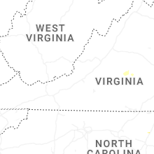
Virginia
| Local Time | Report Details |
|---|---|
| 3:23 PM EDT | Thunderstorm winds blew down one tree along the 3700 block of dunlap creek roa in alleghany county VA, 34.5 miles NNW of Roanoke, VA |
| 4:01 PM EDT | Thunderstorm winds blew down one tree along the intersection of old church street and selma-low moor roa in alleghany county VA, 35.9 miles N of Roanoke, VA |
| 5:08 PM EDT | Thunderstorm winds blew down one large tree branch that smashed through the windshield of a passing suv on highway 58 eastbound between wilkins road and turbeville road in halifax county VA, 61.7 miles NNW of Raleigh, NC |
| 5:58 PM EDT | Multiple trees down... 2 uprooted... 2 snapped and and a tree fell on a house. farm animals injure in powhatan county VA, 12.1 miles WNW of Richmond, VA |
| 5:59 PM EDT | Thunderstorm winds blew down one tree along slate river forest lan in buckingham county VA, 55 miles W of Richmond, VA |
| 6:04 PM EDT | Thunderstorm winds blew down one tree that fell on to a power line along the 400 block of bridge roa in buckingham county VA, 52.7 miles W of Richmond, VA |
| 6:10 PM EDT | Large trees downed in mountainview subdivisio in powhatan county VA, 11.9 miles WNW of Richmond, VA |
| 6:11 PM EDT | Thunderstorm winds blew down several trees and trees branches in buckingha in buckingham county VA, 50 miles W of Richmond, VA |
| 6:15 PM EDT | Several trees down due to thunderstorm wind in spotsylvania county VA, 45.8 miles N of Richmond, VA |
| 6:20 PM EDT | Trees down on riverside at the lee bridg in city of richmond county VA, 11.2 miles E of Richmond, VA |
| 6:20 PM EDT | Large tree branches reported downed onto power lines on midlothian turnpike near huguenot r in chesterfield county VA, 1.7 miles E of Richmond, VA |
| 6:24 PM EDT | Large tree knocked down on a home along s arch rd. in addition... trees were knocked down along arch rd... blocking the roadway. time estimated from rada in chesterfield county VA, 4 miles ESE of Richmond, VA |
| 6:25 PM EDT | Trees downed in tuckahoe just north of river roa in henrico county VA, 6.8 miles NNE of Richmond, VA |
| 6:27 PM EDT | Numerous calls and reports of trees down across the city of richmon in city of richmond county VA, 9.4 miles ENE of Richmond, VA |
| 6:27 PM EDT | Tree down on cotton farm lan in city of suffolk county VA, 27.5 miles WNW of Virginia Beach, VA |
| 6:30 PM EDT | Trees downed at i-64 and parham rd (mm181 in henrico county VA, 14.5 miles NE of Richmond, VA |
| 6:30 PM EDT | Large tree uprooted along mayland dr between parham rd and comet rd. time estimated from rada in henrico county VA, 9.8 miles NE of Richmond, VA |
| 6:34 PM EDT | Multiple trees reported down due to thunderstorm winds across the southern portions of the count in stafford county VA, 55.4 miles NNE of Richmond, VA |
| 6:35 PM EDT | Tree downed on route 10 near old stage road. time radar-estimated. report via social medi in prince george county VA, 32.2 miles ESE of Richmond, VA |
| 6:40 PM EDT | Tree down on a car along highway 30 in caroline county VA, 44.8 miles NNE of Richmond, VA |
| 6:42 PM EDT | Mesonet station domv2 dominion termina in anz639 county VA, 24.5 miles NW of Virginia Beach, VA |
| 6:48 PM EDT | Tree branches also downed in the willow oaks subdivisio in city of hampton county VA, 26.2 miles NW of Virginia Beach, VA |
| 6:51 PM EDT | Half Dollar sized hail reported near Hampton, VA, 25.8 miles NW of Virginia Beach, VA, public report of half dollar sized hail. |
| 6:57 PM EDT | Mesonet station xpoq poquoso in city of poquoson county VA, 28.4 miles NNW of Virginia Beach, VA |
| 6:57 PM EDT | Awos station klfi langley af in city of hampton county VA, 27 miles NNW of Virginia Beach, VA |
| 6:57 PM EDT | Tree knocked down along new kent hwy. time estimated from rada in new kent county VA, 43.5 miles E of Richmond, VA |
| 6:58 PM EDT | Tree down near 13371 round hill rd in king george county VA, 58.5 miles NNE of Richmond, VA |
| 7:00 PM EDT | Tree down near round hill road and sawgrass estate roa in king george county VA, 58.5 miles NNE of Richmond, VA |
| 7:08 PM EDT | Tree knocked down along horners mill rd. time estimated from rada in westmoreland county VA, 58.3 miles NE of Richmond, VA |
| 7:13 PM EDT | Trees downed on airport road just north of i-64. confirmed by county employee. time radar-estimate in new kent county VA, 29.2 miles E of Richmond, VA |
| 7:20 PM EDT | Trees downed on courthouse rd. time radar-estimate in king and queen county VA, 43.9 miles ENE of Richmond, VA |
| 7:27 PM EDT | Multiple large branches knocked down at n enon church rd at meadowville. time estimated from rada in chesterfield county VA, 21.1 miles ESE of Richmond, VA |
| 7:30 PM EDT | Trees downed in petersburg battlefiel in city of petersburg county VA, 24.8 miles SE of Richmond, VA |
| 7:35 PM EDT | Tree limbs downed and partially blocking va-3 in new kent county VA, 45.1 miles E of Richmond, VA |
| 7:47 PM EDT | Trees down at angelico road and meherrin roa in southampton county VA, 61.4 miles SSE of Richmond, VA |
| 7:50 PM EDT | Tree downed along mulberry road at moores mil in richmond county VA, 61.4 miles ENE of Richmond, VA |
| 8:15 PM EDT | Tree downed at ridge road and lara road in heathsvill in northumberland county VA, 66.7 miles ENE of Richmond, VA |
New York
| Local Time | Report Details |
|---|---|
| 3:36 PM EDT | Multiple trees down on property. images provided by property owner via facebook. time estimated by rada in genesee county NY, 32.4 miles E of Buffalo, NY |
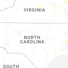
North Carolina
| Local Time | Report Details |
|---|---|
| 3:47 PM EDT | Trees and wires down in tow in beaufort county NC, 98.6 miles NE of Wilmington, NC |
| 3:56 PM EDT | Large limbs down throughout the yar in beaufort county NC, 103.3 miles SSW of Virginia Beach, VA |
| 4:12 PM EDT | Tree down on house. also a tree on a car and lines down along long ridge roa in beaufort county NC, 88.7 miles SSW of Virginia Beach, VA |
| 4:17 PM EDT | Trees and wires down in tow in beaufort county NC, 89.3 miles SSW of Virginia Beach, VA |
| 4:26 PM EDT | Fallen tree damaged equipment causing a power outage. time estimate in sampson county NC, 56.7 miles SSE of Raleigh, NC |
| 4:40 PM EDT | Media relayed a viewer report of wind damage to a church along faison highway... northeast of clinton. time estimate in sampson county NC, 55.5 miles SSE of Raleigh, NC |
| 7:06 PM EDT | 911 call center reports 1 tree down along owl creek r in cherokee county NC, 53.3 miles S of Knoxville, TN |
| 7:10 PM EDT | Tree down at the 12000 block of nc highway 125... near us highway 30 in halifax county NC, 67.6 miles ENE of Raleigh, NC |
| 7:12 PM EDT | 911 call center reports 1 tree down along hendrix r in cherokee county NC, 59.3 miles S of Knoxville, TN |
| 7:19 PM EDT | Quarter sized hail reported near Rocky Mount, NC, 43.9 miles ENE of Raleigh, NC, quarter-sized hail. |
| 7:20 PM EDT | Quarter sized hail reported near Rocky Mount, NC, 44.2 miles ENE of Raleigh, NC, quarter-sized hail (mping report). |
| 7:21 PM EDT | Golf Ball sized hail reported near Rocky Mount, NC, 44.2 miles ENE of Raleigh, NC, trained spotter estimated golf ball sized hail. |
| 8:21 PM EDT | Powerlines down near crockers nub road and old baily r in johnston county NC, 25.6 miles ESE of Raleigh, NC |
| 8:22 PM EDT | Tree down on powerlines along hwy 23 in johnston county NC, 24.1 miles E of Raleigh, NC |
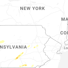
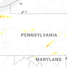
Pennsylvania
| Local Time | Report Details |
|---|---|
| 4:10 PM EDT | Multiple trees and power lines down across the are in crawford county PA, 70.6 miles ENE of Cleveland, OH |
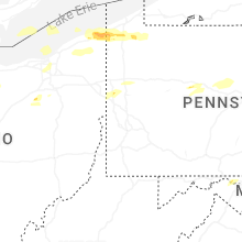
| 4:16 PM EDT | Large hickory tree blown down along with several tree limbs and swirling winds. hail to half dollar size hail. possible tornad in crawford county PA, 75.6 miles ENE of Cleveland, OH |
| 4:23 PM EDT | Lots of tree limbs down in the are in crawford county PA, 77 miles E of Cleveland, OH |
| 4:27 PM EDT | 2 large trees down north of sagertown blocking route 1 in crawford county PA, 81.8 miles ENE of Cleveland, OH |
| 4:33 PM EDT | Storm damage reported in erie county PA, 84.2 miles SW of Buffalo, NY |
| 4:37 PM EDT | Trees/power lines downe in crawford county PA, 85.9 miles E of Cleveland, OH |
| 4:41 PM EDT | Half Dollar sized hail reported near Cambridge Springs, PA, 86.8 miles ENE of Cleveland, OH |
| 4:41 PM EDT | Trees/power lines downe in crawford county PA, 72.8 miles E of Cleveland, OH |
| 4:45 PM EDT | Couple of trees dow in crawford county PA, 78.3 miles E of Cleveland, OH |
| 4:54 PM EDT | Down wire in mercer county PA, 66 miles N of Pittsburgh, PA |
| 4:55 PM EDT | Trees/power lines dow in crawford county PA, 78.8 miles N of Pittsburgh, PA |
| 4:55 PM EDT | Trees/power lines dow in crawford county PA, 88.5 miles N of Pittsburgh, PA |
| 4:56 PM EDT | Multiple trees dow in crawford county PA, 90.7 miles N of Pittsburgh, PA |
| 5:03 PM EDT | Tree blocking roadway on watson highwa in clearfield county PA, 51 miles WNW of State College, PA |
| 5:05 PM EDT | Down tree in venango county PA, 79.9 miles N of Pittsburgh, PA |
| 5:08 PM EDT | Down tree in butler county PA, 24.4 miles N of Pittsburgh, PA |
| 5:10 PM EDT | Down tree in butler county PA, 18.5 miles NNE of Pittsburgh, PA |
| 5:11 PM EDT | Down tree in venango county PA, 73.6 miles N of Pittsburgh, PA |
| 5:12 PM EDT | Trees/wires dow in somerset county PA, 60.1 miles ESE of Pittsburgh, PA |
| 5:15 PM EDT | Several trees down and some trunks snapped along stone springhouse road and breedtown road. time estimated via rada in venango county PA, 81.1 miles N of Pittsburgh, PA |
| 5:17 PM EDT | Down tree in lawrence county PA, 47.2 miles NNW of Pittsburgh, PA |
| 5:23 PM EDT | Down wire in lawrence county PA, 40.6 miles NW of Pittsburgh, PA |
| 5:25 PM EDT | Down tree in lawrence county PA, 43.8 miles NNW of Pittsburgh, PA |
| 5:25 PM EDT | Trees and wires down near intersection of pa route 27 and selkirk roa in warren county PA, 89.2 miles SSW of Buffalo, NY |
| 5:25 PM EDT | Trees down near intersection of route 127 and jimmy lan in warren county PA, 88.7 miles NNE of Pittsburgh, PA |
| 5:25 PM EDT | Trees on wires along pa 87 in potter county PA, 56.6 miles N of State College, PA |
| 5:27 PM EDT | Down tree in lawrence county PA, 38.9 miles NNW of Pittsburgh, PA |
| 5:36 PM EDT | Down wire in butler county PA, 38.7 miles N of Pittsburgh, PA |
| 5:40 PM EDT | Down tree in beaver county PA, 16.5 miles NW of Pittsburgh, PA |
| 5:40 PM EDT | Down wire in butler county PA, 37.6 miles NNW of Pittsburgh, PA |
| 5:40 PM EDT | Tree down on house in warren p in warren county PA, 72.8 miles S of Buffalo, NY |
| 5:40 PM EDT | Trees and wires down on 301 west stree in warren county PA, 72.1 miles S of Buffalo, NY |
| 5:40 PM EDT | Down power lines and tree in clarion county PA, 62.3 miles NNE of Pittsburgh, PA |
| 5:40 PM EDT | Barn roof ripped off and walls torn down. time estimated via rada in butler county PA, 38.7 miles N of Pittsburgh, PA |
| 5:44 PM EDT | Down tree in clarion county PA, 74.5 miles NNE of Pittsburgh, PA |
| 5:44 PM EDT | Corrects previous tornado report from ambridge. down trees and damage to an above ground poo in beaver county PA, 16.1 miles NW of Pittsburgh, PA |
| 5:44 PM EDT | Down tree in butler county PA, 40.1 miles N of Pittsburgh, PA |
| 5:46 PM EDT | Down tree in clarion county PA, 60.3 miles NNE of Pittsburgh, PA |
| 5:47 PM EDT | Down power line in butler county PA, 36.7 miles N of Pittsburgh, PA |
| 5:50 PM EDT | Down large branche in beaver county PA, 28.3 miles NW of Pittsburgh, PA |
| 5:51 PM EDT | Numerous down tree in beaver county PA, 29.1 miles NW of Pittsburgh, PA |
| 5:52 PM EDT | A few snapped trees with littered branches at the intersection of euclid road and muddy creek drive. time estimated via rada in butler county PA, 36.7 miles N of Pittsburgh, PA |
| 5:52 PM EDT | Numerous down tree in butler county PA, 39.8 miles N of Pittsburgh, PA |
| 5:56 PM EDT | Tree down blocking roadwa in warren county PA, 80.6 miles S of Buffalo, NY |
| 5:59 PM EDT | Down tree in butler county PA, 23.6 miles N of Pittsburgh, PA |
| 6:00 PM EDT | Trees/wires down on bain r in franklin county PA, 72.7 miles S of State College, PA |
| 6:01 PM EDT | Tree down near water street and south hillside ave tree dow in mckean county PA, 79.8 miles S of Buffalo, NY |
| 6:04 PM EDT | Down wire in butler county PA, 42.7 miles NNE of Pittsburgh, PA |
| 6:09 PM EDT | Down tree in butler county PA, 18.1 miles N of Pittsburgh, PA |
| 6:10 PM EDT | Large down tree in allegheny county PA, 10.3 miles WNW of Pittsburgh, PA |
| 6:15 PM EDT | Tree down near sedgwick street and state route 32 in mckean county PA, 78.1 miles NW of State College, PA |
| 6:15 PM EDT | Large branches dow in allegheny county PA, 5.6 miles WNW of Pittsburgh, PA |
| 6:16 PM EDT | Trees down on chestnut stree in mckean county PA, 77.6 miles NW of State College, PA |
| 6:24 PM EDT | Tree down near us route 21 in mckean county PA, 76.6 miles NW of State College, PA |
| 6:26 PM EDT | Down tree in butler county PA, 22.3 miles NE of Pittsburgh, PA |
| 6:27 PM EDT | Tree down on williamson roa in franklin county PA, 67.4 miles S of State College, PA |
| 6:29 PM EDT | Trees dow in washington county PA, 13.9 miles SW of Pittsburgh, PA |
| 6:30 PM EDT | Large tree down across brighton road near giant eagle. time estimated via rada in allegheny county PA, 4.2 miles NNW of Pittsburgh, PA |
| 6:30 PM EDT | Storm damage reported in allegheny county PA, 4.8 miles WSW of Pittsburgh, PA |
| 6:35 PM EDT | Trees and wires dow in franklin county PA, 63.8 miles NW of Baltimore, MD |
| 6:35 PM EDT | Wires down on church stree in franklin county PA, 65.2 miles SSE of State College, PA |
| 6:37 PM EDT | Trees down on wires on route in mckean county PA, 75.7 miles NNW of State College, PA |
| 6:45 PM EDT | Tree down blocking road near indian creek and north branch roa in mckean county PA, 65.9 miles SSE of Buffalo, NY |
| 6:47 PM EDT | Tree down on road near westinghouse bridge. photo provide in allegheny county PA, 9.4 miles ESE of Pittsburgh, PA |
| 6:53 PM EDT | Trees and wires dow in mckean county PA, 69 miles NNW of State College, PA |
| 6:53 PM EDT | Tree down near route 6 in liberty townshi in mckean county PA, 72.6 miles NNW of State College, PA |
| 7:00 PM EDT | Several trees down near valley rd and rye brubeck circl in perry county PA, 56.8 miles SE of State College, PA |
| 7:02 PM EDT | Down wire in indiana county PA, 45 miles ENE of Pittsburgh, PA |
| 7:04 PM EDT | Multiple trees down by upper bark shanty road and state route 87 in potter county PA, 63 miles N of State College, PA |
| 7:07 PM EDT | Multiple trees down blocking roadway ridge roa in potter county PA, 72.8 miles N of State College, PA |
| 7:08 PM EDT | Phone lines and trees down along with 1 inch hai in cumberland county PA, 54.3 miles SE of State College, PA |
| 7:08 PM EDT | Quarter sized hail reported near Carlisle, PA, 54.3 miles SE of State College, PA |
| 7:12 PM EDT | Down power line in indiana county PA, 56.1 miles ENE of Pittsburgh, PA |
| 7:18 PM EDT | Tree down on cherry springs roa in potter county PA, 60.5 miles N of State College, PA |
| 7:19 PM EDT | Down tree in fayette county PA, 33.7 miles SSE of Pittsburgh, PA |
| 7:20 PM EDT | Corrects time from previous tstm wnd dmg report from 2 w marysvill in perry county PA, 56.8 miles SE of State College, PA |
| 7:21 PM EDT | Seven trees down... pea sized hai in dauphin county PA, 55 miles ESE of State College, PA |
| 7:24 PM EDT | Quarter sized hail reported near Mechanicsburg, PA, 56.3 miles SE of State College, PA, report from mping: quarter (1.00 in.). |
| 7:25 PM EDT | Tree down on carolyn stree in dauphin county PA, 64.6 miles ESE of State College, PA |
| 7:26 PM EDT | Tree down on peters mountain roa in dauphin county PA, 54.9 miles ESE of State College, PA |
| 7:29 PM EDT | Tree down onto a house in middle paxton township... no injuries reporte in dauphin county PA, 57.1 miles ESE of State College, PA |
| 7:30 PM EDT | Multiple trees down in halifax township peters mountain pa 147 near million dollar r in dauphin county PA, 54.1 miles ESE of State College, PA |
| 7:35 PM EDT | Corrects previous tstm wnd dmg report from 2 sse pine glen. trees down on road hit wires with reports of a roof lifted off of a residence on the 800 block of pine glen in centre county PA, 22.1 miles NNW of State College, PA |
| 7:37 PM EDT | Down tree in fayette county PA, 39.7 miles SE of Pittsburgh, PA |
| 7:55 PM EDT | Multiple trees down on bedford stree in cambria county PA, 59.2 miles E of Pittsburgh, PA |
| 7:57 PM EDT | Down tree in fayette county PA, 47.9 miles SE of Pittsburgh, PA |
| 8:00 PM EDT | Tree dow in tioga county PA, 57.7 miles NNE of State College, PA |
| 8:04 PM EDT | Tree down on car on east howard stree in centre county PA, 9.1 miles NNE of State College, PA |
| 8:15 PM EDT | Trees down on wires... time based on rada in schuylkill county PA, 56.4 miles SW of Scranton, PA |
| 8:17 PM EDT | Trees and wires down on union church roa in york county PA, 40.5 miles N of Baltimore, MD |
| 8:19 PM EDT | Large tree down blocking the roadway in blue knob state park... near burnt house picnic are in bedford county PA, 53.9 miles SW of State College, PA |
| 8:23 PM EDT | Trees down... time based on rada in schuylkill county PA, 48.2 miles SW of Scranton, PA |
| 8:24 PM EDT | Multiple trees down in freedom townshi in blair county PA, 46.3 miles SW of State College, PA |
| 8:26 PM EDT | Corrects previous tstm wnd dmg report from 3 nw stonybrook. tree down on deininger roa in york county PA, 49.7 miles N of Baltimore, MD |
| 8:29 PM EDT | 50kt wind gust at klh in clinton county PA, 33.2 miles NE of State College, PA |
| 8:31 PM EDT | Trees down... time based on rada in schuylkill county PA, 41.9 miles SW of Scranton, PA |
| 8:36 PM EDT | Two trees down on pine creek av in lycoming county PA, 40.5 miles NE of State College, PA |
| 8:38 PM EDT | Tree down on wir in lycoming county PA, 41.3 miles NE of State College, PA |
| 8:39 PM EDT | Tree down on tomhicken rd near prospect r in luzerne county PA, 37.7 miles SW of Scranton, PA |
| 8:41 PM EDT | Tree down on cement hollow roa in lycoming county PA, 43.9 miles NE of State College, PA |
| 8:45 PM EDT | Wires dow in lancaster county PA, 46.9 miles NNE of Baltimore, MD |
| 8:45 PM EDT | Wires down on muddle creek forks roa in york county PA, 37.9 miles N of Baltimore, MD |
| 8:46 PM EDT | Trees and wires down on west village driv in lycoming county PA, 48.6 miles NE of State College, PA |
| 8:50 PM EDT | Trees down... time based on rada in york county PA, 39.8 miles N of Baltimore, MD |
| 9:09 PM EDT | Tree down on reynolds st near rutter av in luzerne county PA, 15.8 miles SW of Scranton, PA |
| 9:13 PM EDT | Wires down and arcing in lewis townshi in northumberland county PA, 61 miles WSW of Scranton, PA |
| 9:15 PM EDT | Wires down. time based on rada in lancaster county PA, 40.8 miles NE of Baltimore, MD |
| 10:20 PM EDT | Several reports of wires down around media. time estimated from rada in delaware county PA, 78.2 miles NE of Baltimore, MD |
| 10:23 PM EDT | Trees and wires down around marple township. time estimated from rada in delaware county PA, 81.1 miles NE of Baltimore, MD |
| 10:25 PM EDT | Multiple reports of wires down around ridley park and prospect park in delaware county. time estimated from rada in delaware county PA, 80.8 miles ENE of Baltimore, MD |
| 10:27 PM EDT | Trees down around radnor township. time estimated from rada in delaware county PA, 84.8 miles NE of Baltimore, MD |
| 10:29 PM EDT | Reports of wires down around broomall. time estimated from rada in delaware county PA, 81.5 miles NE of Baltimore, MD |
| 10:36 PM EDT | Trees down along lincoln drive near gypsy ln with a lane restriction. time estimated from rada in philadelphia county PA, 76.9 miles WSW of Brooklyn, NY |
| 10:54 PM EDT | Trees down around doylestown. time estimated from rada in bucks county PA, 65.6 miles WSW of Brooklyn, NY |
| 11:06 PM EDT | Downed tree on general mercer road... resulting in a road closure. time estimated from rada in bucks county PA, 54 miles WSW of Brooklyn, NY |
| 11:08 PM EDT | Trees down in falls township... pa. time estimated from rada in bucks county PA, 55.5 miles SW of Brooklyn, NY |
Florida
| Local Time | Report Details |
|---|---|
| 4:28 PM EDT | Received pictures of damage to mobile homes in the tropical haven community in melbourne off of w nasa blvd. one unit had a carport ripped from the ground and folded ov in brevard county FL, 55 miles SE of Orlando, FL |
| 6:50 PM EDT | A very large limb from an oak tree was downed in fernandina beach. time estimated via rada in nassau county FL, 26.1 miles NNE of Jacksonville, FL |
Alabama
| Local Time | Report Details |
|---|---|
| 4:04 PM CDT | Tree down in the road near highway 73 at county road 262. time estimated from rada in jackson county AL, 19.9 miles WSW of Chattanooga, TN |
| 4:09 PM CDT | Downed tree and power lines near yarbrough lane and s market street. time estimated from rada in jackson county AL, 48.8 miles WSW of Chattanooga, TN |
| 4:27 PM CDT | Tree down across the road on county road 322. time estimated from rada in jackson county AL, 40.3 miles SW of Chattanooga, TN |
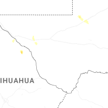
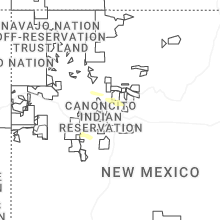
New Mexico
| Local Time | Report Details |
|---|---|
| 3:43 PM MDT | Estimated 50-60mph peak wind gust alongside dime size hai in sandoval county NM, 16.1 miles NNW of Albuquerque, NM |
| 6:08 PM MDT | Thunderstorm wind gust recorded at wfo el pas in dona ana county NM, 14.7 miles WNW of El Paso, TX |
| 6:14 PM MDT | Mesonet station nwsep santa teresa nws rsoi in dona ana county NM, 14.7 miles WNW of El Paso, TX |
Maryland
| Local Time | Report Details |
|---|---|
| 6:06 PM EDT | Tree down due to thunderstorm winds along i-70 eastboun in washington county MD, 79 miles WNW of Baltimore, MD |
| 6:08 PM EDT | Tree down due to thunderstorm winds near national pike and licking creek roa in washington county MD, 79.5 miles S of State College, PA |
| 6:10 PM EDT | Multiple reports of trees down along and near i-70 and earnstvill in washington county MD, 79 miles WNW of Baltimore, MD |
| 6:10 PM EDT | Multiple trees and wires down along and south of i-70 due to thunderstorm wind in washington county MD, 72.4 miles WNW of Baltimore, MD |
| 6:15 PM EDT | Trees and wires down near mercersburg road and faith road. time estimated via rada in washington county MD, 74.8 miles WNW of Baltimore, MD |
| 6:15 PM EDT | Trees and wires down near lanes run road and indian springs roa in washington county MD, 77.8 miles S of State College, PA |
| 6:20 PM EDT | Trees and wires down at cove roa in washington county MD, 76.9 miles WNW of Baltimore, MD |
| 7:19 PM EDT | Several trees reported down due to thunderstorm winds along pomfret road. time estimated via rada in charles county MD, 54 miles SSW of Baltimore, MD |
| 7:20 PM EDT | Half Dollar sized hail reported near La Plata, MD, 57 miles SSW of Baltimore, MD |
| 7:22 PM EDT | Tree down on cobb island. time estimated via rada in charles county MD, 68.1 miles NE of Richmond, VA |
| 7:24 PM EDT | Tree down at 21409 oakley rd in st. marys county MD, 70.9 miles S of Baltimore, MD |
| 7:30 PM EDT | Tree down at 30015 three notch rd in st. marys county MD, 56 miles S of Baltimore, MD |
| 7:38 PM EDT | Tree down onto structure at 30326 summit hill dr in st. marys county MD, 54.9 miles S of Baltimore, MD |
| 7:40 PM EDT | Tree down at summit hill drive. time estimated via rada in st. marys county MD, 54.8 miles S of Baltimore, MD |
| 7:45 PM EDT | Tree and power line down at yardley drive and crofton cour in calvert county MD, 52.5 miles S of Baltimore, MD |
| 7:45 PM EDT | Tree and power line down at german chapel road and dan bowen roa in calvert county MD, 53.2 miles S of Baltimore, MD |
| 7:56 PM EDT | Tree down at western shores boulevard and st leonard roa in calvert county MD, 55.5 miles S of Baltimore, MD |
| 8:10 PM EDT | Trees downed on concord pond rd. report via social medi in wicomico county MD, 31.9 miles W of Ocean City, MD |
| 8:15 PM EDT | Trees downed at us-50 and md-16. social media report. time radar-estimate in dorchester county MD, 54.4 miles WNW of Ocean City, MD |
| 8:17 PM EDT | A tree fell down due to thunderstorm winds at daysville road and harp road. time estimated via rada in frederick county MD, 38.9 miles WNW of Baltimore, MD |
| 8:24 PM EDT | Cell tower damaged near 9095 bessie clemson rd in frederick county MD, 34.2 miles WNW of Baltimore, MD |
| 8:24 PM EDT | Cell tower damaged near 9095 bessie clemson rd in frederick county MD, 34.2 miles WNW of Baltimore, MD |
| 8:24 PM EDT | Farming equipment overturned at 13202 coppermine rd in frederick county MD, 35 miles WNW of Baltimore, MD |
| 8:24 PM EDT | Trees onto vehicles at 13000 st. benedict way in frederick county MD, 33.7 miles WNW of Baltimore, MD |
| 8:24 PM EDT | Barn collapse at 9205 bessie clemson rd in frederick county MD, 34.5 miles WNW of Baltimore, MD |
| 8:24 PM EDT | Barn collapse at 9205 bessie clemson rd in frederick county MD, 34.5 miles WNW of Baltimore, MD |
| 8:24 PM EDT | Barn collapse at 9205 bessie clemson rd in frederick county MD, 34.5 miles WNW of Baltimore, MD |
| 8:24 PM EDT | Multiple structures damaged due to high wind in frederick county MD, 36.4 miles WNW of Baltimore, MD |
| 8:25 PM EDT | Tree down and barn damaged at 10102 bessie clemson rd in frederick county MD, 34.6 miles WNW of Baltimore, MD |
| 8:25 PM EDT | Barn roof damaged at 9701 fountain school rd in frederick county MD, 35.2 miles WNW of Baltimore, MD |
| 8:25 PM EDT | Barn damaged and house shingles damaged at 9804 fountain school rd in frederick county MD, 35.7 miles WNW of Baltimore, MD |
| 8:25 PM EDT | Barn damaged and house shingles damaged at 9804 fountain school rd in frederick county MD, 35.7 miles WNW of Baltimore, MD |
| 8:25 PM EDT | House damaged and tree onto vehicle at 10209 fountain school rd in frederick county MD, 35.5 miles WNW of Baltimore, MD |
| 8:25 PM EDT | House damaged and tree onto vehicle at 10209 fountain school rd in frederick county MD, 35.5 miles WNW of Baltimore, MD |
| 8:26 PM EDT | County highway building damaged near 13216 coppermine rd in frederick county MD, 35 miles WNW of Baltimore, MD |
| 8:26 PM EDT | Tree down onto structure at 45709 belvoir rd in st. marys county MD, 70.1 miles S of Baltimore, MD |
| 8:26 PM EDT | Tree down at new windsor road and bessie clemson road. time estimated via rada in frederick county MD, 34.5 miles WNW of Baltimore, MD |
| 9:35 PM EDT | Multiple trees down in the vicinity of wheeler school rd and st. mary's rd in harford county MD, 29.5 miles NNE of Baltimore, MD |
| 9:39 PM EDT | Multiple trees down near and along wheeler school road. time estimated via rada in harford county MD, 30.8 miles NNE of Baltimore, MD |
Texas
| Local Time | Report Details |
|---|---|
| 7:17 PM MDT | Asos station kbif biggs field awo in el paso county TX, 8.9 miles NE of El Paso, TX |
| 7:44 PM MDT | Asos station kelp el paso international airpor in el paso county TX, 7.6 miles NE of El Paso, TX |
New Jersey
| Local Time | Report Details |
|---|---|
| 11:13 PM EDT | Wires down in gloucester city. time estimated from rada in camden county NJ, 81.4 miles SW of Brooklyn, NY |
| 11:17 PM EDT | Trees and wires down around hamilton township. time estimated from rada in mercer county NJ, 49.3 miles SW of Brooklyn, NY |
| 11:25 PM EDT | Downed trees on nj 27 northbound north of us 206 (princeton twp)... all lanes closed. time estimated from rada in mercer county NJ, 42 miles SW of Brooklyn, NY |
Connect with Interactive Hail Maps