

Hail Map for Sunday, April 5, 2026

Number of Impacted Households on 4/5/2026
0
Impacted by 1" or Larger Hail
0
Impacted by 1.75" or Larger Hail
0
Impacted by 2.5" or Larger Hail
Square Miles of Populated Area Impacted on 4/5/2026
0
Impacted by 1" or Larger Hail
0
Impacted by 1.75" or Larger Hail
0
Impacted by 2.5" or Larger Hail
Cities Most Affected by Hail Storms of 4/5/2026
| Hail Size | Demographics of Zip Codes Affected | ||||||
|---|---|---|---|---|---|---|---|
| City | Count | Average | Largest | Pop Density | House Value | Income | Age |
Hail and Wind Damage Spotted on 4/5/2026
Filter by Report Type:Hail ReportsWind Reports
North Carolina
| Local Time | Report Details |
|---|---|
| 1:22 PM EDT | Tree down along 1000 block of hamilton s in halifax county NC, 72 miles S of Richmond, VA |
| 1:22 PM EDT | Tree down along 700 block of carolina avenu in halifax county NC, 72.4 miles NE of Raleigh, NC |
| 1:22 PM EDT | Power line down near clinton st and roanoke av in halifax county NC, 71.6 miles NE of Raleigh, NC |
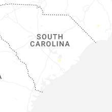
South Carolina
| Local Time | Report Details |
|---|---|
| 2:30 PM EDT | One tree down and part of another tree snapped in temperance hil in marion county SC, 82.2 miles W of Wilmington, NC |
Virginia
| Local Time | Report Details |
|---|---|
| 2:30 PM EDT | Several reports of trees down in isle of wight county south of windsor blvd. time estimated from rada in isle of wight county VA, 38.4 miles W of Virginia Beach, VA |
| 2:49 PM EDT | Mesonet station xmgl middle ground lighthous in anz638 county VA, 22.7 miles NW of Virginia Beach, VA |
| 2:57 PM EDT | Awos station kngu norfolk nas cha in city of norfolk county VA, 16.3 miles NW of Virginia Beach, VA |
| 3:03 PM EDT | Mesonet station xbbt third islan in anz632 county VA, 19.7 miles N of Virginia Beach, VA |
| 3:15 PM EDT | Tree down along moses grandy trail in chesapeake near us 17 and millville r in city of chesapeake county VA, 14 miles W of Virginia Beach, VA |
Connect with Interactive Hail Maps