

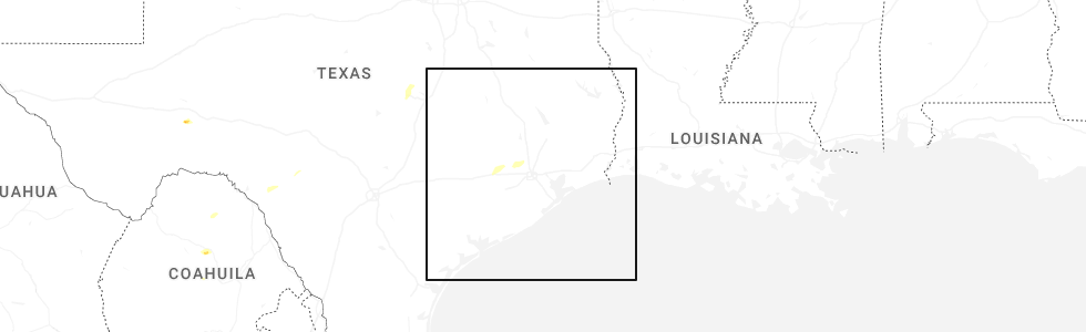
Hail Map for Sunday, April 12, 2026
Number of Impacted Households on 4/12/2026
0
Impacted by 1" or Larger Hail
0
Impacted by 1.75" or Larger Hail
0
Impacted by 2.5" or Larger Hail
Square Miles of Populated Area Impacted on 4/12/2026
0
Impacted by 1" or Larger Hail
0
Impacted by 1.75" or Larger Hail
0
Impacted by 2.5" or Larger Hail
Cities Most Affected by Hail Storms of 4/12/2026
| Hail Size | Demographics of Zip Codes Affected | ||||||
|---|---|---|---|---|---|---|---|
| City | Count | Average | Largest | Pop Density | House Value | Income | Age |
| Cherokee, TX | 1 | 2.00 | 2.00 | 1 | $65k | $31.9k | 46.5 |
Hail and Wind Damage Spotted on 4/12/2026
Filter by Report Type:Hail ReportsWind Reports
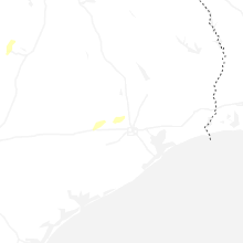
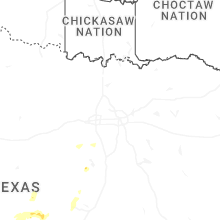
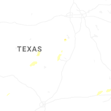
Texas
| Local Time | Report Details |
|---|---|
| 12:51 PM CDT | Wind damage with a tree down or two... minor structural damage... and a tossed trampoline or two in southwestern portions of schulenburg. the radar had indicated a micr in fayette county TX, 92.8 miles W of Houston, TX |
| 3:26 PM CDT | Quarter sized hail reported near Gatesville, TX, 21 miles N of Killeen, TX, report from mping: quarter (1.00 in.). |
| 5:48 PM CDT | Memphis wtm gust to 59 mph at 5:48 pm cd in hall county TX, 27.6 miles NW of Childress, TX |
| 8:30 PM CDT | Hen Egg sized hail reported near Cherokee, TX, 59.6 miles W of Killeen, TX |
Utah
| Local Time | Report Details |
|---|---|
| 1:10 PM MDT | Udot i-15 at willard poe reported a gust of 60 mp in box elder county UT, 47.8 miles N of Salt Lake City, UT |
| 2:10 PM MDT | Hill afb asos reported a 60 mph wind gus in davis county UT, 24.5 miles N of Salt Lake City, UT |
| 2:34 PM MDT | Public report of a large hardwood tree snapped near the base. time estimated by radar and time of report receive in davis county UT, 19 miles NNW of Salt Lake City, UT |
| 2:55 PM MDT | Cenews station reported a 59 mph gus in davis county UT, 15.2 miles N of Salt Lake City, UT |
| 2:55 PM MDT | Photo on social media of large branch around 6 inches in diameter snapped. time estimated from rada in davis county UT, 11.1 miles N of Salt Lake City, UT |
| 9:16 PM MDT | Asos station kmlf milford municipal airpor in beaver county UT, 50.8 miles WSW of Monroe, UT |
| 9:30 PM MDT | Mesonet station utpch i-15 at pine creek hil in beaver county UT, 29 miles WSW of Monroe, UT |
Idaho
| Local Time | Report Details |
|---|---|
| 1:45 PM MDT | Yale itd mesonet sit in cassia county ID, 53.1 miles E of Twin Falls, ID |
| 1:45 PM MDT | Tom cat summit itd sit in butte county ID, 72.7 miles NE of Twin Falls, ID |
| 2:00 PM MDT | Coldwater itd mesone in power county ID, 67.4 miles E of Twin Falls, ID |
| 2:20 PM MDT | Storm damage reported in bingham county ID, 54.2 miles SW of Idaho Falls, ID |
| 2:30 PM MDT | Sterling itd mesonet sit in bingham county ID, 46.8 miles SW of Idaho Falls, ID |
| 2:33 PM MDT | Pocatello regional airport aso in power county ID, 47.6 miles SW of Idaho Falls, ID |
| 2:34 PM MDT | Storm damage reported in bingham county ID, 54.2 miles SW of Idaho Falls, ID |
| 2:45 PM MDT | Tom cat summit itd sit in butte county ID, 72.7 miles NE of Twin Falls, ID |
| 2:50 PM MDT | Taber mesonet sit in bingham county ID, 34.7 miles WSW of Idaho Falls, ID |
| 3:00 PM MDT | Inl puzzle mesonet sit in butte county ID, 42.6 miles W of Idaho Falls, ID |
| 3:00 PM MDT | Tilden flats itd sit in bingham county ID, 31.4 miles WSW of Idaho Falls, ID |
| 3:10 PM MDT | Medicine lodge mesonet sit in clark county ID, 61.3 miles NNW of Idaho Falls, ID |
| 3:30 PM MDT | Relay ridg in teton county ID, 38.3 miles ENE of Idaho Falls, ID |
| 3:35 PM MDT | Storm damage reported in jefferson county ID, 30.6 miles NW of Idaho Falls, ID |
| 3:40 PM MDT | Storm damage reported in jefferson county ID, 30.6 miles NW of Idaho Falls, ID |
| 3:45 PM MDT | Rover mesonet sit in jefferson county ID, 29.1 miles WNW of Idaho Falls, ID |
| 3:45 PM MDT | Junction 33/22 summit itd mesonet sit in butte county ID, 45.6 miles WNW of Idaho Falls, ID |
| 3:50 PM MDT | Specific manufacturing inl sit in butte county ID, 42.8 miles NW of Idaho Falls, ID |
| 3:55 PM MDT | Specific manufacturing inl sit in butte county ID, 42.8 miles NW of Idaho Falls, ID |
Nevada
| Local Time | Report Details |
|---|---|
| 3:59 PM PDT | Storm damage reported in clark county NV, 23.2 miles WSW of Las Vegas, NV |
Minnesota
| Local Time | Report Details |
|---|---|
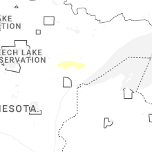
| 6:19 PM CDT | Quarter sized hail reported near Canyon, MN, 23.4 miles NNW of Duluth, MN, reported via spotternetwork. |
Montana
| Local Time | Report Details |
|---|---|
| 6:15 PM MDT | 61 mph convective wind gust. mesonet station mtnor norris hill (mt dot in madison county MT, 34.6 miles WSW of Bozeman, MT |
Connect with Interactive Hail Maps