

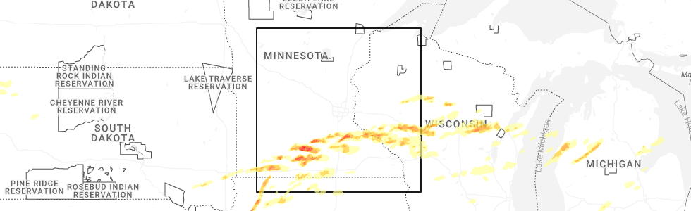
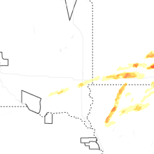
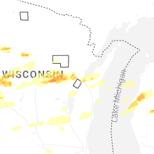
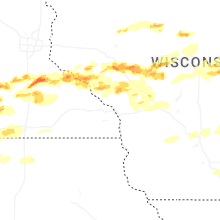
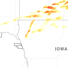
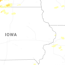
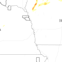
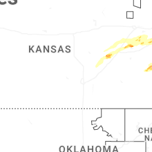
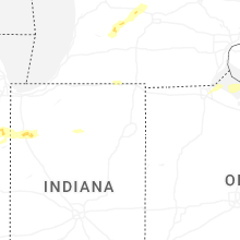
Hail Map for Monday, April 13, 2026
Number of Impacted Households on 4/13/2026
0
Impacted by 1" or Larger Hail
0
Impacted by 1.75" or Larger Hail
0
Impacted by 2.5" or Larger Hail
Square Miles of Populated Area Impacted on 4/13/2026
0
Impacted by 1" or Larger Hail
0
Impacted by 1.75" or Larger Hail
0
Impacted by 2.5" or Larger Hail

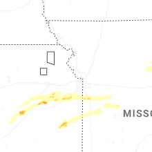
Cities Most Affected by Hail Storms of 4/13/2026
| Hail Size | Demographics of Zip Codes Affected | ||||||
|---|---|---|---|---|---|---|---|
| City | Count | Average | Largest | Pop Density | House Value | Income | Age |
| Lake Crystal, MN | 6 | 2.67 | 3.50 | 16 | $87k | $43.0k | 40.2 |
| Saint James, MN | 5 | 2.05 | 2.50 | 35 | $62k | $35.3k | 40.6 |
| Faribault, MN | 4 | 2.25 | 3.00 | 153 | $113k | $44.7k | 37.5 |
| Lake City, MN | 4 | 2.13 | 2.50 | 53 | $106k | $42.8k | 46.1 |
| Cottonwood Falls, KS | 4 | 2.00 | 2.75 | 4 | $46k | $29.1k | 44.0 |
| Hanska, MN | 3 | 2.33 | 2.75 | 10 | $69k | $42.0k | 40.9 |
| Windom, MN | 3 | 2.00 | 2.00 | 33 | $65k | $32.6k | 44.5 |
| Saint Peter, MN | 2 | 2.63 | 2.75 | 91 | $112k | $43.4k | 29.9 |
| Ottawa, KS | 2 | 2.38 | 2.75 | 96 | $73k | $37.4k | 35.8 |
| Owatonna, MN | 2 | 2.13 | 2.25 | 143 | $106k | $47.0k | 38.2 |
| Osage City, KS | 2 | 2.00 | 2.00 | 27 | $72k | $35.6k | 42.1 |
| Mountain Lake, MN | 2 | 1.88 | 2.00 | 19 | $46k | $30.4k | 39.8 |
| Osseo, WI | 2 | 1.75 | 1.75 | 27 | $78k | $40.1k | 40.6 |
| Fairchild, WI | 2 | 1.75 | 1.75 | 15 | $55k | $28.4k | 40.6 |
| Dennison, MN | 1 | 3.30 | 3.30 | 17 | $124k | $54.1k | 45.5 |
| Waseca, MN | 1 | 3.00 | 3.00 | 67 | $90k | $42.9k | 38.7 |
| Cochrane, WI | 1 | 3.00 | 3.00 | 34 | $85k | $38.4k | 47.1 |
| Kenyon, MN | 1 | 2.50 | 2.50 | 27 | $93k | $45.8k | 42.8 |
| Amboy, MN | 1 | 2.50 | 2.50 | 7 | $66k | $37.3k | 45.2 |
| Portland, MI | 1 | 2.00 | 2.00 | 118 | $114k | $53.5k | 38.0 |
| Reading, KS | 1 | 2.00 | 2.00 | 5 | $34k | $33.8k | 42.1 |
| Nicollet, MN | 1 | 2.00 | 2.00 | 13 | $102k | $44.4k | 36.4 |
| Humbird, WI | 1 | 2.00 | 2.00 | 17 | $47k | $35.3k | 39.1 |
| Pomona, KS | 1 | 2.00 | 2.00 | 19 | $68k | $35.3k | 42.6 |
| Lakefield, MN | 1 | 2.00 | 2.00 | 10 | $48k | $34.9k | 44.0 |
| Marshfield, WI | 1 | 2.00 | 2.00 | 155 | $87k | $40.7k | 42.2 |
| Sanborn, IA | 1 | 1.75 | 1.75 | 14 | $64k | $37.8k | 44.7 |
| Lewisville, MN | 1 | 1.75 | 1.75 | 7 | $34k | $32.4k | 42.1 |
| Odin, MN | 1 | 1.75 | 1.75 | 6 | $39k | $38.5k | 44.0 |
| Remsen, IA | 1 | 1.75 | 1.75 | 13 | $81k | $38.6k | 41.5 |
| Chili, WI | 1 | 1.75 | 1.75 | 32 | $69k | $37.9k | 34.2 |
| Rotan, TX | 1 | 1.75 | 1.75 | 5 | $31k | $24.2k | 45.7 |
| Granville, IA | 1 | 1.75 | 1.75 | 7 | $49k | $41.0k | 39.4 |
| Northfield, MN | 1 | 1.75 | 1.75 | 163 | $151k | $53.4k | 30.5 |
| Emporia, KS | 1 | 1.75 | 1.75 | 99 | $71k | $32.1k | 30.7 |
| Harris, IA | 1 | 1.75 | 1.75 | 4 | $51k | $36.0k | 45.1 |
| Cleveland, MN | 1 | 1.75 | 1.75 | 41 | $102k | $50.8k | 42.4 |
Hail and Wind Damage Spotted on 4/13/2026
Filter by Report Type:Hail ReportsWind Reports
States Impacted
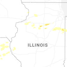
Illinois, Indiana, Minnesota, South Dakota, Wisconsin, Kansas, Iowa, Texas, Michigan, Ohio, MissouriIllinois
| Local Time | Report Details |
|---|---|
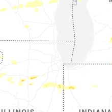
| 1:55 PM CDT | Quarter sized hail reported near Marseilles, IL, 63.6 miles NE of Peoria, IL, spotter reports lots of pea sized hail but a few stones up to quarter size. |
| 2:04 PM CDT | Measured at pws kilbonfi1 in kankakee county IL, 57 miles SSW of Chicago, IL |
| 2:21 PM CDT | Report of 2 power poles down. relayed by em. time estimated via rada in kankakee county IL, 61.3 miles SSW of Chicago, IL |
| 2:25 PM CDT | Report of a tree down and 3 power poles snapped at the base. tree size unknown. time estimated from rada in kankakee county IL, 47 miles SSW of Chicago, IL |
| 2:25 PM CDT | Report of a tree down and 3 power poles snapped at the base. tree size unknown. time estimated from rada in kankakee county IL, 47 miles SSW of Chicago, IL |
Indiana
| Local Time | Report Details |
|---|---|
| 3:14 PM CDT | Time estimated from rada in newton county IN, 63 miles S of Chicago, IL |
| 3:20 PM CDT | Measured at kvp in porter county IN, 44.4 miles SE of Chicago, IL |
| 3:43 PM CDT | Half Dollar sized hail reported near Rensselaer, IN, 69.4 miles SSE of Chicago, IL, photo shared on social media of slightly larger-than-quarter sized hail east of the jasper county fairgrounds. time estimated from radar. |
Minnesota
| Local Time | Report Details |
|---|---|
| 3:25 PM CDT | Quarter sized hail reported near Faribault, MN, 48.3 miles S of Minneapolis, MN |
| 3:25 PM CDT | Hen Egg sized hail reported near Faribault, MN, 47.6 miles S of Minneapolis, MN, corrects previous hail report from 2 wsw faribault. egg sized hail reported via slack. time estimated via radar. |
| 3:27 PM CDT | Ping Pong Ball sized hail reported near Faribault, MN, 46.2 miles S of Minneapolis, MN, report from mping: ping pong ball (1.50 in.). |
| 3:35 PM CDT | Hen Egg sized hail reported near Faribault, MN, 47.6 miles S of Minneapolis, MN, egg sized hail reported via slack. time estimated via radar. |
| 3:39 PM CDT | Ping Pong Ball sized hail reported near Faribault, MN, 47.6 miles S of Minneapolis, MN |
| 3:48 PM CDT | Hen Egg sized hail reported near Faribault, MN, 44.2 miles S of Minneapolis, MN |
| 3:53 PM CDT | Tea Cup sized hail reported near Faribault, MN, 44.2 miles S of Minneapolis, MN |
| 3:55 PM CDT | Ping Pong Ball sized hail reported near Cannon Falls, MN, 43.2 miles SSE of Minneapolis, MN, report from mping: ping pong ball (1.50 in.). |
| 3:56 PM CDT | Ping Pong Ball sized hail reported near Cannon Falls, MN, 42.4 miles SSE of Minneapolis, MN, report from mping: ping pong ball (1.50 in.). |
| 3:57 PM CDT | Quarter sized hail reported near Cannon Falls, MN, 41.5 miles SSE of Minneapolis, MN, report from mping: quarter (1.00 in.). |
| 4:00 PM CDT | Golf Ball sized hail reported near Northfield, MN, 40.3 miles SSE of Minneapolis, MN, reported relayed via slack. |
| 4:25 PM CDT | Ping Pong Ball sized hail reported near Dennison, MN, 39.3 miles SSE of Minneapolis, MN |
| 4:45 PM CDT | Tennis Ball sized hail reported near Kenyon, MN, 46.8 miles SSE of Minneapolis, MN, delayed report relayed with a photo via nwschat. |
| 5:33 PM CDT | Hen Egg sized hail reported near Saint James, MN, 87.8 miles NW of Mason City, IA, report from mping: hen egg (2.00 in.). |
| 5:34 PM CDT | Tennis Ball sized hail reported near Saint James, MN, 87 miles NW of Mason City, IA, report from mping: tennis ball (2.50 in.). |
| 5:35 PM CDT | Golf Ball sized hail reported near Odin, MN, 87.5 miles NNE of Storm Lake, IA |
| 5:38 PM CDT | Golf Ball sized hail reported near Saint James, MN, 88.8 miles NNE of Storm Lake, IA |
| 5:43 PM CDT | Tennis Ball sized hail reported near Lake City, MN, 57.4 miles SE of Minneapolis, MN |
| 5:45 PM CDT | Hen Egg sized hail reported near Lake City, MN, 55.4 miles SE of Minneapolis, MN |
| 5:48 PM CDT | Hen Egg sized hail reported near Nicollet, MN, 64.4 miles SW of Minneapolis, MN |
| 5:50 PM CDT | Mesonet station mn143 u.s.63 - lake city - mp 62. in wabasha county MN, 60.5 miles SE of Minneapolis, MN |
| 5:50 PM CDT | Hen Egg sized hail reported near Lake City, MN, 55.5 miles SE of Minneapolis, MN |
| 5:51 PM CDT | Quarter sized hail reported near Lake City, MN, 62.7 miles SE of Minneapolis, MN, report from mping: quarter (1.00 in.). |
| 5:52 PM CDT | Hen Egg sized hail reported near Saint James, MN, 83.8 miles NW of Mason City, IA, report from mping: hen egg (2.00 in.). |
| 5:54 PM CDT | Ping Pong Ball sized hail reported near Saint James, MN, 85.4 miles NW of Mason City, IA |
| 5:59 PM CDT | Quarter sized hail reported near Lake City, MN, 61.1 miles SE of Minneapolis, MN, report from mping: quarter (1.00 in.). |
| 5:59 PM CDT | Quarter sized hail reported near Fulda, MN, 65.6 miles ENE of Sioux Falls, SD |
| 6:00 PM CDT | Hen Egg sized hail reported near Lake City, MN, 60.7 miles SE of Minneapolis, MN |
| 6:03 PM CDT | Quarter sized hail reported near Lake City, MN, 61.9 miles SE of Minneapolis, MN, report from mping: quarter (1.00 in.). |
| 6:04 PM CDT | Half Dollar sized hail reported near Lake City, MN, 62.7 miles SE of Minneapolis, MN, report from mping: half dollar (1.25 in.). |
| 6:04 PM CDT | Golf Ball sized hail reported near Lewisville, MN, 82.4 miles NW of Mason City, IA |
| 6:12 PM CDT | Ping Pong Ball sized hail reported near Saint Peter, MN, 57.3 miles SW of Minneapolis, MN, report from mping: ping pong ball (1.50 in.). |
| 6:13 PM CDT | Tennis Ball sized hail reported near Saint Peter, MN, 57.8 miles SW of Minneapolis, MN, report from mping: tennis ball (2.50 in.). |
| 6:15 PM CDT | Hen Egg sized hail reported near Windom, MN, 75.4 miles SSE of Montevideo, MN |
| 6:17 PM CDT | Baseball sized hail reported near Saint Peter, MN, 57.8 miles SW of Minneapolis, MN, report from mping: baseball (2.75 in.). |
| 6:20 PM CDT | Hen Egg sized hail reported near Windom, MN, 78.3 miles SSE of Montevideo, MN, social media report with pictures and ruler. |
| 6:21 PM CDT | Hen Egg sized hail reported near Windom, MN, 76.5 miles SSE of Montevideo, MN |
| 6:22 PM CDT | Quarter sized hail reported near Wabasha, MN, 55.3 miles NW of La Crosse, WI |
| 6:22 PM CDT | Ping Pong Ball sized hail reported near Wabasha, MN, 55.1 miles NW of La Crosse, WI |
| 6:22 PM CDT | Quarter sized hail reported near Windom, MN, 73.3 miles SSE of Montevideo, MN |
| 6:26 PM CDT | Quarter sized hail reported near Wabasha, MN, 53.3 miles NW of La Crosse, WI |
| 6:31 PM CDT | Ping Pong Ball sized hail reported near Bingham Lake, MN, 76.4 miles SSE of Montevideo, MN |
| 6:34 PM CDT | Golf Ball sized hail reported near Cleveland, MN, 53.4 miles SSW of Minneapolis, MN, report from mping: golf ball (1.75 in.). |
| 6:40 PM CDT | Hen Egg sized hail reported near Mountain Lake, MN, 79.3 miles SSE of Montevideo, MN |
| 6:41 PM CDT | Ping Pong Ball sized hail reported near Hanska, MN, 82.1 miles SE of Montevideo, MN |
| 6:43 PM CDT | Quarter sized hail reported near Fairmont, MN, 69.4 miles WNW of Mason City, IA |
| 6:44 PM CDT | Tennis Ball sized hail reported near Amboy, MN, 71.8 miles NW of Mason City, IA, report from mping: tennis ball (2.50 in.). |
| 6:45 PM CDT | Golf Ball sized hail reported near Hanska, MN, 77.8 miles SE of Montevideo, MN |
| 6:45 PM CDT | Tea Cup sized hail reported near Dennison, MN, 40.8 miles SSE of Minneapolis, MN |
| 6:46 PM CDT | Golf Ball sized hail reported near Mountain Lake, MN, 80.6 miles SSE of Montevideo, MN, spotter report of golf ball sized hail. |
| 6:50 PM CDT | Half Dollar sized hail reported near Windom, MN, 80.3 miles SSE of Montevideo, MN |
| 6:55 PM CDT | Tennis Ball sized hail reported near Hanska, MN, 82.7 miles SW of Minneapolis, MN |
| 7:02 PM CDT | Baseball sized hail reported near Hanska, MN, 82.8 miles SW of Minneapolis, MN |
| 7:10 PM CDT | Hen Egg sized hail reported near Lake Crystal, MN, 72.2 miles SW of Minneapolis, MN |
| 7:15 PM CDT | Baseball sized hail reported near Lake Crystal, MN, 77.4 miles SW of Minneapolis, MN |
| 7:15 PM CDT | Tea Cup sized hail reported near Lake Crystal, MN, 77.2 miles SW of Minneapolis, MN |
| 7:15 PM CDT | Tea Cup sized hail reported near Waseca, MN, 57.5 miles S of Minneapolis, MN, photo with measured hail. |
| 7:16 PM CDT | Tea Cup sized hail reported near Lake Crystal, MN, 76.9 miles SW of Minneapolis, MN |
| 7:17 PM CDT | Golf Ball sized hail reported near Lake Crystal, MN, 77.2 miles SW of Minneapolis, MN, report from mping: golf ball (1.75 in.). |
| 7:18 PM CDT | Hen Egg sized hail reported near Saint James, MN, 85 miles NW of Mason City, IA |
| 7:29 PM CDT | Ping Pong Ball sized hail reported near Reading, MN, 50.7 miles ENE of Sioux Falls, SD |
| 7:34 PM CDT | Hen Egg sized hail reported near Owatonna, MN, 61.6 miles S of Minneapolis, MN, time estimated from radar. |
| 7:35 PM CDT | Quarter sized hail reported near Goodhue, MN, 50.8 miles SE of Minneapolis, MN |
| 7:39 PM CDT | Ping Pong Ball sized hail reported near Good Thunder, MN, 72.6 miles SSW of Minneapolis, MN |
| 7:40 PM CDT | Quarter sized hail reported near Owatonna, MN, 60.7 miles S of Minneapolis, MN, report from mping: quarter (1.00 in.). |
| 7:45 PM CDT | Hen Egg sized hail reported near Owatonna, MN, 63.1 miles N of Mason City, IA, report from mping: hen egg+ (2.25 in.). |
| 7:46 PM CDT | Quarter sized hail reported near Worthington, MN, 58.9 miles ENE of Sioux Falls, SD |
| 8:04 PM CDT | Ping Pong Ball sized hail reported near West Concord, MN, 58.6 miles SSE of Minneapolis, MN |
| 8:09 PM CDT | Ping Pong Ball sized hail reported near Claremont, MN, 63.8 miles S of Minneapolis, MN, report from mping: ping pong ball (1.50 in.). |
| 8:20 PM CDT | Half Dollar sized hail reported near Okabena, MN, 70.8 miles E of Sioux Falls, SD |
| 8:21 PM CDT | Quarter sized hail reported near Okabena, MN, 70.8 miles N of Storm Lake, IA |
| 8:28 PM CDT | Tea Cup sized hail reported near Lake Crystal, MN, 76.9 miles SW of Minneapolis, MN |
| 8:29 PM CDT | Hen Egg sized hail reported near Lakefield, MN, 69.9 miles N of Storm Lake, IA, most hail stones were penny to quarter sized... but some as big as hen eggs. |
| 8:32 PM CDT | Quarter sized hail reported near Lakefield, MN, 71.3 miles N of Storm Lake, IA, lots of dime to quarter size hail. |
| 8:49 PM CDT | Quarter sized hail reported near Jackson, MN, 70.7 miles N of Storm Lake, IA |
| 8:50 PM CDT | Quarter sized hail reported near Jackson, MN, 69.3 miles N of Storm Lake, IA |
| 9:24 PM CDT | Storm damage reported in fillmore county MN, 54.7 miles NE of Mason City, IA |
| 9:47 PM CDT | Storm damage reported in fillmore county MN, 47 miles WSW of La Crosse, WI |
South Dakota
| Local Time | Report Details |
|---|---|
| 2:40 PM MDT | Storm damage reported in crook county WY, 77.1 miles NE of Gillette, WY |
| 4:00 PM CDT | Quarter sized hail reported near Olivet, SD, 53.3 miles WSW of Sioux Falls, SD |
| 4:16 PM CDT | Quarter sized hail reported near Olivet, SD, 48 miles WSW of Sioux Falls, SD |
| 4:40 PM CDT | Half Dollar sized hail reported near Freeman, SD, 39.2 miles WSW of Sioux Falls, SD |
| 6:14 PM CDT | Ping Pong Ball sized hail reported near Tea, SD, 8.2 miles SW of Sioux Falls, SD |
| 6:18 PM CDT | Ping Pong Ball sized hail reported near Sioux Falls, SD, 3.9 miles WSW of Sioux Falls, SD |
| 6:22 PM CDT | Quarter sized hail reported near Sioux Falls, SD, 5.4 miles SSW of Sioux Falls, SD |
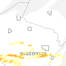
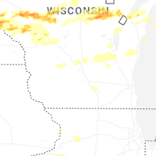
Wisconsin
| Local Time | Report Details |
|---|---|
| 4:34 PM CDT | Quarter sized hail reported near Custer, WI, 70.3 miles W of Green Bay, WI |
| 5:05 PM CDT | Quarter sized hail reported near Durand, WI, 66.4 miles NNW of La Crosse, WI |
| 5:16 PM CDT | Quarter sized hail reported near Neillsville, WI, 61.2 miles NNE of La Crosse, WI |
| 5:17 PM CDT | Quarter sized hail reported near Vesper, WI, 79 miles NE of La Crosse, WI |
| 5:23 PM CDT | Half Dollar sized hail reported near Cornell, WI, 90.8 miles WSW of Rhinelander, WI, report from mping: half dollar (1.25 in.). |
| 5:25 PM CDT | Quarter sized hail reported near Cornell, WI, 89 miles WSW of Rhinelander, WI, report from mping: quarter (1.00 in.). |
| 5:25 PM CDT | Half Dollar sized hail reported near Cornell, WI, 89.8 miles WSW of Rhinelander, WI |
| 5:26 PM CDT | Quarter sized hail reported near Neillsville, WI, 61.4 miles NE of La Crosse, WI |
| 5:40 PM CDT | Quarter sized hail reported near Chili, WI, 73.4 miles NE of La Crosse, WI |
| 5:43 PM CDT | Half Dollar sized hail reported near Chili, WI, 73.4 miles NE of La Crosse, WI |
| 5:55 PM CDT | Quarter sized hail reported near Marshfield, WI, 76.8 miles SSW of Rhinelander, WI |
| 5:55 PM CDT | Quarter sized hail reported near Wausau, WI, 47.8 miles SSW of Rhinelander, WI |
| 6:00 PM CDT | Half Dollar sized hail reported near Marshfield, WI, 75 miles SSW of Rhinelander, WI, report from mping: half dollar (1.25 in.). |
| 6:06 PM CDT | Hen Egg sized hail reported near Marshfield, WI, 75 miles SSW of Rhinelander, WI |
| 6:08 PM CDT | Half Dollar sized hail reported near Marshfield, WI, 72.4 miles SSW of Rhinelander, WI |
| 6:14 PM CDT | Ping Pong Ball sized hail reported near Nelson, WI, 57.8 miles NW of La Crosse, WI |
| 6:25 PM CDT | Half Dollar sized hail reported near Nelson, WI, 57.2 miles NW of La Crosse, WI |
| 6:28 PM CDT | Quarter sized hail reported near Nelson, WI, 56.1 miles NW of La Crosse, WI |
| 6:34 PM CDT | Quarter sized hail reported near Strum, WI, 51.4 miles N of La Crosse, WI |
| 6:35 PM CDT | Golf Ball sized hail reported near Osseo, WI, 52.3 miles N of La Crosse, WI |
| 6:35 PM CDT | Ping Pong Ball sized hail reported near Alma, WI, 51.4 miles NW of La Crosse, WI |
| 6:37 PM CDT | Half Dollar sized hail reported near Iola, WI, 58.8 miles W of Green Bay, WI |
| 6:40 PM CDT | Golf Ball sized hail reported near Chili, WI, 71.7 miles NE of La Crosse, WI |
| 6:41 PM CDT | Golf Ball sized hail reported near Osseo, WI, 53 miles N of La Crosse, WI |
| 6:42 PM CDT | Quarter sized hail reported near Augusta, WI, 60.2 miles N of La Crosse, WI, report from mping: quarter (1.00 in.). |
| 6:50 PM CDT | Golf Ball sized hail reported near Fairchild, WI, 54.4 miles NNE of La Crosse, WI, time estimated via radar. |
| 6:57 PM CDT | Quarter sized hail reported near Osseo, WI, 55.8 miles N of La Crosse, WI |
| 7:03 PM CDT | Tea Cup sized hail reported near Cochrane, WI, 40.1 miles NNW of La Crosse, WI, report made at 713pm after hail core had passed this location. time of hailfall estimated from radar. |
| 7:10 PM CDT | Hen Egg sized hail reported near Humbird, WI, 52.7 miles NNE of La Crosse, WI |
| 7:15 PM CDT | Quarter sized hail reported near Clintonville, WI, 38.4 miles WNW of Green Bay, WI |
| 7:22 PM CDT | Golf Ball sized hail reported near Fairchild, WI, 52.7 miles NNE of La Crosse, WI |
| 7:32 PM CDT | Quarter sized hail reported near Blair, WI, 30.2 miles N of La Crosse, WI, report from mping: quarter (1.00 in.). |
| 7:34 PM CDT | Quarter sized hail reported near Green Bay, WI, 2.5 miles W of Green Bay, WI, report from mping: quarter (1.00 in.). |
| 7:35 PM CDT | Quarter sized hail reported near Green Bay, WI, 1.1 miles WNW of Green Bay, WI |
| 7:35 PM CDT | Quarter sized hail reported near Neillsville, WI, 58.7 miles NNE of La Crosse, WI |
| 7:37 PM CDT | Half Dollar sized hail reported near Green Bay, WI, 1.1 miles WNW of Green Bay, WI, quarter sized to half dollar sized hail. corner of allard ave. and camm place. |
| 8:15 PM CDT | Quarter sized hail reported near Warrens, WI, 43.4 miles ENE of La Crosse, WI |
| 8:39 PM CDT | Quarter sized hail reported near Black River Falls, WI, 38.4 miles NE of La Crosse, WI |
| 9:23 PM CDT | Quarter sized hail reported near Plover, WI, 75.7 miles W of Green Bay, WI, hailing at the time of the report. |
| 9:23 PM CDT | Quarter sized hail reported near Sparta, WI, 31.9 miles ENE of La Crosse, WI |
| 10:05 PM CDT | Quarter sized hail reported near Sparta, WI, 21.8 miles NE of La Crosse, WI |
| 11:38 PM CDT | Shed removed from foundatio in richland county WI, 49.5 miles SE of La Crosse, WI |
| 11:42 PM CDT | Trees and power lines dow in sauk county WI, 41.6 miles NW of Madison, WI |
| 11:46 PM CDT | Pole shed down in rock spring in sauk county WI, 38.9 miles NW of Madison, WI |
| 11:49 PM CDT | Trees and power lines dow in sauk county WI, 36.2 miles NW of Madison, WI |
| 11:59 PM CDT | Barn collapsed and occupied with 30-40 cattl in fond du lac county WI, 58.5 miles NE of Madison, WI |
| 12:05 AM CDT | Corrects previous tstm wnd dmg report from 1 nnw prairie du sac. trees and power lines down. possible major roof damage at a factory. tree down on a hom in sauk county WI, 23.4 miles NW of Madison, WI |
| 12:06 AM CDT | Trees and power lines down. trees on home in sauk county WI, 23.7 miles NNW of Madison, WI |
| 12:12 AM CDT | Roof collapse at a nursing home. power lines and trees dow in columbia county WI, 17.9 miles NNW of Madison, WI |
| 12:26 AM CDT | Power poles and power lines down. a tree down on a hous in dane county WI, 12.4 miles N of Madison, WI |
| 12:38 AM CDT | Two large trees blown down. a pine tree snapped at 80 feet high. additional tree branches down in are in columbia county WI, 25.3 miles NE of Madison, WI |
| 1:00 AM CDT | A roof removed from a home on jackson street in jefferson. some tree damage in the cit in jefferson county WI, 28.9 miles E of Madison, WI |
| 1:00 AM CDT | Scattered trees down throughout jefferson county between 12:46 am to 1:20 a in jefferson county WI, 29.6 miles E of Madison, WI |
| 1:04 AM CDT | Grouping of trees dow in jefferson county WI, 34.2 miles E of Madison, WI |
| 1:07 AM CDT | A couple trees dow in walworth county WI, 36.5 miles ESE of Madison, WI |
| 1:14 AM CDT | Trees dow in waukesha county WI, 48 miles E of Madison, WI |
| 1:14 AM CDT | Storm damage reported in waukesha county WI, 43.9 miles E of Madison, WI |
| 1:17 AM CDT | Storm damage reported in jefferson county WI, 43 miles E of Madison, WI |
| 1:28 AM CDT | Several large trees dow in walworth county WI, 55.4 miles ESE of Madison, WI |
| 1:39 AM CDT | Siding damag in racine county WI, 61.9 miles ESE of Madison, WI |
| 1:55 AM CDT | Timmerman airport awo in milwaukee county WI, 68.2 miles E of Madison, WI |
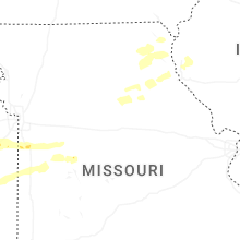
Kansas
| Local Time | Report Details |
|---|---|
| 4:55 PM CDT | Baseball sized hail reported near Cottonwood Falls, KS, 59.2 miles S of Manhattan, KS |
| 5:00 PM CDT | Golf Ball sized hail reported near Cottonwood Falls, KS, 56.5 miles S of Manhattan, KS, reported via ksn-tv and law enforcement. |
| 5:00 PM CDT | Golf Ball sized hail reported near Cottonwood Falls, KS, 59.9 miles S of Manhattan, KS, corrects previous hail report from 6 n matfield green. relayed via social media with picture. |
| 5:00 PM CDT | Golf Ball sized hail reported near Cottonwood Falls, KS, 57 miles NE of Wichita, KS, relayed via social media with picture. |
| 5:20 PM CDT | Quarter sized hail reported near Emporia, KS, 53.4 miles S of Manhattan, KS |
| 5:29 PM CDT | Quarter sized hail reported near Emporia, KS, 53.2 miles SSE of Manhattan, KS |
| 5:32 PM CDT | Half Dollar sized hail reported near Emporia, KS, 54.8 miles SSE of Manhattan, KS, emporia city manager reported quarter to half dollar size hail. |
| 5:58 PM CDT | Half Dollar sized hail reported near Reading, KS, 54.6 miles SSE of Manhattan, KS |
| 5:58 PM CDT | Golf Ball sized hail reported near Emporia, KS, 53.7 miles SSE of Manhattan, KS |
| 6:05 PM CDT | Hen Egg sized hail reported near Reading, KS, 55.5 miles SE of Manhattan, KS, report from mping: hen egg (2.00 in.). |
| 6:30 PM CDT | Hen Egg sized hail reported near Osage City, KS, 57.8 miles SE of Manhattan, KS |
| 6:30 PM CDT | Hen Egg sized hail reported near Osage City, KS, 58.1 miles SE of Manhattan, KS |
| 6:32 PM CDT | Half Dollar sized hail reported near Lyndon, KS, 62.1 miles SE of Manhattan, KS |
| 6:35 PM CDT | Half Dollar sized hail reported near Lyndon, KS, 61.2 miles SE of Manhattan, KS |
| 7:10 PM CDT | Hen Egg sized hail reported near Pomona, KS, 59.6 miles SW of Kansas City, MO, hail was observed on the ground behind the storm. |
| 7:30 PM CDT | Hen Egg sized hail reported near Ottawa, KS, 51.2 miles SW of Kansas City, MO, delayed report of 2 inch hail stones across the street from ottawa high school. photos sent via email. |
| 7:35 PM CDT | Damage to the roof and a wall of the t-mobile store on south main street in ottaw in franklin county KS, 51.2 miles SW of Kansas City, MO |
| 7:42 PM CDT | Baseball sized hail reported near Ottawa, KS, 49.4 miles SW of Kansas City, MO |
| 8:20 PM CDT | Damage in spring hill reported by em. several trees and power poles down. time estimated by rada in johnson county KS, 28.1 miles SSW of Kansas City, MO |
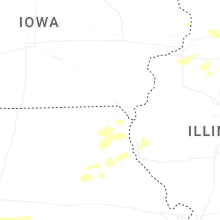
Iowa
| Local Time | Report Details |
|---|---|
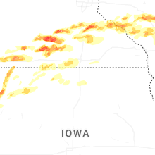
| 5:37 PM CDT | Half Dollar sized hail reported near Remsen, IA, 39.9 miles W of Storm Lake, IA |
| 6:08 PM CDT | Golf Ball sized hail reported near Granville, IA, 37.4 miles WNW of Storm Lake, IA |
| 6:10 PM CDT | Golf Ball sized hail reported near Remsen, IA, 39.3 miles W of Storm Lake, IA |
| 6:25 PM CDT | Quarter sized hail reported near Hartley, IA, 48.5 miles NNW of Storm Lake, IA, spotter report of quarter inch hail with pictures. |
| 6:28 PM CDT | Quarter sized hail reported near Primghar, IA, 37.5 miles NW of Storm Lake, IA |
| 6:30 PM CDT | Quarter sized hail reported near Ocheyedan, IA, 48.8 miles NNW of Storm Lake, IA, social media report with a coin for reference. time estimated by radar. |
| 6:30 PM CDT | Golf Ball sized hail reported near Harris, IA, 55.2 miles NNW of Storm Lake, IA, social media report with picture. time estimated by radar. |
| 6:34 PM CDT | Golf Ball sized hail reported near Sanborn, IA, 44.1 miles NW of Storm Lake, IA, social media report with picture of estimated hail size. |
| 6:40 PM CDT | Ping Pong Ball sized hail reported near Sanborn, IA, 43.5 miles NNW of Storm Lake, IA, report from mping: ping pong ball (1.50 in.). |
| 6:40 PM CDT | Quarter sized hail reported near Sanborn, IA, 41.2 miles NW of Storm Lake, IA, report from mping: quarter (1.00 in.). |
| 6:41 PM CDT | Half Dollar sized hail reported near Sanborn, IA, 43.5 miles NNW of Storm Lake, IA |
| 6:44 PM CDT | Ping Pong Ball sized hail reported near Sanborn, IA, 43.5 miles NNW of Storm Lake, IA |
| 6:53 PM CDT | Quarter sized hail reported near Melvin, IA, 48.9 miles NNW of Storm Lake, IA |
| 7:24 PM CDT | Quarter sized hail reported near Peterson, IA, 21.7 miles NNW of Storm Lake, IA, breif heavy rain and hail up to the size of quarters. |
| 7:52 PM CDT | Quarter sized hail reported near Webb, IA, 23 miles NNE of Storm Lake, IA |
| 9:45 PM CDT | Ping Pong Ball sized hail reported near Garner, IA, 22.9 miles W of Mason City, IA |
| 10:16 PM CDT | Quarter sized hail reported near Mason City, IA, 0.9 miles N of Mason City, IA, dime to quarter sized hail at time of report. |
Texas
| Local Time | Report Details |
|---|---|
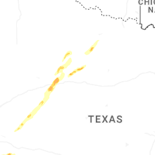
| 6:42 PM CDT | Quarter sized hail reported near Colorado City, TX, 65.8 miles W of Abilene, TX, 40 mph winds. |
| 6:45 PM CDT | Ping Pong Ball sized hail reported near Loraine, TX, 56.7 miles W of Abilene, TX, public report of ping pong ball sized hail in loraine received by media in abilene. |
| 7:05 PM CDT | Quarter sized hail reported near Roscoe, TX, 46.7 miles W of Abilene, TX, media report (photo) of quarter sized hail in the city of roscoe... tx at around 7:05 pm cdt. |
| 7:26 PM CDT | West texas mesonet site (5 w rotan) reported 66 mph wind gust at 7:26 pm cd in fisher county TX, 54.1 miles WNW of Abilene, TX |
| 7:32 PM CDT | Golf Ball sized hail reported near Rotan, TX, 50.2 miles WNW of Abilene, TX, we received a call from an individual in rotan... tx reporting golf ball sized hail in rotan. he was located approximately one block west of the park in town. |
| 8:02 PM CDT | Aspermont wtm gusted to 66 mph at 8:02 pm cdt... gusted again to 65 mph at 8:03 p in stonewall county TX, 56.4 miles NNW of Abilene, TX |
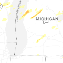
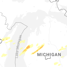
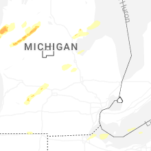
Michigan
| Local Time | Report Details |
|---|---|
| 7:50 PM EDT | Half Dollar sized hail reported near Hastings, MI, 29.2 miles SE of Grand Rapids, MI, reports of quarter to half dollar sized hail from law enforcement and media. |
| 8:04 PM EDT | Quarter sized hail reported near Hastings, MI, 28.9 miles SE of Grand Rapids, MI, report from mping: quarter (1.00 in.). |
| 8:30 PM EDT | Hen Egg sized hail reported near Portland, MI, 39.7 miles E of Grand Rapids, MI |
| 8:30 PM EDT | Ping Pong Ball sized hail reported near Portland, MI, 39.7 miles E of Grand Rapids, MI, quarter to ping pong sized hail from media reports and the public. |
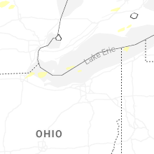
Ohio
| Local Time | Report Details |
|---|---|
| 8:16 PM EDT | Shed damaged on county road 53 near mccomb. time estimated via rada in hancock county OH, 65.8 miles E of Fort Wayne, IN |
| 8:21 PM EDT | Quarter sized hail reported near Toledo, OH, 91.8 miles ENE of Fort Wayne, IN |
| 8:48 PM EDT | Large tree down across road in northern maumee. police are on scen in lucas county OH, 83.3 miles ENE of Fort Wayne, IN |
| 10:42 PM EDT | Buoy station faio1 fairport... o in lake county OH, 27.6 miles NE of Cleveland, OH |
Missouri
| Local Time | Report Details |
|---|---|
| 8:55 PM CDT | Em reported a tree down... time estimated from rada in jackson county MO, 19.7 miles SSE of Kansas City, MO |
| 9:13 PM CDT | Report of 60+ mph wind gusts with storm moving through... magnitude estimated from rada in jackson county MO, 21.2 miles SSE of Kansas City, MO |
| 9:20 PM CDT | Video shared on social media of power flash on storms... looking to the sw. time estimated from rada in lafayette county MO, 28.4 miles ESE of Kansas City, MO |
| 10:22 PM CDT | Weather station recorded 72 mph winds. time estimated from rada in henry county MO, 68.3 miles SE of Kansas City, MO |
Connect with Interactive Hail Maps