

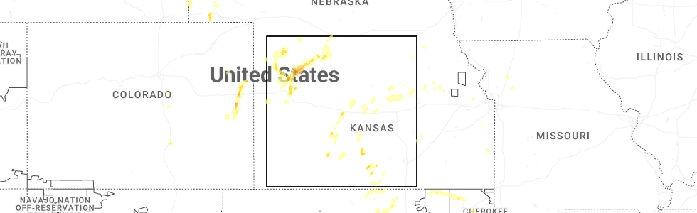
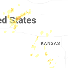
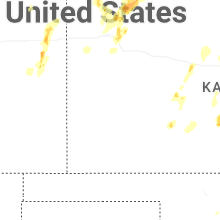
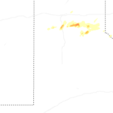
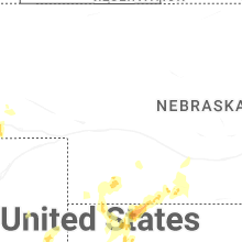
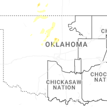
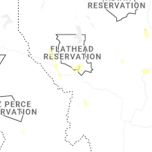
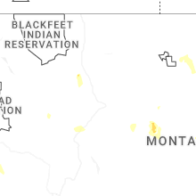
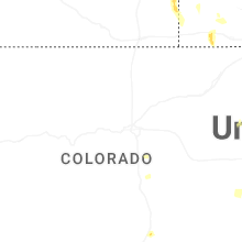
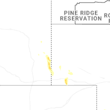
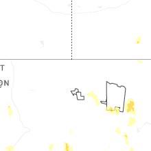
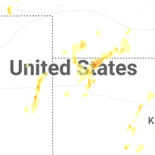
Hail Map for Friday, May 29, 2026
Number of Impacted Households on 5/29/2026
0
Impacted by 1" or Larger Hail
0
Impacted by 1.75" or Larger Hail
0
Impacted by 2.5" or Larger Hail
Square Miles of Populated Area Impacted on 5/29/2026
0
Impacted by 1" or Larger Hail
0
Impacted by 1.75" or Larger Hail
0
Impacted by 2.5" or Larger Hail
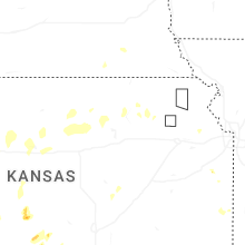
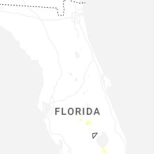
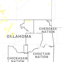
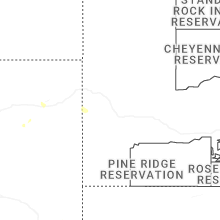
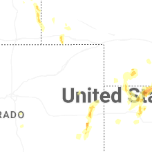
Cities Most Affected by Hail Storms of 5/29/2026
| Hail Size | Demographics of Zip Codes Affected | ||||||
|---|---|---|---|---|---|---|---|
| City | Count | Average | Largest | Pop Density | House Value | Income | Age |
| Happy, TX | 1 | 1.75 | 1.75 | 1 | $37k | $32.6k | 41.3 |
Hail and Wind Damage Spotted on 5/29/2026
Filter by Report Type:Hail ReportsWind Reports
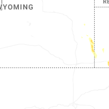
Utah
| Local Time | Report Details |
|---|---|
| 1:40 PM MDT | Measured at the i15 at mp 215 lampson canyon udot rwis sit in juab county UT, 59.2 miles W of Price, UT |
| 2:50 PM MDT | Mesonet station pc290 carter pea in sevier county UT, 21.5 miles NE of Monroe, UT |
| 3:30 PM MDT | Mesonet station utsom us-89 at mp 254 south mant in sanpete county UT, 49.1 miles NNE of Monroe, UT |
| 4:10 PM MDT | Mesonet station pc100 spring city eas in sanpete county UT, 35 miles WSW of Price, UT |
| 5:10 PM MDT | Mesonet station utnbc i-15 north brigham cit in box elder county UT, 57.4 miles N of Salt Lake City, UT |
| 7:53 PM MDT | Corrects previous tstm wnd gst report from 1 ese verna in uintah county UT, 80.5 miles S of Rock Springs, WY |
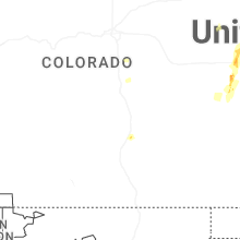
Colorado
| Local Time | Report Details |
|---|---|
| 3:12 PM MDT | Quarter sized hail reported near Kit Carson, CO, 91.7 miles S of Yuma, CO, twitter report with image and measurement of 1.13 inches. time estimated from radar. |
| 3:23 PM MDT | Mesonet station up695 aroya (upr in cheyenne county CO, 89.9 miles ENE of Pueblo, CO |
| 3:46 PM MDT | Quarter sized hail reported near Cheyenne Wells, CO, 75.3 miles S of Yuma, CO, spotter call; time estimated from radar. |
| 4:43 PM MDT | Asos station kitr burlington co airpor in kit carson county CO, 65.7 miles SSE of Yuma, CO |
| 4:46 PM MDT | Asos station kitr burlington co airpor in kit carson county CO, 65.7 miles SSE of Yuma, CO |
Texas
| Local Time | Report Details |
|---|---|
| 4:18 PM CDT | Half Dollar sized hail reported near Stephenville, TX, 85.8 miles WSW of Dallas, TX, facebook report of quarter to half dollar size hail off hwy 281 north of stephenville. location and time estimated. |
| 6:42 PM CDT | Large tree down blocking street. many tree limbs knocked down throughout tow in hall county TX, 27.9 miles NW of Childress, TX |
| 6:43 PM CDT | Also gust to 58 mph at 641 pm. measured by the west texas mesone in hall county TX, 28.1 miles NW of Childress, TX |
| 6:45 PM CDT | Golf Ball sized hail reported near Happy, TX, 27.4 miles S of Amarillo, TX, report from mping: golf ball (1.75 in.) it hailed for 10 minutes at this location. |
| 6:51 PM CDT | Randall county sheriff reported a house that had lost a roof at this locatio in randall county TX, 27.4 miles S of Amarillo, TX |
| 6:53 PM CDT | A pantex weather station measured a 58 mph gust at this location. the anemometer height was reported to be 25 feet above ground leve in randall county TX, 18.4 miles S of Amarillo, TX |
| 7:10 PM CDT | Quarter sized hail reported near Happy, TX, 30.9 miles S of Amarillo, TX, quarter sized hail was measured 1 mile north of happy tx off of interstate 27. small accumulating hail was also reported at this location. |
| 8:12 PM CDT | Storm damage reported in armstrong county TX, 48.5 miles ESE of Amarillo, TX |
| 8:37 PM CDT | Peak wind gust was 62 mph at 837 pm. the first gust was 58 mph at 836 p in donley county TX, 53.1 miles NW of Childress, TX |
| 8:44 PM CDT | Wtamu emergency management shared a report from an officer in clarendon of downed poles in the tow in donley county TX, 52.3 miles NW of Childress, TX |
| 9:29 PM CDT | Storm damage reported in collingsworth county TX, 46 miles NNW of Childress, TX |
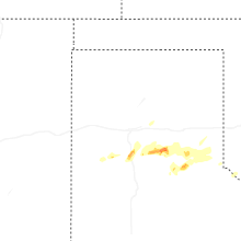
Oklahoma
| Local Time | Report Details |
|---|---|
| 4:35 PM CDT | Quarter sized hail reported near Waukomis, OK, 60.2 miles NNW of Oklahoma City, OK |
| 4:50 PM CDT | Storm damage reported in major county OK, 71.4 miles NNW of Oklahoma City, OK |
| 5:23 PM CDT | Storm damage reported in garfield county OK, 76.3 miles NNW of Oklahoma City, OK |
| 7:23 PM CDT | Quarter sized hail reported near Marshall, OK, 47.8 miles N of Oklahoma City, OK |
| 7:23 PM CDT | Storm damage reported in logan county OK, 47.8 miles N of Oklahoma City, OK |
| 10:45 PM CDT | Storm damage reported in harmon county OK, 27.3 miles NE of Childress, TX |
Idaho
| Local Time | Report Details |
|---|---|
| 5:10 PM MDT | Asos station kllj challis airpor in custer county ID, 48 miles SSW of Salmon, ID |
| 7:25 PM MDT | 3 inch diameter tree branch dow in bonneville county ID, 4.5 miles NE of Idaho Falls, ID |
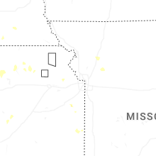
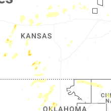
Kansas
| Local Time | Report Details |
|---|---|
| 5:39 PM MDT | Nws employee reported estimated 50-60mph gusts. there was localized blowing dust from a feedlot nearby... reducing visibility to around a mil in sherman county KS, 35.6 miles W of Colby, KS |
| 6:50 PM CDT | Storm damage reported in edwards county KS, 70.4 miles S of Hays, KS |
| 6:58 PM CDT | Storm damage reported in edwards county KS, 69.9 miles S of Hays, KS |
| 7:02 PM CDT | Storm damage reported in pawnee county KS, 50.6 miles SSW of Hays, KS |
| 7:04 PM CDT | Storm damage reported in edwards county KS, 69.9 miles S of Hays, KS |
| 7:10 PM CDT | Brief gust up to 60 mph with little to no rain. winds have calmed down since the initial wind gus in kingman county KS, 62.1 miles WSW of Wichita, KS |
| 8:00 PM CDT | Storm damage reported in rush county KS, 12.6 miles S of Hays, KS |
| 8:07 PM CDT | Storm damage reported in rush county KS, 12.5 miles S of Hays, KS |
| 8:09 PM CDT | Report of shed damaged and moved 20 feet to the north. time estimated via rada in ellis county KS, 11.1 miles S of Hays, KS |
| 8:16 PM CDT | Personal ambient weather statio in ellis county KS, 2.9 miles S of Hays, KS |
| 8:27 PM CDT | Social media report of 55-60 mph winds in hays. time estimated via rada in ellis county KS, 1.5 miles NNE of Hays, KS |
| 8:27 PM CDT | Quarter sized hail reported near Hays, KS, 1.7 miles E of Hays, KS, social media report of quarter size hail on the southeast side of hays. time estimated via radar. |
| 8:48 PM CDT | Ping Pong Ball sized hail reported near Stafford, KS, 72.6 miles W of Wichita, KS, ping pong ball sized hail reported along the stafford and pratt county line. |
| 9:47 PM CDT | Storm damage reported in rice county KS, 67.8 miles ESE of Hays, KS |
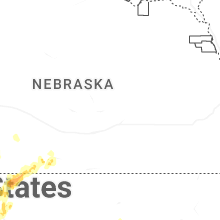
Nebraska
| Local Time | Report Details |
|---|---|
| 6:03 PM MDT | Quarter sized hail reported near Gering, NE, 15.4 miles S of Scottsbluff, NE, storm chaser reported a few quarter-sized hail stones around 6pm. |
| 11:15 PM CDT | Personal weather station reports gust to 67mp in furnas county NE, 80.9 miles SE of North Platte, NE |
Montana
| Local Time | Report Details |
|---|---|
| 6:30 PM MDT | Storm damage reported in fergus county MT, 93.2 miles SSE of Havre, MT |
| 7:25 PM MDT | Straight-line winds knocked down multiple tree limbs and caused the power to go out. nearby automated sensors were gusting 35-40 mp in hill county MT, 28.9 miles W of Havre, MT |
| 8:00 PM MDT | Wagm8 mesonet observation sit in phillips county MT, 70 miles W of Glasgow, MT |
| 10:15 PM MDT | Mesonet station mtstm st. marie mt-24 mp 18. in valley county MT, 15.9 miles NNE of Glasgow, MT |
New York
| Local Time | Report Details |
|---|---|
| 8:44 PM EDT | Several trees down around liverpoo in onondaga county NY, 5.2 miles NW of Syracuse, NY |
| 8:51 PM EDT | Tree fell on house with the front of the house partially collapsed. there were no known injurie in onondaga county NY, 3.5 miles S of Syracuse, NY |
| 9:01 PM EDT | Several areas of trees and wires down... near dewit in onondaga county NY, 4 miles E of Syracuse, NY |
| 9:08 PM EDT | Tree and wires dow in madison county NY, 17.9 miles SE of Syracuse, NY |
| 9:18 PM EDT | Tree on house & car with damage reported to house. residents are out of the hous in madison county NY, 17.9 miles SE of Syracuse, NY |
| 9:23 PM EDT | Corrects the time of previous non-tstm wnd dmg report from new hope. power pole snappe in cayuga county NY, 19.5 miles SSW of Syracuse, NY |
| 9:45 PM EDT | Several trees down in the are in cortland county NY, 32.6 miles SSE of Syracuse, NY |
| 9:47 PM EDT | Wires down in drivewa in tompkins county NY, 32.5 miles SSW of Syracuse, NY |
| 9:50 PM EDT | Electrical transformer damage in otsego county NY, 57.2 miles SE of Syracuse, NY |
Connect with Interactive Hail Maps