

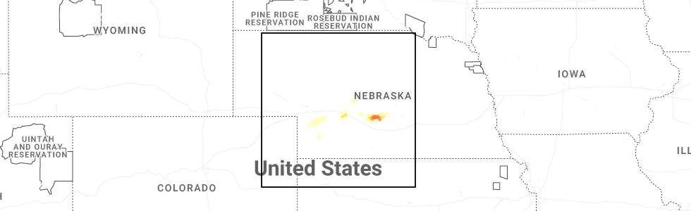
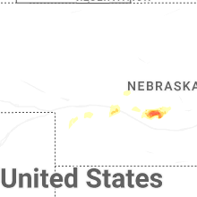
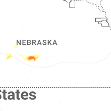
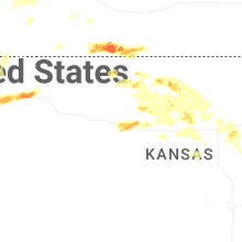
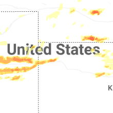
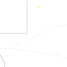
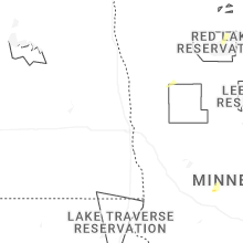
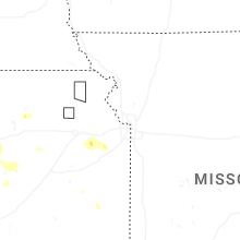
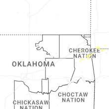
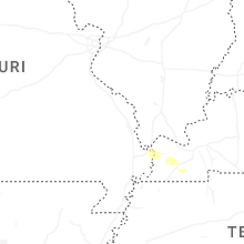
Hail Map for Monday, June 8, 2026
Number of Impacted Households on 6/8/2026
0
Impacted by 1" or Larger Hail
0
Impacted by 1.75" or Larger Hail
0
Impacted by 2.5" or Larger Hail
Square Miles of Populated Area Impacted on 6/8/2026
0
Impacted by 1" or Larger Hail
0
Impacted by 1.75" or Larger Hail
0
Impacted by 2.5" or Larger Hail


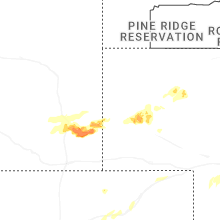
Cities Most Affected by Hail Storms of 6/8/2026
| Hail Size | Demographics of Zip Codes Affected | ||||||
|---|---|---|---|---|---|---|---|
| City | Count | Average | Largest | Pop Density | House Value | Income | Age |
| Burlington, CO | 4 | 2.75 | 3.00 | 6 | $85k | $34.7k | 38.4 |
| Hugo, CO | 4 | 2.18 | 2.50 | 0 | $71k | $31.3k | 46.8 |
| New Cambria, KS | 2 | 1.75 | 1.75 | 10 | $89k | $44.2k | 47.1 |
| Stratton, CO | 2 | 1.75 | 1.75 | 2 | $77k | $35.0k | 37.2 |
| Matheson, CO | 1 | 3.40 | 3.40 | 1 | $75k | $37.2k | 51.0 |
| Agate, CO | 1 | 2.75 | 2.75 | 1 | $131k | $40.7k | 50.9 |
| Beaver City, NE | 1 | 2.50 | 2.50 | 3 | $33k | $28.4k | 48.5 |
| Simla, CO | 1 | 2.00 | 2.00 | 3 | $86k | $32.2k | 39.0 |
| Sumner, NE | 1 | 1.75 | 1.75 | 2 | $36k | $31.8k | 38.4 |
| Goodland, KS | 1 | 1.75 | 1.75 | 9 | $65k | $33.1k | 41.5 |
| Solomon, KS | 1 | 1.75 | 1.75 | 9 | $72k | $42.7k | 40.4 |
| Gaylord, KS | 1 | 1.75 | 1.75 | 2 | $17k | $27.5k | 52.5 |
| Kanorado, KS | 1 | 1.75 | 1.75 | 1 | $51k | $26.9k | 48.3 |
| Eddyville, NE | 1 | 1.75 | 1.75 | 2 | $28k | $28.1k | 45.0 |
| Bennett, CO | 1 | 1.75 | 1.75 | 16 | $141k | $55.3k | 40.3 |
| Lagrange, WY | 1 | 1.75 | 1.75 | 1 | $74k | $25.0k | 25.1 |
| Evergreen, CO | 1 | 1.75 | 1.75 | 130 | $286k | $80.8k | 47.0 |
| Hays, KS | 1 | 1.75 | 1.75 | 62 | $91k | $32.5k | 30.5 |
| Golden, CO | 1 | 1.75 | 1.75 | 138 | $216k | $68.4k | 42.7 |
| Logan, KS | 1 | 1.75 | 1.75 | 2 | $35k | $29.3k | 45.7 |
Hail and Wind Damage Spotted on 6/8/2026
Filter by Report Type:Hail ReportsWind Reports
States Impacted
Nebraska, North Carolina, Colorado, Missouri, New Mexico, Kansas, Illinois, Texas, Kentucky, WyomingNebraska
| Local Time | Report Details |
|---|---|
| 9:36 AM CDT | Quarter sized hail reported near Lexington, NE, 54.3 miles ESE of North Platte, NE |
| 10:09 AM CDT | Golf Ball sized hail reported near Eddyville, NE, 60.8 miles E of North Platte, NE, ground was white with hail. most were ping pong ball size and smaller a few were golf ball size. |
| 10:12 AM CDT | Golf Ball sized hail reported near Sumner, NE, 62.8 miles W of Grand Island, NE, report of hail around the size of golf balls received via facebook. |
| 10:14 AM CDT | Quarter sized hail reported near Sumner, NE, 61.3 miles W of Grand Island, NE, report of hail up to quarter size received via facebook. |
| 3:58 PM CDT | Tennis Ball sized hail reported near Beaver City, NE, 79.6 miles NE of Colby, KS, quarter to ping pong ball sized hail started around 350pm... hail grew to around tennis ball size within last few mins. |
| 4:13 PM CDT | Quarter sized hail reported near Beaver City, NE, 82.5 miles NE of Colby, KS |
| 4:43 PM CDT | Storm damage reported in harlan county NE, 80.7 miles N of Hays, KS |
| 4:50 PM CDT | Wind gusts were estimated to be near 60-70 mph...accompanied by nickel size hai in harlan county NE, 82.5 miles N of Hays, KS |
| 5:05 PM CDT | Delayed report of an overblown mobile home. image sent in over social medi in harlan county NE, 75.1 miles SW of Grand Island, NE |
| 5:06 PM CDT | Storm damage reported in harlan county NE, 79.4 miles N of Hays, KS |
| 5:09 PM CDT | Storm damage reported in harlan county NE, 76.5 miles SW of Grand Island, NE |
| 5:10 PM CDT | Quarter sized hail reported near Republican City, NE, 73.4 miles SW of Grand Island, NE |
| 6:12 PM MDT | Half Dollar sized hail reported near Haigler, NE, 47.7 miles E of Yuma, CO, trained spotter report half dollar size hail currently failing. |
| 6:42 PM MDT | Personal weather statio in morrill county NE, 17.8 miles E of Scottsbluff, NE |
| 6:57 PM MDT | Personal weather station reported gust in stratiform region to the north of a thunderstor in cheyenne county NE, 63.3 miles SSE of Scottsbluff, NE |
| 7:02 PM MDT | Personal weather statio in cheyenne county NE, 61.7 miles SE of Scottsbluff, NE |
| 7:11 PM MDT | Personal weather statio in morrill county NE, 17.8 miles E of Scottsbluff, NE |
| 7:29 PM MDT | In stratiform region of thunderstorm cluste in cheyenne county NE, 63.4 miles SE of Scottsbluff, NE |
| 8:20 PM MDT | Storm damage reported in chase county NE, 61.4 miles ENE of Yuma, CO |
| 8:25 PM MDT | Storm damage reported in chase county NE, 56.5 miles SW of North Platte, NE |
| 9:45 PM CDT | Storm damage reported in hayes county NE, 47.8 miles SW of North Platte, NE |
| 9:53 PM CDT | Storm damage reported in lincoln county NE, 34 miles SSW of North Platte, NE |
| 9:57 PM CDT | Storm damage reported in hayes county NE, 42.2 miles SSW of North Platte, NE |
North Carolina
| Local Time | Report Details |
|---|---|
| 5:02 PM EDT | Tree down on taylorsville rd in the little river area. time estimate in caldwell county NC, 58 miles NW of Charlotte, NC |
| 5:23 PM EDT | Tree down on pearl dr. time estimated from rada in caldwell county NC, 59.7 miles NW of Charlotte, NC |
| 5:24 PM EDT | Tree down on overlook dr. time estimated from rada in caldwell county NC, 60.7 miles NW of Charlotte, NC |
Colorado
| Local Time | Report Details |
|---|---|
| 3:03 PM MDT | Golf Ball sized hail reported near Golden, CO, 12.7 miles W of Denver, CO, time estimated by radar. |
| 3:09 PM MDT | Quarter sized hail reported near Golden, CO, 12.2 miles W of Denver, CO, report from mping: quarter (1.00 in.). |
| 3:14 PM MDT | Quarter sized hail reported near Golden, CO, 10.9 miles WNW of Denver, CO, time and location estimated by radar. |
| 3:15 PM MDT | Half Dollar sized hail reported near Arvada, CO, 8.6 miles WNW of Denver, CO |
| 3:16 PM MDT | Quarter sized hail reported near Wheat Ridge, CO, 8.1 miles WNW of Denver, CO |
| 3:20 PM MDT | Quarter sized hail reported near Hugo, CO, 63 miles NE of Pueblo, CO |
| 3:22 PM MDT | Mesonet station co001 i-25 and c47 in douglas county CO, 14 miles SSE of Denver, CO |
| 3:24 PM MDT | Quarter sized hail reported near Wheat Ridge, CO, 7.2 miles WNW of Denver, CO, report from mping: quarter (1.00 in.). |
| 3:25 PM MDT | Ping Pong Ball sized hail reported near Hugo, CO, 62.5 miles NE of Pueblo, CO |
| 3:26 PM MDT | Quarter sized hail reported near Wheat Ridge, CO, 6.4 miles WNW of Denver, CO |
| 3:27 PM MDT | Quarter sized hail reported near Wheat Ridge, CO, 6.6 miles WNW of Denver, CO |
| 3:30 PM MDT | Ping Pong Ball sized hail reported near Arvada, CO, 6.4 miles NW of Denver, CO |
| 3:30 PM MDT | Quarter sized hail reported near Evergreen, CO, 18.2 miles W of Denver, CO |
| 3:30 PM MDT | Golf Ball sized hail reported near Evergreen, CO, 19.3 miles WSW of Denver, CO |
| 3:31 PM MDT | Quarter sized hail reported near Parker, CO, 18.4 miles SSE of Denver, CO |
| 3:32 PM MDT | Quarter sized hail reported near Denver, CO, 6.3 miles W of Denver, CO |
| 3:34 PM MDT | Tennis Ball sized hail reported near Hugo, CO, 63.4 miles NE of Pueblo, CO, time estimated by radar. |
| 3:35 PM MDT | Hen Egg sized hail reported near Hugo, CO, 62.5 miles NE of Pueblo, CO |
| 3:40 PM MDT | Quarter sized hail reported near Parker, CO, 21.2 miles SSE of Denver, CO, report from mping: quarter (1.00 in.). |
| 3:41 PM MDT | Ping Pong Ball sized hail reported near Parker, CO, 23.2 miles SSE of Denver, CO |
| 3:43 PM MDT | Ping Pong Ball sized hail reported near Hugo, CO, 62.1 miles NE of Pueblo, CO |
| 3:45 PM MDT | Hen Egg sized hail reported near Hugo, CO, 64.7 miles NE of Pueblo, CO |
| 3:56 PM MDT | Quarter sized hail reported near Golden, CO, 13.2 miles W of Denver, CO |
| 4:10 PM MDT | Half Dollar sized hail reported near Fort Lupton, CO, 25.2 miles NNE of Denver, CO |
| 4:12 PM MDT | Asos station kden denver intl airpor in denver county CO, 19.7 miles ENE of Denver, CO |
| 4:15 PM MDT | Half Dollar sized hail reported near Castle Rock, CO, 22.2 miles SSE of Denver, CO |
| 4:15 PM MDT | Half Dollar sized hail reported near Hugo, CO, 82.2 miles ENE of Pueblo, CO |
| 4:22 PM MDT | Quarter sized hail reported near Parker, CO, 28 miles SE of Denver, CO, report from mping: quarter (1.00 in.). |
| 4:37 PM MDT | Golf Ball sized hail reported near Bennett, CO, 27.3 miles ENE of Denver, CO |
| 5:19 PM MDT | Baseball sized hail reported near Agate, CO, 51.2 miles SE of Denver, CO |
| 5:24 PM MDT | Ping Pong Ball sized hail reported near Kit Carson, CO, 93.8 miles S of Yuma, CO, social media report via picture various hail stones roughly ping pong ball size and smaller. |
| 5:26 PM MDT | Ping Pong Ball sized hail reported near Kit Carson, CO, 93.1 miles S of Yuma, CO, report from mping: ping pong ball (1.50 in.). |
| 5:27 PM MDT | Ping Pong Ball sized hail reported near Kit Carson, CO, 84.2 miles S of Yuma, CO, trained spotter report of ping pong ball sized hail. |
| 5:31 PM MDT | Hen Egg sized hail reported near Simla, CO, 57.7 miles ESE of Denver, CO |
| 5:56 PM MDT | Tea Cup sized hail reported near Matheson, CO, 67.7 miles ESE of Denver, CO |
| 6:12 PM MDT | Quarter sized hail reported near Limon, CO, 66.4 miles SW of Yuma, CO, report from mping: quarter (1.00 in.). |
| 6:15 PM MDT | Personal weather statio in lincoln county CO, 69.8 miles SW of Yuma, CO |
| 6:22 PM MDT | Quarter sized hail reported near Limon, CO, 72.6 miles SW of Yuma, CO, report from mping: quarter (1.00 in.). |
| 6:35 PM MDT | Awos station kstk sterlin in logan county CO, 45.1 miles NW of Yuma, CO |
| 6:50 PM MDT | Storm damage reported in logan county CO, 37 miles NNW of Yuma, CO |
| 6:57 PM MDT | Personal weather statio in logan county CO, 39.9 miles N of Yuma, CO |
| 7:00 PM MDT | Storm damage reported in logan county CO, 32.3 miles N of Yuma, CO |
| 7:01 PM MDT | Noaa mobile mesonet. report relayed via spotternetwor in lincoln county CO, 62.1 miles SSW of Yuma, CO |
| 7:17 PM MDT | Half Dollar sized hail reported near Flagler, CO, 54 miles SSW of Yuma, CO, public report 6 n flagler. |
| 7:31 PM MDT | Quarter sized hail reported near Seibert, CO, 48.2 miles S of Yuma, CO, dime to quarter sized hail on the ground on the ground along hwy 59; time estimated from radar... reported about 20-25 mins after estimated time. |
| 7:33 PM MDT | Storm damage reported in sedgwick county CO, 63.1 miles NNE of Yuma, CO |
| 7:38 PM MDT | Half Dollar sized hail reported near Seibert, CO, 44.2 miles S of Yuma, CO, hail stones measured with a ruler along hwy 59... most stones dime sized. time estimated from radar. report about 20-25 minutes after estimated time. |
| 7:41 PM MDT | Mesonet station up469 2.3 ne ovid (upr in sedgwick county CO, 63.1 miles NNE of Yuma, CO |
| 7:51 PM MDT | Personal weather statio in phillips county CO, 42.1 miles NE of Yuma, CO |
| 7:59 PM MDT | Golf Ball sized hail reported near Stratton, CO, 49.3 miles S of Yuma, CO, mping report; time estimated from radar. |
| 8:12 PM MDT | Golf Ball sized hail reported near Stratton, CO, 49.4 miles S of Yuma, CO, report from mping: golf ball (1.75 in.). |
| 8:40 PM MDT | Half Dollar sized hail reported near Bethune, CO, 51.5 miles SSE of Yuma, CO, social media report (picture) of various sizes of hail with the max size estimated 1.25 inch. |
| 9:44 PM MDT | Hen Egg sized hail reported near Hugo, CO, 81 miles SSW of Yuma, CO |
| 9:45 PM MDT | Personal weather statio in lincoln county CO, 81.8 miles NE of Pueblo, CO |
| 10:51 PM MDT | Ping Pong Ball sized hail reported near Stratton, CO, 67.6 miles S of Yuma, CO, twitter report: lots of quarter and ping pong sized hail. time and location estimated from radar. |
| 10:51 PM MDT | Mesonet station co047 385n220 idali in yuma county CO, 35.4 miles SE of Yuma, CO |
| 11:47 PM MDT | Hen Egg sized hail reported near Burlington, CO, 68.2 miles WSW of Colby, KS, mping report; time estimated from radar. |
| 11:49 PM MDT | Tea Cup sized hail reported near Burlington, CO, 66.8 miles WSW of Colby, KS, twitter report with image of 3 inch hail measured with a ruler. time estimated from radar. |
| 12:05 AM MDT | Tea Cup sized hail reported near Burlington, CO, 68.2 miles WSW of Colby, KS, delayed report from mping: tea cup (3.00 in.). |
| 12:10 AM MDT | Tea Cup sized hail reported near Burlington, CO, 68 miles WSW of Colby, KS, delayed report from mping: tea cup (3.00 in.). |
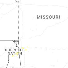
Missouri
| Local Time | Report Details |
|---|---|
| 4:56 PM CDT | Multiple power poles downed along us-61 north of sikesto in scott county MO, 27.9 miles S of Cape Girardeau, MO |
| 5:04 PM CDT | Corrects previous tstm wnd dmg report from 2 nw sikeston. multiple power poles downed along us-61 north of sikesto in scott county MO, 27.9 miles S of Cape Girardeau, MO |
| 1:05 AM CDT | Several reports of downed wires in the loch lloyd area. time estimated from rada in cass county MO, 18.9 miles S of Kansas City, MO |
| 1:08 AM CDT | Multiple reports of downed wires between drexel and archie. penny size hail also reporte in cass county MO, 42.6 miles S of Kansas City, MO |
| 1:12 AM CDT | Reports of limbs and wires down in the raymore area. time estimated from rada in cass county MO, 21.8 miles SSE of Kansas City, MO |
| 1:15 AM CDT | Several reports of tree limbs and wires down. time confirmed from rada in jackson county MO, 15 miles S of Kansas City, MO |
| 1:15 AM CDT | Multiple reports of wires down west of harrisonville. time estimated from rada in cass county MO, 31 miles SSE of Kansas City, MO |
| 1:20 AM CDT | Storm damage reported in jackson county MO, 21.2 miles SSE of Kansas City, MO |
| 1:28 AM CDT | Multiple reports of downed limbs and wires south of garden city. time estimated from rada in cass county MO, 44.9 miles SSE of Kansas City, MO |
| 1:28 AM CDT | Mping report of minor tree damage. time estimated from rada in jackson county MO, 18.8 miles ESE of Kansas City, MO |
| 1:28 AM CDT | Mping report of minor tree damage. time estimated from rada in jackson county MO, 17.3 miles ESE of Kansas City, MO |
| 1:29 AM CDT | Several reports of downed wires and power outages in lees summit. time estimated from rada in jackson county MO, 18.2 miles SE of Kansas City, MO |
| 1:31 AM CDT | Multiple reports of downed wires near east lynne. time estimated from rada in cass county MO, 35.4 miles SSE of Kansas City, MO |
| 1:41 AM CDT | Reports of limbs and wires down near hartwell. time estimated from rada in henry county MO, 58.3 miles SE of Kansas City, MO |
| 1:42 AM CDT | Downed wires near 1301 road. time estimated from rada in henry county MO, 57 miles SE of Kansas City, MO |
New Mexico
| Local Time | Report Details |
|---|---|
| 4:00 PM MDT | Virga induced wind gust measured by a wunderground station in montecito vistas neighborhoo in bernalillo county NM, 7.3 miles NW of Albuquerque, NM |
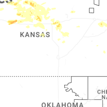
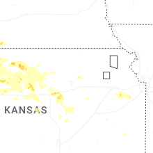
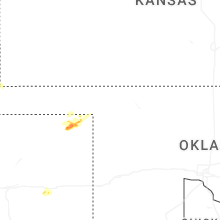
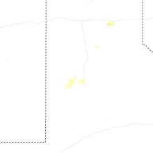
Kansas
| Local Time | Report Details |
|---|---|
| 5:05 PM CDT | Wind gusts estimated to be near 60 mph...outflow from storms to the nort in phillips county KS, 69.9 miles N of Hays, KS |
| 5:49 PM CDT | Quarter sized hail reported near Phillipsburg, KS, 60.9 miles N of Hays, KS |
| 6:10 PM CDT | Golf Ball sized hail reported near Logan, KS, 49.3 miles NNW of Hays, KS |
| 6:14 PM CDT | Golf Ball sized hail reported near Gaylord, KS, 59.6 miles NNE of Hays, KS |
| 6:39 PM CDT | Quarter sized hail reported near Portis, KS, 59.8 miles NE of Hays, KS |
| 6:42 PM CDT | Quarter sized hail reported near Glade, KS, 48.3 miles N of Hays, KS |
| 7:13 PM CDT | Overturned center irrigation pivo in osborne county KS, 56.1 miles NE of Hays, KS |
| 7:14 PM CDT | Storm damage reported in mitchell county KS, 65 miles NE of Hays, KS |
| 7:17 PM CDT | Parked semi overturne in mitchell county KS, 61.5 miles NE of Hays, KS |
| 7:17 PM CDT | Destroyed grain bi in mitchell county KS, 62.4 miles NE of Hays, KS |
| 7:27 PM CDT | Quarter sized hail reported near Natoma, KS, 24.5 miles NNE of Hays, KS |
| 7:34 PM CDT | Quarter sized hail reported near Natoma, KS, 25.4 miles NNE of Hays, KS |
| 7:35 PM CDT | Storm damage reported in mitchell county KS, 58.3 miles NE of Hays, KS |
| 7:35 PM CDT | Wind gusts were estimated to be at least 60 mph...accompanied by dime size hai in osborne county KS, 49.9 miles NE of Hays, KS |
| 7:35 PM CDT | Several reports of overturned pivots... damage to metal grain bins and snapped tree branches up to 10 inches in diameter around tow in mitchell county KS, 56.5 miles NE of Hays, KS |
| 7:42 PM CDT | Some tree damage in tow in mitchell county KS, 65.5 miles NE of Hays, KS |
| 8:05 PM CDT | Personal weather statio in mitchell county KS, 69.7 miles ENE of Hays, KS |
| 8:08 PM CDT | Power poles down along n and p roads between 280 and 29 in mitchell county KS, 72.4 miles ENE of Hays, KS |
| 8:21 PM CDT | Power is reported to be out and a few power poles leaning;time estimated from rada in russell county KS, 44.6 miles ENE of Hays, KS |
| 8:23 PM CDT | Semi flipped over mile marker 255. delayed report. time estimated from rada in saline county KS, 57 miles WSW of Manhattan, KS |
| 8:25 PM CDT | Delayed report. 10-meter wind gust measured from a kansas state mesonet site 1nw of denmark. the 2-meter wind gust was 68 mp in lincoln county KS, 57.8 miles ENE of Hays, KS |
| 8:31 PM CDT | Storm damage reported in lincoln county KS, 69.9 miles ENE of Hays, KS |
| 8:32 PM CDT | Power lines downed and power outage in minneapolis... k in ottawa county KS, 61.8 miles W of Manhattan, KS |
| 8:33 PM CDT | Estimated at least 70 mph... possibly stronger - had to pull over and could not see farther than a few inches in front of the ca in lincoln county KS, 65.3 miles E of Hays, KS |
| 8:40 PM CDT | Corrects previous tstm wnd dmg report from 7 sw westfall. kdot reported i-70 closed between mile markers 219 and 233 due to semis tipped over and severe weather. time e in ellsworth county KS, 66.4 miles E of Hays, KS |
| 8:46 PM CDT | Golf Ball sized hail reported near New Cambria, KS, 55 miles WSW of Manhattan, KS |
| 8:50 PM CDT | Golf Ball sized hail reported near Solomon, KS, 47 miles WSW of Manhattan, KS |
| 8:50 PM CDT | Large trees blown down. estimated 80 mph wind in ottawa county KS, 71.8 miles W of Manhattan, KS |
| 8:59 PM CDT | Golf Ball sized hail reported near New Cambria, KS, 54 miles WSW of Manhattan, KS, ping pong to golf ball size hail. |
| 9:00 PM CDT | Storm damage reported in ellsworth county KS, 59.6 miles E of Hays, KS |
| 9:01 PM CDT | Storm damage reported in saline county KS, 68.6 miles WSW of Manhattan, KS |
| 9:03 PM CDT | Sn11 in saline county KS, 72.3 miles WSW of Manhattan, KS |
| 9:07 PM CDT | Storm damage reported in saline county KS, 54.8 miles WSW of Manhattan, KS |
| 9:10 PM CDT | Sln asos measured 59 mp in saline county KS, 64.9 miles WSW of Manhattan, KS |
| 9:13 PM CDT | Ping Pong Ball sized hail reported near Salina, KS, 60.3 miles WSW of Manhattan, KS |
| 9:18 PM CDT | Possible 113 mph wind gust measured at salina regional airport. supported by county em. will need to be investigate in saline county KS, 64.7 miles WSW of Manhattan, KS |
| 9:20 PM CDT | Storm damage reported in dickinson county KS, 48.3 miles WSW of Manhattan, KS |
| 9:20 PM CDT | Photo shared over social media of metal railroad crossing dow in saline county KS, 60.8 miles WSW of Manhattan, KS |
| 9:21 PM CDT | Wind gust from thunderstorm outflow at great bend municipal airpor in barton county KS, 43.8 miles SE of Hays, KS |
| 9:22 PM CDT | Storm damage reported in ellsworth county KS, 71.2 miles E of Hays, KS |
| 9:23 PM CDT | Measured from a personal weather station west of salina regional airpor in saline county KS, 69.1 miles WSW of Manhattan, KS |
| 9:30 PM CDT | Trees uprooted and power lines down; time estimated from rada in saline county KS, 62.2 miles WSW of Manhattan, KS |
| 9:30 PM CDT | Measured 111 mph on vehicle mounted anemometer. multiple utility poles broken and some trees debarked along hwy in saline county KS, 57.3 miles SW of Manhattan, KS |
| 9:33 PM CDT | Corrects previous tstm wnd dmg report from 4 w lindsborg. em reported several power poles down along hwy k4 near 10th av in mcpherson county KS, 64.8 miles NNW of Wichita, KS |
| 9:40 PM CDT | Kdot reported i-70 closed between mile markers 219 and 233 due to semis tipped over and severe weather. time estimated from rada in ellsworth county KS, 66.4 miles E of Hays, KS |
| 9:40 PM CDT | Shared through social media - large tree uprooted and laying across part of hwy 4 in saline county KS, 64.1 miles WSW of Manhattan, KS |
| 9:41 PM CDT | Storm damage reported in mcpherson county KS, 56.2 miles NNW of Wichita, KS |
| 9:45 PM CDT | Spotter reported 80 mph and power poles snappin in saline county KS, 58.5 miles SW of Manhattan, KS |
| 9:50 PM CDT | Delayed report. peak 10-meter wind gust measured from a kansas state mesonet site in gypsum. the 2-meter wind gust was 71 mp in saline county KS, 56.9 miles SW of Manhattan, KS |
| 9:58 PM CDT | Several trees down in durham. delayed report. time estimated from rada in marion county KS, 55.7 miles N of Wichita, KS |
| 9:59 PM CDT | Mpr asos measured 59 mp in mcpherson county KS, 49.6 miles NNW of Wichita, KS |
| 10:00 PM CDT | Public report of trees down and estimated wind speeds of 60 mp in dickinson county KS, 39.2 miles WSW of Manhattan, KS |
| 10:03 PM CDT | Storm damage reported in marion county KS, 57.3 miles SW of Manhattan, KS |
| 10:10 PM CDT | Measured from a personal weather station. delayed repor in marion county KS, 50.3 miles SW of Manhattan, KS |
| 10:10 PM CDT | Agritrails fertilizer plant had its roof blown off. delayed report. time estimated from rada in marion county KS, 54.3 miles SW of Manhattan, KS |
| 10:14 PM CDT | Storm damage reported in dickinson county KS, 31.3 miles SW of Manhattan, KS |
| 10:19 PM CDT | Marion reservoir reporting heavy rains... zero visibility and 65 mph wind in marion county KS, 49 miles NNE of Wichita, KS |
| 10:20 PM CDT | Storm damage reported in marion county KS, 54.1 miles SSW of Manhattan, KS |
| 10:20 PM CDT | Mesonet station up824 4.8 e chapman (upr in geary county KS, 23.7 miles WSW of Manhattan, KS |
| 10:21 PM CDT | Storm damage reported in marion county KS, 49.7 miles NNE of Wichita, KS |
| 10:23 PM CDT | Personal weather station repor in morris county KS, 42.4 miles SSW of Manhattan, KS |
| 10:24 PM CDT | 90 mph... nickel size hail... heavy rain in marion county KS, 48.2 miles SSW of Manhattan, KS |
| 10:24 PM CDT | Tree fell on a house. delayed report. time estimated from rada in marion county KS, 47.4 miles SSW of Manhattan, KS |
| 10:25 PM CDT | Ewk reported 84 mp in harvey county KS, 25.2 miles N of Wichita, KS |
| 9:27 PM MDT | Golf Ball sized hail reported near Goodland, KS, 44.4 miles W of Colby, KS, time estimated from radar. |
| 10:30 PM CDT | Storm damage reported in dickinson county KS, 40.6 miles SSW of Manhattan, KS |
| 10:30 PM CDT | Storm damage reported in geary county KS, 18.3 miles WSW of Manhattan, KS |
| 9:30 PM MDT | Golf Ball sized hail reported near Kanorado, KS, 53.5 miles W of Colby, KS, sherman county dispatch reported hail varying from 1-1.75 inch hail in kanorado. |
| 10:31 PM CDT | Personal weather station repor in geary county KS, 16.9 miles SW of Manhattan, KS |
| 10:32 PM CDT | Personal weather station repor in geary county KS, 18.2 miles WSW of Manhattan, KS |
| 10:34 PM CDT | Multiple tree limbs down throughout the city of whitewater... average limb size of 4-6 inches. delayed report. time estimated by rada in butler county KS, 21.4 miles NNE of Wichita, KS |
| 10:36 PM CDT | Personal weather station repor in riley county KS, 4.4 miles WNW of Manhattan, KS |
| 10:39 PM CDT | Storm damage reported in riley county KS, 6.4 miles WSW of Manhattan, KS |
| 10:39 PM CDT | Emergency manager reports up to 90 mph winds with signs folding over between peabody and florence at sunflower and 110th s in marion county KS, 41.2 miles NNE of Wichita, KS |
| 10:45 PM CDT | Heavy rain and damaging wind reporte in morris county KS, 38.5 miles SSW of Manhattan, KS |
| 10:47 PM CDT | Measured with anemometer. gusts ranging between 75-79 mph for 10 mi in riley county KS, 2.6 miles NW of Manhattan, KS |
| 9:48 PM MDT | Half Dollar sized hail reported near Goodland, KS, 35.1 miles W of Colby, KS, corrects previous hail report from 1 nne goodland. ongoing 1.25 inch hail at nws goodland. |
| 9:48 PM MDT | Quarter sized hail reported near Goodland, KS, 35.1 miles W of Colby, KS, ongoing 1 inch hail at nws goodland. |
| 10:48 PM CDT | Storm damage reported in sedgwick county KS, 6.2 miles NE of Wichita, KS |
| 9:48 PM MDT | Quarter sized hail reported near Goodland, KS, 35.8 miles W of Colby, KS, facebook image of hail compared to penny and poker chip; time estimated from radar. |
| 10:52 PM CDT | Asos station kmhk manhatta in riley county KS, 7.2 miles WSW of Manhattan, KS |
| 10:55 PM CDT | Measured from a personal weather statio in butler county KS, 16.4 miles ENE of Wichita, KS |
| 11:00 PM CDT | Tree and powerline down with picture in dickinson county KS, 28.5 miles WSW of Manhattan, KS |
| 11:02 PM CDT | Estimated winds over 65 mp in chase county KS, 53.7 miles S of Manhattan, KS |
| 11:15 PM CDT | Reported semi flipped ove in chase county KS, 53.7 miles S of Manhattan, KS |
| 11:21 PM CDT | Power lines down... resulted in a tree fir in butler county KS, 30.5 miles ENE of Wichita, KS |
| 11:35 PM CDT | Storm damage reported in wabaunsee county KS, 33.2 miles SE of Manhattan, KS |
| 11:42 PM CDT | Em reported several power poles down along hwy k4 near 10th av in mcpherson county KS, 64.8 miles NNW of Wichita, KS |
| 11:45 PM CDT | Mesonet station almku alma 5s in wabaunsee county KS, 23.8 miles SE of Manhattan, KS |
| 11:47 PM CDT | Private weather senso in miami county KS, 39.5 miles SW of Kansas City, MO |
| 11:50 PM CDT | Estimated wind gusts 70-80 mp in osage county KS, 58 miles N of Chanute, KS |
| 11:55 PM CDT | Estimated wind gusts 60-65 mp in wabaunsee county KS, 34.4 miles ESE of Manhattan, KS |
| 12:28 AM CDT | Trees down across roadways and power lines down in north lawrence. time estimated from rada in douglas county KS, 35.7 miles WSW of Kansas City, MO |
| 12:31 AM CDT | Quarter sized hail reported near Lawrence, KS, 45.4 miles WSW of Kansas City, MO |
| 12:32 AM CDT | Storm damage reported in jefferson county KS, 44.5 miles W of Kansas City, MO |
| 12:34 AM CDT | Corrects (again) previous tstm wnd gst report from 8 s edgerton. private weather senso in miami county KS, 39.5 miles SW of Kansas City, MO |
| 12:37 AM CDT | Quarter sized hail reported near Baldwin City, KS, 38.3 miles SW of Kansas City, MO, report from mping: quarter (1.00 in.). |
| 12:40 AM CDT | Tree damage and power outages reported on the back side of the line of storm in osage county KS, 53.1 miles ESE of Manhattan, KS |
| 12:40 AM CDT | Several reports of tree limbs and wires down in the antioch area. time estimated from rada in miami county KS, 33 miles SW of Kansas City, MO |
| 12:41 AM CDT | Downed trees and structure damage in the vicinity of 319th street and lookout. time estimated from rada in miami county KS, 42.3 miles SSW of Kansas City, MO |
| 12:44 AM CDT | Tree limbs up to 2 inches in diameter downed. time estimated from rada in shawnee county KS, 47.1 miles E of Manhattan, KS |
| 12:44 AM CDT | Several reports of limbs and wires down in the paola area. time estimated from rada in miami county KS, 39.3 miles SSW of Kansas City, MO |
| 12:53 AM CDT | Asos station kfoe topeka forbe in shawnee county KS, 52 miles ESE of Manhattan, KS |
| 12:58 AM CDT | Multiple reports of downed wires near trading post. time estimated from rada in linn county KS, 56.3 miles S of Kansas City, MO |
| 1:00 AM CDT | Multiple reports of downed wires near lake quivira. time estimated from rada in johnson county KS, 12.2 miles WSW of Kansas City, MO |
| 1:01 AM CDT | Private weather senso in miami county KS, 30 miles SSW of Kansas City, MO |
| 1:05 AM CDT | Downed trees and wires near 191st street. time estimated from rada in johnson county KS, 21.7 miles S of Kansas City, MO |
| 1:05 AM CDT | A tree fell on a house... power lines down with tree limbs on the in shawnee county KS, 52.8 miles ESE of Manhattan, KS |
| 1:25 AM CDT | Quarter sized hail reported near Hays, KS, 2.1 miles NNE of Hays, KS |
| 1:40 AM CDT | Golf Ball sized hail reported near Hays, KS, 6 miles NE of Hays, KS, social media photos of hail ranging from quarter to golf ball size. |
Illinois
| Local Time | Report Details |
|---|---|
| 5:46 PM CDT | Tree limb blocking northbound lane of 300 lincoln. time estimated from rada in marion county IL, 58.4 miles E of Saint Louis, MO |
Texas
| Local Time | Report Details |
|---|---|
| 5:54 PM CDT | Quarter sized hail reported near , , 50.9 miles WSW of Woodward, OK, report from the public for quarter sized hail in north lipscomb off of 305. lasted from 5:54 to 5:56 pm. |
| 6:45 PM CDT | Quarter sized hail reported near Lubbock, TX, 7.5 miles WSW of Lubbock, TX |
Kentucky
| Local Time | Report Details |
|---|---|
| 6:09 PM CDT | Large tree limbs downed in barlo in ballard county KY, 32.4 miles ESE of Cape Girardeau, MO |
| 6:10 PM CDT | A large section of a tree was downed by thunderstorm wind in ballard county KY, 32.4 miles ESE of Cape Girardeau, MO |
| 7:26 PM CDT | Trees down onto ky-849 in dogwoo in graves county KY, 51.6 miles N of Mc Kenzie, TN |
| 7:32 PM CDT | Corrects previous tstm wnd dmg report from symsonia. damage to siding at a mobile home in symsonia off of ky-53 in graves county KY, 53.6 miles N of Mc Kenzie, TN |
| 7:39 PM CDT | Spotter estimated wind gust of 60+ mph in hickor in graves county KY, 47.9 miles N of Mc Kenzie, TN |
| 7:42 PM CDT | Numerous reports of tree and powerline damage in and around mayfiel in graves county KY, 42.5 miles N of Mc Kenzie, TN |
| 8:04 PM CDT | Trees over at least a half dozen roads in the eastern part of the count in marshall county KY, 52 miles NNE of Mc Kenzie, TN |
| 8:08 PM CDT | Tree down in kirksey... reported via social medi in calloway county KY, 39.7 miles N of Mc Kenzie, TN |
| 8:28 PM CDT | Tree down on mcelrath r in calloway county KY, 44.6 miles NNE of Mc Kenzie, TN |
| 8:32 PM CDT | Large tree down on over the roa in trigg county KY, 55 miles NNE of Mc Kenzie, TN |
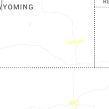
Wyoming
| Local Time | Report Details |
|---|---|
| 5:40 PM MDT | Quarter sized hail reported near Yoder, WY, 44.8 miles W of Scottsbluff, NE, em received reports from public of quarter-sized hail within large quantities of small hail covering the roadway. |
| 7:37 PM MDT | Ping Pong Ball sized hail reported near Lagrange, WY, 36.2 miles WSW of Scottsbluff, NE |
| 7:49 PM MDT | Quarter sized hail reported near Lagrange, WY, 33.2 miles WSW of Scottsbluff, NE |
| 7:57 PM MDT | Half Dollar sized hail reported near Lagrange, WY, 33.5 miles WSW of Scottsbluff, NE, reported by noaa employee. |
| 8:01 PM MDT | Golf Ball sized hail reported near Lagrange, WY, 38.4 miles WSW of Scottsbluff, NE, image provided. |
Connect with Interactive Hail Maps