

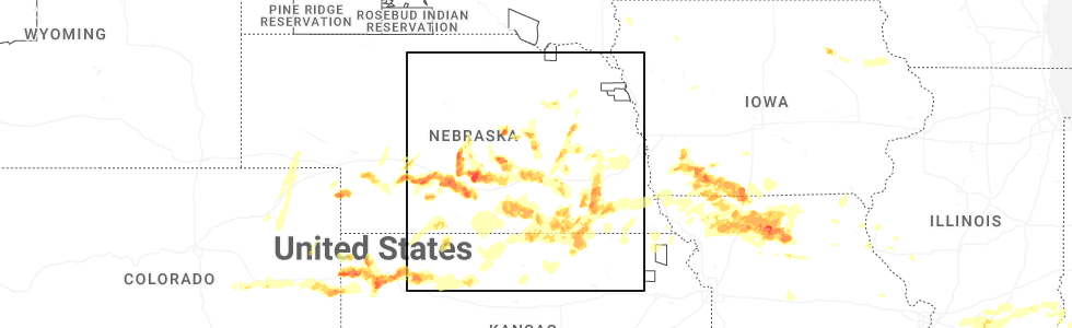
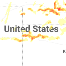
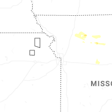
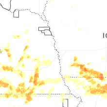
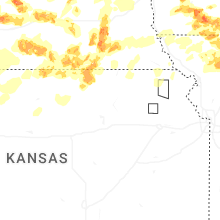
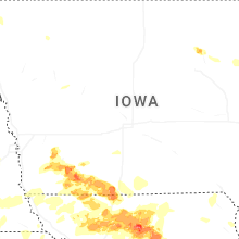
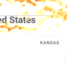
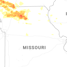
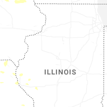
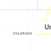
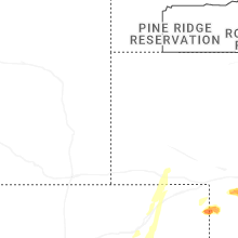
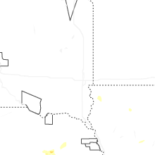
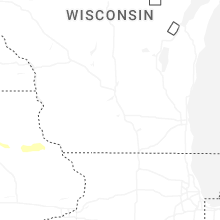
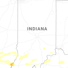
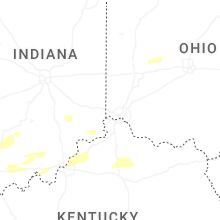
Hail Map for Saturday, May 16, 2026
Number of Impacted Households on 5/16/2026
0
Impacted by 1" or Larger Hail
0
Impacted by 1.75" or Larger Hail
0
Impacted by 2.5" or Larger Hail
Square Miles of Populated Area Impacted on 5/16/2026
0
Impacted by 1" or Larger Hail
0
Impacted by 1.75" or Larger Hail
0
Impacted by 2.5" or Larger Hail


Cities Most Affected by Hail Storms of 5/16/2026
| Hail Size | Demographics of Zip Codes Affected | ||||||
|---|---|---|---|---|---|---|---|
| City | Count | Average | Largest | Pop Density | House Value | Income | Age |
| Goodland, KS | 19 | 2.05 | 2.75 | 9 | $65k | $33.1k | 41.5 |
| Trenton, MO | 10 | 2.40 | 3.00 | 37 | $48k | $27.3k | 42.5 |
| Galt, MO | 6 | 2.04 | 2.50 | 8 | $26k | $28.9k | 43.2 |
| Kanorado, KS | 3 | 2.55 | 2.75 | 1 | $51k | $26.9k | 48.3 |
| Plymouth, NE | 3 | 2.42 | 2.75 | 5 | $63k | $39.3k | 45.6 |
| Red Oak, IA | 3 | 2.17 | 2.75 | 41 | $61k | $33.0k | 43.9 |
| De Witt, NE | 2 | 2.38 | 2.50 | 8 | $64k | $40.7k | 45.1 |
| Gravity, IA | 2 | 2.38 | 2.75 | 5 | $23k | $29.5k | 47.6 |
| Shelton, NE | 2 | 1.88 | 2.00 | 10 | $64k | $37.8k | 39.0 |
| Amherst, NE | 1 | 3.00 | 3.00 | 4 | $84k | $40.8k | 40.7 |
| Agenda, KS | 1 | 2.75 | 2.75 | 2 | $16k | $31.9k | 52.8 |
| Phillips, NE | 1 | 2.50 | 2.50 | 11 | $81k | $41.8k | 44.2 |
| Laredo, MO | 1 | 2.50 | 2.50 | 9 | $17k | $27.9k | 41.6 |
| Platte Center, NE | 1 | 2.00 | 2.00 | 8 | $68k | $36.8k | 41.1 |
| Albany, MO | 1 | 2.00 | 2.00 | 17 | $56k | $27.0k | 44.5 |
| Crete, NE | 1 | 2.00 | 2.00 | 67 | $79k | $37.7k | 31.0 |
| Osceola, NE | 1 | 2.00 | 2.00 | 5 | $61k | $37.8k | 45.0 |
| Linneus, MO | 1 | 2.00 | 2.00 | 6 | $34k | $30.8k | 43.3 |
| Henderson, NE | 1 | 1.75 | 1.75 | 7 | $75k | $39.0k | 50.3 |
| Grand Island, NE | 1 | 1.75 | 1.75 | 336 | $77k | $35.5k | 32.8 |
| Wellfleet, NE | 1 | 1.75 | 1.75 | 1 | $85k | $37.1k | 45.3 |
| Fairbury, NE | 1 | 1.75 | 1.75 | 17 | $42k | $31.2k | 46.2 |
| Narka, KS | 1 | 1.75 | 1.75 | 3 | $10k | $22.3k | 49.2 |
| Western, NE | 1 | 1.75 | 1.75 | 3 | $37k | $34.6k | 51.0 |
| Hugo, CO | 1 | 1.75 | 1.75 | 0 | $71k | $31.3k | 46.8 |
| Lexington, NE | 1 | 1.75 | 1.75 | 46 | $64k | $38.3k | 30.8 |
| Mount Vernon, IL | 1 | 1.75 | 1.75 | 167 | $64k | $31.5k | 41.1 |
| Chula, MO | 1 | 1.75 | 1.75 | 8 | $19k | $30.0k | 37.8 |
| Mount Ayr, IA | 1 | 1.75 | 1.75 | 17 | $52k | $29.3k | 47.4 |
| Corning, IA | 1 | 1.75 | 1.75 | 12 | $52k | $29.9k | 46.8 |
| Pleasant Dale, NE | 1 | 1.75 | 1.75 | 13 | $108k | $50.1k | 44.4 |
| Miller, NE | 1 | 1.75 | 1.75 | 3 | $71k | $34.7k | 43.0 |
| Aurora, NE | 1 | 1.75 | 1.75 | 30 | $81k | $38.9k | 40.7 |
| Boelus, NE | 1 | 1.75 | 1.75 | 7 | $46k | $27.3k | 48.0 |
Hail and Wind Damage Spotted on 5/16/2026
Filter by Report Type:Hail ReportsWind Reports
Ohio
| Local Time | Report Details |
|---|---|
| 8:32 AM EDT | Half Dollar sized hail reported near Urbana, OH, 40.6 miles WNW of Columbus, OH, quarter to half dollar size hail south of town. |
Nebraska
| Local Time | Report Details |
|---|---|
| 11:52 AM CDT | House lost roof west of crystal spring in jefferson county NE, 74.7 miles NNW of Manhattan, KS |
| 4:21 PM CDT | Golf Ball sized hail reported near Wellfleet, NE, 23.3 miles S of North Platte, NE |
| 4:39 PM CDT | Quarter sized hail reported near Wellfleet, NE, 21.4 miles S of North Platte, NE |
| 4:50 PM CDT | Golf Ball sized hail reported near Aurora, NE, 25.3 miles SE of Grand Island, NE, hail slightly smaller than golf ball. |
| 4:52 PM CDT | Quarter sized hail reported near North Platte, NE, 0.4 miles NW of North Platte, NE |
| 4:52 PM CDT | Ping Pong Ball sized hail reported near Henderson, NE, 29.5 miles ESE of Grand Island, NE, actually 1 inch 5/8 inches in diameter. |
| 5:20 PM CDT | Quarter sized hail reported near Oconto, NE, 54.4 miles E of North Platte, NE |
| 5:20 PM CDT | Quarter sized hail reported near Osceola, NE, 36.7 miles ENE of Grand Island, NE |
| 5:26 PM CDT | Hen Egg sized hail reported near Osceola, NE, 40 miles ENE of Grand Island, NE |
| 5:28 PM CDT | Golf Ball sized hail reported near Miller, NE, 53.9 miles W of Grand Island, NE |
| 5:42 PM CDT | Golf Ball sized hail reported near Henderson, NE, 29.5 miles ESE of Grand Island, NE |
| 5:57 PM CDT | Golf Ball sized hail reported near Boelus, NE, 22.6 miles WNW of Grand Island, NE |
| 6:14 PM CDT | Tea Cup sized hail reported near Amherst, NE, 53.1 miles W of Grand Island, NE, biggest hail was 3 inches. it broke windows. it hailed for at least 30 minutes beginning around 5:45 pm. |
| 5:22 PM MDT | Quarter sized hail reported near Sidney, NE, 61.7 miles SE of Scottsbluff, NE, majority of hail was 3/4 inch in size with a few 1 inch sized stones. |
| 6:26 PM CDT | Half Dollar sized hail reported near Platte Center, NE, 61.3 miles NE of Grand Island, NE, social media report of quarter to half dollar sized hail. |
| 6:34 PM CDT | Hen Egg sized hail reported near Platte Center, NE, 65.7 miles NE of Grand Island, NE, public report via social media of 2 inch hail. |
| 6:47 PM CDT | Storm damage reported in buffalo county NE, 42.8 miles WSW of Grand Island, NE |
| 6:48 PM CDT | Storm damage reported in buffalo county NE, 41.3 miles WSW of Grand Island, NE |
| 6:52 PM CDT | Large cottonwood limbs down. estimated 60 to 70 mph win in buffalo county NE, 43.5 miles WSW of Grand Island, NE |
| 6:56 PM CDT | Storm damage reported in buffalo county NE, 41.8 miles WSW of Grand Island, NE |
| 6:58 PM CDT | Quarter sized hail reported near Riverdale, NE, 43.1 miles W of Grand Island, NE |
| 6:58 PM CDT | Quarter sized hail reported near Lexington, NE, 53.7 miles ESE of North Platte, NE |
| 7:00 PM CDT | Storm damage reported in buffalo county NE, 41.8 miles WSW of Grand Island, NE |
| 7:03 PM CDT | Quarter sized hail reported near Kearney, NE, 38.7 miles WSW of Grand Island, NE |
| 7:03 PM CDT | Storm damage reported in buffalo county NE, 40.1 miles WSW of Grand Island, NE |
| 7:11 PM CDT | Power poles and lines down on homes and across roads in the are in buffalo county NE, 40.1 miles WSW of Grand Island, NE |
| 7:15 PM CDT | Wind damage at highway 10 and avenue n in kearney. there was an overturned pivot and fences blown dow in buffalo county NE, 41.8 miles WSW of Grand Island, NE |
| 7:19 PM CDT | Quarter sized hail reported near Plymouth, NE, 79.9 miles ESE of Grand Island, NE, report from emergency management relayed via nwschat. |
| 7:19 PM CDT | At kearney regional airpor in buffalo county NE, 36.6 miles WSW of Grand Island, NE |
| 7:20 PM CDT | Quarter sized hail reported near North Loup, NE, 48.2 miles NNW of Grand Island, NE, a lot of 1 inch hail along with heavy rain and gusty wind. |
| 7:26 PM CDT | Half Dollar sized hail reported near Elwood, NE, 56.1 miles ESE of North Platte, NE, quarter to half dollar size wind driven hail. |
| 7:43 PM CDT | Golf Ball sized hail reported near Lexington, NE, 58.9 miles ESE of North Platte, NE |
| 7:49 PM CDT | Ping Pong Ball sized hail reported near Shelton, NE, 22.7 miles WSW of Grand Island, NE |
| 7:50 PM CDT | Quarter sized hail reported near Wilber, NE, 75.9 miles SW of Omaha, NE |
| 7:57 PM CDT | Quarter sized hail reported near De Witt, NE, 79.9 miles SW of Omaha, NE, report of some quarter size hail mixed with nickels and peas. |
| 8:00 PM CDT | Hen Egg sized hail reported near Shelton, NE, 22.7 miles WSW of Grand Island, NE |
| 8:00 PM CDT | Golf Ball sized hail reported near Shelton, NE, 22.7 miles WSW of Grand Island, NE, delayed social media report. |
| 8:03 PM CDT | Tennis Ball sized hail reported near De Witt, NE, 78.5 miles SW of Omaha, NE |
| 8:11 PM CDT | Ping Pong Ball sized hail reported near Crete, NE, 68 miles SW of Omaha, NE |
| 8:12 PM CDT | Half Dollar sized hail reported near Wood River, NE, 15.4 miles WSW of Grand Island, NE, most hail was dime to penny size but a few were larger than quarters. |
| 8:15 PM CDT | Hen Egg sized hail reported near Crete, NE, 68.9 miles SW of Omaha, NE, lots of hail on the ground. measured hail of approx. 2 inches. |
| 8:27 PM CDT | Hen Egg sized hail reported near De Witt, NE, 77.7 miles SW of Omaha, NE, report from mping: hen egg+ (2.25 in.). |
| 8:30 PM CDT | Golf Ball sized hail reported near Pleasant Dale, NE, 63 miles SW of Omaha, NE, report from mping: golf ball (1.75 in.). |
| 8:35 PM CDT | Gust occurred at the holdrege airpor in phelps county NE, 61.9 miles WSW of Grand Island, NE |
| 8:35 PM CDT | Half Dollar sized hail reported near Pleasant Dale, NE, 61.4 miles WSW of Omaha, NE, public report of half dollar sized hail. |
| 8:36 PM CDT | Quarter sized hail reported near Pleasant Dale, NE, 61.1 miles WSW of Omaha, NE |
| 8:37 PM CDT | Golf Ball sized hail reported near Fairbury, NE, 74.1 miles NNW of Manhattan, KS, several reports of golfball sized hail. |
| 8:49 PM CDT | Golf Ball sized hail reported near Grand Island, NE, 3.8 miles S of Grand Island, NE, spotter report. |
| 8:50 PM CDT | Ping Pong Ball sized hail reported near Grand Island, NE, 1.6 miles WSW of Grand Island, NE |
| 8:50 PM CDT | A large branch came down and damaged a gutter and a roof in nw grand islan in hall county NE, 1.6 miles WSW of Grand Island, NE |
| 8:51 PM CDT | Ping Pong Ball sized hail reported near Grand Island, NE, 2.4 miles S of Grand Island, NE, nws employee. |
| 8:52 PM CDT | Tennis Ball sized hail reported near Phillips, NE, 5.3 miles SE of Grand Island, NE, image sent in. |
| 8:54 PM CDT | Quarter sized hail reported near Malcolm, NE, 54.2 miles WSW of Omaha, NE |
| 8:55 PM CDT | Baseball sized hail reported near Plymouth, NE, 78.8 miles NNW of Manhattan, KS, report received via nwschat from em. |
| 8:55 PM CDT | Baseball sized hail reported near Plymouth, NE, 79.9 miles ESE of Grand Island, NE |
| 8:56 PM CDT | Golf Ball sized hail reported near Plymouth, NE, 79 miles ESE of Grand Island, NE, public report of golf balls. |
| 8:58 PM CDT | Half Dollar sized hail reported near Malcolm, NE, 54.2 miles WSW of Omaha, NE |
| 9:07 PM CDT | Storm damage reported in merrick county NE, 21.5 miles NE of Grand Island, NE |
| 9:21 PM CDT | Gust occurred at the aurora awo in hamilton county NE, 18 miles E of Grand Island, NE |
| 9:33 PM CDT | Storm damage reported in harlan county NE, 79.4 miles N of Hays, KS |
| 9:34 PM CDT | Storm damage reported in hamilton county NE, 28.6 miles ESE of Grand Island, NE |
| 9:34 PM CDT | Storm damage reported in hamilton county NE, 29 miles ESE of Grand Island, NE |
| 9:35 PM CDT | A large tree has fallen on a residence in auror in hamilton county NE, 18.2 miles ESE of Grand Island, NE |
| 9:39 PM CDT | Storm damage reported in fillmore county NE, 36.5 miles SE of Grand Island, NE |
| 9:46 PM CDT | Storm damage reported in fillmore county NE, 40.3 miles SE of Grand Island, NE |
| 9:46 PM CDT | Storm damage reported in fillmore county NE, 36.5 miles SE of Grand Island, NE |
| 9:47 PM CDT | Golf Ball sized hail reported near Western, NE, 66.8 miles ESE of Grand Island, NE, report from mping: golf ball (1.75 in.). |
| 9:52 PM CDT | Storm damage reported in fillmore county NE, 40.4 miles ESE of Grand Island, NE |
| 9:54 PM CDT | Storm damage reported in fillmore county NE, 45.8 miles SE of Grand Island, NE |
| 9:56 PM CDT | Storm damage reported in franklin county NE, 60.7 miles SW of Grand Island, NE |
| 9:56 PM CDT | Storm damage reported in phelps county NE, 57.5 miles SW of Grand Island, NE |
| 9:56 PM CDT | Storm damage reported in fillmore county NE, 46 miles ESE of Grand Island, NE |
| 9:57 PM CDT | Storm damage reported in phelps county NE, 56.7 miles SW of Grand Island, NE |
| 9:58 PM CDT | Storm damage reported in fillmore county NE, 41.2 miles ESE of Grand Island, NE |
| 10:00 PM CDT | Storm damage reported in fillmore county NE, 42.8 miles ESE of Grand Island, NE |
| 10:00 PM CDT | Storm damage reported in fillmore county NE, 40.4 miles ESE of Grand Island, NE |
| 10:00 PM CDT | Storm damage reported in franklin county NE, 55.7 miles SW of Grand Island, NE |
| 10:00 PM CDT | Quarter sized hail reported near Deweese, NE, 41 miles SSE of Grand Island, NE |
| 10:01 PM CDT | Storm damage reported in phelps county NE, 61.9 miles WSW of Grand Island, NE |
| 10:02 PM CDT | Storm damage reported in fillmore county NE, 43.2 miles SE of Grand Island, NE |
| 10:03 PM CDT | Storm damage reported in kearney county NE, 52.9 miles SW of Grand Island, NE |
| 10:04 PM CDT | Storm damage reported in franklin county NE, 62.1 miles SSW of Grand Island, NE |
| 10:04 PM CDT | Storm damage reported in franklin county NE, 62.7 miles SSW of Grand Island, NE |
| 10:05 PM CDT | Storm damage reported in fillmore county NE, 42.8 miles ESE of Grand Island, NE |
| 10:06 PM CDT | Storm damage reported in franklin county NE, 56.3 miles SW of Grand Island, NE |
| 10:08 PM CDT | Storm damage reported in fillmore county NE, 48.4 miles ESE of Grand Island, NE |
| 10:09 PM CDT | Storm damage reported in kearney county NE, 50.4 miles SW of Grand Island, NE |
| 10:10 PM CDT | Storm damage reported in adams county NE, 33.8 miles SSW of Grand Island, NE |
| 10:11 PM CDT | Storm damage reported in webster county NE, 51.2 miles S of Grand Island, NE |
| 10:13 PM CDT | Personal weather statio in webster county NE, 43.8 miles SSW of Grand Island, NE |
| 10:15 PM CDT | Storm damage reported in fillmore county NE, 48.4 miles ESE of Grand Island, NE |
| 10:15 PM CDT | Storm damage reported in kearney county NE, 43.5 miles SW of Grand Island, NE |
| 10:16 PM CDT | Storm damage reported in fillmore county NE, 46.5 miles ESE of Grand Island, NE |
| 10:17 PM CDT | Personal weather statio in webster county NE, 52.7 miles SSW of Grand Island, NE |
| 10:19 PM CDT | Storm damage reported in kearney county NE, 42.5 miles SW of Grand Island, NE |
| 10:24 PM CDT | Storm damage reported in adams county NE, 35.2 miles S of Grand Island, NE |
| 10:24 PM CDT | Storm damage reported in fillmore county NE, 55.4 miles SE of Grand Island, NE |
| 10:24 PM CDT | Storm damage reported in kearney county NE, 38 miles WSW of Grand Island, NE |
| 10:25 PM CDT | Personal weather statio in kearney county NE, 39.3 miles WSW of Grand Island, NE |
| 10:27 PM CDT | Storm damage reported in york county NE, 47.5 miles ESE of Grand Island, NE |
| 10:27 PM CDT | Storm damage reported in kearney county NE, 34.8 miles SW of Grand Island, NE |
| 10:30 PM CDT | Storm damage reported in kearney county NE, 34.8 miles SW of Grand Island, NE |
| 10:31 PM CDT | Storm damage reported in buffalo county NE, 35.9 miles WSW of Grand Island, NE |
| 10:31 PM CDT | Storm damage reported in buffalo county NE, 38.1 miles WSW of Grand Island, NE |
| 10:35 PM CDT | Storm damage reported in thayer county NE, 52.8 miles SSE of Grand Island, NE |
| 10:37 PM CDT | Storm damage reported in thayer county NE, 51.6 miles SSE of Grand Island, NE |
| 10:39 PM CDT | Storm damage reported in fillmore county NE, 58.9 miles ESE of Grand Island, NE |
| 10:45 PM CDT | Storm damage reported in nuckolls county NE, 47.1 miles SSE of Grand Island, NE |
| 10:46 PM CDT | Personal weather statio in thayer county NE, 65.2 miles SE of Grand Island, NE |
| 10:47 PM CDT | Storm damage reported in nuckolls county NE, 51.4 miles SSE of Grand Island, NE |
| 10:48 PM CDT | Storm damage reported in hall county NE, 15.4 miles WSW of Grand Island, NE |
| 10:58 PM CDT | Several large trees down in tow in clay county NE, 41 miles SSE of Grand Island, NE |
| 11:00 PM CDT | Snapped tree branches across the roadwa in clay county NE, 39.5 miles SSE of Grand Island, NE |
| 11:01 PM CDT | Several large trees down in tow in clay county NE, 36.2 miles SSE of Grand Island, NE |
| 11:01 PM CDT | Storm damage reported in nuckolls county NE, 51.7 miles SSE of Grand Island, NE |
| 11:06 PM CDT | Storm damage reported in nuckolls county NE, 53.4 miles SSE of Grand Island, NE |
| 11:10 PM CDT | Storm damage reported in nuckolls county NE, 48.3 miles SSE of Grand Island, NE |
| 11:11 PM CDT | Storm damage reported in saline county NE, 69.3 miles ESE of Grand Island, NE |
| 11:12 PM CDT | Storm damage reported in thayer county NE, 61.8 miles SSE of Grand Island, NE |
| 11:13 PM CDT | Storm damage reported in nuckolls county NE, 51.4 miles SSE of Grand Island, NE |
| 11:13 PM CDT | Storm damage reported in nuckolls county NE, 48.2 miles SSE of Grand Island, NE |
| 11:14 PM CDT | Storm damage reported in saline county NE, 69 miles ESE of Grand Island, NE |
| 11:18 PM CDT | Storm damage reported in thayer county NE, 55.4 miles SE of Grand Island, NE |
| 11:19 PM CDT | Personal weather statio in thayer county NE, 67 miles SSE of Grand Island, NE |
| 11:20 PM CDT | Storm damage reported in thayer county NE, 71.3 miles SSE of Grand Island, NE |
| 11:22 PM CDT | Storm damage reported in thayer county NE, 53.7 miles SE of Grand Island, NE |
| 11:22 PM CDT | Storm damage reported in thayer county NE, 52 miles SE of Grand Island, NE |
| 11:24 PM CDT | Storm damage reported in thayer county NE, 55.8 miles SE of Grand Island, NE |
| 11:30 PM CDT | Storm damage reported in thayer county NE, 52 miles SE of Grand Island, NE |
| 11:44 PM CDT | Storm damage reported in jefferson county NE, 68 miles NNW of Manhattan, KS |
| 11:46 PM CDT | Storm damage reported in jefferson county NE, 76 miles SE of Grand Island, NE |
| 11:52 PM CDT | Storm damage reported in jefferson county NE, 73.2 miles NNW of Manhattan, KS |
| 11:52 PM CDT | Storm damage reported in jefferson county NE, 73.2 miles NNW of Manhattan, KS |
| 11:53 PM CDT | Power is out in fairbury... trees down... and visibility is in jefferson county NE, 73.2 miles NNW of Manhattan, KS |
| 11:53 PM CDT | Storm damage reported in jefferson county NE, 76 miles SE of Grand Island, NE |
| 11:54 PM CDT | Storm damage reported in jefferson county NE, 74.2 miles NNW of Manhattan, KS |
| 12:43 AM CDT | Storm damage reported in gage county NE, 60.1 miles N of Manhattan, KS |
| 1:32 AM CDT | Storm damage reported in richardson county NE, 80.1 miles NE of Manhattan, KS |
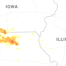
Illinois
| Local Time | Report Details |
|---|---|
| 12:25 PM CDT | Delayed report. several photos of damage on west morton ave between us 67 and massey lane. power poles snapped. traffic lights downed. large trees downed. a trailer was in morgan county IL, 75.4 miles N of Saint Louis, MO |
| 2:15 PM CDT | Several reports of dime to nickel sized hail and large branches down in the benton vicinit in franklin county IL, 59.6 miles NE of Cape Girardeau, MO |
| 4:14 PM CDT | Reports of powerlines and trees down near oden. transformer blown near community beach and odin roa in marion county IL, 62.3 miles E of Saint Louis, MO |
| 4:14 PM CDT | Minor shingle damage to the roof of a residence near the boone street road and farthing road intersection. time estimated by rada in marion county IL, 61.1 miles E of Saint Louis, MO |
| 4:18 PM CDT | Powerlines and trees reported down in the are in marion county IL, 58.3 miles E of Saint Louis, MO |
| 4:46 PM CDT | Golf Ball sized hail reported near Mount Vernon, IL, 70.6 miles ESE of Saint Louis, MO, hail up to the size of golf balls damaged vehicles and roofs along highway 37 between mt vernon and dix. |
| 4:47 PM CDT | Nws employee estimated 60 mph winds near ashle in washington county IL, 58.5 miles ESE of Saint Louis, MO |
| 4:48 PM CDT | Quarter sized hail reported near Centralia, IL, 58.3 miles E of Saint Louis, MO, public post on marion co. em social media of hail in centralia. |
| 4:48 PM CDT | Marion county em submitted photos of two power poles down across woods lane between east mccord street and meadow lane. time estimated by rada in marion county IL, 60.5 miles E of Saint Louis, MO |
| 4:52 PM CDT | Awning to the shell gas station blown over near 12th street. time estimated by rada in clinton county IL, 44.9 miles E of Saint Louis, MO |
| 4:54 PM CDT | Quarter sized hail reported near Mount Vernon, IL, 73.7 miles ESE of Saint Louis, MO |
| 4:58 PM CDT | Estimated 60 mph at highway 50 and boxwood roa in clay county IL, 60.2 miles SSW of Mattoon, IL |
| 5:32 PM CDT | Storm damage reported in wayne county IL, 53.8 miles WNW of Evansville, IN |
| 5:52 PM CDT | Quarter sized hail reported near Fairfield, IL, 43.2 miles NW of Evansville, IN, time estimated via radar. report received via social media. |
| 6:13 PM CDT | Tree down on power line in edwards county IL, 31.2 miles NW of Evansville, IN |
| 6:22 PM CDT | Half Dollar sized hail reported near Crossville, IL, 29.6 miles WNW of Evansville, IN, time estimated via radar. report received via social media. |
Indiana
| Local Time | Report Details |
|---|---|
| 3:40 PM EDT | Trees down on sinking creek l in washington county IN, 44.7 miles NW of Louisville, KY |
| 3:45 PM EDT | Tree partially in the roadway on s club r in dubois county IN, 42.9 miles ENE of Evansville, IN |
| 3:54 PM EDT | Dime sized hai in dubois county IN, 50.9 miles ENE of Evansville, IN |
| 4:40 PM EDT | Quarter sized hail reported near English, IN, 48.8 miles WNW of Louisville, KY, several public reports of quarter size hail from the crawford county em. |
| 5:55 PM EDT | Quarter sized hail reported near Corydon, IN, 27.2 miles NW of Louisville, KY, residential report of quarter size hail. |
| 6:00 PM EDT | Corrects previous tstm wnd dmg report from hardinsburg. trees down on sinking creek l in washington county IN, 44.7 miles NW of Louisville, KY |
| 6:00 PM EDT | Wires down on e us hwy 15 in washington county IN, 44.4 miles NW of Louisville, KY |
| 6:25 PM EDT | Trees down on n mill st in pekin... i in washington county IN, 38.8 miles NNW of Louisville, KY |
| 6:40 PM EDT | Downed power lines on tunnel mill r in clark county IN, 34.3 miles N of Louisville, KY |
| 6:45 PM EDT | Large tree down in everman roa in clark county IN, 42.2 miles NNE of Louisville, KY |
Missouri
| Local Time | Report Details |
|---|---|
| 4:22 PM CDT | Golf Ball sized hail reported near Trenton, MO, 84.9 miles NE of Kansas City, MO, social media report. time estimated from radar. |
| 4:29 PM CDT | Quarter sized hail reported near New Hampton, MO, 83.1 miles NNE of Kansas City, MO, social media report. time estimated from radar. |
| 4:39 PM CDT | Quarter sized hail reported near Trenton, MO, 87.5 miles NE of Kansas City, MO |
| 4:42 PM CDT | Baseball sized hail reported near Trenton, MO, 82.1 miles NE of Kansas City, MO, social media report. damaged windshield. time estimated from radar. |
| 4:49 PM CDT | Quarter sized hail reported near Bethany, MO, 87.7 miles NNE of Kansas City, MO |
| 4:55 PM CDT | Quarter sized hail reported near Galt, MO, 90.5 miles WSW of Kahoka, MO, social media report. time estimated from radar. |
| 4:58 PM CDT | Half Dollar sized hail reported near Bethany, MO, 83.5 miles NNE of Kansas City, MO |
| 4:59 PM CDT | Half Dollar sized hail reported near Bethany, MO, 83.8 miles NNE of Kansas City, MO, report from mping: half dollar (1.25 in.). time corrected from radar. |
| 4:59 PM CDT | Power pole leaned over and downed wires near u.s. highway 65. time estimated from rada in grundy county MO, 83.9 miles NE of Kansas City, MO |
| 5:01 PM CDT | Ping Pong Ball sized hail reported near Bethany, MO, 86.5 miles NNE of Kansas City, MO |
| 5:02 PM CDT | Quarter sized hail reported near Trenton, MO, 87.1 miles NE of Kansas City, MO |
| 5:11 PM CDT | Half Dollar sized hail reported near Trenton, MO, 85.5 miles NE of Kansas City, MO |
| 5:11 PM CDT | Golf Ball sized hail reported near Trenton, MO, 86.1 miles NE of Kansas City, MO |
| 5:12 PM CDT | Quarter sized hail reported near Bethany, MO, 86.9 miles NNE of Kansas City, MO, report from mping: quarter (1.00 in.). |
| 5:13 PM CDT | Tea Cup sized hail reported near Trenton, MO, 86.7 miles NE of Kansas City, MO, social media report. time estimated from radar. |
| 5:14 PM CDT | Quarter sized hail reported near Bethany, MO, 87.1 miles NNE of Kansas City, MO |
| 5:16 PM CDT | Ping Pong Ball sized hail reported near Trenton, MO, 86.1 miles NE of Kansas City, MO, social media report. time estimated from radar. |
| 5:17 PM CDT | Baseball sized hail reported near Trenton, MO, 85 miles NE of Kansas City, MO, chaser reports baseball size hail south of trenton along hwy 65 via social media. |
| 5:20 PM CDT | Ping Pong Ball sized hail reported near Trenton, MO, 85.3 miles NE of Kansas City, MO, social media report. time estimated from radar. |
| 5:20 PM CDT | Downed tree at a residence on town and country lane. time estimated from rada in grundy county MO, 84 miles NE of Kansas City, MO |
| 5:24 PM CDT | Tennis Ball sized hail reported near Galt, MO, 91.1 miles NE of Kansas City, MO, social media report. time estimated from radar. |
| 5:26 PM CDT | Hen Egg sized hail reported near Trenton, MO, 87.3 miles NE of Kansas City, MO |
| 5:29 PM CDT | Personal weather station recorde in grundy county MO, 85.9 miles NE of Kansas City, MO |
| 5:29 PM CDT | Tennis Ball sized hail reported near Trenton, MO, 88.8 miles NE of Kansas City, MO, social media report. time estimated from radar. |
| 5:31 PM CDT | Ping Pong Ball sized hail reported near Trenton, MO, 85.3 miles NE of Kansas City, MO |
| 5:31 PM CDT | Hen Egg sized hail reported near Galt, MO, 91.4 miles NE of Kansas City, MO, social media report. time estimated from radar. |
| 5:31 PM CDT | Tea Cup sized hail reported near Trenton, MO, 90.6 miles NE of Kansas City, MO, social media report... photo... and measurement. time estimated from radar. |
| 5:33 PM CDT | Social media report. several trees... limbs... and wires down in laredo. time estimated from rada in grundy county MO, 88 miles NE of Kansas City, MO |
| 5:36 PM CDT | Downed power lines and power outages near 40th street. time confirmed from rada in grundy county MO, 86.4 miles NE of Kansas City, MO |
| 5:37 PM CDT | Tennis Ball sized hail reported near Galt, MO, 92.5 miles NE of Kansas City, MO, social media report. severe damage to multiple vehicles. time estimated from radar. |
| 5:37 PM CDT | Quarter sized hail reported near Spickard, MO, 93.2 miles S of Des Moines, IA, social media report. time estimated from radar. |
| 5:48 PM CDT | Downed wires and power outages near 16th street. time estimated from rada in grundy county MO, 90.3 miles NE of Kansas City, MO |
| 6:12 PM CDT | 6 inch tree limbs knocked dow in livingston county MO, 82.7 miles NE of Kansas City, MO |
| 6:15 PM CDT | Baseball sized hail reported near Trenton, MO, 81.7 miles NE of Kansas City, MO, golf ball to baseball size hail. |
| 6:28 PM CDT | Damage to outbuildings along clark drive west of browning mo. time estimated from rada in linn county MO, 88 miles NW of Columbia, MO |
| 6:29 PM CDT | Golf Ball sized hail reported near Galt, MO, 90.4 miles NE of Kansas City, MO, social media report. time estimated from radar. |
| 6:30 PM CDT | Golf Ball sized hail reported near Trenton, MO, 82.8 miles NE of Kansas City, MO, social media report. damaged windshields. time estimated from radar. |
| 6:31 PM CDT | Report of tree down on hwy dd 1 mile east of shafter mo. time estimated from rada in linn county MO, 86.5 miles NW of Columbia, MO |
| 6:34 PM CDT | Mping report of damaged power pole near u.s. highway 65 and route z. time estimated from rada in grundy county MO, 82.4 miles NE of Kansas City, MO |
| 6:37 PM CDT | Downed wires and power outages near 60th street. time estimated from rada in grundy county MO, 85.4 miles NE of Kansas City, MO |
| 6:41 PM CDT | Picture of tree damag in livingston county MO, 83.8 miles NE of Kansas City, MO |
| 6:41 PM CDT | Tennis Ball sized hail reported near Laredo, MO, 88 miles NE of Kansas City, MO, social media report. time estimated from radar. |
| 6:55 PM CDT | Golf Ball sized hail reported near Chula, MO, 83.1 miles NE of Kansas City, MO, social media report. time estimated from radar. |
| 7:09 PM CDT | Pws measured 58 mph. pws reported it at 0732... but radar suggests 0709pm cdt is more accurat in daviess county MO, 69.9 miles NNE of Kansas City, MO |
| 7:15 PM CDT | Social media video of large tree limb down on mo hwy 139. time estimated from rada in linn county MO, 85.3 miles NW of Columbia, MO |
| 7:16 PM CDT | Quarter sized hail reported near Sheridan, MO, 86.4 miles SE of Omaha, NE |
| 7:20 PM CDT | Ping Pong Ball sized hail reported near Purdin, MO, 82.1 miles NNW of Columbia, MO, social media report. time estimated from radar. |
| 7:22 PM CDT | Ping Pong Ball sized hail reported near Linneus, MO, 78.7 miles NW of Columbia, MO, social media report. time estimated from radar. |
| 7:30 PM CDT | Downed wires and power outages near route b. time estimated from rada in daviess county MO, 78.8 miles NNE of Kansas City, MO |
| 7:32 PM CDT | Hen Egg sized hail reported near Linneus, MO, 77.5 miles NW of Columbia, MO, social media report. time estimated from radar. |
| 7:34 PM CDT | Tree uprooted near trenton lower lake. time estimated from radar and social media repor in grundy county MO, 85.7 miles NE of Kansas City, MO |
| 7:38 PM CDT | Quarter sized hail reported near Gilman City, MO, 81 miles NNE of Kansas City, MO, social media report. time estimated from radar. |
| 7:41 PM CDT | Social media report. large trees down southeast of hatfield. time estimated from rada in harrison county MO, 76.8 miles SSW of Des Moines, IA |
| 7:42 PM CDT | Downed wires near county road 164. time estimated from rada in worth county MO, 89.4 miles SSW of Des Moines, IA |
| 7:56 PM CDT | Mping report of damaged power pole near u.s. highway 136. time confirmed from rada in gentry county MO, 81.8 miles NNE of Kansas City, MO |
| 7:57 PM CDT | Social media report. downed tree limbs in town. time estimated from rada in harrison county MO, 79.7 miles SSW of Des Moines, IA |
| 7:57 PM CDT | Mping reports of trees and limbs down near 140th street. time estimated from rada in harrison county MO, 76.6 miles SSW of Des Moines, IA |
| 7:58 PM CDT | Video from trained spotter on social media shows severe caliber winds along i-35 near eagleville m in harrison county MO, 79.6 miles SSW of Des Moines, IA |
| 7:59 PM CDT | Half Dollar sized hail reported near Trenton, MO, 84.5 miles NNE of Kansas City, MO, social media report. time confirmed from radar. |
| 7:59 PM CDT | Quarter sized hail reported near Eagleville, MO, 76 miles SSW of Des Moines, IA, social media report. time estimated from radar. |
| 7:59 PM CDT | Quarter sized hail reported near Maryville, MO, 84.8 miles SE of Omaha, NE, social media report. time estimated from radar. |
| 8:01 PM CDT | Golf Ball sized hail reported near Galt, MO, 90.9 miles WSW of Kahoka, MO, social media report. time estimated from radar. |
| 8:03 PM CDT | Half Dollar sized hail reported near Galt, MO, 90.5 miles WSW of Kahoka, MO, social media report. time estimated from radar. |
| 8:08 PM CDT | Quarter sized hail reported near Albany, MO, 81 miles N of Kansas City, MO, report from mping: quarter (1.00 in.). |
| 8:10 PM CDT | Downed wires and power outages near routes n and t. time estimated from rada in harrison county MO, 78.3 miles SSW of Des Moines, IA |
| 8:11 PM CDT | Quarter sized hail reported near Albany, MO, 80.3 miles N of Kansas City, MO |
| 8:15 PM CDT | Golf Ball sized hail reported near Galt, MO, 86.4 miles W of Kahoka, MO, social media report. time estimated from radar. |
| 8:18 PM CDT | Quarter sized hail reported near Galt, MO, 91.1 miles NE of Kansas City, MO, field flooded from torrential rainfall as well. time estimated from radar. |
| 8:20 PM CDT | Quarter sized hail reported near Conception Junction, MO, 80 miles N of Kansas City, MO, social media report. time estimated from radar. |
| 8:25 PM CDT | Hen Egg sized hail reported near Albany, MO, 79.7 miles N of Kansas City, MO |
| 8:37 PM CDT | Mping report of downed tree limbs near u.s. highway 136. time estimated from rada in harrison county MO, 87.5 miles NNE of Kansas City, MO |
| 8:46 PM CDT | Several reports of downed wires north of king city. time estimated from rada in gentry county MO, 69 miles N of Kansas City, MO |
| 9:05 PM CDT | Quarter sized hail reported near Trenton, MO, 84.5 miles NNE of Kansas City, MO, social media report. time estimated from radar. |
| 10:06 PM CDT | Quarter sized hail reported near Jameson, MO, 70.1 miles NNE of Kansas City, MO, social media report. time estimated from radar. |
| 10:13 PM CDT | Private weather senso in daviess county MO, 71.5 miles NNE of Kansas City, MO |
| 10:34 PM CDT | Half Dollar sized hail reported near Trenton, MO, 84.4 miles NE of Kansas City, MO, time estimated from radar. |
| 10:42 PM CDT | Half Dollar sized hail reported near Trenton, MO, 84.9 miles NE of Kansas City, MO, social media report. minor damage to vehicle. time estimated from radar. |
| 11:23 PM CDT | Half Dollar sized hail reported near Pattonsburg, MO, 74.6 miles NNE of Kansas City, MO, social media report. time estimated from radar. |
| 11:47 PM CDT | Quarter sized hail reported near Green City, MO, 65.8 miles W of Kahoka, MO, social media report. time estimated from radar. |
Colorado
| Local Time | Report Details |
|---|---|
| 3:24 PM MDT | Golf Ball sized hail reported near Hugo, CO, 77.8 miles SSW of Yuma, CO |
| 4:00 PM MDT | Quarter sized hail reported near Akron, CO, 28.8 miles WNW of Yuma, CO |
| 4:25 PM MDT | Awn; sears_home_weathe in yuma county CO, 33.7 miles S of Yuma, CO |
| 4:34 PM MDT | Awn; sevenfarm in kit carson county CO, 49.2 miles S of Yuma, CO |
| 5:10 PM MDT | Asos station kitr burlington co airpor in kit carson county CO, 65.7 miles SSE of Yuma, CO |
| 5:10 PM MDT | Asos station kitr burlington co airpor in kit carson county CO, 65.7 miles SSE of Yuma, CO |
| 5:15 PM MDT | Social media report of pictures of a downed dying tree. additional damage to some vehicle in yuma county CO, 35.8 miles SE of Yuma, CO |
| 5:25 PM MDT | Estimated 65-75 mph wind gus in kit carson county CO, 57 miles W of Colby, KS |
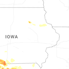
Iowa
| Local Time | Report Details |
|---|---|
| 4:33 PM CDT | Quarter sized hail reported near Stanton, IA, 49.1 miles ESE of Omaha, NE |
| 4:45 PM CDT | Ia dot statio in montgomery county IA, 53.7 miles ESE of Omaha, NE |
| 4:51 PM CDT | Quarter sized hail reported near Stanton, IA, 47.9 miles ESE of Omaha, NE, member of the public reported hail up to the size of quarters. |
| 5:10 PM CDT | Quarter sized hail reported near New Market, IA, 63.4 miles ESE of Omaha, NE |
| 5:12 PM CDT | Quarter sized hail reported near Red Oak, IA, 41.4 miles ESE of Omaha, NE |
| 5:15 PM CDT | Quarter sized hail reported near Red Oak, IA, 40.9 miles ESE of Omaha, NE, report from mping: quarter (1.00 in.). |
| 5:16 PM CDT | Golf Ball sized hail reported near Red Oak, IA, 40.7 miles ESE of Omaha, NE, emergency manager reports golf ball size hail just outside of red oak to the southwest. |
| 5:16 PM CDT | Baseball sized hail reported near Red Oak, IA, 42.2 miles ESE of Omaha, NE, report from mping: baseball (2.75 in.). |
| 5:24 PM CDT | Hen Egg sized hail reported near Red Oak, IA, 44 miles ESE of Omaha, NE, storm chaser shared photos of measured two inch hailstones. |
| 5:31 PM CDT | Golf Ball sized hail reported near Corning, IA, 67.1 miles ESE of Omaha, NE, via spotter network. |
| 5:45 PM CDT | Baseball sized hail reported near Gravity, IA, 70.6 miles ESE of Omaha, NE, caliper measured 2.83 hail. relayed by woi. |
| 5:46 PM CDT | Hen Egg sized hail reported near Gravity, IA, 70.6 miles ESE of Omaha, NE, via spotter network. |
| 6:28 PM CDT | Quarter sized hail reported near Bedford, IA, 73.5 miles ESE of Omaha, NE, report from mping: quarter (1.00 in.). |
| 7:06 PM CDT | Quarter sized hail reported near Mount Ayr, IA, 68.9 miles SSW of Des Moines, IA |
| 7:14 PM CDT | Golf Ball sized hail reported near Mount Ayr, IA, 69.1 miles SSW of Des Moines, IA |
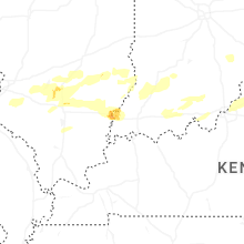
Kentucky
| Local Time | Report Details |
|---|---|
| 6:15 PM EDT | Quarter sized hail reported near Louisville, KY, 18.9 miles N of Louisville, KY, quarter size hail reported throughout downtown louisville. |
| 6:50 PM EDT | Tress down blocking roadwa in oldham county KY, 35.3 miles NNE of Louisville, KY |
| 6:55 PM EDT | Oldham county mesone in oldham county KY, 35.2 miles NNE of Louisville, KY |
| 6:55 PM EDT | Tree down on vehicles on e main s in oldham county KY, 34.4 miles NNE of Louisville, KY |
| 7:00 PM EDT | Tree down in the roadway at ky-146 and webb town r in henry county KY, 38.5 miles NE of Louisville, KY |
| 7:15 PM EDT | Tree down on power line on w college s in henry county KY, 42.6 miles NE of Louisville, KY |
| 7:19 PM EDT | Several trees dow in carroll county KY, 46.8 miles SW of Cincinnati, OH |
| 7:25 PM EDT | Trees down on river roa in henry county KY, 51.5 miles SSW of Cincinnati, OH |
| 7:25 PM EDT | Tree down in roadway on port royal r in henry county KY, 49.4 miles SW of Cincinnati, OH |
| 7:36 PM EDT | Trees dow in owen county KY, 51.3 miles SSW of Cincinnati, OH |
| 7:46 PM EDT | Trees down. time estimated from rada in owen county KY, 43.1 miles SSW of Cincinnati, OH |
| 7:49 PM EDT | Tree dow in grant county KY, 27.6 miles SSW of Cincinnati, OH |
| 7:57 PM EDT | Tree fell on power line in grant county KY, 30 miles S of Cincinnati, OH |
| 7:58 PM EDT | Power lines and pole down. tree dow in grant county KY, 25.2 miles SSW of Cincinnati, OH |
| 8:00 PM EDT | Tree dow in pendleton county KY, 22 miles S of Cincinnati, OH |
| 8:11 PM EDT | Trees dow in pendleton county KY, 31.5 miles SSE of Cincinnati, OH |
| 8:13 PM EDT | Tree dow in pendleton county KY, 31.1 miles SSE of Cincinnati, OH |
| 8:19 PM EDT | Trees dow in pendleton county KY, 25.3 miles SSE of Cincinnati, OH |
| 9:00 PM EDT | 2 trees dow in mason county KY, 51 miles SE of Cincinnati, OH |
Kansas
| Local Time | Report Details |
|---|---|
| 4:29 PM MDT | Quarter sized hail reported near Kanorado, KS, 53.4 miles W of Colby, KS, sherman county dispatch relayed report of one inch hail in kanorado. |
| 4:30 PM MDT | Baseball sized hail reported near Kanorado, KS, 53.4 miles W of Colby, KS, social media report with video of golf ball to baseball sized hail. |
| 4:30 PM MDT | Baseball sized hail reported near Goodland, KS, 45.4 miles W of Colby, KS, delayed report of north of ruleton... baseball sized hail. |
| 4:52 PM MDT | Hen Egg sized hail reported near Goodland, KS, 44.9 miles W of Colby, KS, report of 1.25-2 inch hail. |
| 4:55 PM MDT | Tennis Ball sized hail reported near Goodland, KS, 47.6 miles W of Colby, KS, spotter network report of 2.5 inch hail. |
| 4:59 PM MDT | Tennis Ball sized hail reported near Kanorado, KS, 50.8 miles W of Colby, KS, report from mping: tennis ball (2.50 in.). |
| 5:08 PM MDT | Quarter sized hail reported near Goodland, KS, 42.8 miles W of Colby, KS, spotter network report of one inch hail. |
| 5:09 PM MDT | Golf Ball sized hail reported near Goodland, KS, 41.2 miles W of Colby, KS, golf ball sized hail reported on spotter network. |
| 5:16 PM MDT | Golf Ball sized hail reported near Goodland, KS, 36.8 miles W of Colby, KS, relayed report of golf ball sized hail. |
| 5:19 PM MDT | Golf Ball sized hail reported near Goodland, KS, 36.4 miles W of Colby, KS, report from mping: golf ball (1.75 in.). |
| 5:20 PM MDT | Ping Pong Ball sized hail reported near Goodland, KS, 37 miles W of Colby, KS, report from mping: ping pong ball (1.50 in.). |
| 5:22 PM MDT | Hen Egg sized hail reported near Goodland, KS, 35.1 miles W of Colby, KS, nws employee measured 2 inch hail at the office. |
| 5:27 PM MDT | Hen Egg sized hail reported near Goodland, KS, 35.8 miles W of Colby, KS, report from mping: hen egg (2.00 in.). |
| 5:28 PM MDT | Hen Egg sized hail reported near Kanorado, KS, 48.6 miles W of Colby, KS, relayed report from ham operator of measure 2.4 inch hail. had been laying there a few minutes. |
| 5:29 PM MDT | Hen Egg sized hail reported near Goodland, KS, 35.8 miles W of Colby, KS, social media report 2.05 inch measured hail. |
| 5:30 PM MDT | Hen Egg sized hail reported near Goodland, KS, 35.8 miles W of Colby, KS, public report of 2 inch hail. 11th and sherman. |
| 5:30 PM MDT | Hen Egg sized hail reported near Goodland, KS, 36.2 miles W of Colby, KS, golf ball size; 300 block of sycamore road in goodland. |
| 5:31 PM MDT | Golf Ball sized hail reported near Goodland, KS, 35.7 miles W of Colby, KS, social media report of a golf ball size hail picture. |
| 5:31 PM MDT | Hen Egg sized hail reported near Goodland, KS, 35.8 miles W of Colby, KS, public report of 2 inch hail in gulick park. |
| 5:32 PM MDT | Hen Egg sized hail reported near Goodland, KS, 34.7 miles W of Colby, KS, sheriff office reported 2 inch hail. |
| 6:33 PM CDT | Quarter sized hail reported near Brewster, KS, 18.1 miles W of Colby, KS, report from mping: quarter (1.00 in.). |
| 5:34 PM MDT | Hen Egg sized hail reported near Goodland, KS, 35.8 miles W of Colby, KS, social media report of 2 inch hail. |
| 5:37 PM MDT | Ping Pong Ball sized hail reported near Goodland, KS, 35.8 miles W of Colby, KS, size estimated... photo shows hail a little bigger than a quarter. |
| 5:40 PM MDT | F1147; nw sherma in sherman county KS, 48.1 miles W of Colby, KS |
| 5:42 PM MDT | Quarter sized hail reported near Brewster, KS, 21.8 miles WNW of Colby, KS, off duty nws employee reports 1 inch hail. |
| 5:43 PM MDT | Hen Egg sized hail reported near Goodland, KS, 35.2 miles W of Colby, KS, public report with picture of 2.32 inch hail. |
| 5:45 PM MDT | Golf Ball sized hail reported near Goodland, KS, 35.8 miles W of Colby, KS, public report of 1.75 inch hail. (pictured). |
| 5:50 PM MDT | Mesonet station fw1147 16 nw goodlan in sherman county KS, 48.1 miles W of Colby, KS |
| 5:51 PM MDT | Asos station kgld goodlan in sherman county KS, 35.1 miles W of Colby, KS |
| 6:56 PM CDT | Awn; 1730_rd_ in cheyenne county KS, 46.4 miles NW of Colby, KS |
| 5:56 PM MDT | Hen Egg sized hail reported near Goodland, KS, 35.8 miles W of Colby, KS, 12th and broadway; hail photo with a tape measure. |
| 6:00 PM MDT | Tennis Ball sized hail reported near Goodland, KS, 37 miles W of Colby, KS, spotter report of measured with caliper 2.70 inch hail. |
| 6:00 PM MDT | Social media report of picture of a damaged stand-alone she in sherman county KS, 43.8 miles WSW of Colby, KS |
| 7:02 PM CDT | Awn; hendricks_1420_rd_25 in eastern cheyenne county k in cheyenne county KS, 38.8 miles NW of Colby, KS |
| 6:09 PM MDT | Awn; nw_brewste in sherman county KS, 22.9 miles WNW of Colby, KS |
| 7:34 PM CDT | Quarter sized hail reported near Colby, KS, 2.7 miles SSW of Colby, KS, spotter network report of 1.00 inch hail. |
| 7:39 PM CDT | Plummer; aw in thomas county KS, 12.2 miles S of Colby, KS |
| 7:43 PM CDT | Ostmeyer_weather_station; aw in thomas county KS, 0.8 miles ENE of Colby, KS |
| 7:44 PM CDT | My_weather_station; aw in thomas county KS, 0.8 miles WNW of Colby, KS |
| 7:44 PM CDT | Summers_646; aw in thomas county KS, 13.7 miles SSW of Colby, KS |
| 7:45 PM CDT | F877 in thomas county KS, 1.2 miles SSE of Colby, KS |
| 7:47 PM CDT | Plummer; aw in thomas county KS, 12.2 miles S of Colby, KS |
| 7:47 PM CDT | Mesonet station fw6347 colby 2 in thomas county KS, 1.9 miles E of Colby, KS |
| 7:49 PM CDT | C035 in thomas county KS, 1.4 miles ESE of Colby, KS |
| 7:49 PM CDT | Spotter network of wind gusts between 80 and 84 with a few reaching 8 in thomas county KS, 5.4 miles S of Colby, KS |
| 7:53 PM CDT | Baseball sized hail reported near Agenda, KS, 59.6 miles NW of Manhattan, KS, trained spotter just north of agenda reported 2.5 to 3.0 inch hail. |
| 8:09 PM CDT | Weber; aw in sheridan county KS, 27.9 miles ESE of Colby, KS |
| 8:15 PM CDT | Awos station koin oberli in decatur county KS, 40.6 miles NE of Colby, KS |
| 8:16 PM CDT | Dylan; aw in sheridan county KS, 32.9 miles ESE of Colby, KS |
| 8:20 PM CDT | Multiple social media pictures of a fallen dying tree. roughly 12-15 inch diameter trun in thomas county KS, 5.9 miles WSW of Colby, KS |
| 8:20 PM CDT | Schippers; aw in sheridan county KS, 33.9 miles ESE of Colby, KS |
| 8:24 PM CDT | Kk1601; aw in sheridan county KS, 33 miles E of Colby, KS |
| 8:27 PM CDT | Weather_station; aw in sheridan county KS, 38.5 miles E of Colby, KS |
| 8:28 PM CDT | Spotter network report of 55-60 mph with a few 65 mph gust in gove county KS, 35.8 miles ESE of Colby, KS |
| 8:30 PM CDT | Quarter sized hail reported near Morrowville, KS, 56 miles NW of Manhattan, KS |
| 8:40 PM CDT | Golf Ball sized hail reported near Narka, KS, 71.6 miles NW of Manhattan, KS |
| 8:46 PM CDT | Lowrys; aw in norton county KS, 65.9 miles ENE of Colby, KS |
| 8:46 PM CDT | Quarter sized hail reported near Haddam, KS, 62 miles NW of Manhattan, KS |
| 9:08 PM CDT | Asos station khlc hill cit in graham county KS, 43.6 miles NW of Hays, KS |
| 9:10 PM CDT | Half Dollar sized hail reported near Haddam, KS, 61.5 miles NW of Manhattan, KS, mping report. |
| 9:19 PM CDT | Khlc asos reported gusted 68 mp in graham county KS, 43.6 miles NW of Hays, KS |
| 9:40 PM CDT | Storm damage reported in phillips county KS, 60.9 miles N of Hays, KS |
| 9:41 PM CDT | Storm damage reported in phillips county KS, 60 miles N of Hays, KS |
| 9:45 PM CDT | Estimated from smith county fir in smith county KS, 64.4 miles NNE of Hays, KS |
| 9:48 PM CDT | Storm damage reported in phillips county KS, 62.4 miles N of Hays, KS |
| 10:10 PM CDT | Picture on social media of a large rest stop sign ben in gove county KS, 45.6 miles ESE of Colby, KS |
| 10:15 PM CDT | Storm damage reported in smith county KS, 67.9 miles NNE of Hays, KS |
| 10:41 PM CDT | Storm damage reported in mitchell county KS, 71.7 miles NE of Hays, KS |
| 10:54 PM CDT | Personal weather statio in jewell county KS, 85.8 miles WNW of Manhattan, KS |
| 10:56 PM CDT | Storm damage reported in jewell county KS, 84.1 miles NE of Hays, KS |
| 11:05 PM CDT | Personal weather station reporte in cloud county KS, 75.6 miles WNW of Manhattan, KS |
| 11:14 PM CDT | Personal weather station reporte in cloud county KS, 66.7 miles WNW of Manhattan, KS |
| 11:18 PM CDT | Asos station kcnk concordi in cloud county KS, 63.7 miles WNW of Manhattan, KS |
| 11:18 PM CDT | Mping report of substantial roof damag in cloud county KS, 75.3 miles WNW of Manhattan, KS |
| 11:20 PM CDT | A camper was flipped over in the loves gas station parking lo in republic county KS, 73.5 miles NW of Manhattan, KS |
| 11:22 PM CDT | Quarter sized hail reported near Belleville, KS, 75.8 miles NW of Manhattan, KS, report from mping: quarter (1.00 in.). |
| 11:31 PM CDT | Social media post. also reported quarter size hai in republic county KS, 72.2 miles NW of Manhattan, KS |
| 11:31 PM CDT | Quarter sized hail reported near Belleville, KS, 72.2 miles NW of Manhattan, KS, social media post. also reported 70 mph wind gusts. |
| 11:35 PM CDT | Estimated 90 mph winds with trees and power lines dow in cloud county KS, 64.7 miles WNW of Manhattan, KS |
| 12:02 AM CDT | Cwop statio in clay county KS, 32 miles WNW of Manhattan, KS |
| 12:06 AM CDT | Estimated 60 to 80 mph wind gusts in watervill in marshall county KS, 36.7 miles NNW of Manhattan, KS |
| 12:40 AM CDT | Large tree covering roa in nemaha county KS, 45 miles NNE of Manhattan, KS |
| 12:44 AM CDT | Personal weather statio in nemaha county KS, 47.9 miles NNE of Manhattan, KS |
| 1:49 AM CDT | Several reports of wires down near and north of highland. time estimated from rada in doniphan county KS, 63.8 miles NW of Kansas City, MO |
Connect with Interactive Hail Maps