

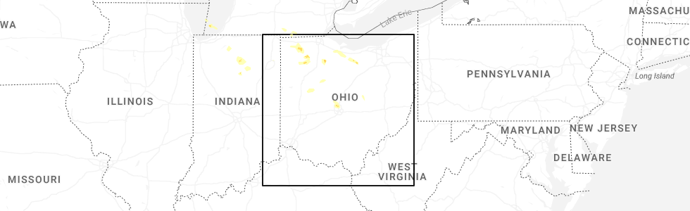
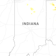
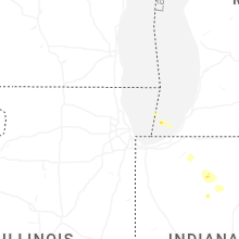
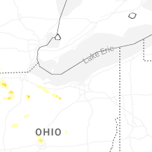
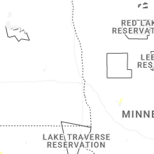
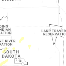
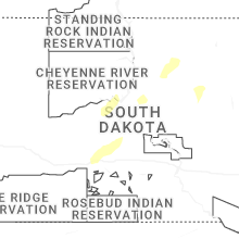
Hail Map for Wednesday, April 22, 2026
Number of Impacted Households on 4/22/2026
0
Impacted by 1" or Larger Hail
0
Impacted by 1.75" or Larger Hail
0
Impacted by 2.5" or Larger Hail
Square Miles of Populated Area Impacted on 4/22/2026
0
Impacted by 1" or Larger Hail
0
Impacted by 1.75" or Larger Hail
0
Impacted by 2.5" or Larger Hail
Cities Most Affected by Hail Storms of 4/22/2026
| Hail Size | Demographics of Zip Codes Affected | ||||||
|---|---|---|---|---|---|---|---|
| City | Count | Average | Largest | Pop Density | House Value | Income | Age |
Hail and Wind Damage Spotted on 4/22/2026
Filter by Report Type:Hail ReportsWind Reports
Utah
| Local Time | Report Details |
|---|---|
| 6:30 AM MDT | Mesonet station ut215 i-215 at i-8 in salt lake county UT, 3.3 miles WNW of Salt Lake City, UT |
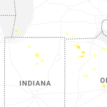
Indiana
| Local Time | Report Details |
|---|---|
| 4:14 PM EDT | Quarter sized hail reported near Fort Wayne, IN, 7.1 miles NE of Fort Wayne, IN, report from mping: quarter (1.00 in.). |
| 4:18 PM EDT | Quarter sized hail reported near Denver, IN, 53.4 miles WSW of Fort Wayne, IN, time estimated by radar. |
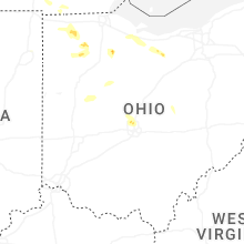
Ohio
| Local Time | Report Details |
|---|---|
| 5:06 PM EDT | Quarter sized hail reported near Napoleon, OH, 55.5 miles ENE of Fort Wayne, IN, range of hail sizes... largest stones nickel to quarter sized. |
| 5:07 PM EDT | Quarter sized hail reported near Dublin, OH, 11.1 miles NNW of Columbus, OH, photos show several 1 inch hail stones. |
| 5:10 PM EDT | Half Dollar sized hail reported near Columbus, OH, 10 miles NNW of Columbus, OH, photos show 1.3 inch hail. |
| 5:37 PM EDT | Quarter sized hail reported near Ottawa, OH, 53.2 miles E of Fort Wayne, IN |
| 5:41 PM EDT | Quarter sized hail reported near Columbus, OH, 9.3 miles NNE of Columbus, OH |
| 5:42 PM EDT | Quarter sized hail reported near Columbus, OH, 4.1 miles N of Columbus, OH, mping report. |
| 6:09 PM EDT | Quarter sized hail reported near Fostoria, OH, 85.5 miles NNW of Columbus, OH |
| 6:09 PM EDT | Ping Pong Ball sized hail reported near Fostoria, OH, 85.4 miles NNW of Columbus, OH, delayed report - ping pong size hail. |
| 6:10 PM EDT | Quarter sized hail reported near Russells Point, OH, 57.7 miles NW of Columbus, OH, hail covering ground. max hailstone diameter is 1 inch. |
South Dakota
| Local Time | Report Details |
|---|---|
| 4:35 PM CDT | Mesonet station llms2 long lake 4nw (sd mesonet in mcpherson county SD, 48.7 miles NW of Aberdeen, SD |
| 4:19 PM MDT | Storm damage reported in custer county SD, 29.1 miles SSE of Rapid City, SD |
| 4:34 PM MDT | Storm damage reported in custer county SD, 29.1 miles SSE of Rapid City, SD |
| 4:55 PM MDT | Storm damage reported in pennington county SD, 45.3 miles ESE of Rapid City, SD |
| 5:05 PM MDT | Storm damage reported in pennington county SD, 36.4 miles E of Rapid City, SD |
| 5:10 PM MDT | Storm damage reported in pennington county SD, 36.4 miles E of Rapid City, SD |
| 5:13 PM MDT | Storm damage reported in pennington county SD, 37.1 miles ESE of Rapid City, SD |
| 5:15 PM MDT | Storm damage reported in pennington county SD, 38.9 miles E of Rapid City, SD |
| 5:20 PM MDT | Storm damage reported in meade county SD, 22.4 miles ENE of Rapid City, SD |
| 5:25 PM MDT | Storm damage reported in pennington county SD, 36.4 miles E of Rapid City, SD |
| 5:30 PM MDT | Storm damage reported in meade county SD, 40.1 miles ENE of Rapid City, SD |
| 5:30 PM MDT | Storm damage reported in pennington county SD, 36.4 miles E of Rapid City, SD |
| 5:40 PM MDT | Storm damage reported in pennington county SD, 36.4 miles E of Rapid City, SD |
| 5:45 PM MDT | Time estimated via rada in pennington county SD, 51.3 miles ESE of Rapid City, SD |
| 5:50 PM MDT | Storm damage reported in jackson county SD, 72.3 miles ESE of Rapid City, SD |
| 6:16 PM MDT | Storm damage reported in ziebach county SD, 71.6 miles ENE of Rapid City, SD |
| 7:35 PM CDT | Mesonet station 332 okobojo (sddot in sully county SD, 24.1 miles NNW of Pierre, SD |
| 8:20 PM CDT | Mesonet station gwms2 gettysburg 14w (sd mesonet in potter county SD, 44.6 miles N of Pierre, SD |
| 8:45 PM CDT | Mesonet station 209 lowry (sddot in walworth county SD, 66.5 miles NNE of Pierre, SD |
| 8:49 PM CDT | Mesonet station 313 selby 5se (sddot in walworth county SD, 71.6 miles W of Aberdeen, SD |
| 9:09 PM CDT | Mesonet station 313 selby 5se (sddot in walworth county SD, 71.6 miles W of Aberdeen, SD |
| 9:19 PM CDT | Mesonet station 313 selby 5se (sddot in walworth county SD, 71.6 miles W of Aberdeen, SD |
| 9:44 PM CDT | Mesonet station 50 herreid (sddot in campbell county SD, 73 miles SSE of Bismarck, ND |
| 11:15 PM CDT | Mesonet station llks2 eureka 13 en in mcpherson county SD, 53.3 miles WNW of Aberdeen, SD |
| 11:15 PM CDT | Mesonet station 313 selby 5se (sddot in walworth county SD, 71.6 miles W of Aberdeen, SD |
Montana
| Local Time | Report Details |
|---|---|
| 4:10 PM MDT | Rock springs n... mt (umt - ggw) elev: 2769.2 ft; lat/lon: 46.88529/-106.2136 in garfield county MT, 37.5 miles NNW of Miles City, MT |
| 4:54 PM MDT | Asos station kjdn jorda in garfield county MT, 61.5 miles SSW of Glasgow, MT |
| 5:00 PM MDT | Mesonet station mtm89 angela in rosebud county MT, 40.7 miles WNW of Miles City, MT |
| 6:00 PM MDT | Montana mesonet station mtm87 (fort peck s in mccone county MT, 38.7 miles SE of Glasgow, MT |
| 6:15 PM MDT | Montana mesonet station vdwm8 (vida w in mccone county MT, 47.8 miles SE of Glasgow, MT |
| 6:35 PM MDT | Corrects previous tstm wnd gst report from 9 ne vida. montana mesonet station vdnm8 (vida ne in mccone county MT, 62.6 miles ESE of Glasgow, MT |
| 6:45 PM MDT | Mesonet station mtlbt lambert mt-200 mp 45. in richland county MT, 60 miles WSW of Williston, ND |
| 6:48 PM MDT | Mesonet station ggwfp 2.4 e fort peck (ggwwfo in mccone county MT, 16.8 miles SE of Glasgow, MT |
| 6:50 PM MDT | Mesonet station fw8536 savag in richland county MT, 55.6 miles SW of Williston, ND |
| 6:50 PM MDT | Montana mesonet station crbm8 (crane w in richland county MT, 51.4 miles SW of Williston, ND |
| 6:55 PM MDT | Montana mesonet station parm8 (poplar n in roosevelt county MT, 65.5 miles E of Glasgow, MT |
| 7:00 PM MDT | Mesonet station fw2498 badger cree in richland county MT, 62.6 miles WSW of Williston, ND |
| 7:15 PM MDT | Mesonet station mtsvg savage mt-16 mp 29. in richland county MT, 60.6 miles SW of Williston, ND |
| 7:20 PM MDT | Montana mesonet station ftkm8 (fort kipp nw in roosevelt county MT, 53.3 miles W of Williston, ND |
| 7:50 PM MDT | Montana mesonet station medm8 (medicine lake w in sheridan county MT, 57.2 miles WNW of Williston, ND |
| 7:58 PM MDT | Mesonet station mlkm8 medicine lake 1es in sheridan county MT, 46.1 miles WNW of Williston, ND |
| 8:10 PM MDT | 54g71 medicine lake w... mt (umt - ggw in sheridan county MT, 57.2 miles WNW of Williston, ND |
| 8:20 PM MDT | Bredette ne... mt (umt - ggw in roosevelt county MT, 68 miles ENE of Glasgow, MT |
| 8:30 PM MDT | Comertown turn-off mt-5 mp 13. in sheridan county MT, 54.1 miles NNW of Williston, ND |
| 8:30 PM MDT | Navajo mt-5 16. in daniels county MT, 80.4 miles NW of Williston, ND |
| 8:35 PM MDT | Sher-wood airport... m in sheridan county MT, 60.6 miles NW of Williston, ND |
| 8:58 PM MDT | Medicine lake... m in sheridan county MT, 46.1 miles WNW of Williston, ND |
| 9:00 PM MDT | Scobey n in daniels county MT, 69.5 miles NE of Glasgow, MT |
| 9:55 PM MDT | Asos station kmls miles cit in custer county MT, 2.2 miles NW of Miles City, MT |
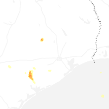
Texas
| Local Time | Report Details |
|---|---|
| 5:30 PM CDT | Half Dollar sized hail reported near Navasota, TX, 67.5 miles NW of Houston, TX, local fire department reported hail... ranging from quarter to approximately golf ball size... over southern brazos county. |
| 5:58 PM CDT | Jackson county emergency manager reported large hail with at least 14 power poles downed over the are in jackson county TX, 87.9 miles WSW of Houston, TX |
North Dakota
| Local Time | Report Details |
|---|---|
| 8:58 PM CDT | 10 m wind gust at ndawn station wishek 5 in mcintosh county ND, 64.9 miles SE of Bismarck, ND |
| 10:03 PM CDT | Ndawn station 10m wind gust measured 60 mp in ramsey county ND, 25.3 miles ENE of Devils Lake, ND |
| 10:06 PM CDT | Ndawn 10m peak gus in mcintosh county ND, 69.5 miles WNW of Aberdeen, SD |
| 10:32 PM CDT | Ndawn 10m peak gus in emmons county ND, 48.9 miles SSE of Bismarck, ND |
| 10:58 PM CDT | Ndawn station 10m wind gust measured 58 mp in benson county ND, 32.3 miles WSW of Devils Lake, ND |
Connect with Interactive Hail Maps