

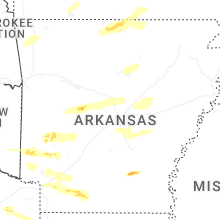
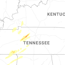
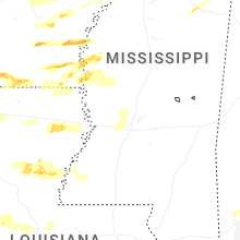
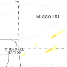
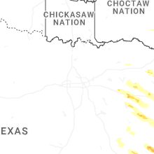
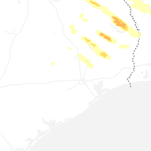
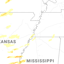
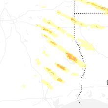
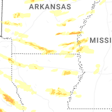
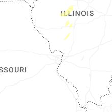
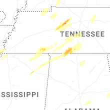
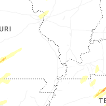
Hail Map for Sunday, March 15, 2026

Number of Impacted Households on 3/15/2026
0
Impacted by 1" or Larger Hail
0
Impacted by 1.75" or Larger Hail
0
Impacted by 2.5" or Larger Hail
Square Miles of Populated Area Impacted on 3/15/2026
0
Impacted by 1" or Larger Hail
0
Impacted by 1.75" or Larger Hail
0
Impacted by 2.5" or Larger Hail


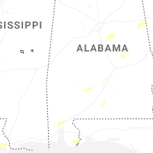
Cities Most Affected by Hail Storms of 3/15/2026
| Hail Size | Demographics of Zip Codes Affected | ||||||
|---|---|---|---|---|---|---|---|
| City | Count | Average | Largest | Pop Density | House Value | Income | Age |
| Jonesville, LA | 2 | 1.75 | 1.75 | 15 | $53k | $24.6k | 40.4 |
| Cushing, TX | 1 | 2.50 | 2.50 | 17 | $52k | $27.0k | 43.6 |
| Broaddus, TX | 1 | 2.50 | 2.50 | 12 | $55k | $26.6k | 54.7 |
| Mc Ewen, TN | 1 | 2.00 | 2.00 | 31 | $80k | $35.7k | 40.1 |
| Rohwer, AR | 1 | 2.00 | 2.00 | 0 | $45k | $55.6k | 33.5 |
| Lake Village, AR | 1 | 1.75 | 1.75 | 15 | $81k | $28.2k | 44.0 |
| El Dorado, AR | 1 | 1.75 | 1.75 | 74 | $59k | $30.6k | 39.5 |
| Palm Bay, FL | 1 | 1.75 | 1.75 | 742 | $78k | $39.8k | 38.0 |
| Rison, AR | 1 | 1.75 | 1.75 | 19 | $53k | $34.1k | 39.5 |
| Oak Grove, LA | 1 | 1.75 | 1.75 | 32 | $49k | $25.5k | 40.1 |
| Goose Creek, SC | 1 | 1.75 | 1.75 | 975 | $93k | $43.6k | 31.0 |
Hail and Wind Damage Spotted on 3/15/2026
Filter by Report Type:Hail ReportsWind Reports
States Impacted
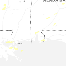
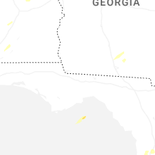
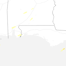
Iowa, Kentucky, Missouri, Florida, Oklahoma, Texas, Arkansas, Illinois, Louisiana, Mississippi, Tennessee, Georgia, Indiana, South Carolina, Alabama, Ohio, Virginia, North Carolina, West VirginiaIowa
| Local Time | Report Details |
|---|---|
| 9:30 AM CDT | Ping Pong Ball sized hail reported near Riverside, IA, 30.3 miles SSE of Cedar Rapids, IA, penny to ping pong. |
Kentucky
| Local Time | Report Details |
|---|---|
| 11:30 AM EDT | Multiple power poles down on ky86 near vertrees church lan in hardin county KY, 30.5 miles SW of Louisville, KY |
| 7:51 PM CDT | Two trees down in the oakton communit in hickman county KY, 47.6 miles NW of Mc Kenzie, TN |
| 8:19 PM CDT | Estimated wind north of cuba fire statio in graves county KY, 30.8 miles NNW of Mc Kenzie, TN |
| 8:30 PM CDT | Pieces of metal blew off of two tobacco barns in kirksey. several trees and power lines were downed over the county. time estimated based on radar at kirkse in calloway county KY, 39.7 miles N of Mc Kenzie, TN |
| 9:19 PM CDT | Storm damage reported in christian county KY, 52.9 miles NW of Nashville, TN |
| 9:35 PM CDT | Awos station khop fort campbell k in christian county KY, 53.1 miles NW of Nashville, TN |
| 9:46 PM CDT | Tree in the roadway on hwy 431 north of central cit in muhlenberg county KY, 51.8 miles SSE of Evansville, IN |
| 9:48 PM CDT | A tree was blown down onto a house in the drakesboro are in muhlenberg county KY, 59.3 miles SSE of Evansville, IN |
| 10:05 PM CDT | Storm damage reported in butler county KY, 68.7 miles N of Nashville, TN |
| 10:11 PM CDT | Large tree down on the 900 block of grancer roa in butler county KY, 63.9 miles SW of Louisville, KY |
| 10:18 PM CDT | Mesonet station av189 leitchfiel in grayson county KY, 47.4 miles SW of Louisville, KY |
| 11:22 PM EDT | Reports of numerous trees down along hwy 84 near hardin springs. time estimated from rada in hardin county KY, 39.2 miles SW of Louisville, KY |
| 10:25 PM CDT | Corrects previous tstm wnd dmg report from leitchfield. 30 trees down calls in leitchfield and about 4300 customers without power in grayson count in grayson county KY, 47 miles SW of Louisville, KY |
| 10:25 PM CDT | Mesonet station blrk leitchfield 3 in grayson county KY, 49.9 miles SW of Louisville, KY |
| 10:27 PM CDT | Few trees down on 86 but roadway is passable. powerlines down on vertress near consstintine rd. time estimated from rada in breckinridge county KY, 33.3 miles WSW of Louisville, KY |
| 11:40 PM EDT | Reports of multiple trees dow in meade county KY, 21.8 miles WSW of Louisville, KY |
| 11:40 PM EDT | Bank sign damage in meade county KY, 21.2 miles WSW of Louisville, KY |
| 11:41 PM EDT | Multiple buildings severely damaged... power lines down and trees in the roadwa in meade county KY, 19.5 miles WSW of Louisville, KY |
| 11:41 PM EDT | Large tree on hous in meade county KY, 19.8 miles WSW of Louisville, KY |
| 11:41 PM EDT | Power poles down on ky 86 in cecili in hardin county KY, 25.9 miles SSW of Louisville, KY |
| 11:42 PM EDT | Railroad crossing gate broken off hinges on hayden school roa in hardin county KY, 23.6 miles SSW of Louisville, KY |
| 11:43 PM EDT | Power lines across the roadway... damage to multiple barn in meade county KY, 18.3 miles WSW of Louisville, KY |
| 11:43 PM EDT | Large tree blown ove in meade county KY, 19.5 miles WSW of Louisville, KY |
| 11:45 PM EDT | Storm damage reported in hardin county KY, 16.3 miles SW of Louisville, KY |
| 10:50 PM CDT | Tree down blocking holly drive near dennis wa in warren county KY, 59.2 miles NNE of Nashville, TN |
| 11:52 PM EDT | Multiple trees down in lebanon junction. one tree was blown down onto a vehicl in bullitt county KY, 10.3 miles S of Louisville, KY |
| 12:01 AM EDT | Multiple trees and power lines down along ridge road east of shepherdsvill in bullitt county KY, 6.4 miles E of Louisville, KY |
| 12:04 AM EDT | Multiple structures damaged along armstrong lane in mount washington as well as tree and power line damag in bullitt county KY, 7.8 miles ENE of Louisville, KY |
| 12:05 AM EDT | Mesonet station crmt shepherdsville 6 s in bullitt county KY, 5.6 miles SSE of Louisville, KY |
| 12:08 AM EDT | Tree down on blossom r in bullitt county KY, 5.9 miles NNE of Louisville, KY |
| 12:15 AM EDT | Awos station kbry bardstow in nelson county KY, 16.6 miles SE of Louisville, KY |
| 12:25 AM EDT | Mesonet station lgrn la grange 6 n in oldham county KY, 35.2 miles NNE of Louisville, KY |
| 11:33 PM CDT | Tree down blocking entire road just off intersection of forrester and clevelan in barren county KY, 69.9 miles S of Louisville, KY |
| 12:35 AM EDT | Mesonet station crop shelbyville 9 nn in shelby county KY, 38 miles NE of Louisville, KY |
| 11:55 PM CDT | Tree down in the road at boston and greensburg rd. another tree reported down at columbia and mosby ridge. time estimated from rada in metcalfe county KY, 67.7 miles S of Louisville, KY |
| 12:00 AM CDT | Tree down on the 2400 block of bridgeport roa in metcalfe county KY, 65.9 miles S of Louisville, KY |
| 12:05 AM CDT | Tree down blocking cumberland parkway westboun in adair county KY, 65.9 miles SSE of Louisville, KY |
| 1:06 AM EDT | Multiple trees down on stamping ground road near betsy wa in scott county KY, 49.9 miles NW of Irvine, KY |
| 1:07 AM EDT | Tree down on the 1000 block of mcclelland circl in scott county KY, 50.3 miles NW of Irvine, KY |
| 12:14 AM CDT | Tree down blocking the roadway at 4710 highway 55 in adair county KY, 69.2 miles SSE of Louisville, KY |
| 2:10 AM EDT | Storm damage reported in pulaski county KY, 56.3 miles SW of Irvine, KY |
Missouri
| Local Time | Report Details |
|---|---|
| 2:30 PM CDT | A large 2 to 3 foot diameter tree was down across both lanes of traffic on harris boulevard at douglas fir roa in christian county MO, 17.2 miles S of Springfield, MO |
| 3:28 PM CDT | Multiple reports were received of trees down in in several locations in douglas county. reports occurred at county road 206 off of ff highway and county road 307 off of in douglas county MO, 42.5 miles ESE of Springfield, MO |
| 3:38 PM CDT | Delayed report with time approximated from radar. emergency management reported damage to a metal outbuilding northeast of cabool. pictures sent in showed the walls col in texas county MO, 42.7 miles SW of Salem, MO |
| 3:39 PM CDT | Tree down on east cherry street with live power lines on the roadwa in lincoln county MO, 48.6 miles WNW of Saint Louis, MO |
| 3:50 PM CDT | Video report of wind overturning a barn and taking down trees on a home security system. time estimated from rada in howell county MO, 49.4 miles SSW of Salem, MO |
| 4:00 PM CDT | From x.com... picture of tree down onto east vine street near sullivan country clu in franklin county MO, 44.8 miles NNE of Salem, MO |
| 4:03 PM CDT | Tree down into a house in sulliva in franklin county MO, 44.3 miles NNE of Salem, MO |
| 4:05 PM CDT | Tree down in washingto in franklin county MO, 44.7 miles W of Saint Louis, MO |
| 4:05 PM CDT | Tree down in unio in franklin county MO, 46.3 miles WSW of Saint Louis, MO |
| 4:09 PM CDT | Emergency management sent in pictures of structural damage to a church and surrounding houses just northwest of summersville. the churchs foundation was lifted off the in texas county MO, 31.7 miles SSW of Salem, MO |
| 4:18 PM CDT | Storm damage reported in st. francois county MO, 59.1 miles NW of Cape Girardeau, MO |
| 4:30 PM CDT | Report of wind damage at west plains racetrack. time estimated from rada in howell county MO, 67.6 miles S of Salem, MO |
| 4:45 PM CDT | Winds blew open strong steel door... estimated at 70 mp in st. louis county MO, 13.7 miles W of Saint Louis, MO |
| 4:53 PM CDT | Bradford pear tree was split in two... with a third of the tree and a 12-inch limb laid across the yar in st. louis county MO, 9.6 miles WSW of Saint Louis, MO |
| 4:58 PM CDT | Report via email of two uprooted trees at a home in alton. time estimated from rada in oregon county MO, 66.4 miles S of Salem, MO |
| 5:01 PM CDT | Up to 8-inch tree limbs down along green park industrial driv in st. louis county MO, 9.4 miles SW of Saint Louis, MO |
| 5:08 PM CDT | Rotating wall cloud or funnel cloud photographed prior to a car port being lifted and set upon a house. in addition... a row of power lines was bent ove in st. francois county MO, 56.8 miles ENE of Salem, MO |
| 5:15 PM CDT | Tree debris is blocking a part of hwy d just north of hwy o. time of damage estimated from rada in ste. genevieve county MO, 54.3 miles SSW of Saint Louis, MO |
| 5:19 PM CDT | Couple trees down at the junction of hwy c and hwy f near eastwoo in carter county MO, 58.6 miles SSE of Salem, MO |
| 5:50 PM CDT | Multiple trees downed near sam a baker state par in wayne county MO, 52.7 miles W of Cape Girardeau, MO |
| 5:52 PM CDT | Some barns and outbuildings damaged in lodi. time estimated from rada in wayne county MO, 50 miles W of Cape Girardeau, MO |
| 6:20 PM CDT | County road 216 blocked by trees and county road 218 blocked by a shed. time estimated by rada in bollinger county MO, 25.7 miles WNW of Cape Girardeau, MO |
| 6:30 PM CDT | Trees damaged and along with a small she in cape girardeau county MO, 22.1 miles NW of Cape Girardeau, MO |
| 6:39 PM CDT | Power poles downed near the intersection of hwy 61 and hwy c in cape girardeau county MO, 18 miles NNW of Cape Girardeau, MO |
| 6:47 PM CDT | Trees down... powerlines down. clarkton is without powe in dunklin county MO, 63.3 miles SSW of Cape Girardeau, MO |
| 6:48 PM CDT | Several reports of structure damage in clarkto in dunklin county MO, 63.3 miles SSW of Cape Girardeau, MO |
Florida
| Local Time | Report Details |
|---|---|
| 3:32 PM EDT | Spotter bre-324 reported wind gusts of 60-65 mph (estimated) and estimated hail 1.0-1.25 inches in diameter on grant s in brevard county FL, 56.4 miles SE of Orlando, FL |
| 3:32 PM EDT | Corrects previous tstm wnd gst report from 3 wsw indialantic. spotter bre-324 reported wind gusts of 60-65 mph (estimated) and estimated hail 1.0-1.25 inches in diamete in brevard county FL, 47.2 miles NNW of Port Saint Lucie, FL |
| 3:37 PM EDT | Quarter sized hail reported near Malabar, FL, 48.1 miles NNW of Port Saint Lucie, FL, off duty nws employee reported dime to quarter sized hail near ramblebrook st. in malabar. |
| 3:49 PM EDT | Golf Ball sized hail reported near Palm Bay, FL, 48.3 miles NNW of Port Saint Lucie, FL, spotter slc-211 reported half inch to golf ball sized hail on i-95 between mm 168-169 (near grant-valkaria) at 3:49 pm. |
| 3:50 PM EDT | Nws spotter bre-324 reported seeing large tree branches down and whole trees blown over... as well as billboards and fences blown over near foundation park blvd and bab in brevard county FL, 51.1 miles NNW of Port Saint Lucie, FL |
| 3:58 PM EDT | Quarter sized hail reported near Palm Bay, FL, 53.4 miles NNW of Port Saint Lucie, FL, resident reported penny to quarter sized hail in palm bay near malabar rd and i-95. |
| 4:00 PM EDT | Ping Pong Ball sized hail reported near Palm Bay, FL, 49.8 miles NNW of Port Saint Lucie, FL, public reported hail of 1.0-1.5 inches near paragon rd and babcock st. in se palm bay around 4:00 pm. |
| 7:20 PM EDT | Power lines down due to thunderstorm winds... time estimated from rada in flagler county FL, 56.8 miles SSE of Jacksonville, FL |
| 7:26 AM EDT | Emergency manager reported limb on powerlin in leon county FL, 11.9 miles SSE of Tallahassee, FL |
| 7:44 AM EDT | Tree in road in sb lanes near spanish moss and meridian in tallahassee... f in leon county FL, 8.3 miles N of Tallahassee, FL |
Oklahoma
| Local Time | Report Details |
|---|---|
| 3:15 PM CDT | Measured 63 mph gust from the idabel mesonet sit in mccurtain county OK, 56.6 miles W of Nashville, AR |
Texas
| Local Time | Report Details |
|---|---|
| 3:45 PM CDT | Quarter sized hail reported near Alba, TX, 71.4 miles E of Dallas, TX, corrects previous hail report from 5 se alba. photo of nickel to quarter size hail between the alba and golden communities via kltv social media. |
| 3:53 PM CDT | Multiple trees and power lines were downed across wood county... including quitman... mineola... winnsboro... hawkins... and alb in wood county TX, 78.3 miles E of Dallas, TX |
| 4:11 PM CDT | Quarter sized hail reported near Lindale, TX, 81.2 miles ESE of Dallas, TX, quarter size hail on the west side of lindale. |
| 4:13 PM CDT | Quarter sized hail reported near Mount Pleasant, TX, 78.3 miles WNW of Shreveport, LA, photo of hail in rural southeast titus county via social media. |
| 4:24 PM CDT | Quarter sized hail reported near Lindale, TX, 80.4 miles ESE of Dallas, TX, quarter size hail reported in the hideaway community. |
| 4:24 PM CDT | Half Dollar sized hail reported near Lindale, TX, 84.7 miles ESE of Dallas, TX, half dollar size hail fell along i-20 near lindale. |
| 4:28 PM CDT | Quarter sized hail reported near Daingerfield, TX, 67.3 miles WNW of Shreveport, LA, photo of quarter size hail via kltv-tv social media page. |
| 4:47 PM CDT | Quarter sized hail reported near Bullard, TX, 65.4 miles NNW of Lufkin, TX, quarter size hail fell in bullard. |
| 4:58 PM CDT | The bulldog marina on lake o the pines was heavily damaged from thunderstorm winds. several trees around the marina were snappe in marion county TX, 50.8 miles WNW of Shreveport, LA |
| 5:00 PM CDT | Quarter sized hail reported near Longview, TX, 62.6 miles W of Shreveport, LA, report from mping: quarter (1.00 in.). |
| 5:03 PM CDT | Storm damage reported in cass county TX, 48.1 miles NNW of Shreveport, LA |
| 5:03 PM CDT | Quarter sized hail reported near Longview, TX, 60.3 miles W of Shreveport, LA, photo of quarter size hail near pine tree high school in longview via kltv social media. |
| 5:08 PM CDT | Quarter sized hail reported near Longview, TX, 59.1 miles W of Shreveport, LA, quarter-size hail reported at the intersection of h. g. mosley parkway and bill owens parkway in longview... tx. |
| 5:10 PM CDT | Quarter sized hail reported near Longview, TX, 61.5 miles W of Shreveport, LA, quarter-size hail reported by mping in west longview. |
| 5:30 PM CDT | Multiple trees and powerlines reported down in the vicinity of marshall. time estimated by rada in harrison county TX, 35.3 miles W of Shreveport, LA |
| 5:33 PM CDT | Ping Pong Ball sized hail reported near Reklaw, TX, 40.5 miles NNW of Lufkin, TX, ping pong ball size hail fell in the reklaw community. |
| 5:48 PM CDT | Quarter sized hail reported near Lovelady, TX, 53.7 miles WSW of Lufkin, TX, report from mping: quarter (1.00 in.). |
| 5:48 PM CDT | Tennis Ball sized hail reported near Cushing, TX, 33.7 miles NNW of Lufkin, TX, pictures were posted to social media of golf ball to tennis ball size hail that fell in cushing. |
| 6:12 PM CDT | A couple of trees were downed in nacogdoches... with sporadic downed trees also reported throughout nacogdoches county as wel in nacogdoches county TX, 21 miles NNE of Lufkin, TX |
| 6:14 PM CDT | Quarter sized hail reported near Nacogdoches, TX, 18.9 miles NNE of Lufkin, TX, quarter size hail reported across several locations on the northside of nacogdoches. |
| 6:42 PM CDT | Half Dollar sized hail reported near Chireno, TX, 24.3 miles ENE of Lufkin, TX, photo of near half dollar size hail in the chireno community via ktre-tv social media. |
| 6:55 PM CDT | Ping Pong Ball sized hail reported near San Augustine, TX, 27.2 miles ENE of Lufkin, TX, quarter to ping pong ball size hail fell in the goodwin community southwest of san augustine. |
| 7:03 PM CDT | A tree was downed across highway 147 south near the angelina county lin in san augustine county TX, 25 miles ESE of Lufkin, TX |
| 7:15 PM CDT | Tennis Ball sized hail reported near Broaddus, TX, 35.4 miles E of Lufkin, TX, hail up to tennis ball size near lake sam rayburn between the broaddus and pineland communities. |
| 7:20 PM CDT | A tree was downed on a power line on county road 432 just east of the anthony harbor communit in san augustine county TX, 36.4 miles E of Lufkin, TX |
| 7:30 PM CDT | Ping Pong Ball sized hail reported near Pineland, TX, 44.8 miles E of Lufkin, TX, photo of hail near ping pong ball size in pineland via ktre-tv social media. |
| 7:33 PM CDT | Ping Pong Ball sized hail reported near Bronson, TX, 39 miles ESE of Lufkin, TX, report from mping: ping pong ball (1.50 in.). |
| 7:44 PM CDT | Quarter sized hail reported near Splendora, TX, 34.9 miles NNE of Houston, TX, an nws employee shared a photo of 1 inch hail... around the size of a quarter. they noted that the hail lasted around 3 to 5 minutes in duration. |
Arkansas
| Local Time | Report Details |
|---|---|
| 3:47 PM CDT | Trees down on power lines just north of de quee in sevier county AR, 28.6 miles WNW of Nashville, AR |
| 3:50 PM CDT | Quarter sized hail reported near Midway, AR, 72.9 miles SE of Springfield, MO |
| 3:58 PM CDT | Trees were downed in the central community between horatio and ben lomon in sevier county AR, 24 miles W of Nashville, AR |
| 3:59 PM CDT | Trees down in dierk in howard county AR, 15.5 miles NW of Nashville, AR |
| 4:00 PM CDT | Quarter sized hail reported near Henderson, AR, 82.1 miles SE of Springfield, MO, heavy accumulation of hail noted in this area... easily covering roadways and much of the ground. one depth measurement of the accumulated hail was between 2-3 inches d |
| 4:10 PM CDT | Trees down in the center point communit in howard county AR, 8.2 miles NW of Nashville, AR |
| 4:15 PM CDT | Quarter sized hail reported near Caddo Gap, AR, 29.8 miles NNE of Nashville, AR |
| 4:19 PM CDT | Trees were downed in nashvill in howard county AR, 0.6 miles SSW of Nashville, AR |
| 4:19 PM CDT | Quarter sized hail reported near Nashville, AR, 7.8 miles N of Nashville, AR, report from mping: quarter (1.00 in.). |
| 4:21 PM CDT | Quarter sized hail reported near Nashville, AR, 7 miles N of Nashville, AR, report from mping: quarter (1.00 in.). |
| 4:35 PM CDT | A few trees uprooted in this are in perry county AR, 31.4 miles NW of Little Rock, AR |
| 4:45 PM CDT | Trees and powerlines down in the vicinity of the town of mccaskill. time estimated by rada in hempstead county AR, 12 miles E of Nashville, AR |
| 4:54 PM CDT | Quarter sized hail reported near Conway, AR, 21.8 miles NNW of Little Rock, AR |
| 4:55 PM CDT | A tin roof was blown off of a shed and multiple trees down in this are in faulkner county AR, 27.9 miles NNW of Little Rock, AR |
| 4:55 PM CDT | A tree was knocked down onto powerlines along highway 36 in faulkner county AR, 19.2 miles NNW of Little Rock, AR |
| 5:00 PM CDT | Quarter sized hail reported near Higden, AR, 57.6 miles N of Little Rock, AR |
| 5:00 PM CDT | Trees and powerlines down throughout the city of hope. time estimated by rada in hempstead county AR, 24.2 miles SE of Nashville, AR |
| 5:00 PM CDT | A home had two trees fall on i in faulkner county AR, 25.3 miles N of Little Rock, AR |
| 5:15 PM CDT | Two barns had their roofs removed by strong winds in this are in faulkner county AR, 30.6 miles N of Little Rock, AR |
| 5:15 PM CDT | Several trees blown down in malver in hot spring county AR, 40.6 miles SW of Little Rock, AR |
| 5:23 PM CDT | A tree was downed across highway 71 near mm 1 in southern miller county. other sporadic downed trees were reported across the county as wel in miller county AR, 37.3 miles NNW of Shreveport, LA |
| 5:25 PM CDT | Trees and powerlines down in this area along highway 22 in grant county AR, 33.6 miles SW of Little Rock, AR |
| 5:25 PM CDT | Quarter sized hail reported near Traskwood, AR, 30.8 miles SW of Little Rock, AR |
| 5:25 PM CDT | Three power poles were broken near rose bud leading to over 3...000 without powe in white county AR, 41.6 miles NNE of Little Rock, AR |
| 5:27 PM CDT | Multiple trees down across highway 371 in laneburg. time estimated by rada in nevada county AR, 33.7 miles ESE of Nashville, AR |
| 5:28 PM CDT | Quarter sized hail reported near Arkadelphia, AR, 52.5 miles E of Nashville, AR |
| 5:31 PM CDT | Asos station klit little rock adams fiel in pulaski county AR, 2.8 miles ESE of Little Rock, AR |
| 5:35 PM CDT | A few trees were knocked down in this are in lawrence county AR, 90.4 miles NW of Memphis, TN |
| 5:45 PM CDT | Several mobile homes with roofs torn off. several power poles down in this are in lawrence county AR, 79.6 miles NW of Memphis, TN |
| 5:46 PM CDT | Several power poles down in this are in lawrence county AR, 76.7 miles NW of Memphis, TN |
| 5:50 PM CDT | Golf Ball sized hail reported near Rison, AR, 67.1 miles N of Bastrop, LA |
| 5:50 PM CDT | Union pacific railroad weather statio in lawrence county AR, 79.6 miles NW of Memphis, TN |
| 6:10 PM CDT | Several trees down across stuttgar in arkansas county AR, 44.7 miles ESE of Little Rock, AR |
| 6:14 PM CDT | Trees downed blocking cr 625... 1/2 mile west of cr 62 in greene county AR, 72.4 miles NNW of Memphis, TN |
| 6:14 PM CDT | Several trees downed across laf in greene county AR, 77.4 miles NNW of Memphis, TN |
| 6:15 PM CDT | Half Dollar sized hail reported near Monticello, AR, 62.6 miles N of Bastrop, LA |
| 6:15 PM CDT | Measured wind gust of 68 mph at the lawson and culberhouse intersection... south side of jonesbor in craighead county AR, 56.7 miles NW of Memphis, TN |
| 6:15 PM CDT | Trees dow in greene county AR, 77.6 miles NNW of Memphis, TN |
| 6:18 PM CDT | Storm damage reported in craighead county AR, 57.9 miles NW of Memphis, TN |
| 6:19 PM CDT | Roof shingles torn off at edgemont circle in jonesbor in craighead county AR, 58.7 miles NW of Memphis, TN |
| 6:22 PM CDT | 9 power poles snapped on 135 s... between 412 e and george ray in greene county AR, 65.2 miles NNW of Memphis, TN |
| 6:24 PM CDT | Damage to a home... barn... and several downed trees off of cr 42 in clay county AR, 80.3 miles NNW of Memphis, TN |
| 6:32 PM CDT | Half Dollar sized hail reported near El Dorado, AR, 56 miles WNW of Bastrop, LA, half dollar size hail fell on shuler road just southwest of el dorado. |
| 6:35 PM CDT | Golf Ball sized hail reported near El Dorado, AR, 54 miles WNW of Bastrop, LA, ping pong ball to golfball size hail fell in the parkers chapel community. |
| 6:37 PM CDT | A tree was downed on champagnolle road just northeast of el dorad in union county AR, 51.4 miles NW of Bastrop, LA |
| 6:38 PM CDT | Quarter sized hail reported near El Dorado, AR, 52.8 miles NW of Bastrop, LA, report from mping: quarter (1.00 in.). |
| 6:47 PM CDT | Roof damage and powerlines downed at lake and beauchamp stree in mississippi county AR, 51.6 miles N of Memphis, TN |
| 6:48 PM CDT | Quarter sized hail reported near Hamburg, AR, 39.6 miles N of Bastrop, LA |
| 6:50 PM CDT | Half Dollar sized hail reported near Dermott, AR, 50 miles NNE of Bastrop, LA |
| 6:50 PM CDT | Golf Ball sized hail reported near Lake Village, AR, 50.4 miles NNE of Bastrop, LA |
| 7:00 PM CDT | Hen Egg sized hail reported near Rohwer, AR, 77 miles NNE of Bastrop, LA |
| 7:10 PM CDT | Corrects previous non-tstm wnd gst report from pendleton. mesonet station ard07 hwy. 165 pendleto in desha county AR, 73.6 miles SE of Little Rock, AR |
| 7:17 PM CDT | Corrects previous non-tstm wnd gst report from pendleton. mesonet station ard07 hwy. 165 pendleto in desha county AR, 73.6 miles SE of Little Rock, AR |
| 7:22 PM CDT | A tree was blown down across a road in the felsenthal communit in union county AR, 24.1 miles NW of Bastrop, LA |
| 7:25 PM CDT | Report of scattered power outages across the city of west memphis with roof damage to southland casin in crittenden county AR, 6.3 miles W of Memphis, TN |
| 7:37 PM CDT | Tree down blocking a part of hwy 6 in chicot county AR, 53 miles NE of Bastrop, LA |
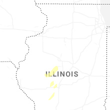
Illinois
| Local Time | Report Details |
|---|---|
| 4:06 PM CDT | Storm damage reported in greene county IL, 49.4 miles NNW of Saint Louis, MO |
| 5:03 PM CDT | Trees and power lines down in brighton at north main street and oak street. time estimated from rada in macoupin county IL, 28.6 miles N of Saint Louis, MO |
| 5:12 PM CDT | Quarter sized hail reported near Wood River, IL, 17.1 miles NNE of Saint Louis, MO, corrects time entry of previous hail report from wood river. quarter-size hail in wood river... reported by madison county skywarn. |
| 5:12 PM CDT | Downed power lines. time estimated from rada in macoupin county IL, 28.7 miles NNE of Saint Louis, MO |
| 5:14 PM CDT | Powerlines dow in sangamon county IL, 71.6 miles W of Mattoon, IL |
| 5:17 PM CDT | Tv meteorologist noted several gusts over 60 mph in his storm runner vehicl in madison county IL, 10.1 miles ENE of Saint Louis, MO |
| 5:31 PM CDT | Power lines down along reservoir rd. time estimated from rada in macoupin county IL, 36.2 miles NE of Saint Louis, MO |
| 5:33 PM CDT | Corrects previous tstm wnd dmg report from mount olive. downed trees and power lines across mount olive at east 1st street... west 4th street... and south lake road. ti in macoupin county IL, 39.7 miles NE of Saint Louis, MO |
| 5:34 PM CDT | Quarter sized hail reported near Wood River, IL, 17.1 miles NNE of Saint Louis, MO, quarter-size hail in wood river... reported by madison county skywarn. |
| 5:38 PM CDT | Corrects previous tstm wnd dmg report from 1 wsw ruma. power poles and live power lines down along route 155 west of rum in randolph county IL, 35.7 miles SSE of Saint Louis, MO |
| 5:40 PM CDT | Large tree downed by thunderstorm winds. delayed report. time estimated from rada in logan county IL, 39.3 miles SSE of Peoria, IL |
| 5:41 PM CDT | Several large power poles snapped along il 3 south of ruma at this location. time estimated from rada in randolph county IL, 36.8 miles SSE of Saint Louis, MO |
| 5:42 PM CDT | A portion of the roof of trinity lutheran church was removed. time estimated from rada in randolph county IL, 33.9 miles SSE of Saint Louis, MO |
| 5:45 PM CDT | Large tree uproote in will county IL, 26.9 miles SW of Chicago, IL |
| 5:48 PM CDT | News footage shows power poles and large tree limbs snapped. time estimated from rada in st. clair county IL, 27.2 miles SE of Saint Louis, MO |
| 5:51 PM CDT | Storm damage reported in st. clair county IL, 27.4 miles SE of Saint Louis, MO |
| 5:55 PM CDT | Trees downed. roofing damage also reporte in cook county IL, 24.2 miles SSW of Chicago, IL |
| 5:55 PM CDT | Tree blocking a road south of coffeen. time estimated from rada in montgomery county IL, 53.3 miles NE of Saint Louis, MO |
| 5:56 PM CDT | Photo on social media shows a destroyed carport. time estimated from rada in st. clair county IL, 35.7 miles SE of Saint Louis, MO |
| 5:58 PM CDT | Witt and nokomis experienced significant damage with trees on homes... poles snapped... campers blown around and rolled ove in montgomery county IL, 54.4 miles WSW of Mattoon, IL |
| 6:03 PM CDT | Swop repor in christian county IL, 49.8 miles W of Mattoon, IL |
| 6:03 PM CDT | Photo of portion of high school roof torn off. swop repor in christian county IL, 50.3 miles W of Mattoon, IL |
| 6:04 PM CDT | Corrects previous tstm wnd dmg report from nokomis. nokomis experienced significant damage with trees on homes... poles snapped... campers blown around and rolled ove in montgomery county IL, 50.3 miles WSW of Mattoon, IL |
| 6:04 PM CDT | Trees downed in riverdale. time estimated from rada in cook county IL, 16.8 miles S of Chicago, IL |
| 6:07 PM CDT | Trees downed in dolton. time estimated from rada in cook county IL, 17.6 miles S of Chicago, IL |
| 6:10 PM CDT | Storm damage reported in christian county IL, 41.4 miles W of Mattoon, IL |
| 6:11 PM CDT | Tv meteorologist reported winds of 60-70 mph at okawville with thunderstorm in washington county IL, 37.7 miles ESE of Saint Louis, MO |
| 6:17 PM CDT | Large... softwood tree uprooted. relayed via broadcast media with phot in christian county IL, 38.2 miles W of Mattoon, IL |
| 6:20 PM CDT | Corrects previous tstm wnd dmg report from assumption. tree down on a car. multiple power lines downed throughout tow in christian county IL, 36.1 miles W of Mattoon, IL |
| 6:20 PM CDT | Corrects previous tstm wnd dmg report from assumption. tree down on a car. multiple power lines downed throughout tow in christian county IL, 36.1 miles W of Mattoon, IL |
| 6:30 PM CDT | Time estimated by rada in clinton county IL, 54.6 miles E of Saint Louis, MO |
| 6:32 PM CDT | Large tree limb down... about 8 inches in diameter... in the city of shelbyville. delayed report. time estimated from rada in shelby county IL, 22.7 miles WSW of Mattoon, IL |
| 6:32 PM CDT | Power pole snapped. time estimated from rada in marion county IL, 58.1 miles E of Saint Louis, MO |
| 6:36 PM CDT | Large tree down over boat dock road. road closed near north oak road per emergency management/idot. time of event estimated by rada in marion county IL, 60.8 miles E of Saint Louis, MO |
| 6:44 PM CDT | Estimated winds at least 50-60 mph. video shared via social medi in moultrie county IL, 14.9 miles WNW of Mattoon, IL |
| 6:58 PM CDT | 8 inch diameter tree branches dow in douglas county IL, 15.6 miles NNW of Mattoon, IL |
| 6:59 PM CDT | Roof blown off barn and tops of trees carried a couple hundred feet. possible tornad in douglas county IL, 15.5 miles NNW of Mattoon, IL |
| 7:05 PM CDT | Several trees down and power outages across jackson count in jackson county IL, 34.8 miles NNE of Cape Girardeau, MO |
| 7:05 PM CDT | Several trees down and power outages across jackson count in jackson county IL, 34.8 miles NNE of Cape Girardeau, MO |
| 7:11 PM CDT | Multiple reports of winds estimated to 60-65mph in and just west of cambri in williamson county IL, 40.7 miles NE of Cape Girardeau, MO |
| 7:12 PM CDT | Tree fell on a hom in champaign county IL, 35 miles N of Mattoon, IL |
| 7:25 PM CDT | Roof damage to a structure... with winds estimated at 60+ mp in williamson county IL, 44 miles NE of Cape Girardeau, MO |
| 7:25 PM CDT | Estimated winds at least 50-60 mp in clay county IL, 49.6 miles S of Mattoon, IL |
| 7:33 PM CDT | Corrects time of previous tstm wnd gst report from lod in iroquois county IL, 73.3 miles NNE of Mattoon, IL |
| 8:55 PM CDT | Awos station krsv robinson arp in crawford county IL, 50.7 miles SE of Mattoon, IL |
| 9:16 PM CDT | Nokomis experienced significant damage with trees on homes... poles snapped... campers blown around and rolled over. there were also reports of significant damage to no in montgomery county IL, 50.3 miles WSW of Mattoon, IL |
| 9:29 PM CDT | Storm damage reported in iroquois county IL, 73.3 miles NNE of Mattoon, IL |
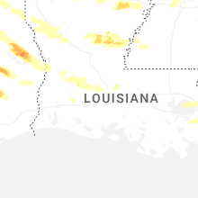
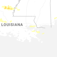
Louisiana
| Local Time | Report Details |
|---|---|
| 5:36 PM CDT | A tree was blown down between trees city road and pelican lodge roa in caddo county LA, 24.5 miles NW of Shreveport, LA |
| 5:38 PM CDT | A tree was downed near the intersection of hosston rodessa road and mira myrtis roa in caddo county LA, 31.6 miles NNW of Shreveport, LA |
| 5:39 PM CDT | A tree was downed on highway 71 at hosston vivian roa in caddo county LA, 26.3 miles NNW of Shreveport, LA |
| 5:47 PM CDT | A tree was blown down across highway 538 near dawes roa in caddo county LA, 18.3 miles NW of Shreveport, LA |
| 6:04 PM CDT | Trees down in plain dealin in bossier county LA, 27.3 miles N of Shreveport, LA |
| 6:05 PM CDT | Trees down near bento in bossier county LA, 12.2 miles N of Shreveport, LA |
| 6:05 PM CDT | A tree was downed across quiet acres road near blanchar in caddo county LA, 12.7 miles WNW of Shreveport, LA |
| 6:06 PM CDT | Quarter sized hail reported near Shreveport, LA, 9.7 miles NW of Shreveport, LA, quarter size hail measured just off old mooringsport road in the blanchard area between the middle and high schools. |
| 6:08 PM CDT | A tree was blown down across greenwood springridge road near blue nole roa in caddo county LA, 14.3 miles WSW of Shreveport, LA |
| 6:08 PM CDT | Trees down in shongalo in webster county LA, 39.2 miles NE of Shreveport, LA |
| 6:10 PM CDT | Quarter sized hail reported near Shreveport, LA, 7.3 miles NW of Shreveport, LA, report from mping: quarter (1.00 in.). |
| 6:16 PM CDT | Quarter sized hail reported near Bossier City, LA, 5.9 miles N of Shreveport, LA, a picture was posted to social media of quarter size hail that fell in the maplewood mobile home and rv park in north bossier city. |
| 6:18 PM CDT | Quarter sized hail reported near Bossier City, LA, 7.3 miles N of Shreveport, LA, quarter size hail on alder lane in north bossier. |
| 6:23 PM CDT | Trees were downed along highway 80 in the eastwood/haughton are in bossier county LA, 11.4 miles ENE of Shreveport, LA |
| 6:24 PM CDT | Quarter sized hail reported near Bossier City, LA, 5.5 miles NE of Shreveport, LA, quarter size hail in the tiburon subdivision in north bossier. |
| 6:50 PM CDT | Trees downed in dixie in in webster county LA, 24.3 miles ENE of Shreveport, LA |
| 6:55 PM CDT | Trees downed in hefli in webster county LA, 28.1 miles E of Shreveport, LA |
| 7:03 PM CDT | Quarter sized hail reported near Spearsville, LA, 45.4 miles WNW of Bastrop, LA, quarter size hail fell in the rum center community north of spearsville. |
| 7:10 PM CDT | Trees and powerlines down throughout the town of gibsland. time estimated by rada in bienville county LA, 40.7 miles E of Shreveport, LA |
| 7:20 PM CDT | Trees and powerlines down throughout the town of arcadia. time estimated by rada in bienville county LA, 48.4 miles E of Shreveport, LA |
| 7:22 PM CDT | Several trees downed near the pelican communit in de soto county LA, 44.7 miles SSE of Shreveport, LA |
| 7:37 PM CDT | A tree was downed on old pleasant hill road northeast of zwoll in sabine county LA, 55.3 miles S of Shreveport, LA |
| 7:45 PM CDT | A power line was downed on mandy lane southwest of many near toledo bend lak in sabine county LA, 64.4 miles ENE of Lufkin, TX |
| 7:58 PM CDT | Trees were downed near eros in the area of highways 144 and 15 in jackson county LA, 39.3 miles SW of Bastrop, LA |
| 8:04 PM CDT | Tree down across highway 480 near campt in natchitoches county LA, 56.2 miles SE of Shreveport, LA |
| 8:08 PM CDT | Trees down on highway 6 near robelin in natchitoches county LA, 62 miles SSE of Shreveport, LA |
| 8:09 PM CDT | Tree down on highway 485 east of marthavill in natchitoches county LA, 60.3 miles SSE of Shreveport, LA |
| 8:10 PM CDT | A tree fell onto power lines in the brewtons mill community in northwest winn paris in winn county LA, 59.6 miles ESE of Shreveport, LA |
| 8:14 PM CDT | Tree down across hart road northeast of campt in natchitoches county LA, 58.3 miles SE of Shreveport, LA |
| 8:21 PM CDT | Multiple trees and power lines were downed across ouachita paris in ouachita county LA, 30.3 miles SSW of Bastrop, LA |
| 8:22 PM CDT | A tree was downed blocking both lanes of highway 71 near highway 477 in the saint maurice communit in winn county LA, 69.5 miles SE of Shreveport, LA |
| 8:26 PM CDT | Tree down across both lanes of highway 501 near hubbard garrett roa in winn county LA, 66.1 miles ESE of Shreveport, LA |
| 8:27 PM CDT | Power lines were downed between swafford street and hall addition 1 in montgomer in grant county LA, 77.8 miles SE of Shreveport, LA |
| 8:30 PM CDT | Tree down across highway 478 near page hill roa in natchitoches county LA, 73.9 miles SSE of Shreveport, LA |
| 8:41 PM CDT | A tree was down blocking gilcrease road near stinson road east of montgomer in grant county LA, 79.3 miles SE of Shreveport, LA |
| 8:45 PM CDT | Corrects previous hail report from chickasaw. tree down along hwy 1 in west carroll county LA, 36.3 miles ENE of Bastrop, LA |
| 8:45 PM CDT | Golf Ball sized hail reported near Oak Grove, LA, 36.3 miles ENE of Bastrop, LA, tree down along hwy 17. |
| 8:53 PM CDT | Tree down on sylvan meadows loo in winn county LA, 73.8 miles SW of Bastrop, LA |
| 8:56 PM CDT | Tree down blocking the northbound lane of highway 167 near the intersection of highway 472 in the williana communit in grant county LA, 85.5 miles SSW of Bastrop, LA |
| 9:10 PM CDT | Tree down blocking lincecum church road near highway 16 in grant county LA, 80.4 miles SSW of Bastrop, LA |
| 9:10 PM CDT | Tree down blocking highway 123 near the intersection of highway 16 in grant county LA, 83 miles SSW of Bastrop, LA |
| 9:14 PM CDT | A few trees down along hwy 860 near union church roa in franklin county LA, 38.6 miles SSE of Bastrop, LA |
| 9:22 PM CDT | A tree was downed at the la salle parish correctional cente in la salle county LA, 67.4 miles SSW of Bastrop, LA |
| 9:40 PM CDT | Trees and power lines down on blade loop road near windmill roa in la salle county LA, 78.2 miles S of Bastrop, LA |
| 9:41 PM CDT | Trees and power lines down on highway 8 near the catahoula parish lin in la salle county LA, 79.3 miles S of Bastrop, LA |
| 9:45 PM CDT | Trees and power lines down across highway 28 east near cypress bayou south of catahoula lake near the catahoula parish lin in la salle county LA, 86.2 miles S of Bastrop, LA |
| 9:55 PM CDT | Golf Ball sized hail reported near Jonesville, LA, 75.7 miles S of Bastrop, LA |
| 10:00 PM CDT | Multiple trees down and some across roads through the central part of the paris in catahoula county LA, 76.5 miles S of Bastrop, LA |
| 10:03 PM CDT | Golf Ball sized hail reported near Jonesville, LA, 86.9 miles S of Bastrop, LA |
| 10:16 PM CDT | Quarter sized hail reported near Oakdale, LA, 53.1 miles NW of Lafayette, LA |
| 10:24 PM CDT | Tree and line down... smart ln and harris roa in concordia county LA, 82 miles SSE of Bastrop, LA |
| 10:24 PM CDT | Quarter sized hail reported near Oakdale, LA, 51.8 miles NW of Lafayette, LA |
| 3:01 AM CDT | Small tree down on marsha d in st. tammany county LA, 29.4 miles NE of New Orleans, LA |
| 3:04 AM CDT | Knew recorded a wind gust of 60 mp in orleans county LA, 6.6 miles NNE of New Orleans, LA |
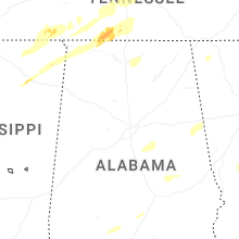
Mississippi
| Local Time | Report Details |
|---|---|
| 7:20 PM CDT | Large tree down on hous in desoto county MS, 12 miles SSE of Memphis, TN |
| 7:42 PM CDT | Seven power poles down near gravestown fire dep in tippah county MS, 62.3 miles ESE of Memphis, TN |
| 7:55 PM CDT | Tree down on fence on laverne roa in desoto county MS, 17.2 miles S of Memphis, TN |
| 7:58 PM CDT | Trees down at w comemrce and elm stree in desoto county MS, 22.9 miles S of Memphis, TN |
| 8:00 PM CDT | *** 1 inj *** tree downed on a home on labauve s in desoto county MS, 23 miles S of Memphis, TN |
| 8:00 PM CDT | Quarter sized hail reported near Hernando, MS, 23.7 miles SSW of Memphis, TN, report from mping: quarter (1.00 in.). |
| 8:00 PM CDT | A few power poles were leaning along hwy in bolivar county MS, 94.7 miles NE of Bastrop, LA |
| 8:02 PM CDT | Powerlines down along hwy in grenada county MS, 68.8 miles WNW of Starkville, MS |
| 8:05 PM CDT | Tree down on blackhack dr in the love communit in desoto county MS, 29.1 miles S of Memphis, TN |
| 8:08 PM CDT | Power lines and trees down through town. roof damage to a home on clay roa in grenada county MS, 61.2 miles WNW of Starkville, MS |
| 8:11 PM CDT | Trees down... east part of tow in grenada county MS, 58.2 miles WNW of Starkville, MS |
| 8:15 PM CDT | Large limb down and through a roof on sunset d in sunflower county MS, 84.1 miles NNW of Jackson, MS |
| 8:16 PM CDT | A few power poles down along hwy 44 in sunflower county MS, 89.2 miles NE of Bastrop, LA |
| 8:18 PM CDT | Tree uprooted on w cox rd near cayes roa in marshall county MS, 28.3 miles ESE of Memphis, TN |
| 8:20 PM CDT | Quarter sized hail reported near Corinth, MS, 52.7 miles W of Florence, AL |
| 8:20 PM CDT | Significant roof damage to church on highway in alcorn county MS, 53 miles W of Florence, AL |
| 8:22 PM CDT | Damage to the pleasant hill churc in alcorn county MS, 53 miles W of Florence, AL |
| 8:33 PM CDT | Power pole dow in leflore county MS, 88.8 miles W of Starkville, MS |
| 8:37 PM CDT | Quarter sized hail reported near Belden, MS, 59 miles N of Starkville, MS |
| 8:37 PM CDT | Quarter sized hail reported near Batesville, MS, 58 miles S of Memphis, TN |
| 8:41 PM CDT | Quarter sized hail reported near Belden, MS, 54.9 miles N of Starkville, MS |
| 8:41 PM CDT | Quarter sized hail reported near Tupelo, MS, 61.6 miles N of Starkville, MS, quarter sized hail on the east side of sherman... in lee county. |
| 8:45 PM CDT | Quarter sized hail reported near Belden, MS, 56.8 miles N of Starkville, MS, quarter sized hail in the belden community. |
| 8:47 PM CDT | Large tree downed in the area of cr 50 in lafayette county MS, 47.8 miles SSE of Memphis, TN |
| 9:02 PM CDT | Corrects previous tstm wnd dmg report from 1 ene holcomb. powerlines down along hwy in grenada county MS, 68.8 miles WNW of Starkville, MS |
| 9:06 PM CDT | Corrects previous tstm wnd dmg report from rolling fork. report of numerous downed street sign in sharkey county MS, 58.6 miles NW of Jackson, MS |
| 9:08 PM CDT | Corrects previous tstm wnd dmg report from grenada. power lines and trees down through town. roof damage to a home on clay roa in grenada county MS, 61.2 miles WNW of Starkville, MS |
| 9:10 PM CDT | Trees downed across hwy 334 near cr 41 in lafayette county MS, 67.9 miles NNW of Starkville, MS |
| 9:11 PM CDT | Corrects previous tstm wnd dmg report from 4 ne tie plant. trees down... east part of tow in grenada county MS, 58.2 miles WNW of Starkville, MS |
| 9:13 PM CDT | Quarter sized hail reported near Booneville, MS, 48.2 miles WSW of Florence, AL, video of quarter-sized hail near the hobo station community. |
| 9:14 PM CDT | Half Dollar sized hail reported near New Site, MS, 45 miles WSW of Florence, AL |
| 9:22 PM CDT | A tree fell on an apartment along kent s in montgomery county MS, 52.4 miles W of Starkville, MS |
| 9:30 PM CDT | Several large branches down across rienzi. one even damaged a car windshiel in alcorn county MS, 48.7 miles W of Florence, AL |
| 9:36 PM CDT | Report of numerous downed street sign in sharkey county MS, 58.6 miles NW of Jackson, MS |
| 9:45 PM CDT | A few power lines dow in webster county MS, 36.9 miles WNW of Starkville, MS |
| 9:56 PM CDT | Storm damage reported in chickasaw county MS, 36.2 miles NNW of Starkville, MS |
| 9:56 PM CDT | Trees down across pontotoc. damage to homes and powerline in pontotoc county MS, 55.1 miles N of Starkville, MS |
| 9:58 PM CDT | A few trees and power lines down in tow in warren county MS, 39.9 miles W of Jackson, MS |
| 10:33 PM CDT | Several trees downed between fulton and smithville. one tree even fell onto a pick up truck and did serious damage to the front en in itawamba county MS, 54.8 miles NNE of Starkville, MS |
| 10:47 PM CDT | Trees down across the road... holmes hollow lan in madison county MS, 28.5 miles NE of Jackson, MS |
| 10:50 PM CDT | Tree on a house on green s in oktibbeha county MS, 0.4 miles SSE of Starkville, MS |
| 10:54 PM CDT | Trees and powerlines down along splunge road in greenwood spring in monroe county MS, 41.2 miles NE of Starkville, MS |
| 10:58 PM CDT | Tin roof panels were wrapped around a power pole. structure appears to be an outbuilding or she in oktibbeha county MS, 1.2 miles SSW of Starkville, MS |
| 11:07 PM CDT | Tree down on mcnair roa in franklin county MS, 69.4 miles SW of Jackson, MS |
| 11:22 PM CDT | Trees and branches downed across from the choctaw fire statio in neshoba county MS, 53.1 miles SSW of Starkville, MS |
| 11:31 PM CDT | A tree fell on a trailer on sistrunk av in neshoba county MS, 51.8 miles SSW of Starkville, MS |
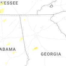
Tennessee
| Local Time | Report Details |
|---|---|
| 7:27 PM CDT | Tree down in the 4500 block of drummonds roa in tipton county TN, 23.2 miles NNE of Memphis, TN |
| 7:37 PM CDT | 3 trees downed... blocking the roadways and resulting in power outage in tipton county TN, 30.3 miles NE of Memphis, TN |
| 7:38 PM CDT | Tree down at brighton clopton rd and shady lan in tipton county TN, 29.4 miles NE of Memphis, TN |
| 7:39 PM CDT | Power lines downed in covingto in tipton county TN, 36.7 miles NE of Memphis, TN |
| 7:41 PM CDT | Trees down near overton squar in shelby county TN, 3.4 miles ESE of Memphis, TN |
| 7:45 PM CDT | Downed trees and a roof to a structure was blown of in lauderdale county TN, 56.3 miles WSW of Mc Kenzie, TN |
| 7:55 PM CDT | Report of 5-10 power poles downed in riple in lauderdale county TN, 50.7 miles NE of Memphis, TN |
| 8:00 PM CDT | A downed tree blocking both lanes on knox daniel rd... near union cit in obion county TN, 33.7 miles NW of Mc Kenzie, TN |
| 8:09 PM CDT | Multiple trees and power poles down throughout the county... but widespread power outages due to downed trees and power poles in alam in crockett county TN, 41.5 miles SW of Mc Kenzie, TN |
| 8:09 PM CDT | A downed tree that also brought down utility lines resulting in power outage in weakley county TN, 22.5 miles NW of Mc Kenzie, TN |
| 8:11 PM CDT | Storm damage reported in gibson county TN, 22.1 miles W of Mc Kenzie, TN |
| 8:20 PM CDT | Several large trees downed on lakeview roa in fayette county TN, 39.5 miles E of Memphis, TN |
| 8:34 PM CDT | A downed tree fell on a carport and utility line at on old state route 2 in carroll county TN, 0.8 miles NW of Mc Kenzie, TN |
| 8:45 PM CDT | Quarter sized hail reported near Big Sandy, TN, 31.8 miles ENE of Mc Kenzie, TN |
| 8:48 PM CDT | Tree downed onto a mobile hom in henry county TN, 16.4 miles NE of Mc Kenzie, TN |
| 8:51 PM CDT | Tree downed onto a home along sunnyside roa in henry county TN, 20.3 miles NE of Mc Kenzie, TN |
| 8:52 PM CDT | Downed powerlines along hwy 69 in henry county TN, 19.7 miles ENE of Mc Kenzie, TN |
| 9:10 PM CDT | About 1400 without power in stewart count in stewart county TN, 45.2 miles ENE of Mc Kenzie, TN |
| 9:20 PM CDT | 5352 power outages reported across stewart count in stewart county TN, 45.2 miles ENE of Mc Kenzie, TN |
| 9:44 PM CDT | Hen Egg sized hail reported near Mc Ewen, TN, 44.4 miles WSW of Nashville, TN |
| 9:45 PM CDT | Quarter sized hail reported near Mc Ewen, TN, 44.2 miles WSW of Nashville, TN, report from mping: quarter (1.00 in.). |
| 9:47 PM CDT | Ping Pong Ball sized hail reported near Dickson, TN, 40.9 miles WSW of Nashville, TN |
| 9:59 PM CDT | Ping Pong Ball sized hail reported near Dickson, TN, 35.8 miles W of Nashville, TN |
| 10:00 PM CDT | Half Dollar sized hail reported near Dickson, TN, 34.7 miles W of Nashville, TN, report from mping: half dollar (1.25 in.). |
| 10:27 PM CDT | Utility pole leaning into tree which caused a fir in lawrence county TN, 44 miles NNE of Florence, AL |
| 10:41 PM CDT | Tree down in charlotte park in west nashvill in davidson county TN, 5.8 miles WSW of Nashville, TN |
| 10:45 PM CDT | Quarter sized hail reported near Saint Joseph, TN, 19.6 miles NNE of Florence, AL, quarter size hail at fairview road near st. joseph. |
| 10:53 PM CDT | Tree down in backyard near lakeland and donelson pik in davidson county TN, 6.2 miles ESE of Nashville, TN |
| 10:53 PM CDT | Many trees down around bonnertown... wsw of minor hil in lawrence county TN, 25.7 miles NE of Florence, AL |
| 10:55 PM CDT | Around 6500 customers without power across maury county. tree limbs and powerlines reported down across roadways with some damage to homes reporte in maury county TN, 40.7 miles SSW of Nashville, TN |
| 11:01 PM CDT | Tree reported down on double branch road near columbi in maury county TN, 36 miles SSW of Nashville, TN |
| 11:05 PM CDT | Reports of sporadic trees across wilson county... including one down in the five oaks neighborhoo in wilson county TN, 22.8 miles ENE of Nashville, TN |
| 11:13 PM CDT | Tree down on rabbit trail roa in lawrence county TN, 26.5 miles NE of Florence, AL |
| 12:20 AM CDT | 63 mph wind gust measured near allon in overton county TN, 81.9 miles ENE of Nashville, TN |
| 12:20 AM CDT | Trees down in the 8600 block of willow grove highwa in overton county TN, 84.9 miles ENE of Nashville, TN |
| 12:25 AM CDT | Trees down near highway 111 and highway 29 in overton county TN, 77.9 miles E of Nashville, TN |
| 1:24 AM CDT | Several trees down across the count in marion county TN, 17.8 miles W of Chattanooga, TN |
| 1:25 AM CDT | Several trees down across the count in sequatchie county TN, 22.8 miles NNW of Chattanooga, TN |
| 2:28 AM EDT | Several trees down across the count in scott county TN, 50 miles NW of Knoxville, TN |
| 2:56 AM EDT | A few trees dow in morgan county TN, 40.1 miles WNW of Knoxville, TN |
| 3:02 AM EDT | Trees dow in rhea county TN, 41.2 miles NE of Chattanooga, TN |
| 3:04 AM EDT | Several trees down across the count in meigs county TN, 42.3 miles NE of Chattanooga, TN |
| 3:17 AM EDT | Several trees and power lines dow in roane county TN, 36.1 miles W of Knoxville, TN |
| 3:47 AM EDT | A few trees dow in bradley county TN, 21 miles ENE of Chattanooga, TN |
| 3:49 AM EDT | Trees and power lines dow in loudon county TN, 27.3 miles WSW of Knoxville, TN |
| 4:00 AM EDT | Several trees dow in mcminn county TN, 48.3 miles ENE of Chattanooga, TN |
| 4:08 AM EDT | Several trees dow in knox county TN, 4 miles E of Knoxville, TN |
| 4:22 AM EDT | Several reports of trees down across the count in monroe county TN, 35 miles SW of Knoxville, TN |
| 4:48 AM EDT | Trees dow in blount county TN, 17.5 miles S of Knoxville, TN |
| 5:02 AM EDT | Several trees down county-wid in blount county TN, 29.2 miles SSW of Knoxville, TN |
| 5:35 AM EDT | A few trees dow in cocke county TN, 36.5 miles E of Knoxville, TN |
Georgia
| Local Time | Report Details |
|---|---|
| 9:10 PM EDT | Buoy 4100 in amz354 county GA, 48.7 miles SSE of Savannah, GA |
| 3:30 AM EDT | Em reports tree on power lines on 100 block of westwood rd ringold g in catoosa county GA, 11.3 miles SE of Chattanooga, TN |
| 3:35 AM EDT | Em reports tree down on baggett rd in western ringgol in catoosa county GA, 12.7 miles SE of Chattanooga, TN |
| 3:35 AM EDT | Em reports tree down on porch at 100 block of pinebrook d in whitfield county GA, 21 miles SE of Chattanooga, TN |
| 3:35 AM EDT | Em reports tree on roadway at 1800 block of old ringgold r in whitfield county GA, 21.6 miles SSE of Chattanooga, TN |
| 3:40 AM EDT | Em reports tree down on powerlines at mt pisgah and windemere d in catoosa county GA, 15.4 miles SSE of Chattanooga, TN |
| 3:45 AM EDT | Em reports tree down on n varnell st in tunnel hil in whitfield county GA, 20 miles SE of Chattanooga, TN |
| 3:50 AM EDT | Em reports utility line down in road near lafayette rd near mt vernon r in whitfield county GA, 23.5 miles SE of Chattanooga, TN |
| 3:55 AM EDT | Em reports tree tree down on structure... no injuries on 700 blk of w dug gape mountain rd near valley brook d in whitfield county GA, 27.5 miles SE of Chattanooga, TN |
| 3:55 AM EDT | Em reports tree down on i75 in dalton near mm33 in whitfield county GA, 26.4 miles SE of Chattanooga, TN |
| 4:00 AM EDT | Em reports 3 to 4 trees down on 2600 blk of s dixie hwy near ohio wy. all lanes blocke in whitfield county GA, 29.3 miles SE of Chattanooga, TN |
| 4:45 AM EDT | Em reports tree down 4400 blk of clear creek r in bartow county GA, 47.1 miles NW of Atlanta, GA |
| 4:50 AM EDT | Em reports tree down blocking roadway at bethlehem rd and stringer r in polk county GA, 46.2 miles WNW of Atlanta, GA |
| 4:50 AM EDT | Em reports tree down on home and outbuilding at 50 block of enterprise dr in temple g in carroll county GA, 35.1 miles W of Atlanta, GA |
| 4:55 AM EDT | Em reports tree down on oak mountain rd near truitt r in carroll county GA, 38.5 miles WSW of Atlanta, GA |
| 4:55 AM EDT | Em reports 2 trees down on vinson mountain r in paulding county GA, 40.1 miles WNW of Atlanta, GA |
| 4:55 AM EDT | Tree on powerlines southwest of rockmoart along 800 block of hightower falls r in polk county GA, 45.6 miles WNW of Atlanta, GA |
| 5:00 AM EDT | Em reports tree down near levans rd and center point r in carroll county GA, 38.7 miles W of Atlanta, GA |
| 5:10 AM EDT | Tree down in roadway along newnan rd near stripling chapel rd. multiple vehicle collision with fallen tre in carroll county GA, 39.3 miles WSW of Atlanta, GA |
| 5:15 AM EDT | Em reports tree down at wooten dr and bells ferry r in cherokee county GA, 30.8 miles NNW of Atlanta, GA |
| 5:35 AM EDT | Em reports tree down on structure along junalaska dr in tomahawk g in cherokee county GA, 25.6 miles N of Atlanta, GA |
| 5:40 AM EDT | Em reports tree on structure at summit springs rd in sandy spring in fulton county GA, 16.8 miles N of Atlanta, GA |
| 5:45 AM EDT | Em reports tree down on jimm star rd from outflow of storm in coweta county GA, 29.1 miles SW of Atlanta, GA |
| 5:45 AM EDT | Em reports tree down at lone oak rd near bass cross r in troup county GA, 49.1 miles SW of Atlanta, GA |
| 5:50 AM EDT | Em reports tree down wy 154 just north of lower fayette rd in sharpsbur in coweta county GA, 28 miles SSW of Atlanta, GA |
| 6:05 AM EDT | Em reports tree down on ware rd and hammett rd resulting in traffic accident. unknown if injurie in troup county GA, 49.2 miles SW of Atlanta, GA |
| 6:30 AM EDT | Broadcast media reports tree down on britton dr in north columbus g in muscogee county GA, 29 miles E of Auburn, AL |
| 6:31 AM EDT | The emergency manager relayed a report of large trees and power lines down blocking highway 92 between vaughn road/david elder road and bicycle roa in spalding county GA, 30.2 miles S of Atlanta, GA |
| 6:35 AM EDT | Em reports tree down at mud bridge rd and county line r in spalding county GA, 28.9 miles S of Atlanta, GA |
| 6:38 AM EDT | Em reports a tree down at fayetteville rd and vaughn r in spalding county GA, 30.2 miles S of Atlanta, GA |
| 6:51 AM EDT | The emergency manager relayed a report of a tree down along chalybeate springs road. possible tornad in talbot county GA, 57 miles ENE of Auburn, AL |
Indiana
| Local Time | Report Details |
|---|---|
| 9:52 PM EDT | Tree blown down by thunderstorm wind in knox county IN, 45.1 miles N of Evansville, IN |
| 9:01 PM CDT | Asos station kevv evansville i in vanderburgh county IN, 5.6 miles NNE of Evansville, IN |
| 10:30 PM EDT | Power pole and tree down and on fire in the 1100 block of ridgewood dr. time estimated from rada in dubois county IN, 39 miles ENE of Evansville, IN |
| 10:43 PM EDT | Tree blocking both lanes in the 7800 block of s 600 e. time estimated from rada in dubois county IN, 46.8 miles ENE of Evansville, IN |
| 10:45 PM EDT | Tree in the roadway. e ellsworth and n 900 e. time estimated from radar. another large tree 2 feet in diameter blocking both lanes in the 7800 block of e state road 164 in dubois county IN, 54.3 miles ENE of Evansville, IN |
| 10:46 PM EDT | Trees and power lines downed near the intersection of us50 and sr 3 in lawrence county IN, 68.9 miles SSW of Indianapolis, IN |
| 10:53 PM EDT | Tree downed near sr 4 in monroe county IN, 39.9 miles SSW of Indianapolis, IN |
| 11:01 PM EDT | Storm damage reported in morgan county IN, 27.9 miles SSW of Indianapolis, IN |
| 11:16 PM EDT | Storm damage reported in marion county IN, 8.6 miles WSW of Indianapolis, IN |
| 11:20 PM EDT | Storm damage reported in marion county IN, 6.1 miles S of Indianapolis, IN |
| 11:23 PM EDT | Storm damage reported in marion county IN, 1.7 miles NNW of Indianapolis, IN |
| 11:24 PM EDT | Tree snapped in hal in bartholomew county IN, 41 miles SSE of Indianapolis, IN |
| 11:25 PM EDT | Tree dow in shelby county IN, 30 miles SSE of Indianapolis, IN |
| 11:37 PM EDT | Two utility poles were blown down by thunderstorm winds near east 256th street and carson road. time estimated from rada in hamilton county IN, 27.3 miles N of Indianapolis, IN |
| 11:42 PM EDT | Tree across state road 3 in madison county IN, 27.2 miles NE of Indianapolis, IN |
| 11:42 PM EDT | Power lines downe in rush county IN, 30.9 miles ESE of Indianapolis, IN |
| 11:44 PM EDT | Trees and power lines downed. time estimated from rada in rush county IN, 32.3 miles ESE of Indianapolis, IN |
| 11:44 PM EDT | Multiple trees downe in rush county IN, 32.6 miles ESE of Indianapolis, IN |
| 11:46 PM EDT | Power lines and trees downe in rush county IN, 33 miles ESE of Indianapolis, IN |
| 11:48 PM EDT | Tree down in front of residence into the power line in rush county IN, 36.2 miles ESE of Indianapolis, IN |
| 11:51 PM EDT | Tree down blocking kiesler r in floyd county IN, 30.8 miles NNW of Louisville, KY |
| 12:00 AM EDT | Semi flipped over blocking the west bound i-265 at mile 33.6. time estimated from rada in floyd county IN, 25.2 miles N of Louisville, KY |
| 12:06 AM EDT | Time estimated from rada in henry county IN, 44.4 miles E of Indianapolis, IN |
| 12:08 AM EDT | Tree down in road n us 31 & killen rd memphi in clark county IN, 32.7 miles N of Louisville, KY |
| 12:10 AM EDT | Power line dow in clark county IN, 22.3 miles N of Louisville, KY |
| 12:15 AM EDT | Tree down in rd - payne koehler/county line roa in clark county IN, 25.8 miles N of Louisville, KY |
| 12:17 AM EDT | 16.4 mile marker s i-65 tree down in roa in clark county IN, 36.1 miles N of Louisville, KY |
| 12:18 AM EDT | Report of tree down on us 3 in clark county IN, 34.7 miles N of Louisville, KY |
| 12:21 AM EDT | Couple of trees down state rd 256 and state rd 5 in jefferson county IN, 53.9 miles NNE of Louisville, KY |
| 12:30 AM EDT | Semi flipped over on wb i-265 blockin in clark county IN, 25 miles N of Louisville, KY |
South Carolina
| Local Time | Report Details |
|---|---|
| 11:07 PM EDT | A wind gust of 58 mph (50 kt) measured at the charleston international airport (kchs in charleston county SC, 20.5 miles S of Charleston, SC |
| 11:15 PM EDT | Golf Ball sized hail reported near Goose Creek, SC, 12.9 miles S of Charleston, SC, trained spotter reported at least two golfball sized hail stones. most of the hail was the size of a quarter. |
Alabama
| Local Time | Report Details |
|---|---|
| 10:50 PM CDT | 911 call center reported powerlines down at 9974 hwy 64 in lauderdale count in lauderdale county AL, 20.9 miles NE of Florence, AL |
| 10:50 PM CDT | 911 call center reported a tree down blocking both lanes at cr 71 and chad ave in lauderdale count in lauderdale county AL, 20.4 miles NE of Florence, AL |
| 10:52 PM CDT | 911 call center reported tree down at cr 89 and cr 6 in lauderdale county AL, 24.3 miles ENE of Florence, AL |
| 10:55 PM CDT | 6 inch tree branch across road near this locatio in lauderdale county AL, 17.3 miles ENE of Florence, AL |
| 11:06 PM CDT | Tree down across road at this locatio in lauderdale county AL, 7.2 miles NE of Florence, AL |
| 11:13 PM CDT | Tree on hous in marion county AL, 48.7 miles SSW of Florence, AL |
| 11:38 PM CDT | Tree down at hwy 107 and wayside roa in fayette county AL, 59.7 miles ENE of Starkville, MS |
| 11:40 PM CDT | Tree down on power line on county road 6 in winston county AL, 37.2 miles S of Florence, AL |
| 11:45 PM CDT | Tree down on 17th avenu in winston county AL, 39.5 miles S of Florence, AL |
| 11:53 PM CDT | 1 foot tree limbs in road near this locatio in lauderdale county AL, 28.2 miles ENE of Florence, AL |
| 12:19 AM CDT | Tree down at intersection of elkton rd. & bean r in limestone county AL, 41.9 miles E of Florence, AL |
| 12:30 AM CDT | Tree down at this locatio in madison county AL, 56.2 miles E of Florence, AL |
| 12:37 AM CDT | Tree blown down on a house at this locatio in madison county AL, 60.4 miles E of Florence, AL |
| 12:39 AM CDT | Multiple trees down along hwy. 33 near bankhead fores in lawrence county AL, 35.1 miles SE of Florence, AL |
| 12:55 AM CDT | Trees down on sipsey roa in walker county AL, 28 miles NW of Birmingham, AL |
| 12:55 AM CDT | Tree down at this locatio in madison county AL, 55.7 miles E of Florence, AL |
| 1:15 AM CDT | Tree down on county road 10 just south of siloam roa in sumter county AL, 69.7 miles WNW of Camden, AL |
| 1:36 AM CDT | Tree blocking road at this locatio in marshall county AL, 67 miles SW of Chattanooga, TN |
| 1:40 AM CDT | Tree down on us highway 278 west of altoon in blount county AL, 47.2 miles NE of Birmingham, AL |
| 1:47 AM CDT | Power line down on haversham driv in jefferson county AL, 12.5 miles NE of Birmingham, AL |
| 1:50 AM CDT | Tree down on college avenu in jefferson county AL, 3.5 miles S of Birmingham, AL |
| 1:53 AM CDT | Tree down in new union near murphy roa in etowah county AL, 54.2 miles NE of Birmingham, AL |
| 2:00 AM CDT | Tree down highway 179 and little cove roa in etowah county AL, 55.3 miles NE of Birmingham, AL |
| 2:00 AM CDT | Tree down on hurricane driv in jefferson county AL, 9 miles S of Birmingham, AL |
| 2:12 AM CDT | Tree down near i-59. truck is stuc in etowah county AL, 58.8 miles NE of Birmingham, AL |
| 2:16 AM CDT | Numerous trees down and lots of debris at this locatio in jackson county AL, 31.4 miles WSW of Chattanooga, TN |
| 2:19 AM CDT | Tree blocking road at this locatio in marshall county AL, 66.6 miles SW of Chattanooga, TN |
| 2:19 AM CDT | Multiple trees blocking road at this locatio in marshall county AL, 55.9 miles NE of Birmingham, AL |
| 2:36 AM CDT | Tree down at this locatio in dekalb county AL, 37.3 miles SSW of Chattanooga, TN |
| 2:46 AM CDT | Tree blocking one lane of us 11 at this locatio in dekalb county AL, 28.7 miles SSW of Chattanooga, TN |
| 2:51 AM CDT | Tree down across highway 77 near ohatche in calhoun county AL, 47.9 miles ENE of Birmingham, AL |
| 2:52 AM CDT | Tree down blocking plant roa in talladega county AL, 29.4 miles ESE of Birmingham, AL |
| 2:52 AM CDT | Tree down blocking road on plant rd in alpin in talladega county AL, 36.3 miles ESE of Birmingham, AL |
| 2:56 AM CDT | Storm damage reported in talladega county AL, 37.7 miles SE of Birmingham, AL |
| 2:57 AM CDT | Tree blocking road on club house roa in talladega county AL, 39 miles ESE of Birmingham, AL |
| 2:58 AM CDT | Tree blocking one lane of al 117 at this locatio in dekalb county AL, 37.6 miles SSW of Chattanooga, TN |
| 2:58 AM CDT | Tree down on hwy21 north of sylacaug in talladega county AL, 39.3 miles ESE of Birmingham, AL |
| 3:00 AM CDT | Tree down on hous in talladega county AL, 42.2 miles E of Birmingham, AL |
| 3:00 AM CDT | Trees and power lines down along renfroe roa in talladega county AL, 37 miles E of Birmingham, AL |
| 3:02 AM CDT | Tree down blocking the roadway along ironaton roa in talladega county AL, 44.9 miles E of Birmingham, AL |
| 3:09 AM CDT | Power pole blown down at a mobile home park at this locatio in dekalb county AL, 63.2 miles SSW of Chattanooga, TN |
| 3:11 AM CDT | Trees down blocking roadway on ledbetter roa in talladega county AL, 48 miles E of Birmingham, AL |
| 3:15 AM CDT | Tree down blocking priebes mill roa in talladega county AL, 50.3 miles E of Birmingham, AL |
| 3:17 AM CDT | Tree blocking road at this locatio in dekalb county AL, 34.8 miles SSW of Chattanooga, TN |
| 3:38 AM CDT | Multiple trees down across road on hwy 43 in randolph county AL, 59 miles N of Auburn, AL |
| 3:48 AM CDT | Tree down blocking both lane in randolph county AL, 51.9 miles N of Auburn, AL |
| 3:54 AM CDT | Trees down on flatwood rd. wetumpk in elmore county AL, 47.8 miles W of Auburn, AL |
| 3:56 AM CDT | Tree down on chapel roa in elmore county AL, 45.5 miles W of Auburn, AL |
| 3:57 AM CDT | Tree down across road on pettus rd and john sellers r in montgomery county AL, 55.9 miles E of Camden, AL |
| 3:58 AM CDT | Numerous trees down on holtville road north of wetumpk in elmore county AL, 44.3 miles W of Auburn, AL |
| 4:05 AM CDT | Trees down on central plank rd... wetumpk in elmore county AL, 40.2 miles W of Auburn, AL |
| 4:14 AM CDT | Trees down on red hill r in elmore county AL, 27.5 miles W of Auburn, AL |
| 4:17 AM CDT | Several snapped pine trees on cr 26 nw of roanok in randolph county AL, 39.1 miles N of Auburn, AL |
| 4:20 AM CDT | Several trees and powerlines down along stillwater d in tallapoosa county AL, 20.5 miles WNW of Auburn, AL |
| 5:12 AM CDT | Tree down on lee road 179 south of 24 in lee county AL, 19.4 miles ESE of Auburn, AL |
| 5:18 AM CDT | Trees down on lee road 30 in lee county AL, 23.8 miles ESE of Auburn, AL |
Ohio
| Local Time | Report Details |
|---|---|
| 1:23 AM EDT | Storm damage reported in montgomery county OH, 57.5 miles NNE of Cincinnati, OH |
| 1:27 AM EDT | Large tree down blocking road near alex bell and ladera. time estimate in montgomery county OH, 41.5 miles NNE of Cincinnati, OH |
| 4:46 AM EDT | Storm damage reported in lawrence county OH, 39.6 miles WNW of Charleston, WV |
Virginia
| Local Time | Report Details |
|---|---|
| 4:15 AM EDT | Trees dow in lee county VA, 54.6 miles NNE of Knoxville, TN |
| 4:47 AM EDT | Several trees dow in lee county VA, 46.9 miles WNW of Bristol, TN |
| 5:05 AM EDT | Several trees dow in wise county VA, 34.2 miles NW of Bristol, TN |
| 5:20 AM EDT | Several trees down across the count in wise county VA, 27 miles NNW of Bristol, TN |
| 5:24 AM EDT | Tree down on thomas mountain roa in buchanan county VA, 51.6 miles N of Bristol, TN |
North Carolina
| Local Time | Report Details |
|---|---|
| 4:35 AM EDT | Utility line damage along jones creek r in swain county NC, 50.9 miles SSE of Knoxville, TN |
| 5:08 AM EDT | A few trees dow in cherokee county NC, 61.1 miles S of Knoxville, TN |
| 6:00 AM EDT | Utility line damage along jacobs bridge r in macon county NC, 52.8 miles WNW of Greenville, SC |
| 6:10 AM EDT | Trees dow in clay county NC, 63.6 miles S of Knoxville, TN |
| 6:30 AM EDT | Upwards of 1500 power outages reported from maggie valley to waynesville to canton to cruso to sunburs in haywood county NC, 48.9 miles NNW of Greenville, SC |
West Virginia
| Local Time | Report Details |
|---|---|
| 4:41 AM EDT | Tree on power line in wayne county WV, 46.2 miles W of Charleston, WV |
| 4:44 AM EDT | Tree down blocking one side of laurel creek roa in mingo county WV, 51.6 miles SW of Charleston, WV |
| 5:07 AM EDT | Tree in roadway on cr-700/80 (176 four seasons rd in logan county WV, 41.7 miles SSW of Charleston, WV |
| 5:07 AM EDT | Tree in roadway on cr-7 (garrett fork road and barkers fork road in logan county WV, 31.5 miles SSW of Charleston, WV |
| 5:21 AM EDT | Tree in roadway on wv-10/stallings underpas in logan county WV, 41.4 miles SSW of Charleston, WV |
| 5:42 AM EDT | Tree down blocking one lane of panther mohawk roa in mcdowell county WV, 61.7 miles SSW of Charleston, WV |
| 5:46 AM EDT | Tree in roadway on cr-33 (poca river road in kanawha county WV, 13.2 miles N of Charleston, WV |
| 5:47 AM EDT | Tree in roadway on cr-4/1 (coopers creek road near kaufmans branch road in kanawha county WV, 8.7 miles NNE of Charleston, WV |
| 5:52 AM EDT | Tree in roadway on cr-1 (panther mohawk rd in mcdowell county WV, 61 miles S of Charleston, WV |
| 5:56 AM EDT | Tree in roadway on us-60 (midland traill/redwood st in fayette county WV, 22.2 miles SE of Charleston, WV |
| 6:04 AM EDT | Tree in roadway on wv-4 (procious maysel road in clay county WV, 27.5 miles ENE of Charleston, WV |
Connect with Interactive Hail Maps