

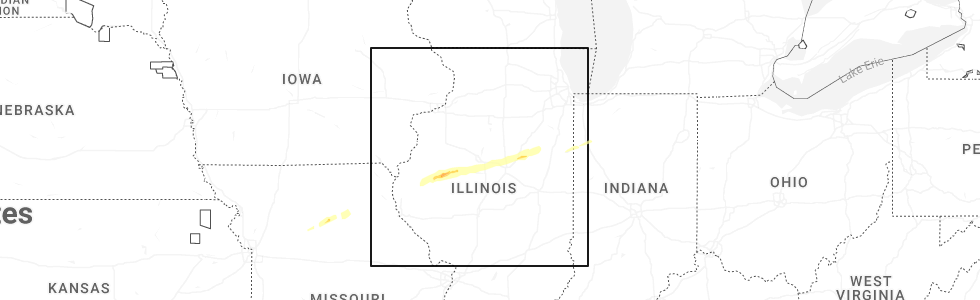
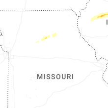
Hail Map for Sunday, December 28, 2025
Number of Impacted Households on 12/28/2025
0
Impacted by 1" or Larger Hail
0
Impacted by 1.75" or Larger Hail
0
Impacted by 2.5" or Larger Hail
Square Miles of Populated Area Impacted on 12/28/2025
0
Impacted by 1" or Larger Hail
0
Impacted by 1.75" or Larger Hail
0
Impacted by 2.5" or Larger Hail
Cities Most Affected by Hail Storms of 12/28/2025
| Hail Size | Demographics of Zip Codes Affected | ||||||
|---|---|---|---|---|---|---|---|
| City | Count | Average | Largest | Pop Density | House Value | Income | Age |
Hail and Wind Damage Spotted on 12/28/2025
Filter by Report Type:Hail ReportsWind Reports
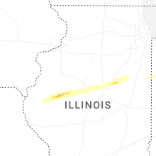
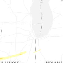
Illinois
| Local Time | Report Details |
|---|---|
| 9:00 AM CST | Power lines downed by thunderstorm wind in fulton county IL, 30.4 miles W of Peoria, IL |
| 9:24 AM CST | Power line downed due to thunderstorm wind in tazewell county IL, 8.9 miles SSW of Peoria, IL |
| 9:24 AM CST | Quarter sized hail reported near Pekin, IL, 8.9 miles SSW of Peoria, IL, relayed via broadcast media. |
| 9:26 AM CST | Power line downed due to thunderstorm wind in tazewell county IL, 7.7 miles SSE of Peoria, IL |
| 9:30 AM CST | Power outage due to thunderstorm wind in tazewell county IL, 6.7 miles SE of Peoria, IL |
| 9:30 AM CST | Several power poles snapped due to thunderstorm wind in tazewell county IL, 10.3 miles SSE of Peoria, IL |
| 9:30 AM CST | Barns destroyed. possible tornad in tazewell county IL, 10.1 miles SSE of Peoria, IL |
| 9:54 AM CST | Quarter sized hail reported near Carlock, IL, 24.2 miles E of Peoria, IL |
| 10:30 AM CST | Power poles downed. a farm outbuilding also had its roof torn off and sustained siding damage in the fairbury area. time estimated from rada in livingston county IL, 56.2 miles E of Peoria, IL |
| 10:34 AM CST | Power poles downed 1-2 miles west of forrest. time estimated from rada in livingston county IL, 60.4 miles E of Peoria, IL |
| 10:34 AM CST | Shed torn off of its foundation... swingset twisted and demolished... and multiple power poles downed on n 2500 east road west of forrest. time estimated from rada in livingston county IL, 59.9 miles E of Peoria, IL |
| 10:37 AM CST | The roof of prairie central junior high schools gymnasium was torn off in forrest. power poles were also downed in the area. time estimated from rada in livingston county IL, 62 miles E of Peoria, IL |
| 10:37 AM CST | Several large trees and power poles downed across the north side of forrest. time estimated from rada in livingston county IL, 62 miles E of Peoria, IL |
| 3:20 PM CST | Multiple trees snapped. possible tornado. twitter repor in macon county IL, 35.2 miles NW of Mattoon, IL |
| 3:24 PM CST | Tree downed by thunderstorm wind in christian county IL, 41.5 miles W of Mattoon, IL |
| 3:30 PM CST | Power lines were blown down. possible tornado damage. time estimated by rada in macon county IL, 31.4 miles NW of Mattoon, IL |
| 3:31 PM CST | Photo shows a large section of roof blown off a farm office building. time estimate in ford county IL, 65.5 miles ESE of Peoria, IL |
| 3:55 PM CST | Portion of dairy barn damaged destroyed. top of tree blown of in douglas county IL, 18.1 miles N of Mattoon, IL |
| 4:00 PM CST | Corrects previous non-tstm wnd dmg report from 3 sse pittsburg. many limbs and at least one large tree knocked dow in fayette county IL, 56.3 miles ENE of Saint Louis, MO |
| 5:15 PM CST | Couple of trees down on kimmel bridge roa in jackson county IL, 37.9 miles NNE of Cape Girardeau, MO |
| 6:04 PM CST | The roof of a pole barn was blown onto a neighboring house. that house also had a 2x4 through its roof. time estimated from rada in jefferson county IL, 72.2 miles ESE of Saint Louis, MO |
| 6:40 PM CST | Tree down across grasty r in pope county IL, 47.9 miles E of Cape Girardeau, MO |
Indiana
| Local Time | Report Details |
|---|---|
| 6:55 PM EST | Storm damage reported in clay county IN, 53.5 miles WSW of Indianapolis, IN |
| 7:18 PM EST | Multiple tree damage reports e and ne of vincennes. time estimated from rada in knox county IN, 48.8 miles N of Evansville, IN |
| 7:33 PM EST | Storm damage reported in owen county IN, 45.4 miles SW of Indianapolis, IN |
| 6:53 PM CST | Trained spotter estimated 50-60 mph winds near wesselman par in vanderburgh county IN, 2.4 miles E of Evansville, IN |
| 8:12 PM EST | Awos station krid richmond municipal airpor in wayne county IN, 48.5 miles NNW of Cincinnati, OH |
| 8:20 PM EST | Trees down in area. time estimated from rada in brown county IN, 48.1 miles S of Indianapolis, IN |
| 8:29 PM EST | Tree dow in dubois county IN, 48.3 miles NE of Evansville, IN |
| 9:18 PM EST | Large tree down causing multiple utility poles to bend. time estimated from rada in clark county IN, 41.7 miles N of Louisville, KY |
| 9:20 PM EST | Tree down on power lines. time estimated from rada in floyd county IN, 27.4 miles NW of Louisville, KY |
| 9:25 PM EST | Large tree down blocking us-31. time estimated from rada in clark county IN, 39.5 miles N of Louisville, KY |
| 9:33 PM EST | Tree and power lines down in the roadway on ohio avenue. time estimated from rada in clark county IN, 27.9 miles N of Louisville, KY |
Missouri
| Local Time | Report Details |
|---|---|
| 5:58 PM CST | Delayed report. campers were moved approximately 25 to 50 feet across a dealership parking lot. an older building lost a portion of its roof in the same vicinit in stoddard county MO, 41.6 miles SW of Cape Girardeau, MO |
Kentucky
| Local Time | Report Details |
|---|---|
| 7:09 PM CST | A tree was blown down across the road near chester hack drive and bloom avenue. time estimated from rada in mccracken county KY, 54.7 miles ESE of Cape Girardeau, MO |
| 7:15 PM CST | A house had a portion of its roof remove in graves county KY, 51.5 miles NNW of Mc Kenzie, TN |
| 9:46 PM EST | Delayed report of multiple trees dow in jefferson county KY, 17.3 miles NNW of Louisville, KY |
| 10:03 PM EST | Large tree branch snapped. time estimated from rada in jefferson county KY, 20.8 miles NE of Louisville, KY |
| 10:09 PM EST | Asos station kcvg cincinnati/northern kentucky international airpor in boone county KY, 10 miles WSW of Cincinnati, OH |
| 10:20 PM EST | Tree down on car on garrard st time estimated by rada in kenton county KY, 1.9 miles S of Cincinnati, OH |
| 10:22 PM EST | Tree down time estimated by rada in campbell county KY, 3.9 miles ESE of Cincinnati, OH |
| 10:36 PM EST | Tree down near grants lick elementary time estimated by rada in campbell county KY, 16.2 miles SSE of Cincinnati, OH |
Ohio
| Local Time | Report Details |
|---|---|
| 9:11 PM EST | Several large tree limbs were downed along new garden road... southwest of new madiso in darke county OH, 59 miles NNW of Cincinnati, OH |
| 9:42 PM EST | Tree downed within 4800 block of versailles road. time estimated by rada in miami county OH, 70.2 miles WNW of Columbus, OH |
| 10:48 PM EST | Tree branches knocked down power lines time estimated by rada in clermont county OH, 19 miles ESE of Cincinnati, OH |
| 10:52 PM EST | Tree down on bethel-new richmond rd time estimated by rada in clermont county OH, 20.2 miles ESE of Cincinnati, OH |
| 10:58 PM EST | Tree down on rich st time estimated by rada in clermont county OH, 25.2 miles ESE of Cincinnati, OH |
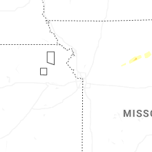
Iowa
| Local Time | Report Details |
|---|---|
| 9:15 PM CST | Storm damage reported in scott county IA, 61.4 miles ESE of Cedar Rapids, IA |
Tennessee
| Local Time | Report Details |
|---|---|
| 9:40 PM CST | Couple of trees down on hwy 161 near dot rd. 1000+ without power in the count in robertson county TN, 27.1 miles NNW of Nashville, TN |
Connect with Interactive Hail Maps