

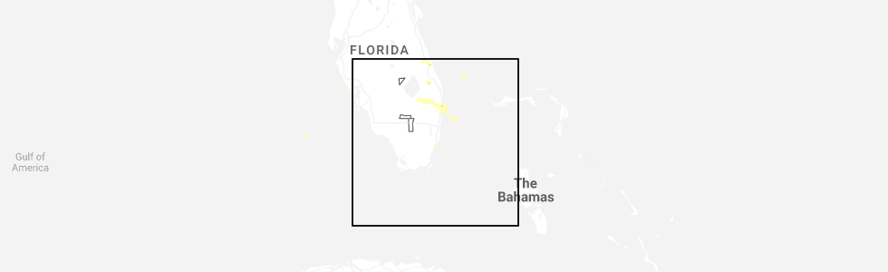
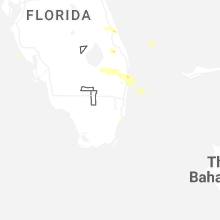
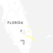
Hail Map for Saturday, February 28, 2026
Number of Impacted Households on 2/28/2026
0
Impacted by 1" or Larger Hail
0
Impacted by 1.75" or Larger Hail
0
Impacted by 2.5" or Larger Hail
Square Miles of Populated Area Impacted on 2/28/2026
0
Impacted by 1" or Larger Hail
0
Impacted by 1.75" or Larger Hail
0
Impacted by 2.5" or Larger Hail

Cities Most Affected by Hail Storms of 2/28/2026
| Hail Size | Demographics of Zip Codes Affected | ||||||
|---|---|---|---|---|---|---|---|
| City | Count | Average | Largest | Pop Density | House Value | Income | Age |
Hail and Wind Damage Spotted on 2/28/2026
Filter by Report Type:Hail ReportsWind Reports
States Impacted
FloridaFlorida
| Local Time | Report Details |
|---|---|
| 3:20 PM EST | Quarter sized hail reported near Boynton Beach, FL, 54.6 miles SSE of Port Saint Lucie, FL, a trained spotter reported and sent images of estimated quarter-size hail in boynton beach. |
| 3:25 PM EST | Quarter sized hail reported near Fort Pierce, FL, 13.5 miles NNW of Port Saint Lucie, FL, picture on social media of quarter sized hail off orange ave west of the florida turnpike. |
| 3:59 PM EST | Quarter sized hail reported near Boynton Beach, FL, 54.6 miles SSE of Port Saint Lucie, FL, a member of the public sent photos of quarter-size estimated hail in boynton beach. |
Connect with Interactive Hail Maps