

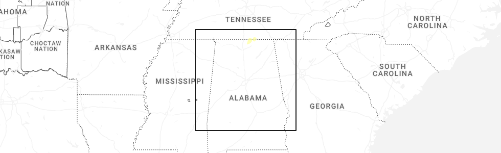
Hail Map for Thursday, December 18, 2025
Number of Impacted Households on 12/18/2025
0
Impacted by 1" or Larger Hail
0
Impacted by 1.75" or Larger Hail
0
Impacted by 2.5" or Larger Hail
Square Miles of Populated Area Impacted on 12/18/2025
0
Impacted by 1" or Larger Hail
0
Impacted by 1.75" or Larger Hail
0
Impacted by 2.5" or Larger Hail
Cities Most Affected by Hail Storms of 12/18/2025
| Hail Size | Demographics of Zip Codes Affected | ||||||
|---|---|---|---|---|---|---|---|
| City | Count | Average | Largest | Pop Density | House Value | Income | Age |
Hail and Wind Damage Spotted on 12/18/2025
Filter by Report Type:Hail ReportsWind Reports
States Impacted
Illinois, Kansas, Tennessee, Alabama, Kentucky, Virginia, North Carolina, West VirginiaIllinois
| Local Time | Report Details |
|---|---|
| 10:20 AM CST | Delayed report of an empty semi truck tipped over on route 24 ne of rushville. time estimated by rada in schuyler county IL, 61.8 miles SW of Peoria, IL |
| 10:35 AM CST | Delayed report of powerlines dow in fulton county IL, 32.5 miles W of Peoria, IL |
| 11:00 AM CST | Numerous power poles down along us 67 on the north side of carrollto in greene county IL, 48.4 miles NNW of Saint Louis, MO |
| 11:11 AM CST | Report of power lines down on jacobs road between manito and green valle in mason county IL, 22.6 miles SSW of Peoria, IL |
Kansas
| Local Time | Report Details |
|---|---|
| 3:30 PM CST | Down power pole on cars in parking lot on 119th st and roe avenue at town center plaz in johnson county KS, 13.7 miles SSW of Kansas City, MO |
Tennessee
| Local Time | Report Details |
|---|---|
| 6:31 PM CST | Numerous trees down in the cross plains/orlinda are in robertson county TN, 26.2 miles NNE of Nashville, TN |
| 6:50 PM CST | Measured at john c. tune airport (kjwn in davidson county TN, 0.2 miles NNW of Nashville, TN |
| 7:55 PM CST | Tspotter report of a broken power pole on frank holt lane near bradyville. time estimated from rada in cannon county TN, 47.8 miles SE of Nashville, TN |
| 8:12 PM CST | Wind damage in the morrison area near highway 8... along vervilla rd.... and in viola. trees and branches down across the area... considerable debris in the roads... a in warren county TN, 51.4 miles NW of Chattanooga, TN |
| 11:11 PM EST | Facebook report of a flag pole bent to the ground in front yard of home in powel in knox county TN, 7.8 miles NW of Knoxville, TN |
| 11:20 PM EST | Large tree fell and significantly damaged home on towanda trail in west knoxville. fire department reported extricating one perso in knox county TN, 3.1 miles WSW of Knoxville, TN |
| 11:26 PM EST | Knoxville tys airport asos recorded a 54 knot (~62 mph) wind gus in blount county TN, 11.3 miles SSW of Knoxville, TN |
| 11:40 PM EST | Over 75 calls to knox county dispatch regarding tree and power line damage across knoxville from the storms. storm passage between 11 and 11:40 p in knox county TN, 0.8 miles NW of Knoxville, TN |
| 11:42 PM EST | Sign covers over food city and regions bank signs sustained damage in jefferson cit in jefferson county TN, 26.5 miles ENE of Knoxville, TN |
| 11:50 PM EST | Security fencing blown over by thunderstorm winds at the avenue church at hwy 160 and us11e in morristow in hamblen county TN, 33.3 miles ENE of Knoxville, TN |
| 12:05 AM EST | Over 30 calls to jefferson dispatch regarding tree damage or power/utility line damage from the storms. storm passage between 11:30 pm and 12:05 a in jefferson county TN, 26.5 miles ENE of Knoxville, TN |
| 12:52 AM EST | Power outages caused by thunderstorm wind in sullivan county TN, 16.5 miles WSW of Bristol, TN |
| 1:00 AM EST | Power pole broken by high winds... large tree branches blown down along with a few shingle in sullivan county TN, 1.6 miles SSE of Bristol, TN |
Alabama
| Local Time | Report Details |
|---|---|
| 6:33 PM CST | Trees down on williams cove rd and blocking one lan in morgan county AL, 61.1 miles ESE of Florence, AL |
| 6:44 PM CST | Tree down at the intersection of county road 71 and county road 3 in lauderdale county AL, 15.9 miles ENE of Florence, AL |
| 7:10 PM CST | Lightning struck a tree... causing it to fall and block both lanes near highway 157 and cr 23 in lauderdale county AL, 15.1 miles NNW of Florence, AL |
| 7:13 PM CST | Tree down blocking one lane of traffic on cr33 and cr3 in lauderdale county AL, 16.6 miles NE of Florence, AL |
| 7:16 PM CST | Peak thunderstorm wind gust of 62 mph measured at the northwest alabama regional airport in muscle shoal in colbert county AL, 5.1 miles SE of Florence, AL |
| 7:36 PM CST | Tree down blocking one lane on cr501 and cr500 at highway 6 in lauderdale county AL, 23.8 miles ENE of Florence, AL |
| 7:40 PM CST | Porch eave blown off of a home... producing roof damage at a home on cox road in the 19000 block. time estimated from rada in limestone county AL, 27.1 miles E of Florence, AL |
| 7:53 PM CST | Tree down on persimmon tree and bailey cove roa in limestone county AL, 29.7 miles ENE of Florence, AL |
| 7:53 PM CST | Trees down in the 10000 block of upper snake roa in limestone county AL, 30.2 miles E of Florence, AL |
| 7:56 PM CST | Tree down on a powerline and a trailer near highway 20 in decatu in morgan county AL, 38.8 miles ESE of Florence, AL |
| 8:10 PM CST | Tree down blocking both lanes on hickory park rd near highway 7 in lauderdale county AL, 11.3 miles ENE of Florence, AL |
| 8:11 PM CST | Tree down on a powerline in the buena vista circle community in decatu in morgan county AL, 42.4 miles ESE of Florence, AL |
| 8:18 PM CST | Tree down at the bridge blocking one lane at the intersection of highway 36 and craze rd in hartsell in morgan county AL, 44.2 miles SE of Florence, AL |
| 8:20 PM CST | Tree down near longhorn pass st and mountain view rd in hartsell in morgan county AL, 48.9 miles ESE of Florence, AL |
| 8:26 PM CST | Trees down at friendship rd and east upper river rd in decatu in morgan county AL, 52.2 miles ESE of Florence, AL |
| 8:26 PM CST | Trees down on highway 53 at plummer roa in madison county AL, 58.3 miles E of Florence, AL |
| 8:53 PM CST | Tree down on a house near howard street in scottsbor in jackson county AL, 47.1 miles WSW of Chattanooga, TN |
| 8:53 PM CST | Debris in the roadway on county road 53 near ras in jackson county AL, 35.4 miles WSW of Chattanooga, TN |
| 8:53 PM CST | Trees down at the intersection of county road 42 and us highway 7 in jackson county AL, 37.7 miles WSW of Chattanooga, TN |
| 8:53 PM CST | Carport partially destroyed near county road 391 in sectio in jackson county AL, 49 miles SW of Chattanooga, TN |
| 8:57 PM CST | Tree down on the road south of cr534 on cr9 in lauderdale county AL, 25.1 miles ENE of Florence, AL |
| 9:00 PM CST | Tree down at apple grove rd at union hill r in morgan county AL, 64.3 miles ESE of Florence, AL |
| 9:18 PM CST | Tree blocking lanes of highway 67 at ryan loo in morgan county AL, 58.8 miles N of Birmingham, AL |
Kentucky
| Local Time | Report Details |
|---|---|
| 6:40 PM CST | Report of a mini trailer tumbled from a gas station onto red rock r in warren county KY, 54.3 miles NNE of Nashville, TN |
| 8:30 PM EST | Mesonet station lrto lebanon 8 n in marion county KY, 31.1 miles SE of Louisville, KY |
| 12:20 AM EST | Mesonet station dort pikeville 13 in pike county KY, 50.2 miles NNW of Bristol, TN |
Virginia
| Local Time | Report Details |
|---|---|
| 1:14 AM EST | Two roads in abingdon with trees blown down blocking lanes of traffic... one with other debris blown onto roadwa in washington county VA, 15.7 miles ENE of Bristol, TN |
| 1:28 AM EST | Large tree limb down outside of lost sock laundry... blocking a lane of traffi in washington county VA, 28.5 miles ENE of Bristol, TN |
| 3:54 AM EST | Tree down blocking lan in franklin county VA, 17.6 miles S of Roanoke, VA |
| 4:16 AM EST | Tree down blocking the lan in henry county VA, 45.2 miles S of Roanoke, VA |
North Carolina
| Local Time | Report Details |
|---|---|
| 2:11 AM EST | Tree down in roadway blocking both lane in surry county NC, 69.2 miles SSW of Roanoke, VA |
| 3:07 AM EST | Peak wind gust of 51 kt at the ocracoke weatherflow statio in amz135 county NC, 110 miles S of Virginia Beach, VA |
| 3:30 AM EST | Peak wind gust of 51 kt at the diamond shoals buoy. this is the 2nd gust at this location as a second thunderstorm moved throug in amz154 county NC, 124 miles SSE of Virginia Beach, VA |
| 3:30 AM EST | Tree in roadway near intersection of armstrong road and old us sout in surry county NC, 66.6 miles SSW of Roanoke, VA |
| 3:54 AM EST | Tree down blocking an entrance ram in surry county NC, 68.6 miles SSW of Roanoke, VA |
| 5:10 AM EST | Report of a tree down on barrier road. time estimated from rada in cabarrus county NC, 26 miles NE of Charlotte, NC |
| 5:15 AM EST | Trees down on mt. pleasant rd n. time estimated from rada in cabarrus county NC, 26.3 miles ENE of Charlotte, NC |
| 5:35 AM EST | Tree down across love mill rd. radar estimated tim in stanly county NC, 22.7 miles E of Charlotte, NC |
| 5:45 AM EST | Tree down at the walmart in asheboro. several other reports of trees down in southern randolph count in randolph county NC, 65.3 miles W of Raleigh, NC |
| 6:00 AM EST | Multiple trees down on piney grove church rd at staley snow camp r in chatham county NC, 48.8 miles W of Raleigh, NC |
West Virginia
| Local Time | Report Details |
|---|---|
| 3:30 AM EST | Tree down on goodwins chapel roa in mercer county WV, 55.3 miles W of Roanoke, VA |
Connect with Interactive Hail Maps