

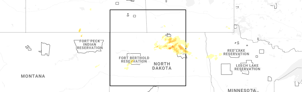
Hail Map for Thursday, September 11, 2025
Number of Impacted Households on 9/11/2025
0
Impacted by 1" or Larger Hail
0
Impacted by 1.75" or Larger Hail
0
Impacted by 2.5" or Larger Hail
Square Miles of Populated Area Impacted on 9/11/2025
0
Impacted by 1" or Larger Hail
0
Impacted by 1.75" or Larger Hail
0
Impacted by 2.5" or Larger Hail
Cities Most Affected by Hail Storms of 9/11/2025
| Hail Size | Demographics of Zip Codes Affected | ||||||
|---|---|---|---|---|---|---|---|
| City | Count | Average | Largest | Pop Density | House Value | Income | Age |
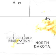
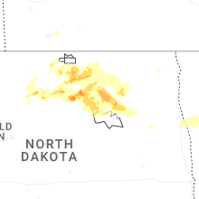
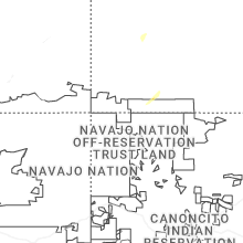
| Granville, ND | 2 | 2.00 | 2.00 | 3 | $35k | $27.0k | 44.7 |
Hail and Wind Damage Spotted on 9/11/2025
Filter by Report Type:Hail ReportsWind Reports
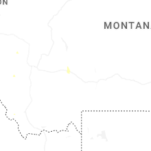
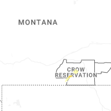
States Impacted
Montana, Florida, Wyoming, Colorado, Alabama, Louisiana, Arizona, Kansas, South Dakota, North Dakota, IdahoMontana
| Local Time | Report Details |
|---|---|
| 10:25 AM MDT | Storm damage reported in stillwater county MT, 42.5 miles WSW of Billings, MT |
| 4:56 PM MDT | Quarter sized hail reported near Richland, MT, 50.9 miles NNE of Glasgow, MT, heavy rain accompanied the hail (0.86 inches). still raining. hail piled up to 5 inches deep. |
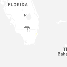
Florida
| Local Time | Report Details |
|---|---|
| 5:15 PM EDT | Corrects previous tstm wnd dmg report from 2 nnw coral gables. reports of downed power lines... tree limbs and side fencing associated with a strong thunderstorm that m in miami-dade county FL, 3 miles WNW of Miami, FL |
Wyoming
| Local Time | Report Details |
|---|---|
| 3:20 PM MDT | Mesonet station pc454 moss roc in fremont county WY, 25.1 miles SW of Riverton, WY |
| 3:26 PM MDT | Asos station klnd lander airpor in fremont county WY, 22.7 miles SW of Riverton, WY |
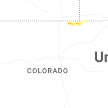
Colorado
| Local Time | Report Details |
|---|---|
| 3:36 PM MDT | Quarter sized hail reported near Grover, CO, 71.5 miles ESE of Laramie, WY, report from mping: quarter (1.00 in.). |
| 3:52 PM MDT | Quarter sized hail reported near Durango, CO, 41.3 miles NNE of Farmington, NM |
| 4:10 PM MDT | Quarter sized hail reported near Grover, CO, 74.1 miles SSW of Scottsbluff, NE, report from mping: quarter (1.00 in.). |
| 4:39 PM MDT | Asos station keeo meeker airpor in rio blanco county CO, 36.5 miles SSW of Craig, CO |
| 4:53 PM MDT | Ping Pong Ball sized hail reported near Grover, CO, 72 miles SSW of Scottsbluff, NE |
| 4:59 PM MDT | Quarter sized hail reported near Grover, CO, 71.1 miles SSW of Scottsbluff, NE, report from mping: quarter (1.00 in.). |
| 5:47 PM MDT | Asos station kcez cortez municipal airpor in montezuma county CO, 45.9 miles NNW of Farmington, NM |
Alabama
| Local Time | Report Details |
|---|---|
| 4:40 PM CDT | Multiple trees were knocked down or uprooted... including one on top of a home on butter and egg road in hazel green. time estimated by rada in madison county AL, 59.7 miles E of Florence, AL |
| 5:40 PM CDT | A tree was knocked down blocking both lanes at the intersection of cr 570... cr 566 and cr 565. time estimated by rada in lauderdale county AL, 25.4 miles E of Florence, AL |
| 5:42 PM CDT | A power line was knocked down at the intersection of bank street and lee street. time estimated by rada in lauderdale county AL, 22 miles E of Florence, AL |
| 5:43 PM CDT | A tree was knocked down on cr 70 near highway 7 in lauderdale county AL, 24.2 miles E of Florence, AL |
| 5:43 PM CDT | At least 2 trees uprooted and other large tree branches down along highway 72 from coxey to near the elk rive in lauderdale county AL, 23.1 miles E of Florence, AL |
Louisiana
| Local Time | Report Details |
|---|---|
| 4:45 PM CDT | Along beebe road... a tree was down and a large limb was down on a roo in west carroll county LA, 25.5 miles E of Bastrop, LA |
Arizona
| Local Time | Report Details |
|---|---|
| 4:20 PM MST | Mesonet station qsca3 san carlos no. 1. time of maximum gust estimated by rada in gila county AZ, 65.2 miles SSW of Show Low, AZ |
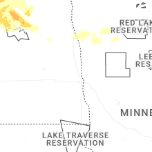
Kansas
| Local Time | Report Details |
|---|---|
| 5:55 PM MDT | Awos station k3k3 syracus in hamilton county KS, 47.9 miles W of Garden City, KS |
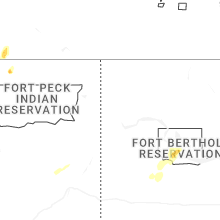
South Dakota
| Local Time | Report Details |
|---|---|
| 7:37 PM MDT | Quarter sized hail reported near Sturgis, SD, 32.8 miles NNW of Rapid City, SD |
| 7:55 PM MDT | Quarter sized hail reported near Newell, SD, 44.4 miles NNW of Rapid City, SD |
North Dakota
| Local Time | Report Details |
|---|---|
| 9:24 PM CDT | Quarter sized hail reported near Granville, ND, 21.2 miles E of Minot, ND, broadcast media relays photo on social media of quarter sized hail near granville. |
| 9:27 PM CDT | Hen Egg sized hail reported near Granville, ND, 21.2 miles E of Minot, ND, broadcast media relays photo on social media of 2 inch hail near granville. |
| 9:30 PM CDT | Half Dollar sized hail reported near Granville, ND, 21.2 miles E of Minot, ND, member of the public shares photo of hailstones estimated to be a quarter in size. hail started around 9:30 and fell for approximately 15 minutes. photo relayed on soci |
| 9:30 PM CDT | Half Dollar sized hail reported near Granville, ND, 23.9 miles E of Minot, ND, member of the public shared a photo of a hailstone estimated to be around the size of a half-dollar. photo relayed on social media. |
| 9:41 PM CDT | Hen Egg sized hail reported near Granville, ND, 21.3 miles E of Minot, ND, member of the public reports hail estimated to be around 2 inches in diameter. still hailing at the time of the report. |
| 1:35 AM CDT | Half Dollar sized hail reported near Leeds, ND, 30 miles WNW of Devils Lake, ND, facebook report: time estimated via radar. handful of nickel to quarters with one larger stone of at least half dollar size. |
Idaho
| Local Time | Report Details |
|---|---|
| 7:30 PM PDT | Quarter sized hail reported near Kamiah, ID, 22.1 miles N of Grangeville, ID |
Connect with Interactive Hail Maps