Hail Map for Wednesday, March 19, 2025

Number of Impacted Households on 3/19/2025
0
Impacted by 1" or Larger Hail
0
Impacted by 1.75" or Larger Hail
0
Impacted by 2.5" or Larger Hail
Square Miles of Populated Area Impacted on 3/19/2025
0
Impacted by 1" or Larger Hail
0
Impacted by 1.75" or Larger Hail
0
Impacted by 2.5" or Larger Hail
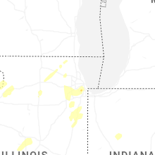
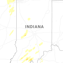
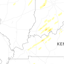
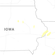
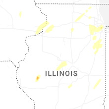
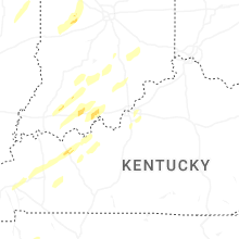
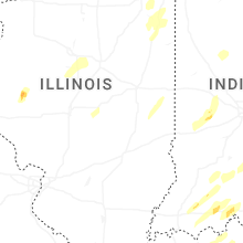
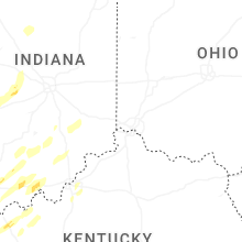
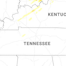
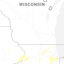
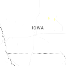
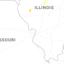
Regions Impacted by Hail on 3/19/2025
Cities Most Affected by Hail Storms of 3/19/2025
| Hail Size | Demographics of Zip Codes Affected | ||||||
|---|---|---|---|---|---|---|---|
| City | Count | Average | Largest | Pop Density | House Value | Income | Age |
| Bedford, IN | 1 | 2.00 | 2.00 | 152 | $76k | $35.9k | 41.9 |
Hail and Wind Damage Spotted on 3/19/2025
Filter by Report Type:Hail ReportsWind Reports
Iowa
| Local Time | Report Details |
|---|---|
| 9:05 AM CDT | Quarter sized hail reported near Clinton, IA, 76.9 miles E of Cedar Rapids, IA, occurring right now. coming down heavy. |
| 1:43 PM CDT | Quarter sized hail reported near Dubuque, IA, 58.4 miles NE of Cedar Rapids, IA, mainly penny sized hail but a few stones around 1 inch. |
Illinois
| Local Time | Report Details |
|---|---|
| 2:00 PM CDT | Portion of barn roof removed... shingles on home blown off... and section of a large tree fell. relayed be county ema. time estimated from rada in fulton county IL, 34.5 miles SW of Peoria, IL |
| 3:25 PM CDT | Power pole bent and 12 inch tree snapped 2.5 miles nw of delava in tazewell county IL, 20.2 miles S of Peoria, IL |
| 3:40 PM CDT | Three power poles blown down on horse barn road. ameren notifie in sangamon county IL, 58.8 miles SSW of Peoria, IL |
| 3:45 PM CDT | Power poles blown down. ameren notifie in sangamon county IL, 70.4 miles NNE of Saint Louis, MO |
| 3:55 PM CDT | Reported by a personal weather statio in livingston county IL, 45 miles ENE of Peoria, IL |
| 3:57 PM CDT | Power lines down and tree branches broken. time estimated by rada in la salle county IL, 49.9 miles NE of Peoria, IL |
| 4:00 PM CDT | Estimated wind gust along with dime size hai in woodford county IL, 16.7 miles ESE of Peoria, IL |
| 4:05 PM CDT | Storm damage reported in moultrie county IL, 10 miles WNW of Mattoon, IL |
| 4:05 PM CDT | Some damage to outbuildings from strong thunderstorm wind gusts. photos provide in moultrie county IL, 8.9 miles WNW of Mattoon, IL |
| 4:10 PM CDT | Semi-truck overturned by high winds at mile marker 7 on i-39 in median. driver transported to hospita in mclean county IL, 31.6 miles E of Peoria, IL |
| 4:30 PM CDT | Power outages from strong winds and small hai in mclean county IL, 45.7 miles E of Peoria, IL |
| 4:30 PM CDT | Power pole blown dow in coles county IL, 9.7 miles NNW of Mattoon, IL |
| 4:32 PM CDT | Semi overturned on i-55 southbound south of mile marker 191. relayed by broadcast medi in livingston county IL, 46.4 miles E of Peoria, IL |
| 4:45 PM CDT | Power pole down by dewey ban in champaign county IL, 58.1 miles N of Mattoon, IL |
| 4:45 PM CDT | Reported by personal weather station kilmorri2 in will county IL, 43.8 miles SW of Chicago, IL |
| 4:48 PM CDT | Two power poles snappe in mclean county IL, 40.7 miles SE of Peoria, IL |
| 4:50 PM CDT | Six power poles blown down and trees damage in coles county IL, 20.2 miles E of Mattoon, IL |
| 4:53 PM CDT | 6 inch diameter limbs down on route 30 before route 5 in will county IL, 35.3 miles WSW of Chicago, IL |
| 4:54 PM CDT | Reported by personal weather station kilauror5 in kane county IL, 33.2 miles W of Chicago, IL |
| 5:00 PM CDT | Semi truck overturned on i-74 in oakwood il. social media report with phot in vermilion county IL, 54.3 miles NE of Mattoon, IL |
| 5:01 PM CDT | Power poles leaning... possibly broken on prince crossing just south of il-64. time estimated by rada in dupage county IL, 28.3 miles W of Chicago, IL |
| 5:02 PM CDT | Half Dollar sized hail reported near Newman, IL, 30.5 miles NE of Mattoon, IL |
| 5:06 PM CDT | Quarter sized hail reported near Romeoville, IL, 28.2 miles SW of Chicago, IL, romeoville ema called in a report of quarter sized with the passing storm. |
| 5:15 PM CDT | Reported by personal weather station west of mone in will county IL, 35.4 miles SSW of Chicago, IL |
| 5:15 PM CDT | Storm damage reported in lawrence county IL, 54 miles N of Evansville, IN |
| 5:28 PM CDT | Roof torn off industrial building. report via social media. time estimated by rada in will county IL, 28.6 miles S of Chicago, IL |
| 5:29 PM CDT | Reported by personal weather station kilparkf1 in will county IL, 28.8 miles S of Chicago, IL |
| 5:30 PM CDT | Outbuilding damaged from strong gusty wind in moultrie county IL, 24.2 miles WNW of Mattoon, IL |
| 5:30 PM CDT | Storm damage reported in montgomery county IL, 53.6 miles W of Mattoon, IL |
| 5:30 PM CDT | Quarter sized hail reported near Kankakee, IL, 54.9 miles SSW of Chicago, IL |
| 5:30 PM CDT | Half Dollar sized hail reported near Oak Lawn, IL, 13.4 miles SSW of Chicago, IL, report from mping: half dollar (1.25 in.). time estimated from radar. |
| 5:33 PM CDT | Half Dollar sized hail reported near Hometown, IL, 12 miles SSW of Chicago, IL, report from mping: half dollar (1.25 in.). time estimated from radar. |
| 5:44 PM CDT | Quarter sized hail reported near Boody, IL, 40.8 miles WNW of Mattoon, IL, quarter size hail at nevada road and mt auburn road. |
| 5:50 PM CDT | Quarter sized hail reported near Blue Mound, IL, 42.5 miles WNW of Mattoon, IL |
| 6:55 PM CDT | Storm damage reported in champaign county IL, 40.7 miles N of Mattoon, IL |
| 6:56 PM CDT | Westerly wind gust 64 mph at champaign airpor in champaign county IL, 38.9 miles N of Mattoon, IL |
| 7:35 PM CDT | Storm damage reported in vermilion county IL, 60.3 miles NE of Mattoon, IL |
| 7:35 PM CDT | Awos station kdnv danville arp in vermilion county IL, 64.8 miles NE of Mattoon, IL |
Indiana
| Local Time | Report Details |
|---|---|
| 5:42 PM CDT | Three trees uprooted on houses on forrest dr. via social media. time estimated by rada in lake county IN, 25.6 miles SSE of Chicago, IL |
| 6:45 PM EDT | Thunderstorm winds estimated 60-70 mph at terre haute 6.5 n. torrential rain and pea hai in vigo county IN, 54.5 miles E of Mattoon, IL |
| 5:47 PM CDT | Branches down. garage collapsed. roof damage. power pole damage. time estimated by radar. reports from emergency management and social medi in lake county IN, 24.7 miles SSE of Chicago, IL |
| 5:55 PM CDT | Storm damage reported in vanderburgh county IN, 4.7 miles W of Evansville, IN |
| 6:59 PM EDT | Thunderstorm wind gust at khuf terre haute regional airpor in vigo county IN, 53.4 miles E of Mattoon, IL |
| 7:15 PM EDT | Quarter sized hail reported near Brazil, IN, 52.7 miles WSW of Indianapolis, IN, additionally pea to nickel sized hail also reported just north of knightsville. |
| 6:18 PM CDT | Measured at the michigan city glerl sit in lmz745 county IN, 37.3 miles ESE of Chicago, IL |
| 7:24 PM EDT | Thunderstorm winds downed roof and siding material off of barn across us highway 231 and brick chapel. possible brief weak tornado. time estimated by rada in putnam county IN, 38.5 miles W of Indianapolis, IN |
| 7:25 PM EDT | Quarter sized hail reported near Greencastle, IN, 37.8 miles WSW of Indianapolis, IN |
| 7:28 PM EDT | Quarter sized hail reported near Greencastle, IN, 39.2 miles WSW of Indianapolis, IN, reports of 1.00 inch hail from the northwest side of greencastle where it caused siding damage to the east side of greencastle as reported by ema to greencastle 3.5 ne |
| 7:33 PM EDT | Thunderstorm winds reportedly downed dozens of trees. time estimated by rada in carroll county IN, 62.5 miles NNW of Indianapolis, IN |
| 7:35 PM EDT | Thunderstorm winds downed 9 poles on county road 750 west. time estimated by rada in clinton county IN, 41.5 miles NW of Indianapolis, IN |
| 7:37 PM EDT | Thunderstorm winds blew over semi truck on interstate 65 between mm 156 and mm 157. time estimated by rada in clinton county IN, 42.3 miles NW of Indianapolis, IN |
| 7:40 PM EDT | Quarter sized hail reported near Stendal, IN, 29 miles NE of Evansville, IN |
| 7:41 PM EDT | Quarter sized hail reported near Jamestown, IN, 28.5 miles WNW of Indianapolis, IN, time estimated by radar. |
| 7:42 PM EDT | Quarter sized hail reported near Stendal, IN, 32.5 miles NE of Evansville, IN |
| 7:42 PM EDT | Public reported thunderstorm winds estimated to 65-70 mph with quarter sized hail at 400 west and 900 sout in boone county IN, 29.9 miles WNW of Indianapolis, IN |
| 7:47 PM EDT | Tree down on power lines along state road 56 west of jaspe in dubois county IN, 42.6 miles NE of Evansville, IN |
| 7:47 PM EDT | Large pine tree was downed along stewart road west of jasper. time estimated from rada in dubois county IN, 41 miles NE of Evansville, IN |
| 6:50 PM CDT | Trained spotter reports a tree blown down into power lines due to strong straight line winds southeast of waterford at 675 w 400 n in la porte county indian in la porte county IN, 44 miles ESE of Chicago, IL |
| 7:52 PM EDT | Additional reports from ema of hanger doors blown in and windows broken at logansport/cass county airport. time estimated by rada in cass county IN, 66.2 miles N of Indianapolis, IN |
| 7:53 PM EDT | A shed roof was blocking the roadway along 350 w west of jaspe in dubois county IN, 44 miles NE of Evansville, IN |
| 7:58 PM EDT | Power lines downed in the roadway at the intersection of 350 w and west schuetter road in jaspe in dubois county IN, 44 miles NE of Evansville, IN |
| 8:04 PM EDT | Quarter sized hail reported near Bedford, IN, 65 miles SSW of Indianapolis, IN, time estimated by radar. |
| 8:10 PM EDT | Thunderstorm winds downed tree onto residence at ohio street and virginia street. also tree on car at park street and blvd. time estimated by rada in howard county IN, 48.5 miles N of Indianapolis, IN |
| 8:18 PM EDT | Light pole down along industrial park road in ferdinan in dubois county IN, 41.1 miles ENE of Evansville, IN |
| 8:18 PM EDT | Thunderstorm winds downed 3 power poles across roadway on howard-miami county line. time estimated by rada in howard county IN, 55.5 miles N of Indianapolis, IN |
| 8:20 PM EDT | Emergency management reports large trees down and sheet metal blown around 3 miles southwest of akron in fulton county indiana. time estimated from radar dat in fulton county IN, 50.5 miles W of Fort Wayne, IN |
| 8:21 PM EDT | Hen Egg sized hail reported near Bedford, IN, 65.9 miles SSW of Indianapolis, IN, time estimated by radar. |
| 8:22 PM EDT | Emergency management reports large trees down and damage to a dwelling around 2 miles southwest of akron in fulton county indiana. time estimated from radar dat in fulton county IN, 49.4 miles W of Fort Wayne, IN |
| 8:29 PM EDT | Multiple trees downed and power lines down along indiana state road 145 south of birdseye. time estimated from rada in dubois county IN, 52.6 miles ENE of Evansville, IN |
| 8:36 PM EDT | Quarter sized hail reported near Taswell, IN, 52.1 miles WNW of Louisville, KY, quarter sized hail was reported near taswell. time estimated by radar. |
| 8:41 PM EDT | Late report of thunderstorm wind damage at 3640 west 700 south which continued through rosstown where a barn roof was reportedly blown off and a trailed blown over. pos in bartholomew county IN, 46.9 miles S of Indianapolis, IN |
| 8:49 PM EDT | Thunderstorm winds downed power lines at 300 south and 350 west. time estimated by rada in howard county IN, 45.8 miles N of Indianapolis, IN |
| 8:59 PM EDT | Thunderstorm wind damage reported on indiana route 9 south of indiana route 46 and on indiana route 46 near hartsville. possible tornado. time estimated by rada in bartholomew county IN, 42.4 miles SSE of Indianapolis, IN |
| 9:05 PM EDT | Quarter sized hail reported near English, IN, 40.1 miles WNW of Louisville, KY, quarter sized hail was reported near curby. |
| 9:06 PM EDT | Late report of some trees and power lines down in decatur county. time estimated by rada in decatur county IN, 41.9 miles SE of Indianapolis, IN |
| 9:08 PM EDT | Quarter sized hail reported near Leavenworth, IN, 39.1 miles WNW of Louisville, KY, quarter sized hail reported in carefree. |
| 9:11 PM EDT | Quarter sized hail reported near Depauw, IN, 38.7 miles NW of Louisville, KY, quarter sized hail reported in milltown. |
| 9:11 PM EDT | Quarter sized hail reported near North Vernon, IN, 52.9 miles SSE of Indianapolis, IN, ham reported. time estimated by radar. |
| 9:17 PM EDT | Trees down on indiana state road 60 at farabee. time estimated from rada in washington county IN, 43.2 miles NNW of Louisville, KY |
| 9:22 PM EDT | Emergency management reported downed powerlines and a broken utility pole on cr 350 n west of sr 32 in steuben county IN, 42.6 miles N of Fort Wayne, IN |
| 9:29 PM EDT | Ham radio operator reported a power pole on fire due to lightning strike along with downed power lines in auburn... in. time estimated by rada in de kalb county IN, 19.8 miles N of Fort Wayne, IN |
| 9:42 PM EDT | Trees down in the memphis area near memphis blue lick road. over 500 power outages reported in the are in clark county IN, 35.6 miles N of Louisville, KY |
Michigan
| Local Time | Report Details |
|---|---|
| 7:42 PM EDT | Media reports large fiberglass outdoor decorations damaged by wind in union pier in berrien county michigan. time estimated from radar dat in berrien county MI, 48.8 miles E of Chicago, IL |
| 8:14 PM EDT | Tree downed. size unknow in berrien county MI, 60.8 miles SSW of Grand Rapids, MI |
| 8:15 PM EDT | Tree downed. size unknow in berrien county MI, 58.3 miles SSW of Grand Rapids, MI |
Kentucky
| Local Time | Report Details |
|---|---|
| 7:51 PM CDT | Quarter sized hail reported near Philpot, KY, 39.3 miles ESE of Evansville, IN, report from mping: quarter (1.00 in.). |
| 8:13 PM CDT | Storm damage reported in christian county KY, 63.7 miles NW of Nashville, TN |
| 8:41 PM CDT | Quarter sized hail reported near Greenville, KY, 62.2 miles SSE of Evansville, IN |
| 8:45 PM CDT | Quarter sized hail reported near Webster, KY, 34.4 miles W of Louisville, KY, quarter sized hail reported near irvington. |
| 10:17 PM EDT | Delayed report. multiple areas with power lines down across roads. used thornhills ln for report. report came in late... so used radar for time estimatio in meade county KY, 21.2 miles W of Louisville, KY |
| 10:40 PM EDT | Ksd in jefferson county KY, 12.6 miles N of Louisville, KY |
| 10:43 PM EDT | Multiple healthy trees dow in boone county KY, 18 miles WSW of Cincinnati, OH |
| 10:50 PM EDT | Mesonet station huey burlington 4 in boone county KY, 14.9 miles SW of Cincinnati, OH |
| 10:53 PM EDT | Storm damage reported in jefferson county KY, 17 miles N of Louisville, KY |
| 10:58 PM EDT | Multiple healthy trees dow in kenton county KY, 2.7 miles WSW of Cincinnati, OH |
| 11:02 PM EDT | Delayed report. power lines down across road... near i-71 in oldham county KY, 27.9 miles NNE of Louisville, KY |
| 11:06 PM EDT | Delayed report. several trees down on smyrna village c in jefferson county KY, 10.5 miles NNE of Louisville, KY |
| 11:06 PM EDT | Quarter sized hail reported near Louisville, KY, 12.3 miles NNE of Louisville, KY, report from mping: quarter (1.00 in.). |
Tennessee
| Local Time | Report Details |
|---|---|
| 8:10 PM CDT | A couple of trees were blown down and were blocking old state rte 1 in new johnsonvill in humphreys county TN, 33.6 miles ESE of Mc Kenzie, TN |
| 8:40 PM CDT | Large tree blown down and blocking kingsbury r in montgomery county TN, 39.3 miles NW of Nashville, TN |
| 10:26 PM CDT | Tspotter report of a large tree down near owls hill nature sanctuary. time is estimated via rada in williamson county TN, 11.2 miles SSW of Nashville, TN |
Ohio
| Local Time | Report Details |
|---|---|
| 11:00 PM EDT | Numerous trees down in colerain townshi in hamilton county OH, 10.5 miles NNW of Cincinnati, OH |
| 11:56 PM EDT | Asos station kday dayton international airpor in montgomery county OH, 57.5 miles NNE of Cincinnati, OH |
| 12:05 AM EDT | Awos station kpcw port clinto in ottawa county OH, 61.2 miles W of Cleveland, OH |


Connect with Interactive Hail Maps