

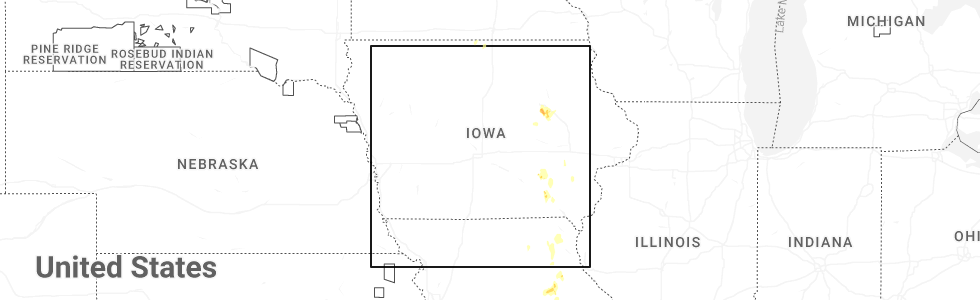
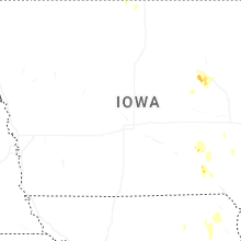
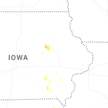
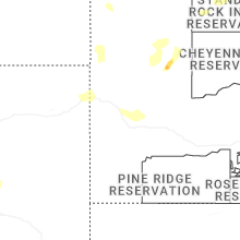
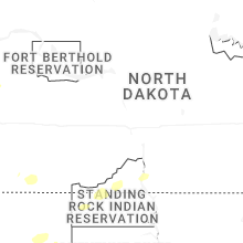
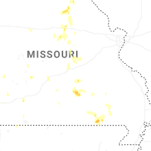
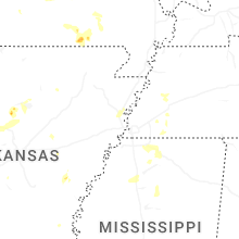
Hail Map for Monday, September 15, 2025
Number of Impacted Households on 9/15/2025
0
Impacted by 1" or Larger Hail
0
Impacted by 1.75" or Larger Hail
0
Impacted by 2.5" or Larger Hail
Square Miles of Populated Area Impacted on 9/15/2025
0
Impacted by 1" or Larger Hail
0
Impacted by 1.75" or Larger Hail
0
Impacted by 2.5" or Larger Hail
Cities Most Affected by Hail Storms of 9/15/2025
| Hail Size | Demographics of Zip Codes Affected | ||||||
|---|---|---|---|---|---|---|---|
| City | Count | Average | Largest | Pop Density | House Value | Income | Age |
Hail and Wind Damage Spotted on 9/15/2025
Filter by Report Type:Hail ReportsWind Reports
States Impacted
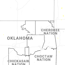
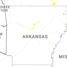
Oklahoma, Missouri, Arkansas, South Dakota, Wyoming, Iowa, Mississippi, North DakotaOklahoma
| Local Time | Report Details |
|---|---|
| 4:20 PM CDT | Several limbs dow in le flore county OK, 35.6 miles SSW of Fort Smith, AR |
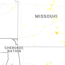
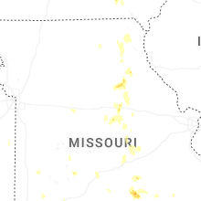
Missouri
| Local Time | Report Details |
|---|---|
| 4:40 PM CDT | Trees down just east of millersburg. time estimated by rada in callaway county MO, 11.6 miles ESE of Columbia, MO |
| 4:50 PM CDT | Dade county 911 reported a powerline down .25 miles west of s state highway 97 and route in dade county MO, 37.8 miles WNW of Springfield, MO |
| 5:06 PM CDT | Estimated 50-60 mp in boone county MO, 12.5 miles SSE of Columbia, MO |
| 5:06 PM CDT | Several large trees and large tree limbs down throughout the town of ashland per photos provided by em. time estimated from rada in boone county MO, 13.2 miles SSE of Columbia, MO |
| 5:09 PM CDT | Tree down blocking the roadway at old hwy 63 south & e bullard rd. time estimated from rada in boone county MO, 13.8 miles SSE of Columbia, MO |
| 5:25 PM CDT | Quarter sized hail reported near Republic, MO, 8.7 miles WSW of Springfield, MO |
| 5:30 PM CDT | Quarter sized hail reported near Republic, MO, 11.1 miles SW of Springfield, MO, quarter 1.00 in. |
| 5:41 PM CDT | Quarter sized hail reported near Gatewood, MO, 80.9 miles SSE of Salem, MO |
Arkansas
| Local Time | Report Details |
|---|---|
| 5:00 PM CDT | Damage to trees and a power pole shared by broadcast media on social medi in cleburne county AR, 57.6 miles N of Little Rock, AR |
| 5:30 PM CDT | Trees blown down northwest of hot springs airpor in garland county AR, 50.8 miles WSW of Little Rock, AR |
| 5:50 PM CDT | Quarter sized hail reported near Bee Branch, AR, 48.8 miles N of Little Rock, AR, pictures of significant accumulating hail in bee branch on social media. |
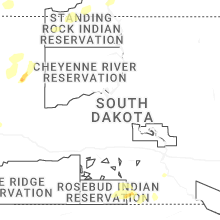
South Dakota
| Local Time | Report Details |
|---|---|
| 4:26 PM MDT | Quarter sized hail reported near Faith, SD, 78.5 miles NNE of Rapid City, SD |
| 6:00 PM MDT | Storm damage reported in custer county SD, 47.5 miles WSW of Rapid City, SD |
| 6:08 PM MDT | Storm damage reported in custer county SD, 47.5 miles WSW of Rapid City, SD |
| 6:10 PM MDT | Storm damage reported in custer county SD, 47.5 miles WSW of Rapid City, SD |
| 8:39 PM MDT | Storm damage reported in meade county SD, 66.7 miles NNE of Rapid City, SD |
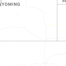
Wyoming
| Local Time | Report Details |
|---|---|
| 5:05 PM MDT | Storm damage reported in campbell county WY, 55.3 miles SSE of Gillette, WY |
| 5:09 PM MDT | Storm damage reported in weston county WY, 52.6 miles SE of Gillette, WY |
| 5:51 PM MDT | Storm damage reported in weston county WY, 57.6 miles W of Rapid City, SD |
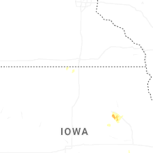
Iowa
| Local Time | Report Details |
|---|---|
| 6:29 PM CDT | Half Dollar sized hail reported near La Porte City, IA, 40.8 miles NW of Cedar Rapids, IA, spotter submitted picture of hail larger than a quarter north of irvine prairie. delayed report... time and location estimated with radar. |
Mississippi
| Local Time | Report Details |
|---|---|
| 6:37 PM CDT | Em reported trees and powerlines down in the byhalia area. time is radar estimate in marshall county MS, 28 miles SE of Memphis, TN |
| 9:29 PM CDT | Quarter sized hail reported near Water Valley, MS, 55.3 miles NW of Starkville, MS |
North Dakota
| Local Time | Report Details |
|---|---|
| 8:30 PM MDT | Heavy rai in adams county ND, 101.9 miles WSW of Bismarck, ND |
Connect with Interactive Hail Maps