

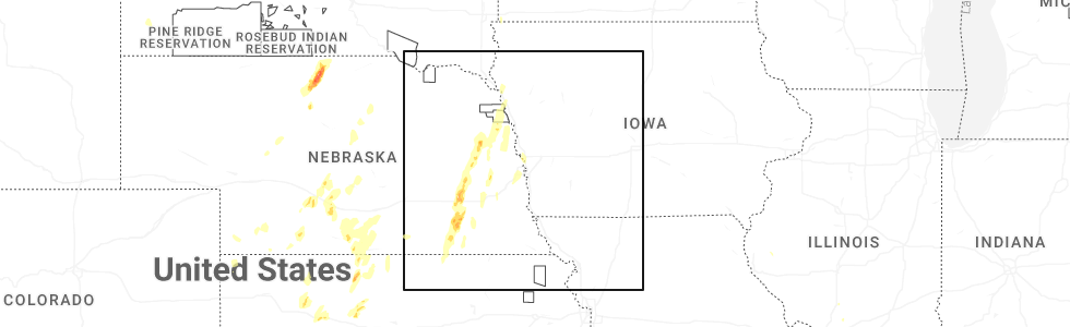
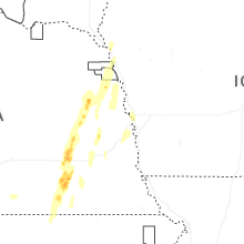
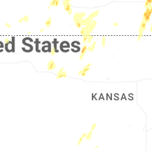
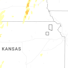
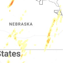
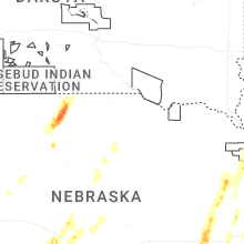
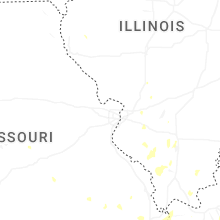
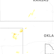
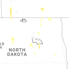
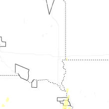
Hail Map for Sunday, September 14, 2025
Number of Impacted Households on 9/14/2025
0
Impacted by 1" or Larger Hail
0
Impacted by 1.75" or Larger Hail
0
Impacted by 2.5" or Larger Hail
Square Miles of Populated Area Impacted on 9/14/2025
0
Impacted by 1" or Larger Hail
0
Impacted by 1.75" or Larger Hail
0
Impacted by 2.5" or Larger Hail
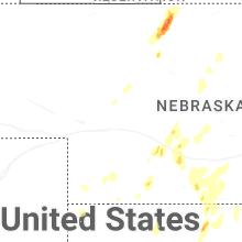
Cities Most Affected by Hail Storms of 9/14/2025
| Hail Size | Demographics of Zip Codes Affected | ||||||
|---|---|---|---|---|---|---|---|
| City | Count | Average | Largest | Pop Density | House Value | Income | Age |
| Phillipsburg, KS | 1 | 1.75 | 1.75 | 8 | $59k | $37.7k | 44.7 |
Hail and Wind Damage Spotted on 9/14/2025
Filter by Report Type:Hail ReportsWind Reports
States Impacted
South Dakota, Nebraska, Iowa, Minnesota, Missouri, Texas, Illinois, North Dakota, Kansas, MontanaSouth Dakota
| Local Time | Report Details |
|---|---|
| 12:45 PM CDT | Winds estimated to be 60-70 mph. time estimate in walworth county SD, 80.9 miles N of Pierre, SD |
| 2:53 PM CDT | Asos station katy watertown muni a in codington county SD, 70.4 miles W of Montevideo, MN |
| 3:49 PM CDT | Mesonet station 2 lake city (sddot in marshall county SD, 54.8 miles ENE of Aberdeen, SD |
| 4:11 PM CDT | Personal weather statio in moody county SD, 21.9 miles N of Sioux Falls, SD |
| 4:21 PM CDT | Mesonet station 58 victor (sddot in roberts county SD, 66.1 miles S of Fargo, ND |
| 4:26 PM CDT | Mesonet station 58 victor (sddot in roberts county SD, 66.1 miles S of Fargo, ND |
| 5:10 PM CDT | Personal weather statio in deuel county SD, 40.4 miles WSW of Montevideo, MN |
| 6:55 PM CDT | Mesonet station ocms2 oacoma 2w (sd mesonet in lyman county SD, 60.7 miles SE of Pierre, SD |
Nebraska
| Local Time | Report Details |
|---|---|
| 2:16 PM CDT | Quarter sized hail reported near Alexandria, NE, 67.9 miles SE of Grand Island, NE, brief quarter size hail...also somewhat strong winds but no speed estimation. |
| 2:36 PM CDT | Trees and power lines down. power poles snappe in saline county NE, 64.6 miles ESE of Grand Island, NE |
| 2:48 PM CDT | Large branch down on house near friend. reported via social media. time estimated from rada in saline county NE, 58.7 miles ESE of Grand Island, NE |
| 2:56 PM CDT | Storm damage reported in saline county NE, 64.7 miles ESE of Grand Island, NE |
| 3:06 PM CDT | Social media report of a lot of power poles down near tamor in seward county NE, 58.7 miles E of Grand Island, NE |
| 3:10 PM CDT | Quarter sized hail reported near Seward, NE, 59.7 miles E of Grand Island, NE |
| 3:12 PM CDT | Tree uprooted. time estimated from rada in seward county NE, 61.3 miles E of Grand Island, NE |
| 3:18 PM CDT | Quarter sized hail reported near Staplehurst, NE, 60.8 miles E of Grand Island, NE, delayed public report of hail measured at 1 inch in diameter. time estimated via radar. |
| 3:36 PM CDT | Photos shared via social media of a destroyed outbuilding and a large... downed tree branch which did damage to the roof of a home. time estimated based on rada in butler county NE, 58.6 miles W of Omaha, NE |
| 4:00 PM CDT | Quarter sized hail reported near Lincoln, NE, 56.3 miles SW of Omaha, NE |
| 4:05 PM CDT | Quarter sized hail reported near Snyder, NE, 53.5 miles NW of Omaha, NE |
| 4:10 PM CDT | Quarter sized hail reported near Lincoln, NE, 50.9 miles SW of Omaha, NE, nickel to quarter-sized hail. |
| 4:35 PM CDT | Half Dollar sized hail reported near Lyons, NE, 54 miles NNW of Omaha, NE |
| 4:50 PM CDT | Storm damage reported in saunders county NE, 35.5 miles W of Omaha, NE |
| 5:00 PM CDT | Former nws employee reported wind gusts 60-65 mph... bringing down a couple 6-8 inch tree limbs. time estimated via rada in douglas county NE, 5.3 miles WNW of Omaha, NE |
| 6:57 PM CDT | Quarter sized hail reported near Alma, NE, 78.3 miles SW of Grand Island, NE, photo via facebook. |
Iowa
| Local Time | Report Details |
|---|---|
| 2:44 PM CDT | Asos station ksux sioux gateway airpor in woodbury county IA, 63 miles WSW of Storm Lake, IA |
| 2:56 PM CDT | Strong wind gusts for about 1 or 2 minutes broke some 3 to 4 inch branches in his yard. there was also some pea to dime sized hai in woodbury county IA, 60.2 miles W of Storm Lake, IA |
| 5:14 PM CDT | Delayed report: a picture of tree damage was submitted from kcau via slack. location was narrowed down using google maps. time was estimated via rada in woodbury county IA, 60.7 miles WSW of Storm Lake, IA |
Minnesota
| Local Time | Report Details |
|---|---|
| 3:50 PM CDT | Mesonet station mn006 i-90 - beaver creek mp in rock county MN, 18.2 miles ENE of Sioux Falls, SD |
| 3:52 PM CDT | Strong wind gusts knowcked down a big rotten tree in town and also some small branches on other trees. heavy rain accompanied the win in rock county MN, 18.7 miles ENE of Sioux Falls, SD |
| 4:01 PM CDT | Roof of cattle barn blown off. tree branches 6 to 10 inches in diameter broken dow in rock county MN, 18.7 miles ENE of Sioux Falls, SD |
| 4:22 PM CDT | Thunderstorm wind gust blew down a big tree and took out the power across much of town. there was not much rain... but a couple minutes of very strong win in pipestone county MN, 37.8 miles NNE of Sioux Falls, SD |
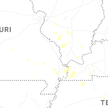
Missouri
| Local Time | Report Details |
|---|---|
| 4:19 PM CDT | Photos on facebook show a healthy tree uprooted in a neighborhood near the cole county fairgrounds. time estimated from rada in cole county MO, 28 miles S of Columbia, MO |
Texas
| Local Time | Report Details |
|---|---|
| 4:27 PM CDT | Also gusted to 73 mph at 428 pm. mesonet station 38 memphis 1n in hall county TX, 27.6 miles NW of Childress, TX |
| 6:15 PM CDT | Storm damage reported in lipscomb county TX, 58.3 miles WSW of Woodward, OK |
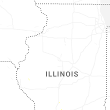
Illinois
| Local Time | Report Details |
|---|---|
| 4:35 PM CDT | A couple of trees were blown down in the south marcum campground on rend lak in franklin county IL, 60.7 miles NNE of Cape Girardeau, MO |
| 4:41 PM CDT | Quarter sized hail reported near Benton, IL, 58.1 miles NE of Cape Girardeau, MO, hail up to the size of quarters was reported in benton. |
| 4:47 PM CDT | A tree was blown down along i-57 south of bento in franklin county IL, 55.1 miles NE of Cape Girardeau, MO |
| 6:03 PM CDT | Trees down along country club road near the murphysboro walmart. also knocked the power out to the surrounding area. time estimated from rada in jackson county IL, 34.7 miles NNE of Cape Girardeau, MO |
| 6:04 PM CDT | A large tree fell through a mobile home on new era road just north of highway 1 in jackson county IL, 33.6 miles NNE of Cape Girardeau, MO |
| 6:05 PM CDT | Quarter sized hail reported near Carbondale, IL, 33.4 miles NNE of Cape Girardeau, MO, quarter size hail reported on the west side of carbondale. |
| 6:08 PM CDT | A tree was blown down across pump house rd just north of chautauqua r in jackson county IL, 31.8 miles NNE of Cape Girardeau, MO |
| 6:14 PM CDT | Tree knocked down along highway 127 near etherto in jackson county IL, 30 miles NNE of Cape Girardeau, MO |
| 7:40 PM CDT | A couple of trees blown down. wind speed estimated at 50-60 mp in franklin county IL, 54.1 miles NNE of Cape Girardeau, MO |
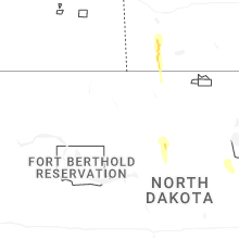
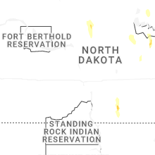
North Dakota
| Local Time | Report Details |
|---|---|
| 4:50 PM CDT | Social media post with video of wind gusts... estimated by observer of 60 mph near i-29 and hwy 1 in richland county ND, 41.9 miles S of Fargo, ND |
| 4:50 PM CDT | Quarter sized hail reported near Balfour, ND, 39.2 miles ESE of Minot, ND |
| 6:40 PM CDT | Tree on house... time estimated from rada in ramsey county ND, 0.6 miles WSW of Devils Lake, ND |
| 8:37 PM CDT | Reported via ndaw in cavalier county ND, 54.8 miles NNE of Devils Lake, ND |
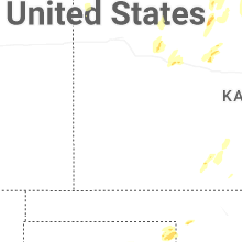
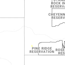
Kansas
| Local Time | Report Details |
|---|---|
| 5:29 PM CDT | Asos station kemp empori in lyon county KS, 60.5 miles NW of Chanute, KS |
| 6:45 PM CDT | Quarter sized hail reported near Collyer, KS, 44 miles WNW of Hays, KS, a social media report of 1 inch hail. |
| 7:11 PM CDT | Golf Ball sized hail reported near Phillipsburg, KS, 71 miles N of Hays, KS, most hail was pea to dimes... a few were as big as golf ball size. |
| 7:27 PM CDT | Quarter sized hail reported near Wakeeney, KS, 34.3 miles WNW of Hays, KS, trego county em reported quarter sized hail 3 w of wakeeney. |
| 7:30 PM CDT | Half Dollar sized hail reported near Glade, KS, 53.1 miles N of Hays, KS, spotter reported hail up to half dollar size with his vehicle suffering several dents. |
Montana
| Local Time | Report Details |
|---|---|
| 7:39 PM MDT | Spotter network report of a large tree down across a fence. time of damage estimated using rada in lewis and clark county MT, 68.1 miles SSW of Great Falls, MT |
| 7:45 PM MDT | Mesonet station mtbls boulder south mt-69 mp 27. in jefferson county MT, 55.3 miles NW of Bozeman, MT |
| 7:55 PM MDT | Toston mt mesone in broadwater county MT, 39.5 miles NW of Bozeman, MT |
| 8:07 PM MDT | Awos station k1gm golf. thunderstorm wind gust of 51 mp in lewis and clark county MT, 39.2 miles WSW of Great Falls, MT |
| 8:07 PM MDT | Mesonet station ginm8 ginger raws. time estimated using rada in broadwater county MT, 52.3 miles NNW of Bozeman, MT |
| 8:15 PM MDT | Mesonet station mttos toston bridge us-287 mp 87. in broadwater county MT, 39.8 miles NNW of Bozeman, MT |
| 10:11 PM MDT | Awos station k1km 2 ene harlowto in wheatland county MT, 77.3 miles NW of Billings, MT |
Connect with Interactive Hail Maps