

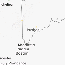
Hail Map for Friday, August 31, 2012

Number of Impacted Households on 8/31/2012
0
Impacted by 1" or Larger Hail
0
Impacted by 1.75" or Larger Hail
0
Impacted by 2.5" or Larger Hail
Square Miles of Populated Area Impacted on 8/31/2012
0
Impacted by 1" or Larger Hail
0
Impacted by 1.75" or Larger Hail
0
Impacted by 2.5" or Larger Hail

Cities Most Affected by Hail Storms of 8/31/2012
| Hail Size | Demographics of Zip Codes Affected | ||||||
|---|---|---|---|---|---|---|---|
| City | Count | Average | Largest | Pop Density | House Value | Income | Age |
Hail and Wind Damage Spotted on 8/31/2012
Filter by Report Type:Hail ReportsWind Reports
Texas
| Local Time | Report Details |
|---|---|
| 3:15 PM CDT | Property damage including multiple trees... fence... well house... barn... porch and mobile home underpinning in lee county TX, 80.5 miles SE of Killeen, TX |
| 6:30 PM CDT | Trees down in town and a large tree limb on hous in angelina county TX, 11.1 miles SSW of Lufkin, TX |
| 6:30 PM CDT | Trees down near groveton at hwys fm355 and us287 in trinity county TX, 30.3 miles SW of Lufkin, TX |
| 6:40 PM CDT | Trees and powerlines down in parts of the county east of lufkin in angelina county TX, 4.7 miles E of Lufkin, TX |
Mississippi
| Local Time | Report Details |
|---|---|
| 4:13 PM CDT | Five trees down in western warren county and northwest portions of vicksburg...one tree landed on a car...one tree took down a power pole...and a 16 ft boat was capsize in warren county MS, 40.4 miles W of Jackson, MS |
Arizona
| Local Time | Report Details |
|---|---|
| 3:00 PM MST | 40 by 20 ft roof of shed blown off and sturdy jungle gym playground twisted and destroye in gila county AZ, 63.2 miles E of Phoenix, AZ |
Illinois
| Local Time | Report Details |
|---|---|
| 5:13 PM CDT | *** 1 inj *** one house and one metal building damaged. power lines also down. one minor injur in morgan county IL, 68.9 miles N of Saint Louis, MO |
Maine
| Local Time | Report Details |
|---|---|
| 6:25 PM EDT | Quarter sized hail reported near Topsham, ME, 23.3 miles NE of Portland, ME |
Arkansas
| Local Time | Report Details |
|---|---|
| 7:02 PM CDT | Trees and powerlines down in dixi in woodruff county AR, 57.2 miles ENE of Little Rock, AR |
| 7:02 PM CDT | Tress and powerlines down north of des arc on highway 11 in prairie county AR, 47.6 miles ENE of Little Rock, AR |
Nevada
| Local Time | Report Details |
|---|---|
| 5:50 PM PDT | Ruby valley raw in elko county NV, 28.1 miles ESE of Elko, NV |
| 5:52 PM PDT | Bishop fla in elko county NV, 57.4 miles ENE of Elko, NV |
| 5:55 PM PDT | Hd summit in elko county NV, 61.3 miles NE of Elko, NV |
| 6:10 PM PDT | Clover valley dri sit in elko county NV, 41.9 miles E of Elko, NV |
| 6:28 PM PDT | Pilot peak junctio in elko county NV, 81.6 miles E of Elko, NV |
| 6:32 PM PDT | Ruby lake raw in elko county NV, 48.2 miles SSE of Elko, NV |
Utah
| Local Time | Report Details |
|---|---|
| 8:15 PM MDT | Wendover peak - 5087 ft in tooele county UT, 91.9 miles E of Elko, NV |
| 8:20 PM MDT | North salt flats - 4218 ft in tooele county UT, 99.3 miles W of Salt Lake City, UT |
| 8:35 PM MDT | Wendover field - 4236 ft in tooele county UT, 91.4 miles E of Elko, NV |
| 9:15 PM MDT | I-80 at grassey - 4650 ft in tooele county UT, 58.9 miles W of Salt Lake City, UT |
| 9:25 PM MDT | Eagle range - 4239 ft in box elder county UT, 65 miles WNW of Salt Lake City, UT |
| 9:30 PM MDT | Gunnison island - 4242 ft in box elder county UT, 63.8 miles NW of Salt Lake City, UT |
| 9:30 PM MDT | Lakeside mountain - 5039 ft in box elder county UT, 56.4 miles WNW of Salt Lake City, UT |
| 9:45 PM MDT | Gunnison island - 4242 ft in box elder county UT, 63.8 miles NW of Salt Lake City, UT |
| 10:00 PM MDT | Hat island - 4242 ft in box elder county UT, 42.5 miles WNW of Salt Lake City, UT |
Idaho
| Local Time | Report Details |
|---|---|
| 8:40 PM MDT | Storm damage reported in bingham county ID, 31.3 miles WNW of Idaho Falls, ID |
| 9:43 PM MDT | Storm damage reported in twin falls county ID, 18.6 miles SSE of Twin Falls, ID |
Connect with Interactive Hail Maps