

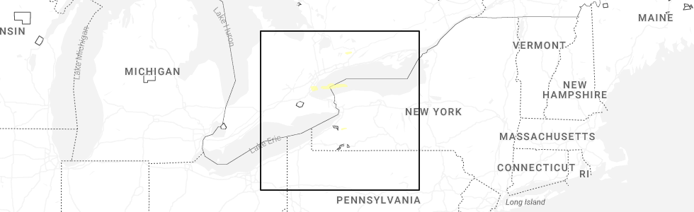
Hail Map for Saturday, November 15, 2025
Number of Impacted Households on 11/15/2025
0
Impacted by 1" or Larger Hail
0
Impacted by 1.75" or Larger Hail
0
Impacted by 2.5" or Larger Hail
Square Miles of Populated Area Impacted on 11/15/2025
0
Impacted by 1" or Larger Hail
0
Impacted by 1.75" or Larger Hail
0
Impacted by 2.5" or Larger Hail
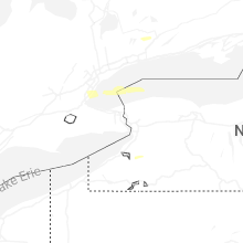
Cities Most Affected by Hail Storms of 11/15/2025
| Hail Size | Demographics of Zip Codes Affected | ||||||
|---|---|---|---|---|---|---|---|
| City | Count | Average | Largest | Pop Density | House Value | Income | Age |
Hail and Wind Damage Spotted on 11/15/2025
Filter by Report Type:Hail ReportsWind Reports
California
| Local Time | Report Details |
|---|---|
| 6:39 AM PST | Tree down in lake balboa are in los angeles county CA, 17.3 miles NW of Los Angeles, CA |
| 6:46 AM PST | Large tree branches down on highway 110 near fair oaks av in los angeles county CA, 7.1 miles NE of Los Angeles, CA |
| 7:00 AM PST | A strong squall line moved across the city of los angeles. per emergency managers... 58 trees were blown down across the cit in los angeles county CA, 9.5 miles NW of Los Angeles, CA |
| 7:16 AM PST | Tree down on 100 block of rockaway r in ventura county CA, 65.7 miles WNW of Los Angeles, CA |
| 7:25 AM PST | Rocks across piru canyon r in ventura county CA, 40.7 miles NW of Los Angeles, CA |
| 7:49 AM PST | Large tree down blocking olive mill rd near danielson r in santa barbara county CA, 74.2 miles SSW of Bakersfield, CA |
West Virginia
| Local Time | Report Details |
|---|---|
| 11:05 PM EST | Tree down with power outages near smoke camp cty rt 2 cr 2. time estimated by rada in lewis county WV, 41.8 miles WNW of Elkins, WV |
| 11:30 PM EST | Tree down near wv 4 with power outages. time estimated by rada in clay county WV, 39.1 miles ENE of Charleston, WV |
| 12:25 AM EST | Tree down affecting 100 people with power outages near davis creek road. time estimated by rada in cabell county WV, 38.2 miles W of Charleston, WV |
| 12:25 AM EST | Tree down with power outages near fort gay rd. time estimated by rada in wayne county WV, 51.6 miles WSW of Charleston, WV |
| 12:30 AM EST | Tree down just west of shoals branch rd. time estimated by rada in wayne county WV, 42.7 miles W of Charleston, WV |
| 12:30 AM EST | Corrects previous tstm wnd dmg report from 2 ssw beech fork state park. tree down just west of shoals branch rd. time estimated by rada in wayne county WV, 42.8 miles W of Charleston, WV |
| 12:40 AM EST | Tree down with power outages near hunter road. time estimated by rada in kanawha county WV, 7.6 miles E of Charleston, WV |
| 12:50 AM EST | Tree down with power outages near rich creek rd. time estimated by rada in fayette county WV, 31.6 miles ESE of Charleston, WV |
Connect with Interactive Hail Maps