

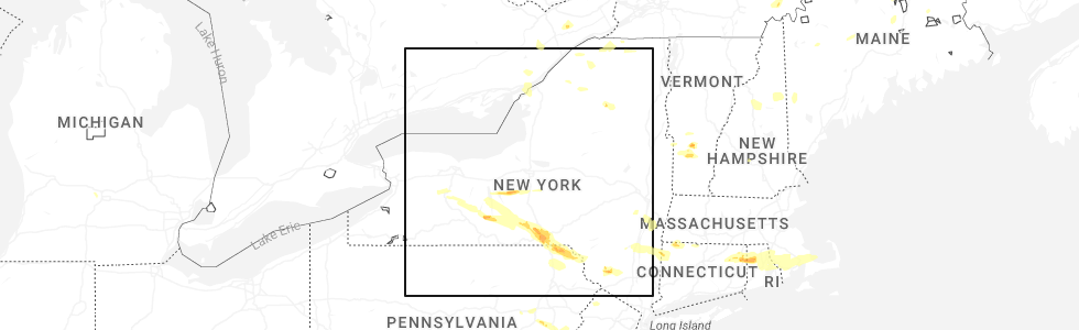
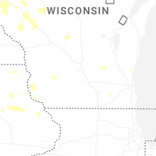
Hail Map for Thursday, July 3, 2025
Number of Impacted Households on 7/3/2025
0
Impacted by 1" or Larger Hail
0
Impacted by 1.75" or Larger Hail
0
Impacted by 2.5" or Larger Hail
Square Miles of Populated Area Impacted on 7/3/2025
0
Impacted by 1" or Larger Hail
0
Impacted by 1.75" or Larger Hail
0
Impacted by 2.5" or Larger Hail

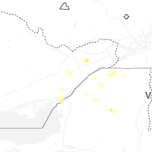
Cities Most Affected by Hail Storms of 7/3/2025
| Hail Size | Demographics of Zip Codes Affected | ||||||
|---|---|---|---|---|---|---|---|
| City | Count | Average | Largest | Pop Density | House Value | Income | Age |
| Johnson City, NY | 3 | 1.83 | 2.00 | 636 | $65k | $29.9k | 40.3 |
| Maine, NY | 1 | 1.75 | 1.75 | 53 | $76k | $41.1k | 39.7 |
| Sterling, CT | 1 | 1.75 | 1.75 | 142 | $118k | $49.7k | 38.6 |
| Ithaca, NY | 1 | 1.75 | 1.75 | 436 | $124k | $33.3k | 27.0 |
| Binghamton, NY | 1 | 1.75 | 1.75 | 379 | $67k | $33.9k | 42.9 |
| Scipio Center, NY | 1 | 1.75 | 1.75 | 29 | $72k | $40.6k | 40.7 |
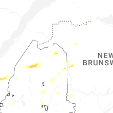
Hail and Wind Damage Spotted on 7/3/2025
Filter by Report Type:Hail ReportsWind Reports
States Impacted
New Hampshire, Maine, New York, Vermont, Pennsylvania, Florida, New Jersey, Connecticut, Arizona, Michigan, Rhode Island, Louisiana, Iowa, Massachusetts, Idaho, Oregon, Minnesota, North Dakota, South Dakota, WisconsinNew Hampshire
| Local Time | Report Details |
|---|---|
| 11:05 AM EDT | Quarter sized hail reported near Lincoln, NH, 72.6 miles WNW of Portland, ME, hail at hancock campground on the kancamagus highway. hail between 0.75 to 1.1 inches. hail fell for about 7 minutes. winds estimated over 50 mph as well. |
| 11:24 AM EDT | Multiple reports of downed trees. tree fell on car in motel parking lot off daniel webster highwa in grafton county NH, 75.4 miles WNW of Portland, ME |
| 11:35 AM EDT | A tree and wires down along bean road in moultonboroug in carroll county NH, 60.9 miles W of Portland, ME |
| 11:35 AM EDT | Numerous large branches and a few trees downed along rt-30 in carroll county NH, 58.8 miles WNW of Portland, ME |
| 11:40 AM EDT | Half Dollar sized hail reported near Jackson, NH, 57.2 miles NW of Portland, ME, photos of hailstones next to ruler. largest stones were half dollar-sized. time estimated by radar. |
| 11:47 AM EDT | Tree and wires down on zoski road in deerin in hillsborough county NH, 88.9 miles NNW of Providence, RI |
| 12:00 PM EDT | Lare tree and wires down at riverway east parking lot in milfor in hillsborough county NH, 71.4 miles N of Providence, RI |
| 12:05 PM EDT | Tree down on maple street in mancheste in hillsborough county NH, 75.4 miles SW of Portland, ME |
| 12:06 PM EDT | Tree down on a house on merrill court in milfor in hillsborough county NH, 70.6 miles N of Providence, RI |
| 12:12 PM EDT | Tree down on perimeter road next to manchester airpor in hillsborough county NH, 76.4 miles N of Providence, RI |
| 12:25 PM EDT | Tree and wires down in the area of blossom stree in hillsborough county NH, 64 miles N of Providence, RI |
| 12:34 PM EDT | Large tree down on river road near lower road in new ipswic in hillsborough county NH, 67.4 miles NNW of Providence, RI |
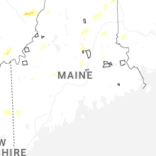
Maine
| Local Time | Report Details |
|---|---|
| 11:38 AM EDT | Quarter sized hail reported near Presque Isle, ME, 18.3 miles SSE of Caribou, ME, hail mostly nickel size... with a few quarter size. |
| 11:38 AM EDT | Half Dollar sized hail reported near Presque Isle, ME, 18.3 miles SSE of Caribou, ME, corrects previous hail report from 2 nnw westfield. hail mostly nickel size... with a few up to half dollar size. |
| 11:42 AM EDT | Trees and powerlines down in the madawaska... me area. time estimated by rada in aroostook county ME, 37.7 miles NNW of Caribou, ME |
| 11:42 AM EDT | Multiple trees and powerlines down in the portage... me area. time estimated by rada in aroostook county ME, 22.8 miles WSW of Caribou, ME |
| 11:53 AM EDT | 6-8 trees down across powerlines in the grand isle area. time estimated by rada in aroostook county ME, 31.9 miles NNW of Caribou, ME |
| 12:20 PM EDT | Wires dow in oxford county ME, 43.9 miles NW of Portland, ME |
| 12:24 PM EDT | A tree was observed to be leaning on a powerline in the caribou area. time estimated by rada in aroostook county ME, 0.1 miles NE of Caribou, ME |
| 12:40 PM EDT | Norway fire reported a large tree blown over onto powerlines on round the pond rd in norway. time estimated by rada in oxford county ME, 45.3 miles NNW of Portland, ME |
| 12:50 PM EDT | Tree down blocking rt-302. time estimated by rada in cumberland county ME, 27.5 miles NW of Portland, ME |
| 1:13 PM EDT | Trees and powerlines down in the sangerville... me area. time estimated by rada in piscataquis county ME, 38 miles NW of Bangor, ME |
| 1:27 PM EDT | Tree across parsonsfield road in limeric in york county ME, 27.9 miles W of Portland, ME |
| 1:43 PM EDT | Trees down on north stage coach rd in atkinson... me. time estimated by rada in piscataquis county ME, 31.6 miles NNW of Bangor, ME |
| 2:00 PM EDT | 911 caller reported a tree down in east millinocket. time estimated by rada in penobscot county ME, 58 miles N of Bangor, ME |
| 2:41 PM EDT | 911 caller reported a tree down in the howland area. time estimated by rada in penobscot county ME, 30.7 miles N of Bangor, ME |
| 3:48 PM EDT | Tree down on powerlines on water st. time estimated by rada in washington county ME, 55.6 miles ENE of Bangor, ME |
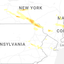
New York
| Local Time | Report Details |
|---|---|
| 12:06 PM EDT | Tree down on lake shore road in chazy/ingrahm n in clinton county NY, 26.9 miles NNW of Burlington, VT |
| 12:21 PM EDT | Tree down on salmon river road in schuyler fall in clinton county NY, 19.3 miles NW of Burlington, VT |
| 1:06 PM EDT | Quarter sized hail reported near Geneseo, NY, 59.1 miles E of Buffalo, NY, quarter sized hail reported on conesus lake. |
| 1:28 PM EDT | Tree down. time estimated from rada in ontario county NY, 73.3 miles WSW of Syracuse, NY |
| 1:30 PM EDT | Quarter sized hail reported near Aurora, NY, 34.9 miles SW of Syracuse, NY, large amount of at least quarter size hail in aurora. photo shared via broadcaster social media. radar-estimated time. |
| 1:41 PM EDT | Golf Ball sized hail reported near Scipio Center, NY, 28 miles SW of Syracuse, NY, estimated golf ball size hail via social media photo. |
| 1:50 PM EDT | Multiple reports of trees and wire down along mecklenburg roa in tompkins county NY, 48.7 miles SSW of Syracuse, NY |
| 1:59 PM EDT | Quarter sized hail reported near Burdett, NY, 56.3 miles SW of Syracuse, NY, corrects previous hail report from burdett. nickel to quarter size hail in burdett. |
| 1:59 PM EDT | Corrects timing of previous tstm wnd dmg report from 1 nw ithaca. tree down over trumansburg roa in tompkins county NY, 44.9 miles SSW of Syracuse, NY |
| 2:00 PM EDT | Trees and powerlines down on elmira road near robert treman state park. picture sent to nws binghamton via social media. radar-estimated tim in tompkins county NY, 49.3 miles SSW of Syracuse, NY |
| 2:00 PM EDT | Corrects previous tstm wnd dmg report from 1 ene enfield. tree down over south apple gate roa in tompkins county NY, 48.2 miles SSW of Syracuse, NY |
| 2:00 PM EDT | Quarter sized hail reported near Binghamton, NY, 48.7 miles NNW of Scranton, PA, quarter size hail estimated with a quarter coin in a picture on social media. |
| 2:01 PM EDT | Half Dollar sized hail reported near Montour Falls, NY, 60.1 miles SW of Syracuse, NY, estimated half dollar size hail via social media photo. |
| 2:02 PM EDT | Golf Ball sized hail reported near Ithaca, NY, 42.8 miles SSW of Syracuse, NY, estimated golf ball size hail via social media photo. |
| 2:02 PM EDT | Tree down in montour fall in schuyler county NY, 60.1 miles SW of Syracuse, NY |
| 2:04 PM EDT | Tree down on amabel roa in tompkins county NY, 45.8 miles SSW of Syracuse, NY |
| 2:04 PM EDT | Multiple trees down via social media photo in kirkwood n in broome county NY, 44.7 miles N of Scranton, PA |
| 2:05 PM EDT | Numerous trees and wires down through out tompkins count in tompkins county NY, 47 miles SSW of Syracuse, NY |
| 2:35 PM EDT | 61 mph max wind gust reported at the berkshire nys mesone in tioga county NY, 51.8 miles S of Syracuse, NY |
| 2:40 PM EDT | Multiple uprooted trees along pollard hill road... facing south-southwes in broome county NY, 57.6 miles NNW of Scranton, PA |
| 2:43 PM EDT | At least 10 trees down behind house on east maine road. radar-estimated time. photo sent to nws binghamton via social medi in broome county NY, 58.2 miles NNW of Scranton, PA |
| 2:45 PM EDT | Large snapped trees along hardy roa in broome county NY, 57.8 miles S of Syracuse, NY |
| 2:45 PM EDT | Ping Pong Ball sized hail reported near Binghamton, NY, 52.4 miles NNW of Scranton, PA, estimated ping pong hail via social media photo. |
| 2:45 PM EDT | Golf Ball sized hail reported near Maine, NY, 58.3 miles NNW of Scranton, PA, estimated golf ball size hail via social media photo. |
| 2:47 PM EDT | Wires down over airport roa in broome county NY, 53.7 miles NNW of Scranton, PA |
| 2:47 PM EDT | Large pine trees down by power hill roa in broome county NY, 57.8 miles NNW of Scranton, PA |
| 2:48 PM EDT | Golf Ball sized hail reported near Johnson City, NY, 57.8 miles NNW of Scranton, PA |
| 2:50 PM EDT | Golf Ball sized hail reported near Johnson City, NY, 56.3 miles NNW of Scranton, PA, multiple photos of estimated golf ball size hail... shown with a quarter coin via social media photo. |
| 2:50 PM EDT | Portion of roof peeled off horse barn near airport. picture sent to nws binghamton via social media. radar-estimated tim in broome county NY, 56.5 miles NNW of Scranton, PA |
| 2:52 PM EDT | Multiple uprooted trees... downed power lines... and estimated 1 inch hail siz in broome county NY, 52.7 miles NNW of Scranton, PA |
| 2:55 PM EDT | Numerous trees down over upper front stree in broome county NY, 51.3 miles NNW of Scranton, PA |
| 2:55 PM EDT | Trees on wires on bradley creek roa in broome county NY, 54.9 miles NNW of Scranton, PA |
| 2:55 PM EDT | Golf Ball sized hail reported near Binghamton, NY, 49.6 miles NNW of Scranton, PA, estimated hail on glen avenue. |
| 2:55 PM EDT | Tree down over glen avenue... property damage reporte in broome county NY, 49.6 miles NNW of Scranton, PA |
| 2:55 PM EDT | Hen Egg sized hail reported near Johnson City, NY, 51.4 miles NNW of Scranton, PA, estimated 2 inch hail from social media photo. |
| 2:56 PM EDT | Half Dollar sized hail reported near Binghamton, NY, 51.6 miles NNW of Scranton, PA |
| 2:58 PM EDT | Property damage reporte in broome county NY, 51.1 miles NNW of Scranton, PA |
| 2:58 PM EDT | Trees snapped... property damage reported... 1 inch hail estimat in broome county NY, 49.6 miles NNW of Scranton, PA |
| 2:58 PM EDT | Multiple trees fallen on property on roosevelt avenue... via social media phot in broome county NY, 50.5 miles NNW of Scranton, PA |
| 2:58 PM EDT | Severe damage to a house from a large tree on chenango street. second floor porch completely destroyed. other trees and wires down in vicinit in broome county NY, 50.5 miles NNW of Scranton, PA |
| 2:59 PM EDT | Quarter sized hail reported near Burdett, NY, 56.3 miles SW of Syracuse, NY, nickel to quarter size hail in burdett. |
| 2:59 PM EDT | Tree down over south apple gate roa in tompkins county NY, 48.2 miles SSW of Syracuse, NY |
| 2:59 PM EDT | Tree down over trumansburg roa in tompkins county NY, 44.9 miles SSW of Syracuse, NY |
| 2:59 PM EDT | Half Dollar sized hail reported near Binghamton, NY, 49.6 miles NNW of Scranton, PA, elongated hail... size estimated from photo. |
| 3:00 PM EDT | Half Dollar sized hail reported near Binghamton, NY, 48.7 miles NNW of Scranton, PA, estimated half dollar hail via social media photo. |
| 3:00 PM EDT | Quarter sized hail reported near Binghamton, NY, 48.7 miles NNW of Scranton, PA, corrects previous hail report from 1 ssw binghamton. quarter size hail estimated with a quarter coin in a picture on social media. |
| 3:00 PM EDT | Half Dollar sized hail reported near Binghamton, NY, 51.2 miles NNW of Scranton, PA, estimated hail size from photo. |
| 3:00 PM EDT | Large trees snapped and uproote in broome county NY, 51.2 miles NNW of Scranton, PA |
| 3:00 PM EDT | Ping Pong Ball sized hail reported near Binghamton, NY, 53.5 miles NNW of Scranton, PA |
| 3:00 PM EDT | Corrects previous tstm wnd dmg report from port dickinson. numerous trees and wires down throughout broome county and the greater binghamton are in broome county NY, 51.9 miles NNW of Scranton, PA |
| 3:03 PM EDT | Half Dollar sized hail reported near Binghamton, NY, 48.7 miles NNW of Scranton, PA, estimated half dollar hail via social media photo. |
| 3:03 PM EDT | Quarter sized hail reported near Port Crane, NY, 51.6 miles N of Scranton, PA, burst of pea sized hail with scattered quarter sized pieces. |
| 3:03 PM EDT | Quarter sized hail reported near Binghamton, NY, 49.7 miles NNW of Scranton, PA, size estimated from photo. |
| 3:04 PM EDT | Corrects previous tstm wnd dmg report from 1 n conklin. multiple trees down via social media photo in kirkwood n in broome county NY, 44.7 miles N of Scranton, PA |
| 3:10 PM EDT | Pair of trees uprooted onto vehicle at a conklin road property... heavily damaging it. also lifted tow trailer. pic sent to nws binghamton via social media. radar-estim in broome county NY, 47.1 miles N of Scranton, PA |
| 3:12 PM EDT | Tree down on conklin-kirkwood bridge. pic sent to nws binghamton via social media. radar-estimated tim in broome county NY, 44.1 miles N of Scranton, PA |
| 3:27 PM EDT | Ping Pong Ball sized hail reported near Gouverneur, NY, 22 miles S of Ogdensburg, NY, half to silver dollar sized hail |
| 3:33 PM EDT | Numerous trees and wires down throughout broome county and the greater binghamton are in broome county NY, 51.9 miles NNW of Scranton, PA |
| 4:12 PM EDT | Tree down onto powerlines on haggerty road in potsda in st. lawrence county NY, 24.7 miles E of Ogdensburg, NY |
| 4:18 PM EDT | Tree down on roadway... near hilltop road... as per dispatch feed. radar-estimated tim in sullivan county NY, 41.1 miles NE of Scranton, PA |
| 4:20 PM EDT | Tree down on propane tank... as per dispatch feed. hortonville area. radar-estimated tim in sullivan county NY, 40.6 miles NE of Scranton, PA |
| 4:27 PM EDT | Ping Pong Ball sized hail reported near Gouverneur, NY, 22 miles S of Ogdensburg, NY, half to silver dollar sized hail |
| 4:40 PM EDT | Quarter sized hail reported near Moira, NY, 46.6 miles E of Ogdensburg, NY, quarter size hail in moria... ny. |
| 4:40 PM EDT | Multiple downed trees. segar road as per dispatch feed. radar-estimated tim in sullivan county NY, 46.8 miles ENE of Scranton, PA |
| 4:43 PM EDT | Social media report of a tree down near route 28 near beesmer road in kingsto in ulster county NY, 58 miles S of Schenectady, NY |
| 4:48 PM EDT | Shed blown into old monticello road as per dispatch feed. radar-estimated tim in sullivan county NY, 58.6 miles ENE of Scranton, PA |
| 4:49 PM EDT | Quarter sized hail reported near Ghent, NY, 37.3 miles SSE of Schenectady, NY |
| 4:50 PM EDT | Trees and wires down near lucas avenue at heritage driv in ulster county NY, 63.3 miles S of Schenectady, NY |
| 4:52 PM EDT | Trees and wires down on katrine lan in ulster county NY, 56.8 miles S of Schenectady, NY |
| 4:54 PM EDT | Trees and wires down on elk drive... as per dispatch feed. radar-estimated tim in sullivan county NY, 53.5 miles ENE of Scranton, PA |
| 4:55 PM EDT | Trees and wires down in a couple locations... including cold spring road as per dispatch feed. radar-estimated tim in sullivan county NY, 53.3 miles ENE of Scranton, PA |
| 4:55 PM EDT | Tree down and downed wires and road closure on us 9w both directions north of ulster avenu in ulster county NY, 65.1 miles S of Schenectady, NY |
| 4:55 PM EDT | Multiple trees down near the intersection of state route 11 and state route 11 in franklin county NY, 54.2 miles E of Ogdensburg, NY |
| 5:00 PM EDT | Quarter sized hail reported near Rhinebeck, NY, 60.9 miles S of Schenectady, NY, quarter size hail reported in the village of rhinebeck. |
| 5:00 PM EDT | Wires downed on minturn stree in ulster county NY, 62.3 miles S of Schenectady, NY |
| 5:00 PM EDT | Quarter sized hail reported near Kinderhook, NY, 31 miles SSE of Schenectady, NY, quarter size hail reported in the village of rhinebeck. |
| 5:03 PM EDT | Trees downed in esopu in ulster county NY, 66.4 miles S of Schenectady, NY |
| 5:07 PM EDT | Trees downed on albany post roa in dutchess county NY, 67.8 miles S of Schenectady, NY |
| 5:08 PM EDT | Tree downed and blocking traffic on us route 9 southbound between mill road and ackert hook roa in dutchess county NY, 61.6 miles S of Schenectady, NY |
| 5:09 PM EDT | Tree down on browns pond road near lake pleasant road in the town of clinto in dutchess county NY, 65.2 miles S of Schenectady, NY |
| 5:10 PM EDT | Trees and wires down near mill road and brockway roa in franklin county NY, 57.8 miles NW of Burlington, VT |
| 5:12 PM EDT | Tree downed on ny route 9g at ny 308 in rhinebeck. two lanes blocke in dutchess county NY, 60.3 miles S of Schenectady, NY |
| 5:12 PM EDT | Two trees downed on a drivewa in dutchess county NY, 65.7 miles S of Schenectady, NY |
| 5:13 PM EDT | Tree down on over highway 209... as per dispatch feed. radar-estimated tim in sullivan county NY, 59.9 miles E of Scranton, PA |
| 5:18 PM EDT | Broken pole and downed tension wires on highway 209 as per disptach feed. radar-estimated tim in sullivan county NY, 61.9 miles ENE of Scranton, PA |
| 5:20 PM EDT | Tree and wires down and on fire on arnott lane at goshen turnpik in orange county NY, 61.6 miles NNW of Brooklyn, NY |
| 5:24 PM EDT | Tree down on taconic state parkway northbound north of pumpkin lan in dutchess county NY, 64.9 miles S of Schenectady, NY |
| 5:30 PM EDT | Tree and wires downed on horsenden roa in ulster county NY, 72.2 miles S of Schenectady, NY |
| 5:35 PM EDT | Wires downed on route 3 in ulster county NY, 63.5 miles N of Brooklyn, NY |
| 5:37 PM EDT | Corrects previous tstm wnd dmg report from 1 s goshen. tree and wires dow in orange county NY, 51.3 miles NNW of Brooklyn, NY |
| 5:43 PM EDT | Corrects previous tstm wnd dmg report from 1 nne chester. tree on wire in orange county NY, 49 miles NNW of Brooklyn, NY |
| 5:45 PM EDT | Tree downed in lagrang in dutchess county NY, 66.2 miles N of Brooklyn, NY |
| 5:46 PM EDT | Tree and wires down on herman driv in ulster county NY, 63.3 miles N of Brooklyn, NY |
| 5:46 PM EDT | Wires dow in orange county NY, 51.9 miles NNW of Brooklyn, NY |
| 5:50 PM EDT | Wires on hous in orange county NY, 55.6 miles NNW of Brooklyn, NY |
| 5:50 PM EDT | Trees and wires down on military turnpik in clinton county NY, 23.9 miles NW of Burlington, VT |
| 5:54 PM EDT | Tree and wires down on mahoney roa in ulster county NY, 67.5 miles N of Brooklyn, NY |
| 5:55 PM EDT | Tree down on wires. old castle point road is impassabl in dutchess county NY, 58.5 miles N of Brooklyn, NY |
| 6:00 PM EDT | Tree down and blocking lanes on taconic state parkway near rossway roa in dutchess county NY, 73.1 miles N of Brooklyn, NY |
| 6:00 PM EDT | Multiple reports of trees and wires down in plattburgh and beekmantow in clinton county NY, 19.7 miles NW of Burlington, VT |
| 6:09 PM EDT | Ny dot reports tree down on ny 100 at saw mill river road. all lanes closed. time estimated from rada in westchester county NY, 38.8 miles NNE of Brooklyn, NY |
| 6:20 PM EDT | Large tree down on rae avenu in richmond county NY, 14.1 miles SW of Brooklyn, NY |
| 6:25 PM EDT | Large tree down on cromer stree in richmond county NY, 11.9 miles SW of Brooklyn, NY |
| 6:25 PM EDT | Corrects previous tstm wnd dmg report from 1 wsw westerleigh. large tree down on christopher lane near croton plac in richmond county NY, 10.6 miles WSW of Brooklyn, NY |
| 6:28 PM EDT | Quarter sized hail reported near Staten Island, NY, 14.1 miles SW of Brooklyn, NY, corrects previous hail report from huguenot. photo shared by nyc emergency management of quarter sized hail in huguenot. time estimated from radar. |
| 6:35 PM EDT | Large tree down on christopher lane near croton plac in richmond county NY, 10.6 miles WSW of Brooklyn, NY |
| 7:10 PM EDT | Storm damage reported in suffolk county NY, 67.6 miles ENE of Brooklyn, NY |
| 7:13 PM EDT | Quarter sized hail reported near Staten Island, NY, 14.1 miles SW of Brooklyn, NY, photo shared by nyc emergency management of quarter sized hail in huguenot. |
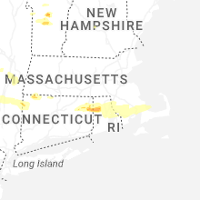
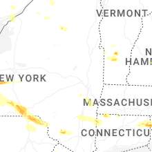
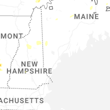
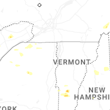
Vermont
| Local Time | Report Details |
|---|---|
| 12:18 PM EDT | Tree down into powerlines on west shore road in south hero/keeler ba in grand isle county VT, 13.6 miles NNW of Burlington, VT |
| 12:40 PM EDT | Two trees fell into the parking lot of votey hall at uvm. one tree fell into a parked car and caused damag in chittenden county VT, 0.7 miles ENE of Burlington, VT |
| 1:50 PM EDT | Tree down on river road in addison county VT, 27.6 miles S of Burlington, VT |
| 4:40 PM EDT | Quarter sized hail reported near Danby, VT, 60.4 miles NE of Schenectady, NY, quarter sized |
| 5:08 PM EDT | Ping Pong Ball sized hail reported near Cuttingsville, VT, 70.1 miles SSE of Burlington, VT, silver dollar size hail reported. |
| 6:25 PM EDT | Storm damage reported in chittenden county VT, 10.7 miles N of Burlington, VT |
| 6:30 PM EDT | Tree down on riverside av in chittenden county VT, 1.3 miles NW of Burlington, VT |
| 6:55 PM EDT | Trees reported down along route 105 in enosbur in franklin county VT, 36 miles NE of Burlington, VT |
| 6:55 PM EDT | Quarter sized hail reported near Richford, VT, 38.9 miles NE of Burlington, VT |
| 7:18 PM EDT | Trees down and powerlines pulled from a house on college stree in washington county VT, 35.8 miles ESE of Burlington, VT |
Pennsylvania
| Local Time | Report Details |
|---|---|
| 2:28 PM EDT | Multiple trees down between lawrenceville and millerto in tioga county PA, 80.6 miles WNW of Scranton, PA |
| 2:33 PM EDT | Tree limbs down on powerlines on 2200 block of village r in schuylkill county PA, 57.5 miles SSW of Scranton, PA |
| 3:13 PM EDT | Multiple trees and wires down on oakhill roa in susquehanna county PA, 39.4 miles N of Scranton, PA |
| 3:16 PM EDT | Tree on a house on east church street and spring avenu in susquehanna county PA, 37.4 miles N of Scranton, PA |
| 3:20 PM EDT | Tree down on house... church street of great bend... as per dispatch feed. tree blocking another road in great bend. radar-estimated tim in susquehanna county PA, 38.9 miles N of Scranton, PA |
| 3:24 PM EDT | Multiple trees and wires down in silver lake townshi in susquehanna county PA, 39.8 miles NNW of Scranton, PA |
| 3:24 PM EDT | Corrects previous tstm wnd dmg report from 3 nw lanesboro. multiple trees and wires down on oakhill roa in susquehanna county PA, 39.4 miles N of Scranton, PA |
| 3:25 PM EDT | Multiple trees and wires down in the are in susquehanna county PA, 37.4 miles N of Scranton, PA |
| 3:35 PM EDT | Tree down on house. trees and wires down blocking roadway as well. via dispatch fee in susquehanna county PA, 36.7 miles N of Scranton, PA |
| 3:35 PM EDT | Another tree down on house... laurel street... susquehanna depot. other trees and wires down nearby in oakland. radar-estimated tim in susquehanna county PA, 37.4 miles N of Scranton, PA |
| 3:35 PM EDT | Update to prior report. 26 instances of various levels of home damage between susquehanna and oakland boros. numerous downed tree in susquehanna county PA, 37.4 miles N of Scranton, PA |
| 3:46 PM EDT | Numerous trees down. time estimated from rada in wayne county PA, 34.6 miles NNE of Scranton, PA |
| 3:48 PM EDT | Multiple trees and lines down from high winds according to buckingham township em. radar-estimated tim in wayne county PA, 33.9 miles NNE of Scranton, PA |
| 3:57 PM EDT | Significant tree and power line damage in the lakewood... lake como... and equinunk area in wayne county PA, 38 miles NE of Scranton, PA |
| 4:08 PM EDT | Tree down over road at wilcox road and galloway road as per dispatch feed. radar-estimated tim in wayne county PA, 36.4 miles NE of Scranton, PA |
| 4:40 PM EDT | Trees down on wires... bending power poles over state route 92. reported via pema. radar-estimated tim in luzerne county PA, 8.9 miles W of Scranton, PA |
| 4:41 PM EDT | Quarter sized hail reported near Lansford, PA, 41.6 miles SSW of Scranton, PA, picture of quarter sized hail sent in. time estimated from radar. |
| 4:43 PM EDT | Trees down on wires on the 400 block of elm street in franklin township. time estimated from rada in carbon county PA, 40 miles S of Scranton, PA |
| 4:45 PM EDT | Trees and wires down with a fire reported on the 400 block of frable dr. time estimated from rada in monroe county PA, 37.7 miles SSE of Scranton, PA |
| 4:52 PM EDT | Trees and wires down around lower towamensing township. time estimated from rada in carbon county PA, 41.1 miles S of Scranton, PA |
| 5:30 PM EDT | Wires down across the area. time estimated from rada in lehigh county PA, 51.8 miles S of Scranton, PA |
| 5:39 PM EDT | Widespread lines down across allen township. time estimated from rada in lehigh county PA, 56.3 miles SSE of Scranton, PA |
| 5:50 PM EDT | Quarter sized hail reported near Bethlehem, PA, 56.4 miles SSE of Scranton, PA, pictures sent in via social media. time given in report. |
| 5:54 PM EDT | Quarter sized hail reported near Summit Hill, PA, 41.5 miles SSW of Scranton, PA, picture sent in of quarter-size hail on social media. time estimated from radar. |
| 6:54 PM EDT | Photo relayed of a large tree lying across rte 662 in perry twp. time estimated from rada in berks county PA, 64.1 miles SSW of Scranton, PA |
| 7:10 PM EDT | Tree downed on vehicle on state stree in dauphin county PA, 63.5 miles SE of State College, PA |
Florida
| Local Time | Report Details |
|---|---|
| 3:35 PM EDT | Several trees down on the northern side of interlachen. time estimated via rada in putnam county FL, 44.6 miles SSW of Jacksonville, FL |
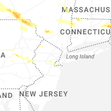
New Jersey
| Local Time | Report Details |
|---|---|
| 3:43 PM EDT | Trees and wires down near halsey road. fire reported. time estimated from rada in sussex county NJ, 47.4 miles ESE of Scranton, PA |
| 3:52 PM EDT | Power lines and power poles downed and on fire near hillcrest road. time estimated from rada in sussex county NJ, 49.9 miles WNW of Brooklyn, NY |
| 3:55 PM EDT | Several trees and wires down around hampton township. time estimated from rada in sussex county NJ, 49.1 miles NW of Brooklyn, NY |
| 3:57 PM EDT | Trees and wires down within stillwater. time estimated from rada in sussex county NJ, 48 miles ESE of Scranton, PA |
| 3:58 PM EDT | Several trees and wires down around newton. time estimated from rada in sussex county NJ, 47.2 miles WNW of Brooklyn, NY |
| 4:00 PM EDT | Pictures of trees down along cr 52 at the top of cummins hill. time estimated from rada in sussex county NJ, 47.9 miles NW of Brooklyn, NY |
| 4:00 PM EDT | Trees down on wires by mile marker 4 on route 623. time estimated from rada in sussex county NJ, 45 miles NW of Brooklyn, NY |
| 4:12 PM EDT | Downed tree on us 206 northbound at south of goodale rd (andover twp)... all lanes closed northbound; 1 right lane of 2 lanes closed southbound. time estimated from rad in sussex county NJ, 45.4 miles WNW of Brooklyn, NY |
| 4:13 PM EDT | Trees and wires down in sparta... nj. time estimated from rada in sussex county NJ, 41.6 miles NW of Brooklyn, NY |
| 5:15 PM EDT | Trained spotter sent in report of 62 mph gust recorded on a personal weather statio in warren county NJ, 52.2 miles W of Brooklyn, NY |
| 5:32 PM EDT | Trees and wires down. time estimated from rada in hunterdon county NJ, 47.3 miles W of Brooklyn, NY |
| 5:35 PM EDT | Trees down across phillipsbur in warren county NJ, 54.8 miles SSE of Scranton, PA |
| 5:37 PM EDT | Trees and wires down. time estimated from rada in hunterdon county NJ, 42 miles W of Brooklyn, NY |
| 5:44 PM EDT | Trees down along i-287 with lane restrictions reported. time estimated from rada in somerset county NJ, 32.6 miles W of Brooklyn, NY |
| 5:47 PM EDT | Trees down across the roadway along madison avenue. time estimated from rada in somerset county NJ, 34.5 miles W of Brooklyn, NY |
| 5:54 PM EDT | Trees and wires down along king george road. time estimated from rada in somerset county NJ, 28.4 miles W of Brooklyn, NY |
| 5:54 PM EDT | Wires down and on fire on watchung road. time estimated from rada in somerset county NJ, 29.6 miles WSW of Brooklyn, NY |
| 5:55 PM EDT | Downed tree on i-78 westbound at west of exit 33 - cr 525/liberty corner rd/martinsville (bernards twp)... 1 right lane of 3 lanes closed. time estimated from rada in somerset county NJ, 31.1 miles W of Brooklyn, NY |
| 6:00 PM EDT | Trees down all over north plainfield. time estimated from rada in somerset county NJ, 23.6 miles WSW of Brooklyn, NY |
| 6:01 PM EDT | Several trees and wires down along andrew street and park avenue in green brook township. time estimated from rada in somerset county NJ, 26.5 miles WSW of Brooklyn, NY |
| 6:03 PM EDT | Green brook road completely blocked with trees down. time estimated from rada in somerset county NJ, 26 miles WSW of Brooklyn, NY |
| 6:05 PM EDT | Pictures shared on social media showed significant tree damage. time estimated from rada in middlesex county NJ, 25.7 miles WSW of Brooklyn, NY |
| 6:05 PM EDT | Treen down hitting moving train in fanwoo in union county NJ, 20.8 miles W of Brooklyn, NY |
| 6:05 PM EDT | Tree down on home on hillside avenu in union county NJ, 22.1 miles WSW of Brooklyn, NY |
| 6:05 PM EDT | Treen down on car on myrtle avenu in union county NJ, 24.3 miles WSW of Brooklyn, NY |
| 6:07 PM EDT | Multiple trees down across north edison. time estimated from rada in middlesex county NJ, 21.4 miles WSW of Brooklyn, NY |
| 6:08 PM EDT | Several large tree limbs down blocking roads around south plainfield. time estimated from rada in middlesex county NJ, 23.9 miles WSW of Brooklyn, NY |
| 6:10 PM EDT | Multiple trees and power lines down. time estimated from rada in middlesex county NJ, 22.1 miles WSW of Brooklyn, NY |
| 6:10 PM EDT | Large tree and some wires down on a vehicle with occupants trapped inside. time estimated from rada in middlesex county NJ, 21.4 miles WSW of Brooklyn, NY |
| 6:13 PM EDT | Trees and wires down along park avenue east of south plainfield. time estimated from rada in middlesex county NJ, 22.6 miles WSW of Brooklyn, NY |
| 6:13 PM EDT | Trees and wires down along tingley lane. time estimated from rada in middlesex county NJ, 21.2 miles WSW of Brooklyn, NY |
| 6:13 PM EDT | Large tree down on wires on annette drive. time estimated from rada in middlesex county NJ, 21.4 miles WSW of Brooklyn, NY |
| 6:15 PM EDT | Measured by a private weather statio in middlesex county NJ, 19 miles WSW of Brooklyn, NY |
| 6:17 PM EDT | Delayed report. trees down and down power lines on route 27. time estimated from rada in middlesex county NJ, 17.7 miles WSW of Brooklyn, NY |
| 6:20 PM EDT | Trees and wires down near park avenue in avenel. time estimated from rada in middlesex county NJ, 17.1 miles WSW of Brooklyn, NY |
| 7:00 PM EDT | Mesonet station fw2099 keypor in monmouth county NJ, 20.6 miles SSW of Brooklyn, NY |
| 7:10 PM EDT | Corrects previous tstm wnd dmg report from delaware twp. trees and wires down. time estimated from rada in hunterdon county NJ, 53.4 miles WSW of Brooklyn, NY |
| 7:16 PM EDT | Trees and wires down. time estimated from rada in hunterdon county NJ, 53.4 miles WSW of Brooklyn, NY |
| 7:29 PM EDT | Tree down on house on woodland avenu in union county NJ, 21.2 miles W of Brooklyn, NY |
Connecticut
| Local Time | Report Details |
|---|---|
| 5:10 PM EDT | Tree snapped and downed on reservoir roa in litchfield county CT, 80 miles W of Providence, RI |
| 5:30 PM EDT | Tree down on center st near indian mountain rd. time estimated from rada in hartford county CT, 65.9 miles W of Providence, RI |
| 5:43 PM EDT | Trees/wires reported down king street and king cour in hartford county CT, 61.9 miles W of Providence, RI |
| 5:45 PM EDT | Trees reported down on wynwood dr and standish s in hartford county CT, 60.4 miles W of Providence, RI |
| 5:50 PM EDT | *** 1 inj *** tree down on vehicle with occupants inside on white plains road at merritt parkway. one injury reporte in fairfield county CT, 56.8 miles NE of Brooklyn, NY |
| 5:50 PM EDT | Large tree and power lines down on merrimac driv in fairfield county CT, 55.1 miles NE of Brooklyn, NY |
| 5:55 PM EDT | Trees and wires downed and laying across route 7. the roadway was closed between bulls bridge road and ct route 34 in litchfield county CT, 72.6 miles NNE of Brooklyn, NY |
| 6:03 PM EDT | Corrects previous tstm wnd dmg report from 3 nnw gaylordsville. trees and wires downed and laying across route 7. the roadway was closed between bulls bridge road and c in litchfield county CT, 72.6 miles NNE of Brooklyn, NY |
| 6:26 PM EDT | Ct dot reports tree down on roadway at ct 188 and benson rd. time estimated from rada in new haven county CT, 70.9 miles NE of Brooklyn, NY |
| 6:33 PM EDT | Report of a number of branches dow in hartford county CT, 68.2 miles W of Providence, RI |
| 6:35 PM EDT | Trees down in town. time estimated from rada in windham county CT, 23.6 miles W of Providence, RI |
| 6:40 PM EDT | Quarter sized hail reported near Danielson, CT, 23.6 miles W of Providence, RI, quarter size hail. time estimated from radar. |
| 6:40 PM EDT | Quarter sized hail reported near Danielson, CT, 25.4 miles W of Providence, RI, corrects previous hail report from danielson. quarter size hail. |
| 6:45 PM EDT | Golf Ball sized hail reported near Sterling, CT, 21.5 miles WSW of Providence, RI, golf ball sized hail was reported which destroyed a gazebo. |
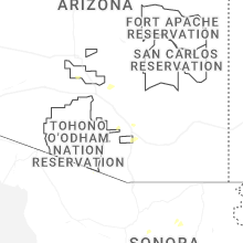
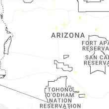
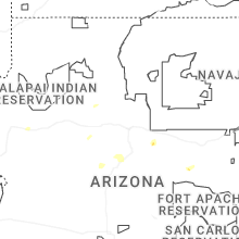
Arizona
| Local Time | Report Details |
|---|---|
| 2:30 PM MST | Palm tree knocked down due to thunderstorm winds. storm also had nickel sized hai in pima county AZ, 4.4 miles NE of Tucson, AZ |
| 2:30 PM MST | Quarter sized hail reported near Dewey, AZ, 59.5 miles SW of Flagstaff, AZ, location estimated... size estimated from social media picture. |
| 3:30 PM MST | Quarter sized hail reported near Cornville, AZ, 36.1 miles SSW of Flagstaff, AZ, from social media. location estimated. |
| 3:30 PM MST | Quarter sized hail reported near Cornville, AZ, 36.3 miles SSW of Flagstaff, AZ, corrects location of previous hail report from cornville. from social media. |
| 5:50 PM MST | Storm damage reported in pinal county AZ, 49 miles SE of Phoenix, AZ |
| 5:55 PM MST | Downed power lines resulting in road closure. time estimated based on rada in pinal county AZ, 48.2 miles SE of Phoenix, AZ |
Michigan
| Local Time | Report Details |
|---|---|
| 5:30 PM EDT | Numerous 1-2 inch diameter tree branches down in eaton rapid in eaton county MI, 60.3 miles ESE of Grand Rapids, MI |
Rhode Island
| Local Time | Report Details |
|---|---|
| 6:45 PM EDT | Quarter sized hail reported near Foster, RI, 16.1 miles W of Providence, RI, in foster... quarter sized hail fell. |
| 7:12 PM EDT | Storm damage reported in kent county RI, 7.2 miles S of Providence, RI |
| 7:15 PM EDT | Measured by anemometer. wind caused minor damage to a street sig in kent county RI, 8.9 miles SSW of Providence, RI |
| 7:15 PM EDT | Dozens of trees down across the city... including 2 dozen in roger williams park. utility pole also downe in providence county RI, 3 miles S of Providence, RI |
| 7:25 PM EDT | Tree on a vehicle on county road. time estimated from rada in bristol county RI, 6.1 miles SE of Providence, RI |
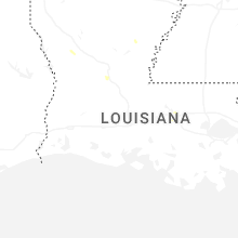
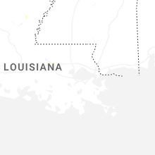
Louisiana
| Local Time | Report Details |
|---|---|
| 5:54 PM CDT | Tree down on highway 117... south of provenca in natchitoches county LA, 69.5 miles SSE of Shreveport, LA |
| 6:38 PM CDT | Report of utility lines down on martin springs r in rapides county LA, 65.3 miles NNW of Lafayette, LA |
| 6:39 PM CDT | Tree on power lines on cappel r in rapides county LA, 82.9 miles NNW of Lafayette, LA |
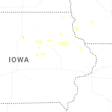
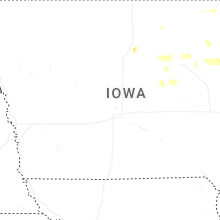
Iowa
| Local Time | Report Details |
|---|---|
| 6:18 PM CDT | Personal weather statio in grundy county IA, 58.8 miles SSE of Mason City, IA |
| 6:19 PM CDT | Six inch tree limbs broken in grundy center. time estimated by rada in grundy county IA, 58.6 miles SSE of Mason City, IA |
| 8:25 PM CDT | Quarter sized hail reported near Manchester, IA, 39.1 miles NNE of Cedar Rapids, IA, hail ranging from half inch to quarter size. |
| 8:30 PM CDT | Quarter sized hail reported near Manchester, IA, 36.5 miles NNE of Cedar Rapids, IA |
Massachusetts
| Local Time | Report Details |
|---|---|
| 7:29 PM EDT | Numerous small branches and limbs blown dow in bristol county MA, 13 miles ESE of Providence, RI |
| 7:30 PM EDT | Numerous trees... branches and power lines down across the city. at least one car damaged due to fallen branc in bristol county MA, 15.5 miles ESE of Providence, RI |
| 7:30 PM EDT | In fall river... a building that was under renovation has a portion of the facade of the building collaps in bristol county MA, 15.6 miles ESE of Providence, RI |
| 7:30 PM EDT | In fall river... several trees and large branches were down including one tree on a ca in bristol county MA, 16 miles ESE of Providence, RI |
| 7:35 PM EDT | Tree blocking part of a lane on i-195. time estimated from rada in bristol county MA, 20.2 miles ESE of Providence, RI |
| 7:50 PM EDT | Tree down... blocking hamlin stree in bristol county MA, 27.5 miles ESE of Providence, RI |
| 7:50 PM EDT | In acushnet... several trees were down including on a few car in bristol county MA, 27.8 miles ESE of Providence, RI |
| 7:50 PM EDT | In acushnet there was several trees dow in bristol county MA, 26.8 miles ESE of Providence, RI |
| 7:50 PM EDT | In new bedford... there was a tree down blocking puritan wa in bristol county MA, 24.9 miles ESE of Providence, RI |
| 8:09 PM EDT | A weather flow station at angelica point gusted to 62 mp in plymouth county MA, 35.5 miles ESE of Providence, RI |
| 8:15 PM EDT | In bourne... a tree was down on shore rd. relayed by amateur radi in barnstable county MA, 42.6 miles ESE of Providence, RI |
| 8:20 PM EDT | In plymouth... several trees were down on white island rd and a tree was down on sandy beach r in plymouth county MA, 40.9 miles E of Providence, RI |
Idaho
| Local Time | Report Details |
|---|---|
| 5:40 PM MDT | Medium tree... approximately 1 foot in diameter... with shallow roots blown over in estimated 45 mph outflow winds. station elevation: 4926 f in fremont county ID, 35.3 miles NNE of Idaho Falls, ID |
| 10:00 PM MDT | Mesonet station msi04 pilot gol in cassia county ID, 81.5 miles ESE of Twin Falls, ID |
Oregon
| Local Time | Report Details |
|---|---|
| 7:00 PM PDT | Quarter sized hail reported near Ashland, OR, 17.8 miles SE of Medford, OR, public reported 1.00 inch (quarter size) hail at emigrant lake. |
| 9:31 PM PDT | Mesonet station od152 2.6 ne burns (odot in harney county OR, 2.4 miles NE of Burns, OR |
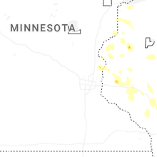
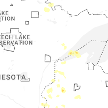
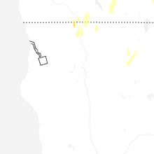
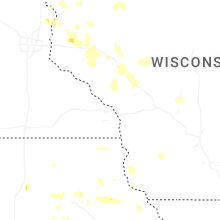
Minnesota
| Local Time | Report Details |
|---|---|
| 9:43 PM CDT | Quarter sized hail reported near Chisago City, MN, 30.1 miles NE of Minneapolis, MN, report from mping: quarter (1.00 in.). |
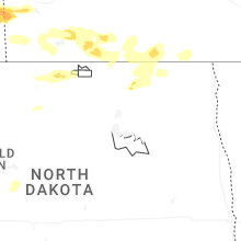
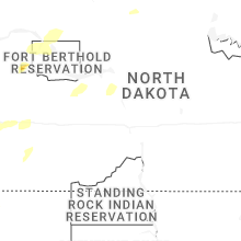
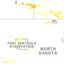
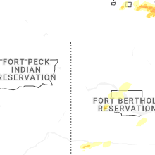
North Dakota
| Local Time | Report Details |
|---|---|
| 8:45 PM MDT | 10 meter wind gust from ndawn statio in stark county ND, 94.8 miles SSE of Williston, ND |
| 12:19 AM CDT | 10 m gust at ndawn station 5 wsw parshal in mountrail county ND, 48.4 miles WSW of Minot, ND |
| 12:20 AM CDT | Estimated 70-90 mph winds (based on observations immediately to the east) impacted parshall bay recreational area. fire and emergency management reported 2 camper trail in mountrail county ND, 50.9 miles WSW of Minot, ND |
| 12:24 AM CDT | 10 m gust at ndawn station 5 wsw parshal in mountrail county ND, 48.4 miles WSW of Minot, ND |
| 12:30 AM CDT | Camper was blown over. no other details on damage at this tim in mountrail county ND, 45.4 miles WSW of Minot, ND |
| 11:33 PM MDT | Asos station kdik dickinson airpor in stark county ND, 95.9 miles W of Bismarck, ND |
| 1:00 AM CDT | Private weather station southeast of parshal in mountrail county ND, 43.2 miles WSW of Minot, ND |
| 2:20 AM CDT | Edinburg... nd-32 nd dot rwis statio in walsh county ND, 53.2 miles ENE of Devils Lake, ND |
South Dakota
| Local Time | Report Details |
|---|---|
| 9:13 PM MDT | Storm damage reported in harding county SD, 106 miles N of Rapid City, SD |
| 9:23 PM MDT | Storm damage reported in harding county SD, 106 miles N of Rapid City, SD |
| 9:45 PM MDT | Storm damage reported in harding county SD, 109.7 miles ESE of Miles City, MT |
Wisconsin
| Local Time | Report Details |
|---|---|
| 11:22 PM CDT | Trees downed across county road ff near osse in jackson county WI, 50.4 miles N of La Crosse, WI |
| 11:44 PM CDT | Trees downed around county highway h and mcnab roa in jackson county WI, 33.5 miles NNE of La Crosse, WI |
| 12:07 AM CDT | Trees down around us highway 12 and lambert roa in jackson county WI, 38.6 miles NE of La Crosse, WI |
| 12:15 AM CDT | Dispatch reported the power company had 15 power lines down along crosstown road ese of grantsburg. time estimated based on rada in burnett county WI, 63.2 miles NNE of Minneapolis, MN |
| 1:37 AM CDT | Dispatch reported a tree down. time estimated based on rada in burnett county WI, 67.2 miles S of Duluth, MN |
| 1:37 AM CDT | Dispatch reported multiple trees down. time estimated based on rada in burnett county WI, 66.7 miles S of Duluth, MN |
| 3:38 AM CDT | Quarter sized hail reported near Shell Lake, WI, 70.8 miles S of Duluth, MN, trained spotter reported hail the size of a quarter along with heavy rainfall. storm total rainfall has been 2.8 inches over 3.5 hours of time at the time of the call. |
Connect with Interactive Hail Maps