

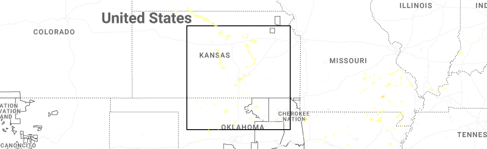
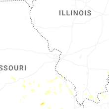
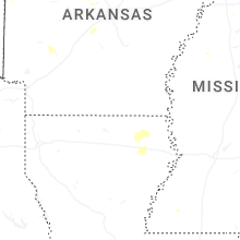
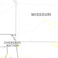
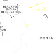
Hail Map for Tuesday, August 19, 2025
Number of Impacted Households on 8/19/2025
0
Impacted by 1" or Larger Hail
0
Impacted by 1.75" or Larger Hail
0
Impacted by 2.5" or Larger Hail
Square Miles of Populated Area Impacted on 8/19/2025
0
Impacted by 1" or Larger Hail
0
Impacted by 1.75" or Larger Hail
0
Impacted by 2.5" or Larger Hail


Cities Most Affected by Hail Storms of 8/19/2025
| Hail Size | Demographics of Zip Codes Affected | ||||||
|---|---|---|---|---|---|---|---|
| City | Count | Average | Largest | Pop Density | House Value | Income | Age |
Hail and Wind Damage Spotted on 8/19/2025
Filter by Report Type:Hail ReportsWind Reports
States Impacted
Texas, Arkansas, Kansas, Missouri, Indiana, Oklahoma, Illinois, Ohio, Kentucky, Mississippi, Louisiana, MontanaTexas
| Local Time | Report Details |
|---|---|
| 8:18 AM CDT | Photo sent by harris county pct 4 employee showing trees down on waller spring creek rd. time estimated from rada in harris county TX, 37.2 miles NW of Houston, TX |
| 12:54 PM CDT | A 58 mph gust was measured by station anpt in gmz232 county TX, 18.8 miles E of Corpus Christi, TX |
| 2:40 PM CDT | Corrects previous tstm wnd dmg report from inks lake state park. pictures of a multi-trunked tree split at inks lake state park. the park has an anemometer that measure in burnet county TX, 46.2 miles SW of Killeen, TX |
| 2:55 PM CDT | Trained spotter reported damaging winds 1 mile to the north of clyde... tx. he received some damage to his hous in callahan county TX, 14.2 miles E of Abilene, TX |
| 4:20 PM CDT | The sutton county sheriffs office reported numerous roofs blown off... power poles are down... and numerous large trees are down just south of sonora off of u.s. hwy 27 in sutton county TX, 83.6 miles N of Del Rio, TX |
| 4:25 PM CDT | Corrects previous tstm wnd dmg report from 1 wnw natalia. there was damage on 5th and 6th streets in natalia. several trees were knocked down and took down power line in medina county TX, 27.8 miles SW of San Antonio, TX |
| 4:30 PM CDT | A multi-trunk tree was split and knocked over a street ligh in bexar county TX, 15.6 miles N of San Antonio, TX |
| 5:15 PM CDT | A few small trees down and metal traffic signs bent near st. marys universit in bexar county TX, 4.9 miles WNW of San Antonio, TX |
| 10:52 PM CDT | Storm damage reported in sherman county TX, 64.4 miles N of Amarillo, TX |
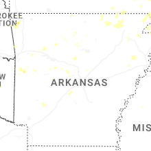
Arkansas
| Local Time | Report Details |
|---|---|
| 12:45 PM CDT | Large tree fell on home in the athens community on highway 84. also... some hail was reported with this storm... but size unknow in howard county AR, 25.9 miles NNW of Nashville, AR |
| 1:41 PM CDT | Multiple trees and powerlines blown down in the general area. near this specific point... there were a couple of roofs damaged by thunderstorm winds. near oaklawn there in garland county AR, 51.1 miles WSW of Little Rock, AR |
| 6:45 PM UTC | Several trees were blown dow in conway county AR, 45.8 miles NNW of Little Rock, AR |
| 3:20 PM CDT | Trees blown down in this are in saline county AR, 19.4 miles WSW of Little Rock, AR |
| 3:40 PM CDT | Trees were blown dow in saline county AR, 16 miles SSW of Little Rock, AR |
| 3:58 PM CDT | Lawrence county oem reports trees down in black rock due to winds associated with nearby storm in lawrence county AR, 88.8 miles NW of Memphis, TN |
| 4:19 PM CDT | A couple of trees down in the city limits. time is radar estimate in clay county AR, 73 miles SSW of Cape Girardeau, MO |
| 4:40 PM CDT | Tree down on a camper near monte ne. time estimated from radar. photo shared via broadcast media social media accoun in benton county AR, 65.5 miles NNE of Fort Smith, AR |
| 4:40 PM CDT | Destroyed outbuilding. time estimated via radar. video relayed via broadcast media social media accoun in benton county AR, 66.2 miles NNE of Fort Smith, AR |
| 5:00 PM CDT | Tree down at the intersection of 10th and hear in mississippi county AR, 54.4 miles N of Memphis, TN |
| 5:50 PM CDT | Tree and powerlines down on highway 42 in the city limits. time is radar estimate in cross county AR, 42.7 miles WNW of Memphis, TN |
| 6:30 PM CDT | Downed trees and powerlines around gentry. time estimated from radar. info relayed by local broadcast medi in benton county AR, 61.1 miles N of Fort Smith, AR |
| 6:35 PM CDT | Trees dow in benton county AR, 69.6 miles SW of Springfield, MO |
| 7:25 PM CDT | Quarter sized hail reported near Gentry, AR, 60.5 miles N of Fort Smith, AR |
| 7:30 PM CDT | Fence blown dow in washington county AR, 52.1 miles NNE of Fort Smith, AR |
| 7:35 PM CDT | Limbs and power lines dow in washington county AR, 52.6 miles NNE of Fort Smith, AR |
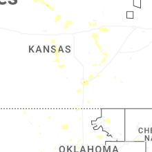
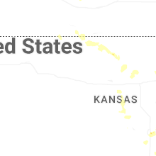
Kansas
| Local Time | Report Details |
|---|---|
| 12:54 PM CDT | Metal building damaged (specifics on size and extent of damage unknown). delayed report and time estimated by rada in dickinson county KS, 37.1 miles SSW of Manhattan, KS |
| 1:00 PM CDT | Several outbuildings destroyed. time estimated from rada in morris county KS, 35.3 miles SSW of Manhattan, KS |
| 1:04 PM CDT | 10-12 inch tree limbs down on the north side of tow in dickinson county KS, 40 miles SSW of Manhattan, KS |
| 1:07 PM CDT | Large tree limbs down across junction city (unknown diameter). power outages reported. wind gust estimates 60-70 mp in geary county KS, 17.7 miles SW of Manhattan, KS |
| 1:10 PM CDT | 4-6 inch tree limbs dow in geary county KS, 13.9 miles WSW of Manhattan, KS |
| 3:09 PM CDT | Quarter sized hail reported near Wichita, KS, 3.6 miles ESE of Wichita, KS, report from mping: quarter (1.00 in.). |
| 3:10 PM CDT | Storm damage reported in butler county KS, 30.7 miles ENE of Wichita, KS |
| 3:16 PM CDT | Quarter sized hail reported near Wichita, KS, 7.4 miles E of Wichita, KS |
| 3:18 PM CDT | Half Dollar sized hail reported near Wichita, KS, 4.4 miles SE of Wichita, KS, report from mping: half dollar (1.25 in.). |
| 3:28 PM CDT | Quarter sized hail reported near Wichita, KS, 5.3 miles S of Wichita, KS, report from mping: quarter (1.00 in.). |
| 3:29 PM CDT | Quarter sized hail reported near Glen Elder, KS, 68.7 miles NE of Hays, KS, spotter reports quarter sized hail near glen elder. |
| 3:44 PM CDT | Storm damage reported in reno county KS, 43.6 miles NW of Wichita, KS |
| 5:44 PM CDT | Kzlf_transmitter_sit in barber county KS, 56.4 miles NE of Woodward, OK |
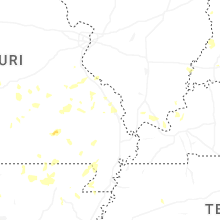
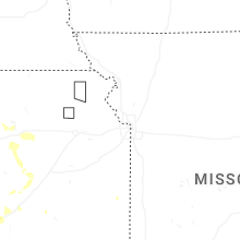
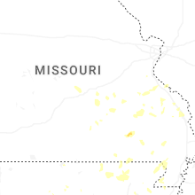
Missouri
| Local Time | Report Details |
|---|---|
| 1:46 PM CDT | A few trees down between cape girardeau and jackson. observed wind gusts estimated between 40-60 mp in cape girardeau county MO, 6.1 miles NW of Cape Girardeau, MO |
| 2:00 PM CDT | Wind blew down a large portion of a tre in cape girardeau county MO, 7.2 miles WNW of Cape Girardeau, MO |
| 2:00 PM CDT | Large amount of corn blown over due to strong winds near intersection of cr 638 and 61 in cape girardeau county MO, 5.4 miles N of Cape Girardeau, MO |
| 2:05 PM CDT | Two reports of estimated gusts to around 60 mph in cape girardea in cape girardeau county MO, 0.8 miles ESE of Cape Girardeau, MO |
| 2:31 PM CDT | Quarter sized hail reported near Van Buren, MO, 52 miles SE of Salem, MO, 50-55 mph wind gusts also reported. |
| 2:45 PM CDT | Movie theater screen damaged at the 21 drive inn northeast of van buren due to strong wind in carter county MO, 53.7 miles SE of Salem, MO |
| 2:45 PM CDT | Garage door blown in near home depo in butler county MO, 61.2 miles SW of Cape Girardeau, MO |
| 3:20 PM CDT | Fences down... playsets damaged... and shingle damage on homes at township line rd/cr-46 in butler county MO, 64.2 miles SW of Cape Girardeau, MO |
| 4:37 PM CDT | Tree down on east commercial s in dunklin county MO, 75.2 miles N of Memphis, TN |
| 4:52 PM CDT | Tree down between senath and carut in dunklin county MO, 67.7 miles N of Memphis, TN |
Indiana
| Local Time | Report Details |
|---|---|
| 2:47 PM EDT | Multiple trees down... one of which fell on powerline in shelby county IN, 26.9 miles SE of Indianapolis, IN |
| 6:55 PM EDT | Storm damage reported in orange county IN, 61.8 miles NW of Louisville, KY |
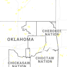
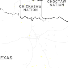
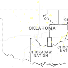
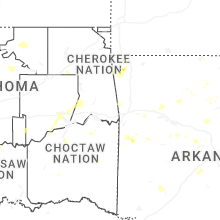
Oklahoma
| Local Time | Report Details |
|---|---|
| 2:39 PM CDT | Lawton municipal airpor in comanche county OK, 45.8 miles N of Wichita Falls, TX |
| 3:20 PM CDT | Power poles snapped and some leaning along stretch of 1st street/jennings road east to sw 177th street. time estimated from rada in comanche county OK, 36.2 miles NNW of Wichita Falls, TX |
| 4:33 PM CDT | Personal weather station measured 67 mph wind gus in kingfisher county OK, 36.9 miles NW of Oklahoma City, OK |
| 4:40 PM CDT | Rolled over rvs... peeled roofs on houses... and roofs removed from barn in kingfisher county OK, 39 miles NW of Oklahoma City, OK |
| 5:30 PM CDT | 59 mph gust measured by the oklahoma mesonet site 3 miles southeast of stuar in pittsburg county OK, 34.2 miles N of Atoka, OK |
| 6:10 PM CDT | Power lines downed. time estimate in garfield county OK, 53.2 miles NNW of Oklahoma City, OK |
| 6:21 PM CDT | Large tree downe in oklahoma county OK, 5.5 miles NNW of Oklahoma City, OK |
Illinois
| Local Time | Report Details |
|---|---|
| 3:02 PM CDT | Tree fell onto bassett school r in hardin county IL, 53.8 miles SW of Evansville, IN |
| 4:35 PM CDT | 4 to 6 inch diameter tree branches blown down... one limb taking a power line with it. intersection of il-1 and county road 880 in lawrence county IL, 50.3 miles N of Evansville, IN |
Ohio
| Local Time | Report Details |
|---|---|
| 4:10 PM EDT | Corrects previous tstm wnd dmg report from 1 se north college hill. large tree down near the intersection of edwood ave and north bend rd -- time estimate in hamilton county OH, 6.7 miles NNW of Cincinnati, OH |
| 5:15 PM EDT | Large tree down near the intersection of edwood ave and north bend rd -- time estimate in hamilton county OH, 6.7 miles NNW of Cincinnati, OH |
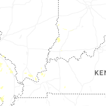
Kentucky
| Local Time | Report Details |
|---|---|
| 4:15 PM EDT | Six trees fell on parker lane property. time estimated from rada in boone county KY, 15.4 miles SW of Cincinnati, OH |
| 4:20 PM EDT | Large tree fell on/near a hous in boone county KY, 15.5 miles SW of Cincinnati, OH |
| 4:31 PM CDT | Tree down on a house near ky-408/ky-1241. tree in the roadway at ky-1241/beasley loo in graves county KY, 50.7 miles N of Mc Kenzie, TN |
| 4:45 PM CDT | Corrects previous tstm wnd dmg report from 2 sse folsomdale. tree down on a house near ky-408/ky-1241. tree in the roadway at ky-1241/beasley loo in graves county KY, 50.7 miles N of Mc Kenzie, TN |
| 7:18 PM EDT | Tree fell on building on the 7500 block of dunwoody court. sdf gusted to 37 mp in jefferson county KY, 10.6 miles N of Louisville, KY |
| 8:34 PM EDT | Damage to a fence and broken tree limbs at the overlook at eastwood. time from rada in jefferson county KY, 23.2 miles NE of Louisville, KY |
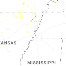
Mississippi
| Local Time | Report Details |
|---|---|
| 6:58 PM CDT | A couple of trees down on itasca drive. time is radar estimate in desoto county MS, 19.6 miles SSE of Memphis, TN |
| 8:32 PM CDT | Greenville asos site measured a 59 mph gus in washington county MS, 66 miles NE of Bastrop, LA |
| 8:32 PM CDT | Corrects previous tstm wnd gst report from greenville. greenville asos site measured a 59 mph gus in washington county MS, 72.2 miles NE of Bastrop, LA |
| 8:50 PM CDT | Law enforcement reported multiple trees down within the city limit in washington county MS, 66 miles NE of Bastrop, LA |
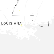
Louisiana
| Local Time | Report Details |
|---|---|
| 9:12 PM CDT | Thunderstorm winds blew off part of a tin roof on a house in spearsvill in union county LA, 41.7 miles WNW of Bastrop, LA |
| 10:05 PM CDT | A utility pole was broken near jaggers ln and wade r in richland county LA, 25.5 miles SE of Bastrop, LA |
Montana
| Local Time | Report Details |
|---|---|
| 9:45 PM MDT | Ambient statio in teton county MT, 45.2 miles W of Great Falls, MT |
| 9:55 PM MDT | Ambient weather statio in teton county MT, 43.4 miles W of Great Falls, MT |
| 10:05 PM MDT | Awos station k1hm 6 nne fairfiel in teton county MT, 32.9 miles WNW of Great Falls, MT |
| 10:30 PM MDT | Corrects previous non-tstm wnd gst report from 5 wsw great falls. asos station kgtf great falls airpor in cascade county MT, 4.3 miles SW of Great Falls, MT |
| 10:34 PM MDT | Ambient weather statio in cascade county MT, 1.7 miles NNW of Great Falls, MT |
| 10:40 PM MDT | Ambient weather station. sustained winds were 57 mph at the time of observatio in pondera county MT, 40.9 miles NNW of Great Falls, MT |
| 10:43 PM MDT | Ambient weather station. sustained winds were 55 mph at the time of observatio in cascade county MT, 5.9 miles NE of Great Falls, MT |
| 10:50 PM MDT | Ambient weather station. sustained winds were 57 mph at the time of observatio in pondera county MT, 36.5 miles N of Great Falls, MT |
| 11:25 PM MDT | Mesonet station gw1986 lothair 9 in liberty county MT, 70.2 miles W of Havre, MT |
| 11:30 PM MDT | Mesonet station gw1952 riverview colon in liberty county MT, 48.2 miles NNE of Great Falls, MT |
| 11:30 PM MDT | Mesonet station gw1986 lothair 9 in liberty county MT, 70.2 miles W of Havre, MT |
| 11:45 PM MDT | Mesonet station gw3478 tctibe in liberty county MT, 63 miles N of Great Falls, MT |
| 12:00 AM MDT | Big sandy mt mesone in chouteau county MT, 43.6 miles SW of Havre, MT |
| 12:15 AM MDT | Mesonet station ew1937 goldston in hill county MT, 47.2 miles WNW of Havre, MT |
| 12:35 AM MDT | Mesonet station gw6391 gildford 10 in hill county MT, 29.5 miles WNW of Havre, MT |
| 1:15 AM MDT | Blm cherry ridg in blaine county MT, 32.5 miles ENE of Havre, MT |
Connect with Interactive Hail Maps