

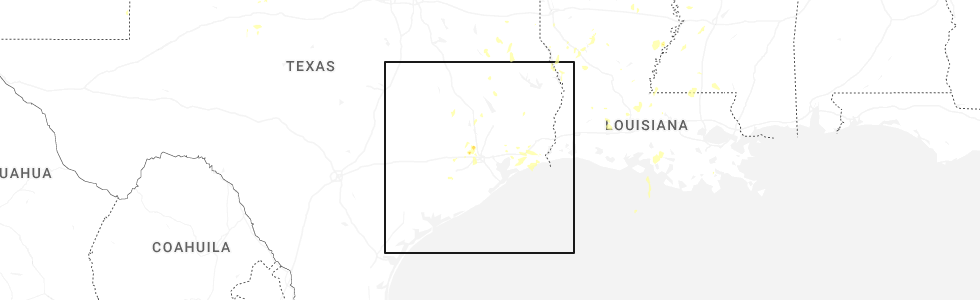
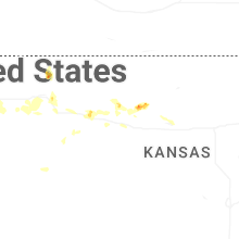
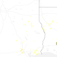
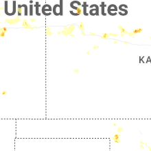
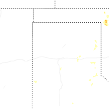
Hail Map for Monday, August 18, 2025
Number of Impacted Households on 8/18/2025
0
Impacted by 1" or Larger Hail
0
Impacted by 1.75" or Larger Hail
0
Impacted by 2.5" or Larger Hail
Square Miles of Populated Area Impacted on 8/18/2025
0
Impacted by 1" or Larger Hail
0
Impacted by 1.75" or Larger Hail
0
Impacted by 2.5" or Larger Hail
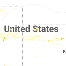
Cities Most Affected by Hail Storms of 8/18/2025
| Hail Size | Demographics of Zip Codes Affected | ||||||
|---|---|---|---|---|---|---|---|
| City | Count | Average | Largest | Pop Density | House Value | Income | Age |
| Rapid City, SD | 3 | 2.92 | 3.25 | 111 | $119k | $47.4k | 44.3 |
Hail and Wind Damage Spotted on 8/18/2025
Filter by Report Type:Hail ReportsWind Reports
States Impacted
Missouri, Louisiana, South Dakota, Colorado, Illinois, Texas, North Dakota, Iowa, Alabama, Kansas, Oklahoma, Nebraska, Minnesota, FloridaMissouri
| Local Time | Report Details |
|---|---|
| 9:05 AM CDT | Many tree limbs blown down... taking down power lines. roof damage to two building in audrain county MO, 28.2 miles ENE of Columbia, MO |
| 4:00 PM CDT | A tree fell down on a home in dixo in pulaski county MO, 39.3 miles NW of Salem, MO |
| 4:12 PM CDT | Trees were down due to downburst winds across goff creek road. time was estimated via rada in christian county MO, 23.4 miles S of Springfield, MO |
| 4:50 PM CDT | A car port was rolled and damaged and large limbs up to 8 inches in diameter were reported dow in webster county MO, 19.7 miles E of Springfield, MO |
| 4:58 PM CDT | A large tree was reported down blocking the east bound lane of highway ff near the intersection of bell ford roa in webster county MO, 21.2 miles E of Springfield, MO |
| 5:05 PM CDT | 8 inch tree limb down along karen ann circl in franklin county MO, 44.9 miles NNE of Salem, MO |
| 5:05 PM CDT | Multiple trees down along spring bluff rd and hwy 18 in franklin county MO, 45.9 miles NNE of Salem, MO |
| 5:08 PM CDT | 10-12 inch diameter tree limb down along george stree in franklin county MO, 44.9 miles NNE of Salem, MO |
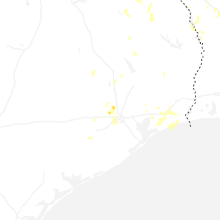
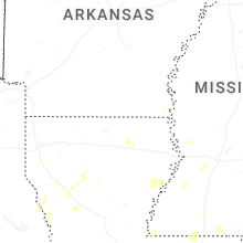
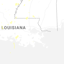
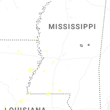
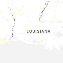
Louisiana
| Local Time | Report Details |
|---|---|
| 2:35 PM CDT | A few trees and powerlines reported down along chenal roa in pointe coupee county LA, 49.6 miles NE of Lafayette, LA |
| 4:25 PM CDT | 3 power poles broken near crowley. 1...976 customers with out power in slemco's are in acadia county LA, 21.7 miles W of Lafayette, LA |
| 4:30 PM CDT | 2 powerpoles broken... shed moved... and partial roof damage in the estherwood are in acadia county LA, 26.6 miles W of Lafayette, LA |
| 5:53 PM CDT | A tree fell onto a house on ed edelen road. a tree was also downed on stubbs vinson roa in ouachita county LA, 16.7 miles S of Bastrop, LA |
| 6:45 PM CDT | Trees and power lines down along highway 6 east near highway 486 near grand ecore. trees and power lines were also downed on tauzin island road near grand ecor in natchitoches county LA, 62.2 miles SE of Shreveport, LA |
| 7:25 PM CDT | Trees and power lines down on robeline provencal road near provenca in natchitoches county LA, 66.5 miles SSE of Shreveport, LA |
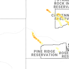
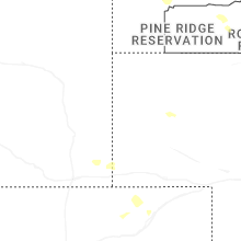
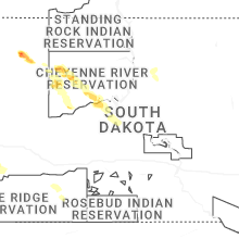
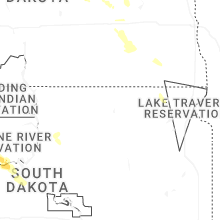
South Dakota
| Local Time | Report Details |
|---|---|
| 2:15 PM MDT | Quarter sized hail reported near Nemo, SD, 16.1 miles WNW of Rapid City, SD, 1/2 inch to 1 inch hail |
| 2:40 PM MDT | Tea Cup sized hail reported near Rapid City, SD, 15 miles W of Rapid City, SD, measured 2 to 3 inch hail stones. |
| 2:55 PM MDT | Tea Cup sized hail reported near Rapid City, SD, 12.5 miles W of Rapid City, SD |
| 3:00 PM MDT | Ping Pong Ball sized hail reported near Rapid City, SD, 10.4 miles W of Rapid City, SD, mping report |
| 3:10 PM MDT | Tennis Ball sized hail reported near Rapid City, SD, 8.5 miles W of Rapid City, SD, rear window of vehicle has several holes in it. |
| 3:27 PM MDT | Quarter sized hail reported near Rapid City, SD, 5.1 miles SW of Rapid City, SD, mping report |
| 3:37 PM MDT | Quarter sized hail reported near Rapid City, SD, 4.2 miles S of Rapid City, SD, mping report |
| 4:15 PM MDT | Sdsu mesonet in ziebach county SD, 75 miles NW of Pierre, SD |
| 4:20 PM MDT | Storm damage reported in dewey county SD, 72.9 miles NW of Pierre, SD |
| 4:22 PM MDT | Damage to flag in dewey county SD, 69.6 miles NW of Pierre, SD |
| 4:26 PM MDT | Ping Pong Ball sized hail reported near Hermosa, SD, 21.2 miles SSE of Rapid City, SD |
| 5:21 PM MDT | Per pw in dewey county SD, 48.4 miles NW of Pierre, SD |
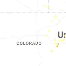
Colorado
| Local Time | Report Details |
|---|---|
| 2:22 PM MDT | Pws-kcowatki1 in arapahoe county CO, 23.7 miles ESE of Denver, CO |
| 2:47 PM MDT | Asos station klic limo in lincoln county CO, 77.3 miles SW of Yuma, CO |
| 3:38 PM MDT | Site kcoflagl13 measured 60 mph wind gus in kit carson county CO, 54.7 miles SSW of Yuma, CO |
| 3:54 PM MDT | Corrects previous tstm wnd gst report from 7 nnw flagler. kcoflagl13 on wunderground reported the wind gus in kit carson county CO, 54.7 miles SSW of Yuma, CO |
| 4:13 PM MDT | Site livingston ag seibert measured 61 mph wind gus in kit carson county CO, 46.3 miles S of Yuma, CO |
| 4:33 PM MDT | Quarter sized hail reported near Vona, CO, 51 miles S of Yuma, CO, trained spotter reported hail ranging in size from pea to quarters in size. |
| 5:01 PM MDT | Awos station kako akro in washington county CO, 26.6 miles W of Yuma, CO |
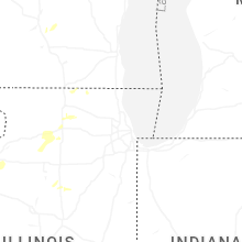
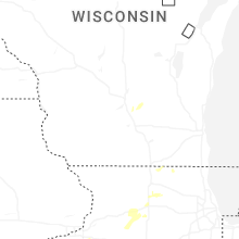
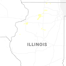
Illinois
| Local Time | Report Details |
|---|---|
| 3:48 PM CDT | Tree damage around genoa... north and south of town. time estimated from rada in de kalb county IL, 56.5 miles WNW of Chicago, IL |
| 3:50 PM CDT | Many trees down northeast of genoa along ash road between north state and illinois route 23. damage includes poles... trees and wires. time estimated from rada in de kalb county IL, 55.8 miles WNW of Chicago, IL |
| 3:52 PM CDT | Large tree across the whole road... illinois 23 north of illinois 72... northeast of genoa. time estimated from rada in de kalb county IL, 54.5 miles WNW of Chicago, IL |
| 4:06 PM CDT | Three power poles down on old state road between five points road and church rd west of sycamore. time estimated from rada in de kalb county IL, 58.2 miles W of Chicago, IL |
| 5:18 PM CDT | Power lines down in coal valle in rock island county IL, 69 miles NW of Peoria, IL |
| 5:25 PM CDT | Trees and power lines down in tow in mercer county IL, 70.2 miles WNW of Peoria, IL |
| 5:26 PM CDT | 2-4 inch diameter branch down just south of 36th avenue cour in rock island county IL, 70.4 miles NW of Peoria, IL |
| 5:30 PM CDT | Tree down blocking the intersection of u.s. 6 and highway 8 in henry county IL, 66.6 miles NW of Peoria, IL |
| 5:45 PM CDT | Trees and power lines down with some roads blocke in carroll county IL, 73 miles SSW of Madison, WI |
| 5:50 PM CDT | Tree down at stewart and wells street in henry county IL, 60.8 miles NNW of Peoria, IL |
| 6:11 PM CDT | Report of several small branches generally between 1 to 2 inches in diameter down in freepor in stephenson county IL, 55.4 miles SSW of Madison, WI |
| 6:20 PM CDT | Several 6 to 7 inch diameter tree limbs were knocked down with some blocking a street in southern freeport for a time. time estimated by rada in stephenson county IL, 56.9 miles SSW of Madison, WI |
| 7:50 PM CDT | Estimated 50 to 60 mph wind gust in knox county IL, 35.9 miles W of Peoria, IL |
| 7:52 PM CDT | Severe winds lasted 2-3 minute in knox county IL, 35.9 miles W of Peoria, IL |
| 8:18 PM CDT | Storm damage reported in will county IL, 34.4 miles WSW of Chicago, IL |
| 8:58 PM CDT | Large tree branch broken off near the intersection of s. 8th st. and prince s in tazewell county IL, 9.5 miles SSW of Peoria, IL |
| 9:05 PM CDT | North side of peori in peoria county IL, 3.4 miles N of Peoria, IL |
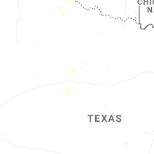
Texas
| Local Time | Report Details |
|---|---|
| 4:00 PM CDT | Report of trees down in the 2200 block of north pecan stree in nacogdoches county TX, 19.5 miles NNE of Lufkin, TX |
| 4:04 PM CDT | Report of a tree down on the 1200 block of woodbine stree in nacogdoches county TX, 18.6 miles N of Lufkin, TX |
| 5:26 PM CDT | West texas mesone in hockley county TX, 29.4 miles W of Lubbock, TX |
| 7:40 PM CDT | Quarter sized hail reported near Houston, TX, 17.6 miles NNW of Houston, TX, storm spotter reported marble to quarter size hail near fm 1960 and veterans memorial drive. |
| 7:40 PM CDT | Quarter sized hail reported near Spring, TX, 19.4 miles NNW of Houston, TX, fort bend emergency manager reported golf ball size hail in champions forest. |
| 8:08 PM CDT | Half Dollar sized hail reported near Houston, TX, 17.1 miles NNW of Houston, TX, report from mping: half dollar (1.25 in.). |
| 8:36 PM CDT | Half Dollar sized hail reported near Houston, TX, 6.9 miles WSW of Houston, TX, report from mping: half dollar (1.25 in.). |
| 9:00 PM CDT | Multiple reports were received from the public of approximately 10 power poles broken just above the base along hwy 285 between pecos and mentone. all poles were laying in reeves county TX, 73.5 miles WSW of Odessa, TX |
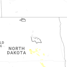
North Dakota
| Local Time | Report Details |
|---|---|
| 4:40 PM CDT | Nddot sensor. time estimated from rada in foster county ND, 47.3 miles SSE of Devils Lake, ND |
| 7:20 PM CDT | Ndawn station marion 2s. report at 10 meters... 55 mph observed at the surfac in lamoure county ND, 76.4 miles N of Aberdeen, SD |
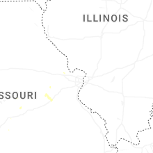
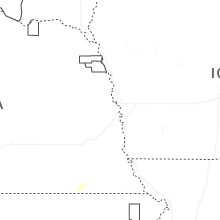
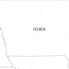
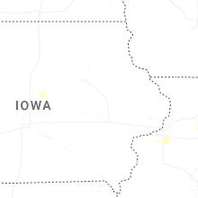
Iowa
| Local Time | Report Details |
|---|---|
| 4:55 PM CDT | Photo relayed via social media of a large branch of a tree snapped off. time estimated by rada in scott county IA, 63.6 miles ESE of Cedar Rapids, IA |
| 5:18 PM CDT | Several tree limbs are down... 6 to 10 inches across... around town. power lines are also down; no power in leclaire. the house at 12th and jones had power lines ripped in scott county IA, 72.7 miles ESE of Cedar Rapids, IA |
Alabama
| Local Time | Report Details |
|---|---|
| 5:18 PM CDT | Large tree down along cr 21 reported by jackson county em in jackson county AL, 48.1 miles WSW of Chattanooga, TN |
| 5:19 PM CDT | Jackson county ema reported a tree down along cr 10 in jackson county AL, 47.7 miles WSW of Chattanooga, TN |
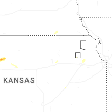
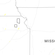
Kansas
| Local Time | Report Details |
|---|---|
| 5:30 PM CDT | Ping Pong Ball sized hail reported near Natoma, KS, 24.8 miles NNE of Hays, KS |
| 5:40 PM CDT | Emergency manager relayed a report (with pictures) of roof damage ~4 miles nw of oakley... in far southeast thomas county. precise time of occurrence unknown. time esti in thomas county KS, 17.7 miles SSE of Colby, KS |
| 5:57 PM CDT | Picture of at least 1 power pole blown over along highway 83 and cr c. time estimated by rada in thomas county KS, 18.9 miles SSE of Colby, KS |
| 5:36 PM MDT | Site kgld measured 60 mph wind gus in sherman county KS, 34.6 miles W of Colby, KS |
| 5:41 PM MDT | Site kgld measured 64 mph wind gus in sherman county KS, 34.6 miles W of Colby, KS |
| 8:18 PM CDT | Up840 reported the wind gus in logan county KS, 33.1 miles SW of Colby, KS |
| 5:15 AM CDT | Power lines and poles downed. damage to roofs and trees also reported. time estimated from rada in jefferson county KS, 52.8 miles W of Kansas City, MO |
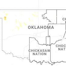
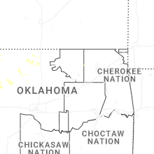
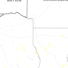
Oklahoma
| Local Time | Report Details |
|---|---|
| 5:36 PM CDT | Kga in ellis county OK, 22.6 miles WSW of Woodward, OK |
| 6:20 PM CDT | Approximately 20 power poles were snapped between wheatridge road and imo road. time estimated by rada in garfield county OK, 69.4 miles NNW of Oklahoma City, OK |
| 6:30 PM CDT | Multiple metal transmission poles were snapped along cleveland road. time estimated by rada in garfield county OK, 61.1 miles NNW of Oklahoma City, OK |
| 8:00 PM CDT | Estimated wind gus in blaine county OK, 63.3 miles NW of Oklahoma City, OK |
Nebraska
| Local Time | Report Details |
|---|---|
| 5:34 PM MDT | Storm damage reported in box butte county NE, 46.3 miles ENE of Scottsbluff, NE |
Minnesota
| Local Time | Report Details |
|---|---|
| 8:39 PM CDT | Ndawn 10 meter wind gust measured 62 mph at 2039l in wilkin county MN, 22.3 miles SSE of Fargo, ND |
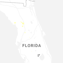
Florida
| Local Time | Report Details |
|---|---|
| 10:30 PM EDT | Mesonet station xapa apalachee bay - panacea channe in gmz730 county FL, 29.8 miles S of Tallahassee, FL |
Connect with Interactive Hail Maps