

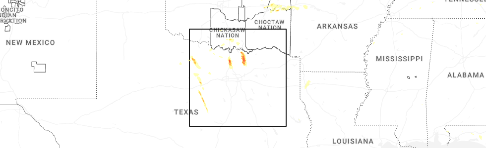
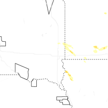
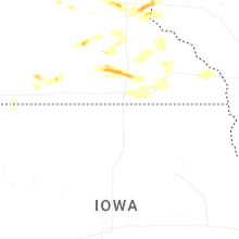
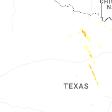
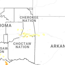
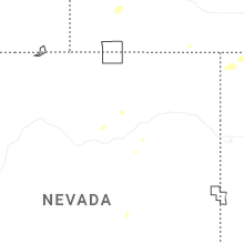
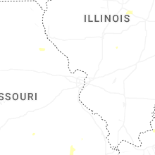
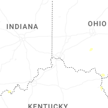
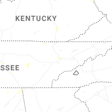
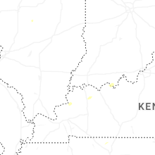
Hail Map for Sunday, September 21, 2025
Number of Impacted Households on 9/21/2025
0
Impacted by 1" or Larger Hail
0
Impacted by 1.75" or Larger Hail
0
Impacted by 2.5" or Larger Hail
Square Miles of Populated Area Impacted on 9/21/2025
0
Impacted by 1" or Larger Hail
0
Impacted by 1.75" or Larger Hail
0
Impacted by 2.5" or Larger Hail

Cities Most Affected by Hail Storms of 9/21/2025
| Hail Size | Demographics of Zip Codes Affected | ||||||
|---|---|---|---|---|---|---|---|
| City | Count | Average | Largest | Pop Density | House Value | Income | Age |
| Minnetonka, MN | 3 | 1.83 | 2.00 | 1887 | $190k | $78.5k | 46.0 |
| Sherman, TX | 1 | 2.50 | 2.50 | 305 | $53k | $31.7k | 31.9 |
| Melissa, TX | 1 | 2.00 | 2.00 | 340 | $116k | $54.9k | 33.1 |
| Saint Paul, MN | 1 | 2.00 | 2.00 | 2920 | $170k | $73.8k | 37.0 |
| Valley View, TX | 1 | 2.00 | 2.00 | 43 | $83k | $44.0k | 42.3 |
| Wayzata, MN | 1 | 2.00 | 2.00 | 908 | $279k | $87.6k | 47.1 |
| Le Mars, IA | 1 | 2.00 | 2.00 | 51 | $92k | $40.3k | 39.4 |
| Waseca, MN | 1 | 2.00 | 2.00 | 67 | $90k | $42.9k | 38.7 |
| Howe, TX | 1 | 1.75 | 1.75 | 44 | $73k | $41.9k | 36.1 |
| Van Alstyne, TX | 1 | 1.75 | 1.75 | 64 | $110k | $46.8k | 41.0 |
| Anna, TX | 1 | 1.75 | 1.75 | 143 | $85k | $49.1k | 32.2 |
| South Saint Paul, MN | 1 | 1.75 | 1.75 | 3591 | $111k | $45.5k | 36.9 |
Hail and Wind Damage Spotted on 9/21/2025
Filter by Report Type:Hail ReportsWind Reports
States Impacted
Ohio, Florida, Oklahoma, Illinois, Texas, Tennessee, Minnesota, Michigan, Louisiana, Utah, Iowa, Wisconsin, ArkansasOhio
| Local Time | Report Details |
|---|---|
| 2:16 PM EDT | 3 foot diameter tree dow in clermont county OH, 15.1 miles ENE of Cincinnati, OH |
| 2:16 PM EDT | Several trees and large limbs down along bailey drive. time estimated from radar dat in clermont county OH, 14.2 miles ENE of Cincinnati, OH |
| 2:16 PM EDT | Large 2 foot diameter branch fell on house... causing damage to roof. time estimated from radar dat in clermont county OH, 14.7 miles ENE of Cincinnati, OH |
| 2:22 PM EDT | Large tree limbs on power lines- radar estimated tim in clermont county OH, 17.6 miles ENE of Cincinnati, OH |
| 2:27 PM EDT | Trees down on power lines- time radar estimat in clermont county OH, 20.5 miles ENE of Cincinnati, OH |
| 2:37 PM EDT | Several trees down across harlan township in southeast warren county. time estimated from radar dat in warren county OH, 27.6 miles ENE of Cincinnati, OH |
| 3:00 PM EDT | Trees down near sr 380 and buck run road. time estimated from rada in clinton county OH, 42.3 miles NE of Cincinnati, OH |
| 4:49 PM EDT | Tree down into wires on cleveland road southwest. time estimated from rada in licking county OH, 13.2 miles ENE of Columbus, OH |
Florida
| Local Time | Report Details |
|---|---|
| 2:25 PM CDT | Half Dollar sized hail reported near Freeport, FL, 21.3 miles ENE of Miramar Beach, FL, estimated from video on social media from the windswept dunes neighborhood. |
Oklahoma
| Local Time | Report Details |
|---|---|
| 2:40 PM CDT | The oklahoma mesonet station near haskell measured 65 mph thunderstorm wind gust in muskogee county OK, 33.4 miles SE of Tulsa, OK |
| 3:46 PM CDT | Strong thunderstorm wind snapped large tree limb in muskogee county OK, 50.7 miles W of Fort Smith, AR |
| 3:48 PM CDT | Quarter sized hail reported near Warner, OK, 49.5 miles W of Fort Smith, AR, report from mping: quarter (1.00 in.). |
| 7:28 PM CDT | Roof damage to home. at least one tree down in vicinity. estimated wind speeds 60-70mp in le flore county OK, 11.8 miles SW of Fort Smith, AR |
| 8:40 PM CDT | Storm damage reported in atoka county OK, 9 miles SE of Atoka, OK |
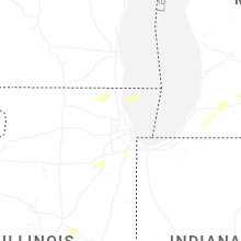
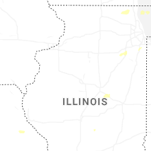
Illinois
| Local Time | Report Details |
|---|---|
| 3:38 PM CDT | Corrects the timing of previous tstm wnd dmg report from 1 nne bull valley. report of power line wires down in roadway. time estimated by rada in mchenry county IL, 47.6 miles NW of Chicago, IL |
| 3:38 PM CDT | Half Dollar sized hail reported near Matteson, IL, 26.4 miles SSW of Chicago, IL, photo shared on social media showing 1 to 1.25 inch hail. time estimated by radar. |
| 3:48 PM CDT | Photo shared on social media of a tree limb roughly 6 to 8 inches in diameter and about 15 to 20 feet long downed in homewood. time estimated by rada in cook county IL, 22.5 miles S of Chicago, IL |
| 3:51 PM CDT | Report of power line wires down in roadway. time estimated by rada in mchenry county IL, 47.6 miles NW of Chicago, IL |
| 3:52 PM CDT | Tree limb roughly 6 inches in diameter downed partially blocking eastbound river road near i-55. time estimated by rada in will county IL, 40.8 miles SW of Chicago, IL |
| 3:57 PM CDT | Social media report of two trees down near hoff road entrance to midewin national tallgrass prarie. the person who reported the damage noted their personal weather stat in will county IL, 41.2 miles SW of Chicago, IL |
| 3:59 PM CDT | Report of trees down in lakemoor near il 120. time estimated by rada in mchenry county IL, 42.4 miles NW of Chicago, IL |
| 7:04 PM CDT | Em reports one tree blown onto a house and 4 trees down on roadways in jacksonvill in morgan county IL, 74.6 miles SSW of Peoria, IL |
| 7:37 PM CDT | Power outages reported in springfield at illes park... harvard park... skyline height in sangamon county IL, 61.6 miles S of Peoria, IL |
Texas
| Local Time | Report Details |
|---|---|
| 4:35 PM CDT | Scattered downed trees and sheet metal removed from buildings throughout olney. wooden power poles leanin in young county TX, 40 miles SSW of Wichita Falls, TX |
| 5:03 PM CDT | Kgy in grayson county TX, 56 miles SW of Atoka, OK |
| 5:21 PM CDT | Ping Pong Ball sized hail reported near Sherman, TX, 56 miles SSW of Atoka, OK, report from mping. |
| 5:23 PM CDT | Half Dollar sized hail reported near Sherman, TX, 57.2 miles SSW of Atoka, OK |
| 5:30 PM CDT | Hen Egg sized hail reported near Valley View, TX, 49.9 miles NNW of Dallas, TX, report from mping. |
| 5:30 PM CDT | Tennis Ball sized hail reported near Sherman, TX, 56.4 miles NNE of Dallas, TX, photo received of measured 2.5 inch hail. time estimated. |
| 5:31 PM CDT | Quarter sized hail reported near Sanger, TX, 45.6 miles NNW of Dallas, TX |
| 5:32 PM CDT | Multiple overturned campers at the sanger koa on i35 near view road. time estimate in denton county TX, 48.3 miles NNW of Dallas, TX |
| 5:32 PM CDT | Partial wall collapse at a walmart distribution center. time estimate in denton county TX, 48 miles NNW of Dallas, TX |
| 5:35 PM CDT | Quarter sized hail reported near Sanger, TX, 46.5 miles NNW of Dallas, TX, in addition to hail also reported a blown over chicken coop. |
| 5:35 PM CDT | Social media video of a semi trailer blown over onto two other vehicles on i35 near sanger. exact location unknow in denton county TX, 47.7 miles NNW of Dallas, TX |
| 5:39 PM CDT | Quarter sized hail reported near Sherman, TX, 56.7 miles NNE of Dallas, TX, report from mping. |
| 5:45 PM CDT | Golf Ball sized hail reported near Howe, TX, 50.5 miles NNE of Dallas, TX, photo received of measured 1.75 inch hail. time estimated. |
| 5:50 PM CDT | Power lines down at bennett rd and fm 902 just east-northeast of how in grayson county TX, 52.5 miles NNE of Dallas, TX |
| 5:52 PM CDT | Social media photo and video of large tree uprooted... approximately 2 feet in diamete in montague county TX, 50.7 miles E of Wichita Falls, TX |
| 5:57 PM CDT | Half Dollar sized hail reported near Aubrey, TX, 40.3 miles NNW of Dallas, TX, report from mping. |
| 6:02 PM CDT | 64.2 mph gust measured at hwy 288 and i-3 in denton county TX, 43.5 miles NNW of Dallas, TX |
| 6:05 PM CDT | 60 mph gust measured by the denton airport awo in denton county TX, 37.4 miles NW of Dallas, TX |
| 6:05 PM CDT | Half Dollar sized hail reported near Van Alstyne, TX, 45.3 miles NNE of Dallas, TX, report from mping. |
| 6:13 PM CDT | Ping Pong Ball sized hail reported near Van Alstyne, TX, 48.6 miles NNE of Dallas, TX, report from mping: ping pong ball (1.50 in.). |
| 6:16 PM CDT | Golf Ball sized hail reported near Anna, TX, 42.5 miles NNE of Dallas, TX, report from mping: golf ball (1.75 in.). |
| 6:16 PM CDT | Golf Ball sized hail reported near Van Alstyne, TX, 46.1 miles NNE of Dallas, TX |
| 6:17 PM CDT | Half Dollar sized hail reported near Anna, TX, 40.9 miles NNE of Dallas, TX, report from mping: half dollar (1.25 in.). |
| 6:23 PM CDT | Quarter sized hail reported near Anna, TX, 41.5 miles NNE of Dallas, TX, report from mping. |
| 6:25 PM CDT | Hen Egg sized hail reported near Melissa, TX, 39.3 miles NNE of Dallas, TX, report from mping: hen egg (2.00 in.). |
| 6:34 PM CDT | Quarter sized hail reported near Melissa, TX, 37.4 miles NNE of Dallas, TX, report from mping. |
| 6:35 PM CDT | 68 mph gust measured at tw in denton county TX, 36.4 miles NNW of Dallas, TX |
| 7:50 PM CDT | Front entrance of a building collapsed inward with glass blown out of the front windows in mingu in palo pinto county TX, 77.4 miles E of Abilene, TX |
| 9:26 PM CDT | Kmn in hamilton county TX, 45.6 miles NNW of Killeen, TX |
| 9:59 PM CDT | Storm damage reported in coryell county TX, 35.4 miles NW of Killeen, TX |
Tennessee
| Local Time | Report Details |
|---|---|
| 5:17 PM CDT | Tspotter report of a large tree down on greenland drive. time is radar estimate in rutherford county TN, 31.3 miles SE of Nashville, TN |
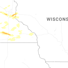
Minnesota
| Local Time | Report Details |
|---|---|
| 5:33 PM CDT | Quarter sized hail reported near Pipestone, MN, 34.6 miles NNE of Sioux Falls, SD |
| 5:41 PM CDT | Ping Pong Ball sized hail reported near Pipestone, MN, 35.4 miles NNE of Sioux Falls, SD |
| 5:51 PM CDT | Quarter sized hail reported near Waseca, MN, 60.8 miles NNW of Mason City, IA, spotter measured hailstones of penny to quarter size. |
| 5:54 PM CDT | Hen Egg sized hail reported near Waseca, MN, 59.9 miles NNW of Mason City, IA |
| 6:00 PM CDT | Half Dollar sized hail reported near Waseca, MN, 59.3 miles NNW of Mason City, IA |
| 6:51 PM CDT | Quarter sized hail reported near Jasper, MN, 27.7 miles NE of Sioux Falls, SD, storm chaser reported increasing hail activity and size at 6:51 pm cdt. they also reported a rotating wall cloud. |
| 6:59 PM CDT | Half Dollar sized hail reported near Edgerton, MN, 38 miles NE of Sioux Falls, SD |
| 7:00 PM CDT | Half Dollar sized hail reported near Edgerton, MN, 37.5 miles NE of Sioux Falls, SD, time estimated based on radar. |
| 7:00 PM CDT | Quarter sized hail reported near Edgerton, MN, 38 miles NE of Sioux Falls, SD, public report of hail 1 inch at 7:00 pm cdt. |
| 7:30 PM CDT | Quarter sized hail reported near Hardwick, MN, 31.2 miles ENE of Sioux Falls, SD, spotter reported heavy rain and quarter sized hail at 7:30 pm cdt. |
| 8:06 PM CDT | Quarter sized hail reported near South Saint Paul, MN, 13.8 miles ESE of Minneapolis, MN |
| 8:07 PM CDT | Golf Ball sized hail reported near South Saint Paul, MN, 13.8 miles ESE of Minneapolis, MN |
| 8:10 PM CDT | Quarter sized hail reported near South Saint Paul, MN, 14.2 miles SE of Minneapolis, MN, picture sent via x. |
| 8:10 PM CDT | Ping Pong Ball sized hail reported near Saint Paul, MN, 13.8 miles ESE of Minneapolis, MN, had about 2 minutes of 0.5 to 1.5 inch hail. |
| 8:14 PM CDT | Half Dollar sized hail reported near Saint Paul, MN, 15.5 miles ESE of Minneapolis, MN, mping report. |
| 8:17 PM CDT | Hen Egg sized hail reported near Saint Paul, MN, 16.8 miles ESE of Minneapolis, MN, sent via x. |
| 8:21 PM CDT | Quarter sized hail reported near Saint Paul, MN, 16 miles ESE of Minneapolis, MN, report from mping: quarter (1.00 in.). |
| 8:21 PM CDT | Half Dollar sized hail reported near Saint Paul, MN, 17.7 miles E of Minneapolis, MN, report from mping: half dollar (1.25 in.). |
| 8:21 PM CDT | Ping Pong Ball sized hail reported near Saint Paul, MN, 17.1 miles ESE of Minneapolis, MN, report from mping: ping pong ball (1.50 in.). |
| 8:30 PM CDT | Half Dollar sized hail reported near Magnolia, MN, 33.6 miles ENE of Sioux Falls, SD, spotter reported quarter to half dollar sized hail at 8:30 pm cdt. |
| 9:04 PM CDT | Quarter sized hail reported near Minnetonka, MN, 11.1 miles WSW of Minneapolis, MN, report from mping: quarter (1.00 in.). |
| 9:05 PM CDT | Hen Egg sized hail reported near Wayzata, MN, 12.8 miles WSW of Minneapolis, MN, report and picture sent via x. |
| 9:07 PM CDT | Golf Ball sized hail reported near Minnetonka, MN, 12.5 miles WSW of Minneapolis, MN |
| 9:10 PM CDT | Quarter sized hail reported near Hutchinson, MN, 57 miles W of Minneapolis, MN |
| 9:12 PM CDT | Quarter sized hail reported near Hopkins, MN, 8.3 miles WSW of Minneapolis, MN |
| 9:14 PM CDT | Half Dollar sized hail reported near Hopkins, MN, 9.9 miles WSW of Minneapolis, MN |
| 9:15 PM CDT | Golf Ball sized hail reported near Minnetonka, MN, 10.9 miles WSW of Minneapolis, MN |
| 9:16 PM CDT | Ping Pong Ball sized hail reported near Minnetonka, MN, 10.9 miles WSW of Minneapolis, MN, report from mping: ping pong ball (1.50 in.). |
| 9:20 PM CDT | Hen Egg sized hail reported near Minnetonka, MN, 10.9 miles WSW of Minneapolis, MN, report from mping: hen egg (2.00 in.). |
| 11:05 PM CDT | Trained spotter reported pea sized hail and small branches down near county borde in sibley county MN, 55.3 miles SW of Minneapolis, MN |
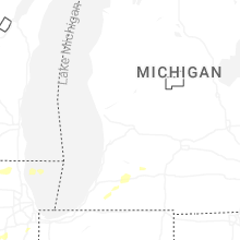
Michigan
| Local Time | Report Details |
|---|---|
| 7:07 PM EDT | Quarter sized hail reported near Dowagiac, MI, 72.2 miles SSW of Grand Rapids, MI, report from mping: quarter (1.00 in.). |
Louisiana
| Local Time | Report Details |
|---|---|
| 6:45 PM CDT | Ping Pong Ball sized hail reported near Bossier City, LA, 3.8 miles NE of Shreveport, LA, spotter measured ping pong ball sized hail at the target at airline and i-220. |
| 6:45 PM CDT | Ping Pong Ball sized hail reported near Bossier City, LA, 4.1 miles NNE of Shreveport, LA, nws employee measured ping pong ball sized hail. |
| 6:50 PM CDT | Half Dollar sized hail reported near Bossier City, LA, 7.6 miles NNE of Shreveport, LA, nws employee reported half dollar sized hail. |
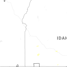
Utah
| Local Time | Report Details |
|---|---|
| 6:40 PM MDT | Mesonet station utedl i-80 at mp 71 east dell in tooele county UT, 45.8 miles W of Salt Lake City, UT |
| 7:10 PM MDT | Mesonet station pc358 hansel valle in box elder county UT, 85.6 miles NNW of Salt Lake City, UT |
Iowa
| Local Time | Report Details |
|---|---|
| 7:55 PM CDT | Quarter sized hail reported near Ocheyedan, IA, 57.5 miles NNW of Storm Lake, IA, spotter reported quarters at 7:55 pm cdt. |
| 9:15 PM CDT | Hen Egg sized hail reported near Le Mars, IA, 51.2 miles WNW of Storm Lake, IA, report relayed by broadcast media. |
Wisconsin
| Local Time | Report Details |
|---|---|
| 8:37 PM CDT | Quarter sized hail reported near Hudson, WI, 24.8 miles E of Minneapolis, MN |
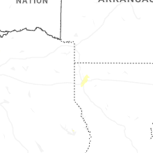
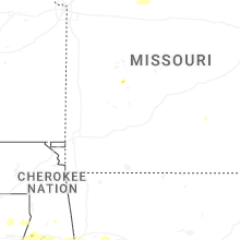
Arkansas
| Local Time | Report Details |
|---|---|
| 8:59 PM CDT | Quarter sized hail reported near Van Buren, AR, 5.5 miles NE of Fort Smith, AR |
Connect with Interactive Hail Maps