

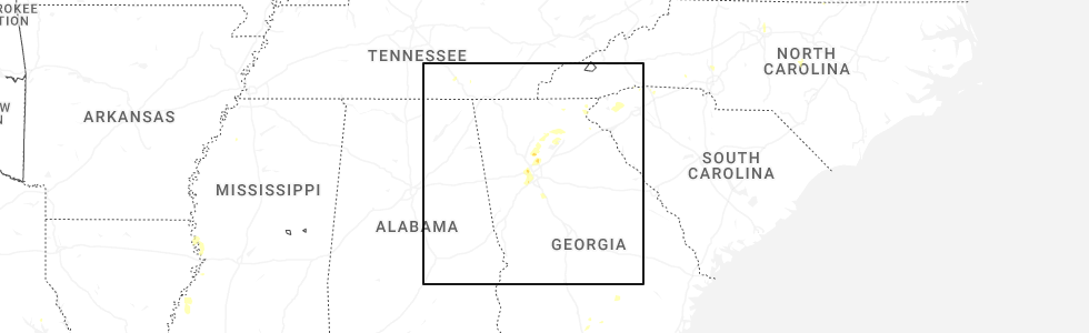
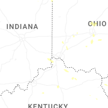
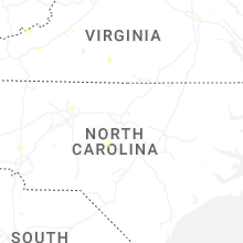
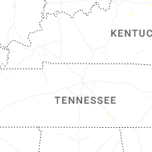
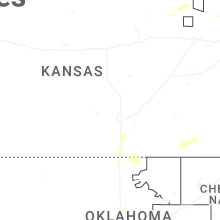
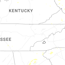
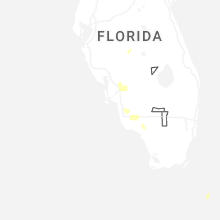
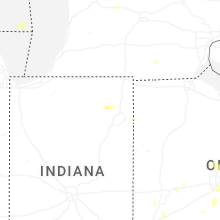
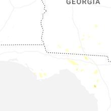
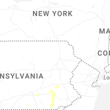
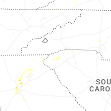
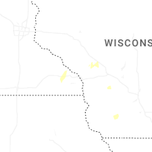
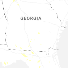
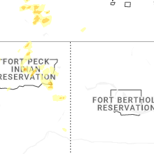
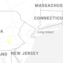
Hail Map for Thursday, June 26, 2025
Number of Impacted Households on 6/26/2025
0
Impacted by 1" or Larger Hail
0
Impacted by 1.75" or Larger Hail
0
Impacted by 2.5" or Larger Hail
Square Miles of Populated Area Impacted on 6/26/2025
0
Impacted by 1" or Larger Hail
0
Impacted by 1.75" or Larger Hail
0
Impacted by 2.5" or Larger Hail


Cities Most Affected by Hail Storms of 6/26/2025
| Hail Size | Demographics of Zip Codes Affected | ||||||
|---|---|---|---|---|---|---|---|
| City | Count | Average | Largest | Pop Density | House Value | Income | Age |
Hail and Wind Damage Spotted on 6/26/2025
Filter by Report Type:Hail ReportsWind Reports
States Impacted
Virginia, Kentucky, Michigan, Indiana, Texas, Minnesota, North Carolina, Ohio, Pennsylvania, Georgia, West Virginia, Iowa, Maryland, South Carolina, Florida, Kansas, Missouri, Montana, Oklahoma, Alabama, Tennessee, Illinois, NebraskaVirginia
| Local Time | Report Details |
|---|---|
| 12:31 PM EDT | Several trees dow in scott county VA, 25.2 miles W of Bristol, TN |
| 12:57 PM EDT | Two trees dow in lee county VA, 50.9 miles W of Bristol, TN |
| 2:20 PM EDT | Multiple trees dow in washington county VA, 23.8 miles NE of Bristol, TN |
| 3:32 PM EDT | Tree down blocking both lanes of mary hunter driv in henry county VA, 36.1 miles S of Roanoke, VA |
| 3:59 PM EDT | Tree down blocking odell roa in henry county VA, 47.6 miles S of Roanoke, VA |
| 4:35 PM EDT | Multiple trees and power lines down in the vicinity of dill rd and us36 in henrico county VA, 14.5 miles ENE of Richmond, VA |
| 4:35 PM EDT | Tree downed onto a line at cold harbor rd at i-29 in hanover county VA, 17.3 miles ENE of Richmond, VA |
| 4:39 PM EDT | Tree down near intersection of old liberty drive and mount olivet roa in henry county VA, 42.8 miles S of Roanoke, VA |
| 4:51 PM EDT | Tree was reported down off grayson parkway near the town of galax in grayson county virgini in grayson county VA, 67.9 miles E of Bristol, TN |
| 4:56 PM EDT | A tree was reported down by the 911 call center off meadow creek road near the town of galax in grayson county virgini in grayson county VA, 71.2 miles E of Bristol, TN |
| 4:57 PM EDT | Tree down blocking intersection of meadwood trail and tanyard roa in henry county VA, 42.9 miles S of Roanoke, VA |
| 4:59 PM EDT | Huge tree down along reserve blv in city of galax county VA, 69.5 miles SW of Roanoke, VA |
| 5:09 PM EDT | Tree blown down across anderson mill roa in pittsylvania county VA, 33.9 miles SE of Roanoke, VA |
| 5:28 PM EDT | 911 call center reported a downed tree blocking the entire roadway in the intersection of prices fork road and brightwood manor driv in montgomery county VA, 28.2 miles W of Roanoke, VA |
| 5:43 PM EDT | A large tree is down blocking the entire intersection of meadow creek road and youngs lane in montgomery county virgini in montgomery county VA, 32.3 miles WSW of Roanoke, VA |
| 6:30 PM EDT | Tree down along east laurel ln in madison county VA, 71.8 miles NNW of Richmond, VA |
| 6:35 PM EDT | One tree down on hwy 903 in brace in mecklenburg county VA, 62.8 miles NNE of Raleigh, NC |
| 6:35 PM EDT | Trees down in shenandoah national park north of big meadow in madison county VA, 81.7 miles ESE of Elkins, WV |
| 6:37 PM EDT | Multiple trees were reported down in the town of blue ridge in botetourt county virgini in botetourt county VA, 10.4 miles NE of Roanoke, VA |
| 6:59 PM EDT | 911 call center reported multiple trees down in the town of troutville in botetourt county virgini in botetourt county VA, 10.1 miles NNE of Roanoke, VA |
| 6:59 PM EDT | Tree down along forbes mill roa in bedford county VA, 24.3 miles ENE of Roanoke, VA |
| 7:06 PM EDT | Tree down along hebron valley rd off of us 29 in madison county VA, 69.8 miles NNW of Richmond, VA |
| 7:24 PM EDT | Corrects previous tstm wnd dmg report from troutville. 911 call center reported multiple trees down in the town of troutville in botetourt county virgini in botetourt county VA, 10.1 miles NNE of Roanoke, VA |
| 7:26 PM EDT | Tree down near the corner of richmond and greene road in amelia county VA, 17.1 miles SSW of Richmond, VA |
| 7:37 PM EDT | Reports of multiple trees down near bentonvill in warren county VA, 82.5 miles E of Elkins, WV |
| 8:13 PM EDT | Tree downed by thunderstorm winds... landing on a power line in the front yard of a residence on straightstone roa in pittsylvania county VA, 47 miles ESE of Roanoke, VA |
| 8:57 PM EDT | Two trees down near the intersection of dumfries rd and wellington r in prince william county VA, 59.9 miles SW of Baltimore, MD |
| 9:02 PM EDT | Numerous trees down near manassa in prince william county VA, 59.9 miles SW of Baltimore, MD |
| 10:11 PM EDT | Numerous trees down in the dumfries are in prince william county VA, 62.7 miles SW of Baltimore, MD |
Kentucky
| Local Time | Report Details |
|---|---|
| 1:25 PM EDT | Downed tree on a home along radio hill road in manchester. time estimated via radar. report came from social media and was relayed to us via slac in clay county KY, 39.6 miles SSE of Irvine, KY |
| 3:00 PM EDT | Report of multiple trees... powerlines... and a utility pole down around goshen lane. time estimated from rada in oldham county KY, 30.6 miles NNE of Louisville, KY |
| 4:29 PM EDT | Downed trees in the 1100 block of left fork little paint road. time estimated via rada in floyd county KY, 63.3 miles E of Irvine, KY |
| 4:44 PM EDT | Trees reported down along north central avenue behind the wendys in prestonsburg. time estimated via rada in floyd county KY, 65.5 miles E of Irvine, KY |
| 4:49 PM EDT | Trees reported down in the 500 block of ky-1428 east of prestonsburg. time estimated via rada in floyd county KY, 68.8 miles E of Irvine, KY |
| 5:19 PM EDT | Tree on car in fairdale - report through medi in jefferson county KY, 8.8 miles NNW of Louisville, KY |
| 5:24 PM EDT | Ksdf asos measured 58 mph at 524 pm ed in jefferson county KY, 13.3 miles N of Louisville, KY |
| 5:25 PM EDT | Power lines down near palatka rd and southdale r in jefferson county KY, 11.7 miles NNW of Louisville, KY |
| 5:26 PM EDT | Power lines down - report from medi in jefferson county KY, 16.2 miles N of Louisville, KY |
| 5:26 PM EDT | Power out near intersection of southside drive and strawberry lane - media reporte in jefferson county KY, 12.1 miles N of Louisville, KY |
| 5:26 PM EDT | Tree in roadway near baker lan in jefferson county KY, 10.9 miles NNW of Louisville, KY |
| 5:29 PM EDT | Corrects previous tstm wnd dmg report from 2 wnw louisville intl airport for time of occurrence. trees down on newcut r in jefferson county KY, 13 miles NNW of Louisville, KY |
| 5:31 PM EDT | Corrects previous tstm wnd gst report from 1 n louisville intl airport. corrects previous tstm wnd gst report from 1 n louisville intl airport for wind speed. wind gust in jefferson county KY, 13.3 miles N of Louisville, KY |
| 5:44 PM EDT | Wind gusts of 50 kts reported at sdf international airpor in jefferson county KY, 13.3 miles N of Louisville, KY |
| 6:00 PM EDT | Trees down & other wind damage - along newtown pik in fayette county KY, 41.9 miles NW of Irvine, KY |
| 6:06 PM EDT | Tree down on roadway near intersection of mason headley rd and versailles r in fayette county KY, 39.2 miles NW of Irvine, KY |
| 6:08 PM EDT | Trees and power lines down in bellevie in boone county KY, 19.3 miles WSW of Cincinnati, OH |
| 6:29 PM EDT | Trees down on newcut r in jefferson county KY, 13 miles NNW of Louisville, KY |
Michigan
| Local Time | Report Details |
|---|---|
| 1:36 PM EDT | Report of a downed powerline in monroe county MI, 78.1 miles S of Flint, MI |
| 1:36 PM EDT | Emergency manager reported trees/limbs downed near the town of moscow on milnes road in hillsdale county in michigan due to thunderstorm winds. time is radar estimate in hillsdale county MI, 71 miles NNE of Fort Wayne, IN |
Indiana
| Local Time | Report Details |
|---|---|
| 1:47 PM EDT | Pictures showing barn destroyed on county road 800 north. time estimated from rada in ripley county IN, 45.8 miles W of Cincinnati, OH |
| 3:53 PM EDT | Asos station kgsh goshe in elkhart county IN, 47.3 miles NW of Fort Wayne, IN |
| 4:50 PM EDT | Reports of trees and large branches down in churubusc in whitley county IN, 15.7 miles NW of Fort Wayne, IN |
| 8:05 PM CDT | Photo shared on social media showed a 4 inch diameter tree limb and another 6 inch diameter tree limb blown down near east 108th street and park stree in lake county IN, 37.9 miles SSE of Chicago, IL |
Texas
| Local Time | Report Details |
|---|---|
| 1:05 PM CDT | Mesonet station twb23 12.1 se belding (twdb in pecos county TX, 46.6 miles ENE of Alpine, TX |
| 5:03 PM CDT | Mesonet station 18 lamesa 2s in dawson county TX, 61 miles S of Lubbock, TX |
| 7:48 PM CDT | Corrects previous tstm wnd dmg report from cotton flat. midland county emergency manager reports many power lines down near scr 1200 and wcr 125 and along rankin highwa in midland county TX, 19.3 miles ENE of Odessa, TX |
| 9:23 PM CDT | Midland county emergency manager reports many power lines down near scr 1200 and wcr 125 and along rankin highway south of wcr 140. this is all in the cotton flat area in midland county TX, 19.3 miles ENE of Odessa, TX |
Minnesota
| Local Time | Report Details |
|---|---|
| 1:20 PM CDT | Downed trees and powerlines... possible tornado damage. time estimated from rada in freeborn county MN, 33.6 miles NNW of Mason City, IA |
North Carolina
| Local Time | Report Details |
|---|---|
| 2:25 PM EDT | Tree down and blocking zion hill r in mcdowell county NC, 63.9 miles NNE of Greenville, SC |
| 3:09 PM EDT | Corrects previous tstm wnd dmg report from 2 se benham. large tree blown down on home damaging part of it. 6 to 8 trees dow in wilkes county NC, 73 miles N of Charlotte, NC |
| 3:09 PM EDT | Photos from emergency manager showed crops flattened and trees snapped in one direction along and near the intersection of cool springs church rd and preacher field r in wilkes county NC, 73.7 miles N of Charlotte, NC |
| 3:18 PM EDT | Trees down along taylor stree in yadkin county NC, 63.4 miles N of Charlotte, NC |
| 5:10 PM EDT | Several trees were reported down by the 911 call center in madison north carolina in rockingham count in rockingham county NC, 60.8 miles S of Roanoke, VA |
| 5:19 PM EDT | 1 tree down off hope beasley road in sandy ridge north carolin in stokes county NC, 52.8 miles S of Roanoke, VA |
| 5:33 PM EDT | A couple of trees were reported down in the town of wentworth north carolina in rockingham count in rockingham county NC, 60.7 miles S of Roanoke, VA |
| 5:45 PM EDT | Tree down on air harbor rd.... between quail ridge dr. and bass chapel r in guilford county NC, 70.9 miles WNW of Raleigh, NC |
| 5:45 PM EDT | Tree down at 4200 bell orchard d in guilford county NC, 69.1 miles WNW of Raleigh, NC |
| 5:45 PM EDT | Tree down at 4490 baylor s in guilford county NC, 69.6 miles WNW of Raleigh, NC |
| 5:46 PM EDT | Fallen trees or limbs caused power outage on crescent dr. time estimated from rada in mecklenburg county NC, 18.4 miles N of Charlotte, NC |
| 6:19 PM EDT | Multiple power poles down on wright road west of enochville. time estimated from rada in rowan county NC, 22.1 miles NNE of Charlotte, NC |
| 6:43 PM EDT | Corrects previous tstm wnd dmg report from 2 w enochville. multiple power poles down on wright road west of enochville. time estimated from rada in rowan county NC, 22.1 miles NNE of Charlotte, NC |
| 7:40 PM EDT | Duke energy reported power outage caused by fallen trees or limbs damaging equipmen in lee county NC, 37.2 miles SW of Raleigh, NC |
| 7:45 PM EDT | Tree down at 4000 lower river r in lee county NC, 27.6 miles WSW of Raleigh, NC |
| 8:03 PM EDT | Tree down near train track in chatham county NC, 22.5 miles WSW of Raleigh, NC |
| 8:38 PM EDT | Corrects previous tstm wnd dmg report from 2 nw apex. large tree down on powerlines on williams street near targe in wake county NC, 13 miles W of Raleigh, NC |
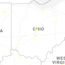
Ohio
| Local Time | Report Details |
|---|---|
| 2:32 PM EDT | Broadcast media relayed reports of thunderstorm wind damage of a barn with the doors blown off and a silo now leaning off of the concrete pad near the town of delta in in fulton county OH, 68 miles NE of Fort Wayne, IN |
| 2:32 PM EDT | Trained spotter reports thunderstorm wind damage in the form of 3 semi trucks blown over on the ohio turnpike near county road 5-2 near the town of delta in fulton coun in fulton county OH, 69 miles ENE of Fort Wayne, IN |
| 2:33 PM EDT | South bound lanes of us-23 blocked by large tree and other downed branches. time estimated from rada in pickaway county OH, 14 miles S of Columbus, OH |
| 2:54 PM EDT | 10 inch tree branch down near east main st. and eastmoor blvd in bexley. time estimated from radar dat in franklin county OH, 4.4 miles E of Columbus, OH |
| 4:15 PM EDT | Tree down near intersection of gambier st/boyton st. time estimated via rada in knox county OH, 40.8 miles NE of Columbus, OH |
| 4:23 PM EDT | One large healthy pine tree downed at kenwood road and galbraith road. one large maple tree downed on power lines at kenwood road and kugler mill roa in hamilton county OH, 9.8 miles NE of Cincinnati, OH |
| 4:30 PM EDT | Fire dept responded to a report of a tree down along price street. time estimated from rada in columbiana county OH, 32.1 miles WNW of Pittsburgh, PA |
Pennsylvania
| Local Time | Report Details |
|---|---|
| 2:40 PM EDT | Corrects previous flash flood report from 3 w fredonia to tstm wnd dmg. tree down on mercer rd and partially blocking lan in mercer county PA, 63.8 miles NNW of Pittsburgh, PA |
| 3:09 PM EDT | Corrects previous tstm wnd dmg report from 1 se new castle. tree down on wires at east lutton street and cunningham avenu in lawrence county PA, 42.1 miles NNW of Pittsburgh, PA |
| 3:09 PM EDT | Wires reported down along centertown roa in mercer county PA, 51.9 miles N of Pittsburgh, PA |
| 3:38 PM EDT | Tree down near squaw run road and ellwood roa in lawrence county PA, 34.7 miles NNW of Pittsburgh, PA |
| 3:38 PM EDT | Tree down on wires at east lutton street and cunningham avenu in lawrence county PA, 42.1 miles NNW of Pittsburgh, PA |
| 3:43 PM EDT | Wires down along bridge stree in lawrence county PA, 33.5 miles NNW of Pittsburgh, PA |
| 3:50 PM EDT | Tree down blocking lane on 6500 block of pa 14 in northumberland county PA, 53.7 miles E of State College, PA |
| 4:40 PM EDT | Wires down. time estimated from rada in berks county PA, 64.2 miles S of Scranton, PA |
| 4:50 PM EDT | Multiple trees uprooted. time estimated from rada in berks county PA, 66 miles S of Scranton, PA |
| 4:50 PM EDT | Multiple houses with roof damage and windows blown out. time estimated from rada in berks county PA, 65.3 miles S of Scranton, PA |
| 5:00 PM EDT | Power poles blown down. time estimated from rada in berks county PA, 64.3 miles S of Scranton, PA |
| 5:00 PM EDT | Roofing material removed from a barn. time estimated from rada in berks county PA, 64.3 miles S of Scranton, PA |
| 5:00 PM EDT | Multiple trees snapped and uprooted. time estimated from rada in berks county PA, 66.8 miles S of Scranton, PA |
| 5:10 PM EDT | Multiple reports of trees down across raccoon creek state park near the beach. time estimated from rada in beaver county PA, 21.6 miles WNW of Pittsburgh, PA |
| 5:11 PM EDT | A report of wires down near the 100 block of thompson hill rd. time estimated from rada in beaver county PA, 19.1 miles WNW of Pittsburgh, PA |
| 5:15 PM EDT | Tree and wires down on packing house rd near pigeon hill r in york county PA, 43.3 miles NNW of Baltimore, MD |
| 5:19 PM EDT | Several trees down. chicken coop blown ove in beaver county PA, 18.6 miles WNW of Pittsburgh, PA |
| 5:25 PM EDT | Tree down on vilsack road. time estimated via rada in allegheny county PA, 6.3 miles N of Pittsburgh, PA |
| 5:30 PM EDT | Tree limbs down along 40th st in lawrencevill in allegheny county PA, 2.5 miles NE of Pittsburgh, PA |
| 5:40 PM EDT | Trees and wires down on chapel hill road. time estimated from rada in berks county PA, 76.9 miles SSW of Scranton, PA |
| 5:55 PM EDT | Trees down on zion road. time estimated from rada in berks county PA, 75.8 miles NNE of Baltimore, MD |
| 5:58 PM EDT | Reports of a tree down on power lines causing them to spark. time estimated from rada in washington county PA, 13.6 miles WSW of Pittsburgh, PA |
| 6:05 PM EDT | Multiple trees and wires down across lancaster city and manor tw in lancaster county PA, 54.3 miles NNE of Baltimore, MD |
| 6:05 PM EDT | Tree on wires. time estimated from rada in berks county PA, 73.3 miles NNE of Baltimore, MD |
| 6:20 PM EDT | 4 to 5 trees down. time estimated via rada in westmoreland county PA, 16 miles ESE of Pittsburgh, PA |
| 6:25 PM EDT | Report of a tree falling on power lines causing the lines to go down and close frye avenue. time estimated from rada in washington county PA, 13 miles S of Pittsburgh, PA |
| 6:30 PM EDT | Wires dow in lancaster county PA, 48.1 miles NNE of Baltimore, MD |
| 6:30 PM EDT | Tree down on wires on pennsy rd near providence twp lin in lancaster county PA, 46.8 miles NNE of Baltimore, MD |
| 6:34 PM EDT | Reports of wires down along erskine road. time estimated from rada in washington county PA, 37.2 miles SW of Pittsburgh, PA |
| 6:47 PM EDT | Tree damage and power poles blown down. time estimated from rada in chester county PA, 59.8 miles NE of Baltimore, MD |
| 6:50 PM EDT | Multiple trees and power poles snapped. time estimated from rada in chester county PA, 60 miles NE of Baltimore, MD |
| 7:06 PM EDT | Power outages and wires down reported west of oxford. time estimate in chester county PA, 47.4 miles NE of Baltimore, MD |
| 7:21 PM EDT | Trees and wires down on the roadway on point roa in huntingdon county PA, 23.5 miles SSW of State College, PA |
| 7:27 PM EDT | Trees down and blocking the roadway of s jefferson stree in huntingdon county PA, 28.6 miles S of State College, PA |
| 8:27 PM EDT | Trees down on wire in huntingdon county PA, 46.2 miles S of State College, PA |
| 8:39 PM EDT | Multiple trees down in the area of n clear ridge road in dublin townshi in fulton county PA, 52 miles S of State College, PA |
| 9:18 PM EDT | Trees down on wires on meadow ground roa in fulton county PA, 61 miles S of State College, PA |
| 9:20 PM EDT | Trees down on wires meadow mountain driv in fulton county PA, 62.4 miles S of State College, PA |
Georgia
| Local Time | Report Details |
|---|---|
| 2:50 PM EDT | County communications reported trees and powerlines downed. time estimated from rada in stephens county GA, 44.1 miles WSW of Greenville, SC |
| 2:54 PM EDT | Tree down at bowen bridge r in hall county GA, 61 miles NE of Atlanta, GA |
| 3:04 PM EDT | Tree down at keinmer rd and ransom free r in hall county GA, 61 miles NNE of Atlanta, GA |
| 3:05 PM EDT | Tree down at dahlonega hwy and clermont hw in hall county GA, 59.6 miles NNE of Atlanta, GA |
| 3:19 PM EDT | Tree down at thompson bridge rd and mt vernon r in hall county GA, 52.5 miles NNE of Atlanta, GA |
| 3:19 PM EDT | Multiple trees down in old dahloneg in lumpkin county GA, 58.8 miles NNE of Atlanta, GA |
| 3:19 PM EDT | Multiple trees down near red oak flats r in lumpkin county GA, 56.7 miles NNE of Atlanta, GA |
| 3:20 PM EDT | Lowndes county dispatch reported trees down onto powerlines along gornto road. timing estimated by rada in lowndes county GA, 52.2 miles SSW of Douglas, GA |
| 3:33 PM EDT | Tree down at east lake dr and antioch campground r in hall county GA, 50.8 miles NE of Atlanta, GA |
| 3:33 PM EDT | Report of a tree on a home on river sound l in dawson county GA, 51.3 miles NNE of Atlanta, GA |
| 4:07 PM EDT | Report via social media that a tree fell and took out a fence and power line in lowndes county GA, 47 miles SW of Douglas, GA |
| 4:08 PM EDT | Tree down on gaines mill rd near shady lane driv in hall county GA, 51.1 miles NE of Atlanta, GA |
| 4:08 PM EDT | Tree down at floyd rd and azelea l in hall county GA, 50.8 miles NE of Atlanta, GA |
| 4:08 PM EDT | Tree down at 1800 block of tulip d in hall county GA, 50.8 miles NE of Atlanta, GA |
| 4:09 PM EDT | Tree down at 800 block of chattahoochee s in hall county GA, 50.7 miles NE of Atlanta, GA |
| 4:09 PM EDT | Couple of trees down near the 100 block of spring stree in hall county GA, 51.5 miles NE of Atlanta, GA |
| 4:23 PM EDT | Quarter sized hail reported near Alpharetta, GA, 28.7 miles N of Atlanta, GA, report of 1-inch hail at birmingham rd and freemanville rd. |
| 5:00 PM EDT | Power pole and lines downed near the intersection of dunwoody club dr and happy hollow rd... leading to power outages in the neighborhoo in dekalb county GA, 15.9 miles NNE of Atlanta, GA |
| 5:02 PM EDT | Tree reported down on dunwoody club way near the intersection of dunwoody club d in dekalb county GA, 15.3 miles NNE of Atlanta, GA |
| 5:03 PM EDT | Quarter sized hail reported near Atlanta, GA, 15.3 miles NNE of Atlanta, GA, report of 1-inch hail in dunwoody. |
| 5:03 PM EDT | Quarter sized hail reported near Atlanta, GA, 14.9 miles NNE of Atlanta, GA, 1 inch hail reported at n peachtree rd. & starcross ct. |
| 5:03 PM EDT | Quarter sized hail reported near Atlanta, GA, 16.1 miles N of Atlanta, GA, report of 1-inch hail at ison rd ne and roswell rd. |
| 5:05 PM EDT | Quarter sized hail reported near Atlanta, GA, 16.1 miles N of Atlanta, GA, report from mping: quarter (1.00 in.). |
| 5:18 PM EDT | Measured 60.2 mph wind gust with rooftop anemomete in cook county GA, 39.9 miles WSW of Douglas, GA |
| 5:38 PM EDT | Quarter sized hail reported near Atlanta, GA, 6.7 miles NW of Atlanta, GA, report of 1-inch hail at james jackson pkwy and bolton rd nw. |
| 5:45 PM EDT | Quarter sized hail reported near Mableton, GA, 10.7 miles WNW of Atlanta, GA, quarter-sized hail reported near mableton. |
| 6:16 PM EDT | There were three reports of trees down in thomas count in thomas county GA, 29.9 miles NNE of Tallahassee, FL |
| 6:34 PM EDT | Trees fell on several roads in grady count in grady county GA, 30 miles NNE of Tallahassee, FL |
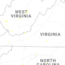
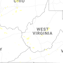
West Virginia
| Local Time | Report Details |
|---|---|
| 3:04 PM EDT | Tree reported down into powerlines on n washington stree in morgan county WV, 82.5 miles SSW of State College, PA |
| 3:04 PM EDT | Multiple trees reported down along cold run valley road near cacapon roa in morgan county WV, 83.4 miles SSW of State College, PA |
| 3:30 PM EDT | A couple trees down and wires down on highland ridge roa in morgan county WV, 84.2 miles SSW of State College, PA |
| 6:43 PM EDT | Three trees down in the davy are in mcdowell county WV, 60 miles S of Charleston, WV |
| 6:45 PM EDT | Tree down blocking a lane in hensle in mcdowell county WV, 60.8 miles S of Charleston, WV |
| 6:55 PM EDT | Skywarn spotter reported several trees down along west virginia highway 20 in summers count in summers county WV, 57.2 miles WNW of Roanoke, VA |
| 7:25 PM EDT | Report of a tree down along us 119 near frye driv in logan county WV, 38.8 miles SW of Charleston, WV |
| 7:45 PM EDT | Tree down reported in phic in logan county WV, 35.1 miles SW of Charleston, WV |
| 7:55 PM EDT | Large tree down along blair mountain highway east of stolling in logan county WV, 38.2 miles SSW of Charleston, WV |
| 7:55 PM EDT | Tree down along lick creek road west of danvill in boone county WV, 23.7 miles SW of Charleston, WV |
| 8:25 PM EDT | Tree reported down on wv 37 at marina road near east lynn lak in wayne county WV, 42.3 miles WSW of Charleston, WV |
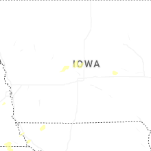
Iowa
| Local Time | Report Details |
|---|---|
| 2:15 PM CDT | Branches... trees... and powerlines down. according to alden fire departmen in hardin county IA, 44.9 miles SSW of Mason City, IA |
| 4:20 PM CDT | From personal weather statio in madison county IA, 13.1 miles SW of Des Moines, IA |
| 4:30 PM CDT | Hardwood tree damage near grays lake. delayed report via tv media. time estimated from rada in polk county IA, 1.6 miles SSW of Des Moines, IA |
| 7:57 PM CDT | Storm damage reported in dubuque county IA, 57.5 miles NE of Cedar Rapids, IA |
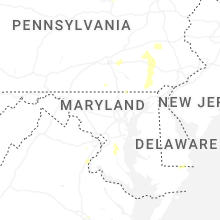
Maryland
| Local Time | Report Details |
|---|---|
| 3:30 PM EDT | Tree downed at intersection of campbelltown road and pitts rd. time is radar-estimate in worcester county MD, 9.5 miles WNW of Ocean City, MD |
| 5:21 PM EDT | Tree down near the intersection of bankard rd and grand valley roa in carroll county MD, 35.3 miles NNW of Baltimore, MD |
| 5:50 PM EDT | Tree down near the intersection of falls rd and grave run r in baltimore county MD, 25.1 miles NNW of Baltimore, MD |
| 5:51 PM EDT | Tree down near the intersection of brickstore rd and upper beckleysville r in baltimore county MD, 26.4 miles NNW of Baltimore, MD |
| 6:06 PM EDT | Tree down near the 16800 block of ridge roa in baltimore county MD, 22.8 miles NNW of Baltimore, MD |
| 6:35 PM EDT | Tree down near the intersection of norrisville rd and harford creamery r in harford county MD, 27.1 miles N of Baltimore, MD |
| 6:50 PM EDT | One foot diameter tree branch snapped off... blocking the road... on the 13000 block of overton l in montgomery county MD, 25.9 miles SW of Baltimore, MD |
| 6:57 PM EDT | Multiple trees reported down between pylesville ant the state lin in harford county MD, 31 miles NNE of Baltimore, MD |
| 7:00 PM EDT | Power lines down onto two unoccupied vehicles at the intersection of gregory st. and snure r in montgomery county MD, 28.9 miles SW of Baltimore, MD |
| 7:26 PM EDT | Numerous trees down near conowingo... m in cecil county MD, 36 miles NE of Baltimore, MD |
| 7:26 PM EDT | Tree down near the intersection of court house drive and martha bush driv in howard county MD, 10.8 miles W of Baltimore, MD |
| 7:39 PM EDT | Multiple trees down in rising sun including on route in cecil county MD, 40.8 miles NE of Baltimore, MD |
| 8:06 PM EDT | Multiple trees down on tydings lan in harford county MD, 30.7 miles ENE of Baltimore, MD |
| 9:05 PM EDT | Wires down. time estimated from rada in kent county MD, 29.5 miles E of Baltimore, MD |
| 9:57 PM EDT | Tree down near the intersection of friendship rd and old solomons island r in anne arundel county MD, 38 miles S of Baltimore, MD |
| 10:00 PM EDT | Tree down near the intersection of deep cove rd and central av in anne arundel county MD, 33.5 miles S of Baltimore, MD |
South Carolina
| Local Time | Report Details |
|---|---|
| 4:19 PM EDT | Powerlines down on roadwa in greenville county SC, 18.1 miles ENE of Greenville, SC |
| 4:45 PM EDT | At least 15 trees down along and south of hwy 183 east of six mil in pickens county SC, 11.4 miles W of Greenville, SC |
| 4:49 PM EDT | Powerlines down on roadway and power pole on fir in pickens county SC, 13.1 miles W of Greenville, SC |
| 4:54 PM EDT | Powerlines down on roadwa in pickens county SC, 11.5 miles W of Greenville, SC |
| 5:20 PM EDT | Trees down at church street and w union r in oconee county SC, 25.5 miles W of Greenville, SC |
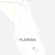
Florida
| Local Time | Report Details |
|---|---|
| 3:25 PM CDT | Utility company reported downed trees and power poles and lines in gulf county. timing approximated by radar and location by the utility company outage ma in gulf county FL, 61.2 miles WSW of Tallahassee, FL |
| 5:27 PM EDT | Tree dow in jefferson county FL, 29.1 miles ENE of Tallahassee, FL |
| 5:30 PM EDT | Tree dow in jefferson county FL, 30.2 miles ENE of Tallahassee, FL |
| 5:52 PM EDT | Small tree down with two reports of wires down nearby as wel in taylor county FL, 48.7 miles ESE of Tallahassee, FL |
| 6:11 PM EDT | Tree dow in jefferson county FL, 19.7 miles E of Tallahassee, FL |
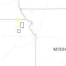
Kansas
| Local Time | Report Details |
|---|---|
| 4:16 PM CDT | Downed wires near 206th road. time estimated from rada in atchison county KS, 37.9 miles NW of Kansas City, MO |
| 4:18 PM CDT | Storm damage reported in leavenworth county KS, 31.6 miles NW of Kansas City, MO |
| 4:35 PM CDT | Downed wires near county road 29. time estimated from rada in leavenworth county KS, 24.3 miles WNW of Kansas City, MO |
| 4:37 PM CDT | Several reports of downed tree limbs and wires in the leavenworth area. time estimated from rada in leavenworth county KS, 23.5 miles NW of Kansas City, MO |
| 4:41 PM CDT | Large tree broke in half at k92 and lecompto in leavenworth county KS, 33.4 miles WNW of Kansas City, MO |
| 4:41 PM CDT | Tree down with 3 branches approximately 24 tall and approximately 1 wid in leavenworth county KS, 24.7 miles NW of Kansas City, MO |
| 5:14 PM CDT | Mping report of downed tree limbs near state avenue. time estimated from rada in wyandotte county KS, 11.7 miles W of Kansas City, MO |
| 5:15 PM CDT | Trees downed near state ave & 90th street east of the legend in wyandotte county KS, 11.2 miles W of Kansas City, MO |
| 5:19 PM CDT | Trees down on 72nd and riverview near the turner diagona in wyandotte county KS, 9 miles W of Kansas City, MO |
| 5:20 PM CDT | Mping report of downed tree limbs near 71st terrace. time estimated from rada in wyandotte county KS, 8.4 miles W of Kansas City, MO |
| 5:24 PM CDT | Social media report and photos of several downed tree limbs near 78th and i-70. time estimated from rada in wyandotte county KS, 9.5 miles W of Kansas City, MO |
| 5:25 PM CDT | Several social media and spotter reports and photos of trees and power poles down near state avenue between 78th and 94th streets. time estimated from rada in wyandotte county KS, 9.6 miles W of Kansas City, MO |
| 5:26 PM CDT | Very large mature tree uprooted and fell onto house at the 1500 block of north 78th stree in wyandotte county KS, 9.6 miles W of Kansas City, MO |
| 5:33 PM CDT | Mping report of downed trees near leavenworth road. time estimated from rada in wyandotte county KS, 6.3 miles WNW of Kansas City, MO |
| 5:37 PM CDT | Downed tree and wires near orchard street. time estimated from rada in wyandotte county KS, 12 miles WSW of Kansas City, MO |
| 5:58 PM CDT | Trees down along wooden fence at 95th and antioch road in johnson county KS, 11.4 miles SSW of Kansas City, MO |
| 5:59 PM CDT | Downed tree and wires near osage avenue. time estimated from rada in wyandotte county KS, 3 miles WSW of Kansas City, MO |
| 5:59 PM CDT | Downed tree and wires near grandview lane. time estimated from rada in johnson county KS, 10.3 miles SW of Kansas City, MO |
| 6:00 PM CDT | Mping report of downed tree limbs near foster lane. time estimated from rada in johnson county KS, 10.3 miles SSW of Kansas City, MO |
| 6:01 PM CDT | Large tree uprooted. time estimated from rada in johnson county KS, 10.7 miles SSW of Kansas City, MO |
| 6:02 PM CDT | Multiple reports of downed trees and wires in prairie village. time estimated from rada in johnson county KS, 9 miles SSW of Kansas City, MO |
| 6:02 PM CDT | Several trees down near 95th and mission. time estimated from rada in johnson county KS, 10.2 miles SSW of Kansas City, MO |
| 6:03 PM CDT | Social media report of a downed tree on belinder avenue. time estimated from rada in johnson county KS, 8 miles SSW of Kansas City, MO |
| 6:04 PM CDT | Several large trees down on ward parkway center at 88th and state lin in johnson county KS, 9.3 miles S of Kansas City, MO |
| 6:05 PM CDT | Tree limbs downed at ward parkway shopping center on state lin in jackson county MO, 9.3 miles S of Kansas City, MO |
| 6:28 PM CDT | Several reports of downed wires and power outages west of paola. time based on dispatch report and confirmed from rada in miami county KS, 42.2 miles SSW of Kansas City, MO |
| 6:49 PM CDT | Downed wires near route 68. time estimated from rada in miami county KS, 37.2 miles SSW of Kansas City, MO |
| 8:31 PM CDT | On us36 at the nemaha / brown co lin in nemaha county KS, 61.5 miles NE of Manhattan, KS |
Missouri
| Local Time | Report Details |
|---|---|
| 4:43 PM CDT | Social media report of several downed trees and limbs north of agency. time estimated from rada in buchanan county MO, 39.3 miles NNW of Kansas City, MO |
| 4:47 PM CDT | Downed tree near u.s. highway 169 and 75th road. time estimated from rada in buchanan county MO, 41.9 miles N of Kansas City, MO |
| 4:48 PM CDT | Several reports of downed power poles and wires in northeastern buchanan... southwestern dekalb... and northwestern clinton counties. time estimated from rada in buchanan county MO, 45.4 miles N of Kansas City, MO |
| 4:49 PM CDT | Downed tree near whitson road and 80th road. time estimated from rada in buchanan county MO, 41.8 miles N of Kansas City, MO |
| 4:49 PM CDT | Downed tree and wires near 82nd road. time estimated from rada in buchanan county MO, 42.5 miles N of Kansas City, MO |
| 4:51 PM CDT | Several reports of downed limbs and wires near ode road. time estimated from rada in platte county MO, 22.5 miles NW of Kansas City, MO |
| 4:57 PM CDT | Multiple reports of tree limbs and wires down near the platte city area. time estimated from rada in platte county MO, 21 miles NNW of Kansas City, MO |
| 5:01 PM CDT | Social media report of several large trees snapped west of kci airport from a microburst. time estimated from rada in platte county MO, 16.9 miles NW of Kansas City, MO |
| 5:05 PM CDT | Downed tree and wires near 120th road. time estimated from rada in buchanan county MO, 38.5 miles N of Kansas City, MO |
| 5:05 PM CDT | Mci aso in platte county MO, 15.7 miles NNW of Kansas City, MO |
| 5:13 PM CDT | Downed wires north of 188th street. time estimated from rada in clay county MO, 23.2 miles N of Kansas City, MO |
| 5:15 PM CDT | Downed limbs and wires near kirk road. time estimated from rada in clinton county MO, 34.4 miles N of Kansas City, MO |
| 5:15 PM CDT | Trees downed across stewartsvill in clinton county MO, 44.9 miles N of Kansas City, MO |
| 5:22 PM CDT | Damage and blown debris at a construction site near smithville lake. time estimated from rada in clay county MO, 18.6 miles N of Kansas City, MO |
| 5:23 PM CDT | Downed wires near route h. time estimated from rada in clinton county MO, 40.2 miles NNE of Kansas City, MO |
| 5:37 PM CDT | Downed wires near 116th terrace. time estimated from rada in clay county MO, 14.3 miles NNE of Kansas City, MO |
| 6:05 PM CDT | 1-2 tree limbs down about 8 inches in diamete in jackson county MO, 5 miles S of Kansas City, MO |
| 6:06 PM CDT | Several reports of downed trees and wires near gregory boulevard. time estimated from rada in jackson county MO, 7.2 miles S of Kansas City, MO |
| 6:06 PM CDT | Video of large tree snapped toward the base in wald in jackson county MO, 7.1 miles S of Kansas City, MO |
| 6:08 PM CDT | Several reports of downed trees and wires near indian village. time estimated from rada in jackson county MO, 9.2 miles S of Kansas City, MO |
| 6:08 PM CDT | Mping report of downed tree limbs near 65th street. time estimated from rada in jackson county MO, 6.4 miles S of Kansas City, MO |
| 6:09 PM CDT | Downed wires near 61st street. time estimated from rada in jackson county MO, 6.2 miles SSE of Kansas City, MO |
| 6:12 PM CDT | Downed tree at 55th and troost. time estimated from rada in jackson county MO, 5.1 miles S of Kansas City, MO |
| 6:13 PM CDT | Social media report of a downed tree in the eastwood hills area. time estimated from rada in jackson county MO, 6.7 miles SE of Kansas City, MO |
| 6:14 PM CDT | Downed wires near 24th street. time estimated from rada in jackson county MO, 2.4 miles SE of Kansas City, MO |
| 6:24 PM CDT | Downed tree limbs and wires near phelps road. time estimated from rada in jackson county MO, 10.8 miles ESE of Kansas City, MO |
| 7:37 PM CDT | Social media photo of a large tree downed south of unionville. time estimated from rada in putnam county MO, 68.1 miles W of Kahoka, MO |
| 9:47 PM CDT | Asos station kstj st. josep in buchanan county MO, 49.4 miles NNW of Kansas City, MO |
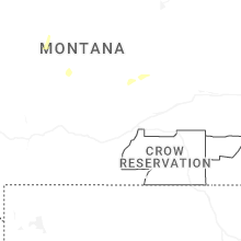
Montana
| Local Time | Report Details |
|---|---|
| 3:45 PM MDT | Quarter sized hail reported near Larslan, MT, 31.6 miles NNE of Glasgow, MT, hail up to the size of quarters in addition to heavy rain. |
| 3:57 PM MDT | Ping Pong Ball sized hail reported near Scobey, MT, 70.1 miles NE of Glasgow, MT, public report with photo via facebook. |
| 4:00 PM MDT | Wolf point n in roosevelt county MT, 40.5 miles E of Glasgow, MT |
| 6:10 PM MDT | Quarter sized hail reported near Froid, MT, 42.5 miles WNW of Williston, ND, pea to quarter sized hail. |
| 7:50 PM MDT | Winnett southwest (hydromet) statio in petroleum county MT, 81.9 miles N of Billings, MT |
| 8:40 PM MDT | Mosby se (hydromet) statio in garfield county MT, 89.7 miles NNE of Billings, MT |
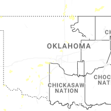
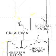
Oklahoma
| Local Time | Report Details |
|---|---|
| 5:30 PM CDT | Trees down on richland road between southwest 15th and ren in canadian county OK, 15.8 miles W of Oklahoma City, OK |
Alabama
| Local Time | Report Details |
|---|---|
| 5:56 PM CDT | Tree down across lynnbrook d in lauderdale county AL, 17.3 miles NW of Florence, AL |
Tennessee
| Local Time | Report Details |
|---|---|
| 7:30 PM EDT | Trees dow in roane county TN, 47.1 miles WSW of Knoxville, TN |
Illinois
| Local Time | Report Details |
|---|---|
| 6:49 PM CDT | Photos shared show two large tree limbs snapped off a tree near lovell street. time estimate in kane county IL, 45.9 miles W of Chicago, IL |
| 6:50 PM CDT | Power lines blown down on harter road. time estimate in kane county IL, 47.9 miles W of Chicago, IL |
| 6:59 PM CDT | Half dozen 911 calls for trees down in batavia. time estimte in kane county IL, 35 miles W of Chicago, IL |
| 6:59 PM CDT | Tree down on wires and wires on fire. time estimate in kane county IL, 35.8 miles WNW of Chicago, IL |
| 7:05 PM CDT | Tree limbs blown down into the roadway on green road. multiple power outages reported in the area. time estimate in kane county IL, 42.3 miles W of Chicago, IL |
| 7:05 PM CDT | Photo shared of a small tree limb blown down near geneva drive and kirk roa in kane county IL, 33.4 miles W of Chicago, IL |
| 7:09 PM CDT | Trees... tree limbs and power lines blown down in crystal lake. time estimate in mchenry county IL, 43.1 miles NW of Chicago, IL |
| 7:18 PM CDT | Trees blown down at route 72 and romke road. time estimate in kane county IL, 46.9 miles WNW of Chicago, IL |
| 7:22 PM CDT | Photos shared on social media showed half of a tree split and blown down... a deck awning partially collapsed and small tree limbs blown down. a tree was also reported in mchenry county IL, 41.3 miles WNW of Chicago, IL |
| 7:27 PM CDT | Light pole blown down at tekler and route 14. several 3 to 4 inch tree limbs blown down. one 8 inch diameter tree uprooted. time estimate in mchenry county IL, 42.7 miles NW of Chicago, IL |
Nebraska
| Local Time | Report Details |
|---|---|
| 6:50 PM CDT | Quarter sized hail reported near Du Bois, NE, 66.2 miles NNE of Manhattan, KS |
Connect with Interactive Hail Maps