

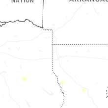
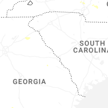
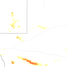
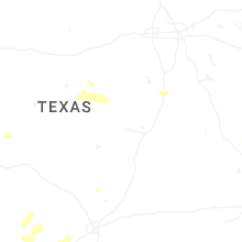
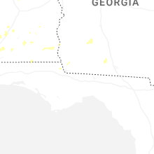
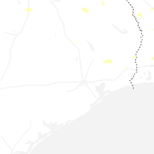
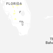
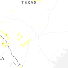
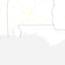
Hail Map for Tuesday, June 10, 2025

Number of Impacted Households on 6/10/2025
0
Impacted by 1" or Larger Hail
0
Impacted by 1.75" or Larger Hail
0
Impacted by 2.5" or Larger Hail
Square Miles of Populated Area Impacted on 6/10/2025
0
Impacted by 1" or Larger Hail
0
Impacted by 1.75" or Larger Hail
0
Impacted by 2.5" or Larger Hail

Cities Most Affected by Hail Storms of 6/10/2025
| Hail Size | Demographics of Zip Codes Affected | ||||||
|---|---|---|---|---|---|---|---|
| City | Count | Average | Largest | Pop Density | House Value | Income | Age |
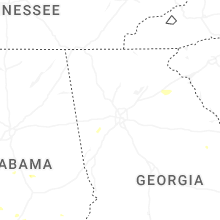
Hail and Wind Damage Spotted on 6/10/2025
Filter by Report Type:Hail ReportsWind Reports
States Impacted
Georgia, South Carolina, North Carolina, Texas, Louisiana, Mississippi, New York, Alabama, New Mexico, Florida, Oklahoma, MontanaGeorgia
| Local Time | Report Details |
|---|---|
| 8:21 AM EDT | Tree down on old portal r in bulloch county GA, 60.4 miles NW of Savannah, GA |
| 8:25 AM EDT | Tree down on cypress lake rd at country club r in bulloch county GA, 49.3 miles WNW of Savannah, GA |
| 8:29 AM EDT | Tree down on arcola rd at hwy 2 in bulloch county GA, 34.8 miles WNW of Savannah, GA |
| 9:21 AM EDT | Power lines down on walthour r in chatham county GA, 8.6 miles SE of Savannah, GA |
| 3:38 PM EDT | A tree was reported down in the 1500 block of lockridge driv in forsyth county GA, 34.5 miles NNE of Atlanta, GA |
| 4:36 PM EDT | A tree was reported down across bill rutledge road near matthews school roa in barrow county GA, 39.6 miles ENE of Atlanta, GA |
| 8:57 PM EDT | Burke county dispatch reported powerlines down at 1071 hwy 80 in burke county. time estimated based on rada in burke county GA, 27.4 miles SSW of Augusta, GA |
| 9:03 PM EDT | Burke county dispatch reported a tree down along herndon rd. time estimated based on rada in burke county GA, 32.6 miles S of Augusta, GA |
South Carolina
| Local Time | Report Details |
|---|---|
| 9:18 AM EDT | Tree down on forest ave at wise s in jasper county SC, 27.6 miles NNE of Savannah, GA |
| 9:21 AM EDT | Tree down on honey hill circle at old house r in jasper county SC, 28.9 miles NNE of Savannah, GA |
| 9:21 AM EDT | Tree down on speed limit rd at uncle jims lan in hampton county SC, 46.9 miles N of Savannah, GA |
| 9:22 AM EDT | Tree down on rivers hill r in jasper county SC, 40.6 miles N of Savannah, GA |
| 9:25 AM EDT | Tree down on coosaw scenic dr at salzburg r in jasper county SC, 29.5 miles NNE of Savannah, GA |
| 9:30 AM EDT | Tree down on henderson rd at yemassee hw in hampton county SC, 49.8 miles N of Savannah, GA |
| 9:32 AM EDT | Tree down on hwy 68 at grays hw in hampton county SC, 51 miles N of Savannah, GA |
| 9:34 AM EDT | Tree down on possum corner at yemassee hw in hampton county SC, 47.1 miles NNE of Savannah, GA |
| 9:37 AM EDT | Tree down on old sheldon church rd at bailey r in beaufort county SC, 41.4 miles NNE of Savannah, GA |
| 9:40 AM EDT | Tree down at wash farm rd near trask pkw in beaufort county SC, 40.1 miles NNE of Savannah, GA |
| 9:40 AM EDT | Tree down on henderson rd at old salkehatchie r in hampton county SC, 53.1 miles N of Savannah, GA |
| 9:41 AM EDT | 10-12 inch diameter hardwood limb snapped off by thunderstorm win in beaufort county SC, 19.7 miles NE of Savannah, GA |
| 9:53 AM EDT | Tree down on mable t willis blv in colleton county SC, 45 miles WSW of Charleston, SC |
| 9:53 AM EDT | Tree down at bells hwy and stokes r in colleton county SC, 45.2 miles WSW of Charleston, SC |
| 9:53 AM EDT | Tree down at stormy ln and bells hw in colleton county SC, 44.4 miles WSW of Charleston, SC |
| 10:01 AM EDT | Tree and power lines down on featherbed r in colleton county SC, 40.2 miles SW of Charleston, SC |
| 10:10 AM EDT | Tree and power lines down on chinese dog run ln at bama r in colleton county SC, 33.1 miles SW of Charleston, SC |
| 10:40 AM EDT | Tree down on fickling hill rd at brownswood r in charleston county SC, 30.9 miles S of Charleston, SC |
| 10:50 AM EDT | 911 dispatch reported large tree down on power line in charleston county SC, 26.9 miles SSE of Charleston, SC |
| 11:08 AM EDT | The capers nearshore buoy reported a wind gust of 56 knot in amz350 county SC, 34.7 miles SE of Charleston, SC |
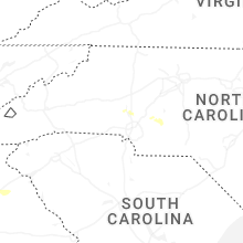
North Carolina
| Local Time | Report Details |
|---|---|
| 1:39 PM EDT | Storm damage reported in new hanover county NC, 3.4 miles NNE of Wilmington, NC |
| 2:10 PM EDT | Multiple power outages reported across southern onslow county by jones onslow emc. time estimated from rada in onslow county NC, 31.4 miles NE of Wilmington, NC |
| 2:24 PM EDT | Report of a downed tree on a home near the cedar creek are in cumberland county NC, 54.5 miles S of Raleigh, NC |
| 2:45 PM EDT | Carteret-craven electric coop reports approximately 133 power outages between emerald isle and cape carteret... with most of the outages on emerald isl in carteret county NC, 60 miles ENE of Wilmington, NC |
| 6:35 PM EDT | Utility company reports power outages due to fallen trees and large limbs damaging equipmen in cabarrus county NC, 17.9 miles NNE of Charlotte, NC |
| 7:51 PM EDT | Half Dollar sized hail reported near Mount Pleasant, NC, 28.6 miles ENE of Charlotte, NC, quarter to half dollar size hail observed. additionally... tree blown down in yard. |
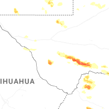
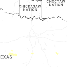
Texas
| Local Time | Report Details |
|---|---|
| 1:01 PM CDT | Half Dollar sized hail reported near Andrews, TX, 35 miles NNW of Odessa, TX, andrews police department measured 1.25 inch hail. |
| 3:43 PM CDT | Ping Pong Ball sized hail reported near Marfa, TX, 27.4 miles WSW of Alpine, TX, quarter to ping pong ball sized hail reported by storm chaser near rm 169 and us 67. |
| 4:00 PM CDT | Storm damage reported in presidio county TX, 30.2 miles SW of Alpine, TX |
| 4:22 PM CDT | Storm damage reported in brewster county TX, 56.2 miles SSE of Alpine, TX |
| 4:37 PM CDT | Mesonet station 60 pine springs gmn in culberson county TX, 99.1 miles E of El Paso, TX |
| 4:45 PM CDT | Estimated 70mph winds accompanied by small hai in terrell county TX, 77.1 miles E of Alpine, TX |
| 5:01 PM CDT | Awos station k6r6 5 w dryden recorded a storm-related gust of 93mp in terrell county TX, 89.6 miles ESE of Alpine, TX |
| 5:40 PM CDT | Mesonet station twb49 11.2 ne van horn (twdb in culberson county TX, 85.4 miles NW of Alpine, TX |
| 6:08 PM CDT | Storm damage reported in pecos county TX, 49.9 miles NE of Alpine, TX |
| 6:38 PM CDT | Mesonet station ur144 14.1 sw toyah (upr in reeves county TX, 60.1 miles NNW of Alpine, TX |
| 6:39 PM CDT | Storm damage reported in brewster county TX, 27.4 miles ENE of Alpine, TX |
| 6:43 PM CDT | Mesonet station ur249 6.7 e langtry (upr in val verde county TX, 44.7 miles NW of Del Rio, TX |
| 7:00 PM CDT | Mesonet station twb98 gray ranc in val verde county TX, 42.5 miles NNW of Del Rio, TX |
| 7:05 PM CDT | Mesonet station twb47 13.9 se toyah lake (twdb in reeves county TX, 59.1 miles NNE of Alpine, TX |
| 7:35 PM CDT | Storm damage reported in ward county TX, 36.6 miles WSW of Odessa, TX |
| 7:50 PM CDT | Storm damage reported in pecos county TX, 58.9 miles NE of Alpine, TX |
| 8:23 PM CDT | Asos station kdrt del rio intl airpor in val verde county TX, 2.2 miles WNW of Del Rio, TX |
| 9:20 PM CDT | Emergency manager reports tree limbs down and power outage in maverick county TX, 51.2 miles SSE of Del Rio, TX |
| 10:15 PM CDT | Mesonet station tw101 camp eagl in real county TX, 70.5 miles NE of Del Rio, TX |
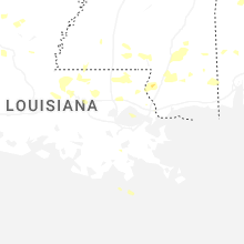
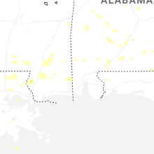
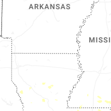
Louisiana
| Local Time | Report Details |
|---|---|
| 2:24 PM CDT | Sheriffs office reported a tree down on south ochsner road near rober in tangipahoa county LA, 40.8 miles NNW of New Orleans, LA |
| 3:03 PM CDT | Quarter sized hail reported near Baton Rouge, LA, 61.9 miles ENE of Lafayette, LA, video on social media showed hail up to quarter size. |
| 3:19 PM CDT | Picture of large tree partially on a home northeast of walker shared by broadcast medi in livingston county LA, 61.4 miles NW of New Orleans, LA |
| 3:21 PM CDT | Sheriffs office reported a tree down on east walker roa in tangipahoa county LA, 62.4 miles NNW of New Orleans, LA |
| 3:23 PM CDT | Sheriffs office reported a tree down on james chapel road near highway 44 in livingston county LA, 49.5 miles NW of New Orleans, LA |
| 3:23 PM CDT | Multiple trees down north of livingsto in livingston county LA, 59.8 miles NW of New Orleans, LA |
| 3:42 PM CDT | Sheriffs office reported a tree down on highway 430 near franklinto in washington county LA, 62.6 miles N of New Orleans, LA |
| 3:45 PM CDT | Sheriffs office reported a tree down on sylvest road near highway 1 in washington county LA, 59.4 miles N of New Orleans, LA |
| 3:49 PM CDT | Sheriffs office reported a tree down on highway 16... near jenkins road in washington county LA, 59.1 miles N of New Orleans, LA |
| 4:52 PM CDT | Knew asos reported a gust of 58 mp in orleans county LA, 6.6 miles NNE of New Orleans, LA |
Mississippi
| Local Time | Report Details |
|---|---|
| 2:37 PM CDT | Quarter sized hail reported near Carriere, MS, 54.3 miles NNE of New Orleans, LA, picture of hail estimated to be quarter sized west of mcneil. |
| 4:11 PM CDT | Broadcast media relayed a picture of trees down on a roadway in wiggins. time estimated via rada in stone county MS, 65.6 miles W of Mobile, AL |
| 6:11 PM CDT | Ship island mesonet measured a 58mph wind gus in gmz532 county MS, 63.6 miles WSW of Mobile, AL |
New York
| Local Time | Report Details |
|---|---|
| 3:43 PM EDT | Reports of multiple trees down and damage to roo in clinton county NY, 23.3 miles NNW of Burlington, VT |
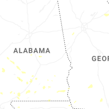
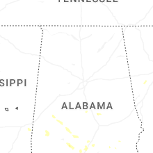
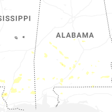
Alabama
| Local Time | Report Details |
|---|---|
| 3:19 PM CDT | Quarter sized hail reported near Brewton, AL, 54.7 miles NE of Mobile, AL, public reports quarter sized hail in pineview... al. time estimated via radar. |
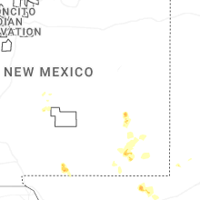
New Mexico
| Local Time | Report Details |
|---|---|
| 2:42 PM MDT | Quarter sized hail reported near Artesia, NM, 55.1 miles S of Roswell, NM, report of quarter sized hail near sever rivers... off of us hwy 285. |
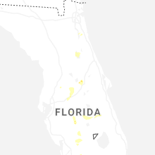
Florida
| Local Time | Report Details |
|---|---|
| 5:10 PM EDT | Delayed report. wind damage to barns... roof... and powerlines down. time estimated from radar. report found on social medi in st. johns county FL, 33.8 miles SSE of Jacksonville, FL |
| 5:10 PM EDT | Quarter sized hail reported near Saint Augustine, FL, 34.4 miles SSE of Jacksonville, FL, hail measuring up to one inch in diameter observed. |
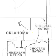
Oklahoma
| Local Time | Report Details |
|---|---|
| 5:31 PM CDT | Power poles downed... video from social media. time estimated from rada in tulsa county OK, 14.3 miles SE of Tulsa, OK |
| 5:31 PM CDT | Numerous tree damage in indian springs area. time estimated from rada in tulsa county OK, 16.5 miles SE of Tulsa, OK |
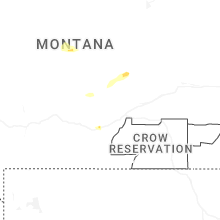
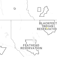
Montana
| Local Time | Report Details |
|---|---|
| 7:13 PM MDT | Half Dollar sized hail reported near Browning, MT, 61.9 miles ENE of Whitefish, MT, hail up to walnut size. |
| 7:18 PM MDT | Half Dollar sized hail reported near Browning, MT, 62.5 miles E of Whitefish, MT, browning bia reported large hail. location is estimated. |
Connect with Interactive Hail Maps