

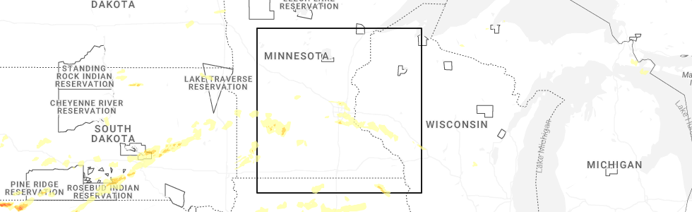
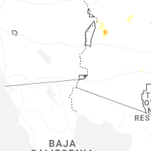
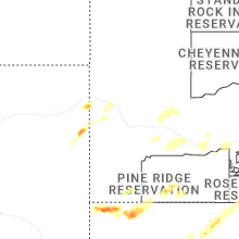
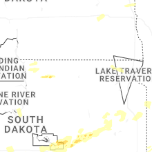
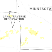
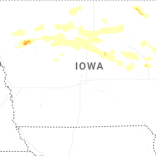
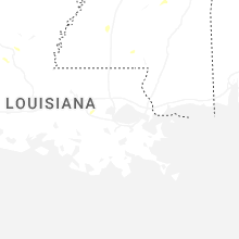
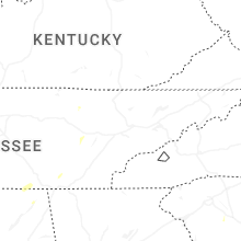
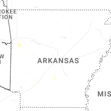
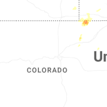
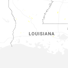
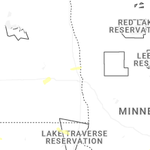
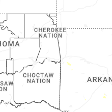
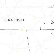
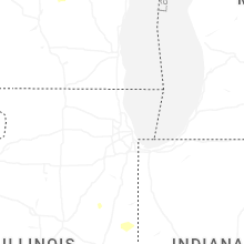
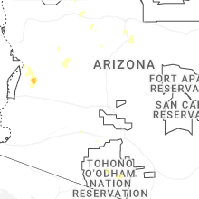
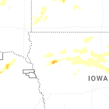
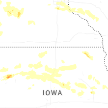
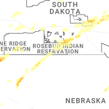
Hail Map for Friday, August 15, 2025
Number of Impacted Households on 8/15/2025
0
Impacted by 1" or Larger Hail
0
Impacted by 1.75" or Larger Hail
0
Impacted by 2.5" or Larger Hail
Square Miles of Populated Area Impacted on 8/15/2025
0
Impacted by 1" or Larger Hail
0
Impacted by 1.75" or Larger Hail
0
Impacted by 2.5" or Larger Hail
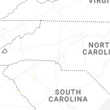
Cities Most Affected by Hail Storms of 8/15/2025
| Hail Size | Demographics of Zip Codes Affected | ||||||
|---|---|---|---|---|---|---|---|
| City | Count | Average | Largest | Pop Density | House Value | Income | Age |
Hail and Wind Damage Spotted on 8/15/2025
Filter by Report Type:Hail ReportsWind Reports
States Impacted
Nebraska, Iowa, Minnesota, Alabama, Texas, Utah, Nevada, Wyoming, Wisconsin, Idaho, Illinois, South DakotaNebraska
| Local Time | Report Details |
|---|---|
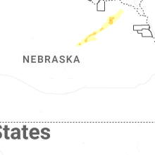
| 8:13 AM CDT | Quarter sized hail reported near Oakdale, NE, 42.2 miles SE of Oneill, NE |
| 8:58 AM CDT | Half Dollar sized hail reported near Osmond, NE, 56.5 miles E of Oneill, NE |
| 5:24 PM MDT | Mesonet station in montrose reported 68mph wind gusts between 4:24 and 5:24 p in sioux county NE, 73.1 miles N of Scottsbluff, NE |
| 7:20 PM MDT | Kcdr gusted 51 kts at 7:20p in dawes county NE, 73.4 miles NNE of Scottsbluff, NE |
| 7:22 PM MDT | Kcdr reported a wind gust of 63 mph with sustained winds around 40 mph at the tim in dawes county NE, 73.4 miles NNE of Scottsbluff, NE |
| 8:04 PM MDT | Tree branches broken... estimated 60 mph win in sheridan county NE, 83.3 miles SSE of Rapid City, SD |
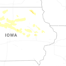
Iowa
| Local Time | Report Details |
|---|---|
| 12:12 PM CDT | Ping Pong Ball sized hail reported near Holstein, IA, 18.8 miles WSW of Storm Lake, IA, hail not quite as large as golf balls. time estimated from radar. |
| 1:20 PM CDT | Quarter sized hail reported near Holstein, IA, 20.4 miles WSW of Storm Lake, IA, public report of quarter sized hail ongoing in holstein at at 1320 on 15 aug 2025. corroborated time and likelihood of hail with radar. |
| 2:05 PM CDT | Report of trees down in belmond. time estimated from rada in wright county IA, 29.1 miles SW of Mason City, IA |
| 2:30 PM CDT | Trees and power lines down. time estimate in franklin county IA, 28.1 miles S of Mason City, IA |
| 2:40 PM CDT | Tree down on a power line. time estimate in butler county IA, 24.1 miles SSE of Mason City, IA |
| 2:40 PM CDT | Trees down. time estimate in butler county IA, 29.8 miles SSE of Mason City, IA |
| 2:45 PM CDT | Quarter sized hail reported near Dumont, IA, 29.8 miles SSE of Mason City, IA |
| 3:05 PM CDT | Report of a tree down in tow in butler county IA, 37 miles SE of Mason City, IA |
| 3:45 PM CDT | 6-8 inch branches down. bean crops flattened. pea sized hail. time estimate in hardin county IA, 48.6 miles SSW of Mason City, IA |
| 4:00 PM CDT | Trees down at campground. one camper was blown off of its blocks. large tree limb fell on a truck. large metal shed with door damage. time estimated from rada in hardin county IA, 51.9 miles S of Mason City, IA |
| 4:59 PM CDT | Measured by a personal weather station. reports of trees down in town as wel in black hawk county IA, 35.2 miles NW of Cedar Rapids, IA |
| 5:10 PM CDT | Report of 60+ mph winds. time estimated by rada in benton county IA, 26.8 miles WNW of Cedar Rapids, IA |
| 5:15 PM CDT | Pw in benton county IA, 22.3 miles NW of Cedar Rapids, IA |
| 5:16 PM CDT | Pw in buchanan county IA, 35.8 miles NNW of Cedar Rapids, IA |
| 5:17 PM CDT | Pw in benton county IA, 16.8 miles W of Cedar Rapids, IA |
| 5:21 PM CDT | Pw in benton county IA, 19 miles WNW of Cedar Rapids, IA |
| 5:22 PM CDT | Pw in benton county IA, 15.6 miles WNW of Cedar Rapids, IA |
| 5:30 PM CDT | Pw in linn county IA, 6.6 miles NNE of Cedar Rapids, IA |
| 5:36 PM CDT | Pw in iowa county IA, 12.4 miles SW of Cedar Rapids, IA |
| 5:37 PM CDT | Storm damage reported in linn county IA, 6.2 miles SSW of Cedar Rapids, IA |
| 5:40 PM CDT | Ping Pong Ball sized hail reported near Cedar Rapids, IA, 2.9 miles W of Cedar Rapids, IA |
| 5:41 PM CDT | Storm damage reported in linn county IA, 4.4 miles W of Cedar Rapids, IA |
| 5:44 PM CDT | Several large branches down. dime size hail to in linn county IA, 6.5 miles NE of Cedar Rapids, IA |
| 5:54 PM CDT | Pw in linn county IA, 5.4 miles SE of Cedar Rapids, IA |
| 5:59 PM CDT | Storm damage reported in johnson county IA, 24.1 miles SSE of Cedar Rapids, IA |
| 6:01 PM CDT | Large tree limbs down along nearby roadway in johnson county IA, 20 miles S of Cedar Rapids, IA |
| 6:06 PM CDT | Downed tree approx. 2-2.5 ft diameter acros in johnson county IA, 16.9 miles SSE of Cedar Rapids, IA |
| 6:28 PM CDT | Downed tree approx 1.5 ft diameter on melrose ave @ mormon trek... iowa cit in johnson county IA, 22.5 miles SSE of Cedar Rapids, IA |
| 1:13 AM CDT | Quarter sized hail reported near Calmar, IA, 53.3 miles SW of La Crosse, WI |
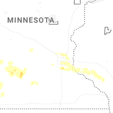
Minnesota
| Local Time | Report Details |
|---|---|
| 12:14 PM CDT | 4 medium to large trees down... one uprooted with the full root ball. one tree fell on garage. time estimated from rada in aitkin county MN, 57.7 miles W of Duluth, MN |
| 4:44 PM CDT | Half Dollar sized hail reported near Victoria, MN, 20.6 miles WSW of Minneapolis, MN |
| 4:51 PM CDT | Half Dollar sized hail reported near Waconia, MN, 22.4 miles WSW of Minneapolis, MN |
| 4:52 PM CDT | Half Dollar sized hail reported near Victoria, MN, 20.9 miles WSW of Minneapolis, MN |
| 4:53 PM CDT | Half Dollar sized hail reported near Saint Paul, MN, 17.3 miles ESE of Minneapolis, MN, relayed through spotter network. |
| 5:02 PM CDT | Quarter sized hail reported near Rogers, MN, 20.7 miles NW of Minneapolis, MN, just northeast of i-94 and highway 101. |
| 5:17 PM CDT | Quarter sized hail reported near Champlin, MN, 15.4 miles NNW of Minneapolis, MN |
| 5:20 PM CDT | Trees and power lines down. extent unknow in washington county MN, 25.8 miles SE of Minneapolis, MN |
| 5:28 PM CDT | Quarter sized hail reported near Eden Valley, MN, 62.5 miles ENE of Montevideo, MN |
| 5:29 PM CDT | Quarter sized hail reported near Minneapolis, MN, 11.1 miles NNW of Minneapolis, MN |
| 5:55 PM CDT | Half Dollar sized hail reported near Burnsville, MN, 15.9 miles S of Minneapolis, MN, hail was photographed near county roads 42 and 5. hailed for five minutes. time based on radar. |
| 5:55 PM CDT | Half Dollar sized hail reported near Circle Pines, MN, 12.9 miles NNE of Minneapolis, MN, photo sent via facebook. |
| 6:06 PM CDT | Quarter sized hail reported near Burnsville, MN, 17.2 miles S of Minneapolis, MN |
| 6:12 PM CDT | Half Dollar sized hail reported near Saint Paul, MN, 18.2 miles S of Minneapolis, MN, hail was photographed. |
| 4:06 AM CDT | Quarter sized hail reported near Lake Wilson, MN, 54.5 miles NE of Sioux Falls, SD, report from mping: quarter (1.00 in.). |
| 4:37 AM CDT | Awos station kmml marshall municipal airpor in lyon county MN, 35 miles S of Montevideo, MN |
| 4:40 AM CDT | Mesonet station mn059 t.h.212 - marietta - mp in lac qui parle county MN, 35.4 miles W of Montevideo, MN |
| 4:44 AM CDT | Storm damage reported in yellow medicine county MN, 30.7 miles WSW of Montevideo, MN |
| 4:45 AM CDT | Mesonet station mn059 t.h.212 - marietta - mp in lac qui parle county MN, 35.4 miles W of Montevideo, MN |
| 4:50 AM CDT | Mesonet station mn160 u.s.14 - florence - mp 21. in lyon county MN, 51.8 miles SSW of Montevideo, MN |
| 5:00 AM CDT | A 63 mph wind gust was recorded on a personal weather station just northeast of minneot in lyon county MN, 27 miles SSW of Montevideo, MN |
| 5:09 AM CDT | A 70 mph wind gust has been recorded at marshall regional airport (kmml in lyon county MN, 35 miles S of Montevideo, MN |
| 5:15 AM CDT | Awos station kgdb granite falls a in yellow medicine county MN, 16.2 miles SSE of Montevideo, MN |
| 5:20 AM CDT | Mesonet station mn033 t.h.23 - hanley falls - mp 9 in yellow medicine county MN, 18.8 miles SSE of Montevideo, MN |
| 5:58 AM CDT | An emergency manager reported major tree damage across the city of marshall with several downed trees blocking roadway in lyon county MN, 34.8 miles S of Montevideo, MN |
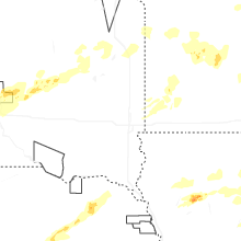
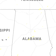
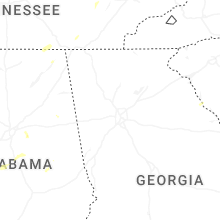
Alabama
| Local Time | Report Details |
|---|---|
| 1:40 PM CDT | Multiple reports of trees down in the area of hwy 25 nw of vincen in shelby county AL, 21.2 miles ESE of Birmingham, AL |
| 4:02 PM CDT | Large construction materials from construction site and large tree branches blown across bradford rd near intersection with wynn driv in madison county AL, 58 miles E of Florence, AL |
| 4:06 PM CDT | Large tree branches down on voyager way n in madison county AL, 56.9 miles E of Florence, AL |
| 4:46 PM CDT | Tree blocking both lanes of cr 175 at this locatio in jackson county AL, 48.6 miles W of Chattanooga, TN |
Texas
| Local Time | Report Details |
|---|---|
| 3:25 PM CDT | Storm damage reported in travis county TX, 64 miles S of Killeen, TX |
Utah
| Local Time | Report Details |
|---|---|
| 3:44 PM MDT | Mesonet station clfu1 clifton fla in tooele county UT, 80.4 miles NE of Ely, NV |
| 5:00 PM MDT | Mesonet station ut107 i-80 at mp 10 in salt lake county UT, 13.8 miles W of Salt Lake City, UT |
| 6:05 PM MDT | Mesonet station dpg31 west granit in tooele county UT, 87.3 miles WSW of Salt Lake City, UT |
| 6:15 PM MDT | Mesonet station dpg12 juliet roa in tooele county UT, 79.3 miles SW of Salt Lake City, UT |
| 6:55 PM MDT | Mesonet station dpg10 baker la in tooele county UT, 71.8 miles WSW of Salt Lake City, UT |
Nevada
| Local Time | Report Details |
|---|---|
| 2:53 PM PDT | Station id: up994 name: ola elevation: 4408 fee in elko county NV, 88.3 miles E of Elko, NV |
Wyoming
| Local Time | Report Details |
|---|---|
| 4:00 PM MDT | Asos station kriw riverton airport station elevation: 5509 f in fremont county WY, 5.5 miles NW of Riverton, WY |
| 5:18 PM MDT | Quarter sized hail reported near Newcastle, WY, 44.8 miles W of Rapid City, SD |
| 5:18 PM MDT | Storm damage reported in weston county WY, 44.8 miles W of Rapid City, SD |
Wisconsin
| Local Time | Report Details |
|---|---|
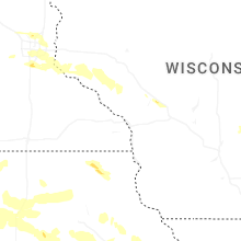
| 5:15 PM CDT | Few trees dow in pepin county WI, 66.8 miles NNW of La Crosse, WI |
| 5:25 PM CDT | Trees and power lines dow in pierce county WI, 28.2 miles SE of Minneapolis, MN |
Idaho
| Local Time | Report Details |
|---|---|
| 5:00 PM MDT | Mesonet station 2977 d5 arbon valley i-8 in power county ID, 52.5 miles SW of Idaho Falls, ID |
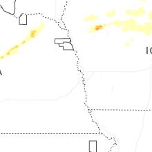
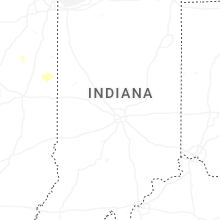
Illinois
| Local Time | Report Details |
|---|---|
| 7:05 PM CDT | Photos received on social media of a large tree downed on a powerline in moline. location and time estimated by rada in rock island county IL, 68.4 miles ESE of Cedar Rapids, IA |
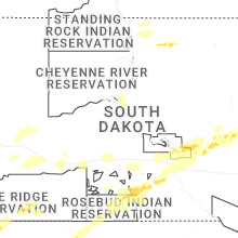
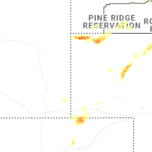
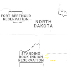
South Dakota
| Local Time | Report Details |
|---|---|
| 7:15 PM MDT | Storm damage reported in lawrence county SD, 47.9 miles NW of Rapid City, SD |
| 7:20 PM MDT | Storm damage reported in oglala lakota county SD, 62.7 miles S of Rapid City, SD |
| 8:00 PM MDT | Sdsu mesonet in meade county SD, 22.4 miles ENE of Rapid City, SD |
| 8:03 PM MDT | Storm damage reported in oglala lakota county SD, 80.9 miles SSE of Rapid City, SD |
| 8:35 PM MDT | Storm damage reported in pennington county SD, 51.3 miles ESE of Rapid City, SD |
| 9:39 PM MDT | Storm damage reported in haakon county SD, 68.9 miles ENE of Rapid City, SD |
| 10:17 PM MDT | Storm damage reported in haakon county SD, 54.5 miles W of Pierre, SD |
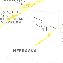
| 12:50 AM CDT | Sdsu mesonet in todd county SD, 24.1 miles NNW of Valentine, NE |
| 12:55 AM CDT | Sdsu mesonet in todd county SD, 24.1 miles NNW of Valentine, NE |
| 1:14 AM CDT | Storm damage reported in tripp county SD, 43.1 miles NE of Valentine, NE |
| 1:29 AM CDT | Storm damage reported in tripp county SD, 50.3 miles NE of Valentine, NE |
| 1:50 AM CDT | Sdsu mesonet in tripp county SD, 62.5 miles SSE of Pierre, SD |
| 1:52 AM CDT | Mesonet station 283 sd rwis dixo in gregory county SD, 66.5 miles ENE of Valentine, NE |
| 1:55 AM CDT | Mesonet station grms2 gregory 16n (sd mesonet in gregory county SD, 69.2 miles NE of Valentine, NE |
| 1:55 AM CDT | Mesonet station 54 reliance (sddot in lyman county SD, 53.2 miles SE of Pierre, SD |
| 1:56 AM CDT | Storm damage reported in lyman county SD, 64.1 miles SE of Pierre, SD |
| 2:00 AM CDT | Mesonet station ocms2 oacoma 2w (sd mesonet in lyman county SD, 60.7 miles SE of Pierre, SD |
| 2:02 AM CDT | Recorded via personal weather station in chamberlai in brule county SD, 63.7 miles SE of Pierre, SD |
| 2:12 AM CDT | Via personal weather statio in brule county SD, 63.2 miles SE of Pierre, SD |
| 2:15 AM CDT | Asos station k9v9 chamberlain municipal airpor in brule county SD, 65.9 miles SE of Pierre, SD |
| 2:18 AM CDT | Via personal weather statio in brule county SD, 82.9 miles ESE of Pierre, SD |
| 2:19 AM CDT | Mesonet station 25 sd rwis kimbal in brule county SD, 81.7 miles ESE of Pierre, SD |
| 2:30 AM CDT | Mesonet station wtes2 white lake (sd mesonet in aurora county SD, 87.9 miles N of Oneill, NE |
| 2:30 AM CDT | Via personal weather statio in brule county SD, 75.3 miles ESE of Pierre, SD |
| 2:33 AM CDT | Via personal weather statio in brule county SD, 82.9 miles ESE of Pierre, SD |
| 2:39 AM CDT | Mesonet station 214 sd rwis plankinto in aurora county SD, 86.5 miles N of Oneill, NE |
| 2:43 AM CDT | Via personal weather statio in aurora county SD, 87.3 miles W of Sioux Falls, SD |
| 2:47 AM CDT | Mesonet station 201 gann valley (sddot in buffalo county SD, 70.4 miles ESE of Pierre, SD |
| 2:51 AM CDT | Mesonet station 305 sd rwis lan in jerauld county SD, 93.3 miles WNW of Sioux Falls, SD |
| 3:00 AM CDT | Mesonet station lcms2 letcher 2ene (sd mesonet in sanborn county SD, 73.2 miles WNW of Sioux Falls, SD |
| 3:06 AM CDT | Mesonet station 305 sd rwis lan in jerauld county SD, 93.3 miles WNW of Sioux Falls, SD |
| 3:08 AM CDT | Asos station kmhe mitchell municipal airpor in davison county SD, 67.4 miles WNW of Sioux Falls, SD |
| 3:15 AM CDT | Recorded at khon aso in beadle county SD, 74.9 miles S of Aberdeen, SD |
| 3:34 AM CDT | Mesonet station 297 sd rwis howar in miner county SD, 52 miles NW of Sioux Falls, SD |
| 3:53 AM CDT | Mesonet station 262 4w bryant (sddot in clark county SD, 75.6 miles SE of Aberdeen, SD |
| 3:57 AM CDT | Mesonet station 162 sd rwis arlingto in kingsbury county SD, 55.8 miles NNW of Sioux Falls, SD |
| 4:08 AM CDT | Mesonet station 318 4 wsw stone bridge (sddot in hamlin county SD, 73.8 miles WSW of Montevideo, MN |
| 4:18 AM CDT | Mesonet station 47 brandt (sddot in deuel county SD, 57.8 miles WSW of Montevideo, MN |
| 4:18 AM CDT | Asos station katy watertown muni a in codington county SD, 70.4 miles W of Montevideo, MN |
| 4:22 AM CDT | Mesonet station 224 sd rwis war in moody county SD, 41.8 miles N of Sioux Falls, SD |
| 4:32 AM CDT | Mesonet station 291 4n altamont (sddot in deuel county SD, 47.4 miles W of Montevideo, MN |
Connect with Interactive Hail Maps