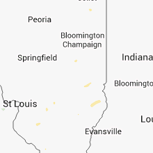
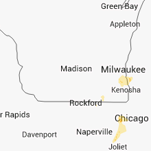
Hail Map for Saturday, October 5, 2013

Number of Impacted Households on 10/5/2013
0
Impacted by 1" or Larger Hail
0
Impacted by 1.75" or Larger Hail
0
Impacted by 2.5" or Larger Hail
Square Miles of Populated Area Impacted on 10/5/2013
0
Impacted by 1" or Larger Hail
0
Impacted by 1.75" or Larger Hail
0
Impacted by 2.5" or Larger Hail
Regions Impacted by Hail on 10/5/2013
Cities Most Affected by Hail Storms of 10/5/2013
| Hail Size | Demographics of Zip Codes Affected | ||||||
|---|---|---|---|---|---|---|---|
| City | Count | Average | Largest | Pop Density | House Value | Income | Age |
Hail and Wind Damage Spotted on 10/5/2013
Filter by Report Type:Hail ReportsWind Reports
Illinois
| Local Time | Report Details |
|---|---|
| 12:53 PM CDT | One ten foot long 3 inch diameter maple tree limb downe in st. clair county IL, 35.2 miles SE of Saint Louis, MO |
| 2:45 PM CDT | Late repor in jefferson county IL, 68.3 miles NNE of Cape Girardeau, MO |
| 3:52 PM CDT | Small tree limbs down south side of napervill in dupage county IL, 28.1 miles WSW of Chicago, IL |
| 3:54 PM CDT | Quarter sized hail reported near Bolingbrook, IL, 26.4 miles WSW of Chicago, IL, half mile west of route 53 bolingbrook. |
| 4:40 PM CDT | Storm damage reported in lake county IL, 29.5 miles NNW of Chicago, IL |
| 4:40 PM CDT | Small limbs dow in cook county IL, 20.4 miles WNW of Chicago, IL |
Indiana
| Local Time | Report Details |
|---|---|
| 3:40 PM EDT | One utility pole snapped at base... couple trees damaged... cornfields damaged... report received via twitter in warren county IN, 74.9 miles WNW of Indianapolis, IN |
| 5:35 PM EDT | Utility lines down on east clark road outside bruceville....relayed from brucevile fire chief to em.... time estimated via radar in knox county IN, 57.1 miles N of Evansville, IN |
| 5:40 PM EDT | Roof partially blown off a barn. also a few trees blown dow in owen county IN, 47.6 miles SW of Indianapolis, IN |
| 5:41 PM EDT | Numerous reports being received by knox co em about damage around freelandville regarding tree limbs down on homes and vehicle in knox county IN, 62.5 miles NNE of Evansville, IN |
| 5:41 PM EDT | Tree down...taking power lines with it in front of nursing home in knox county IN, 62.5 miles NNE of Evansville, IN |
| 12:00 AM CDT | Warrick dispatch reported a tree down across sr 61 between lynnville and boonville. social media reports tree limbs down in chandler. time estimate in warrick county IN, 11.5 miles ENE of Evansville, IN |
| 2:38 AM EDT | One tree down in orange county IN, 48.1 miles NW of Louisville, KY |
Kentucky
| Local Time | Report Details |
|---|---|
| 5:30 PM CDT | Wind gusts of 55 to 60 mph with some rotation noted in the clouds in carlisle county KY, 42 miles SE of Cape Girardeau, MO |
| 5:55 PM CDT | Wall cloud reported by spotters in western mccracken county in mccracken county KY, 52.4 miles ESE of Cape Girardeau, MO |
| 6:16 PM CDT | Non rotating wall cloud. no damage reported. no funnel clouds reporte in mccracken county KY, 52.4 miles ESE of Cape Girardeau, MO |


Connect with Interactive Hail Maps