Hail Map for Castle Rock, Colorado July 30, 2012
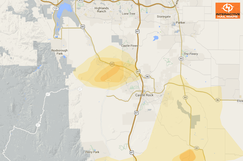
Hail Map for Castle Rock, Colorado July 30, 2012
Here is a map of the radar indicated hail around Castle Rock, Colorado on July 30, 2012. The most intense large hail hit just west of the city. Use Interactive Hail Maps to pinpoint hail storms nationwide. Scroll day to day and zoom all the way to […]
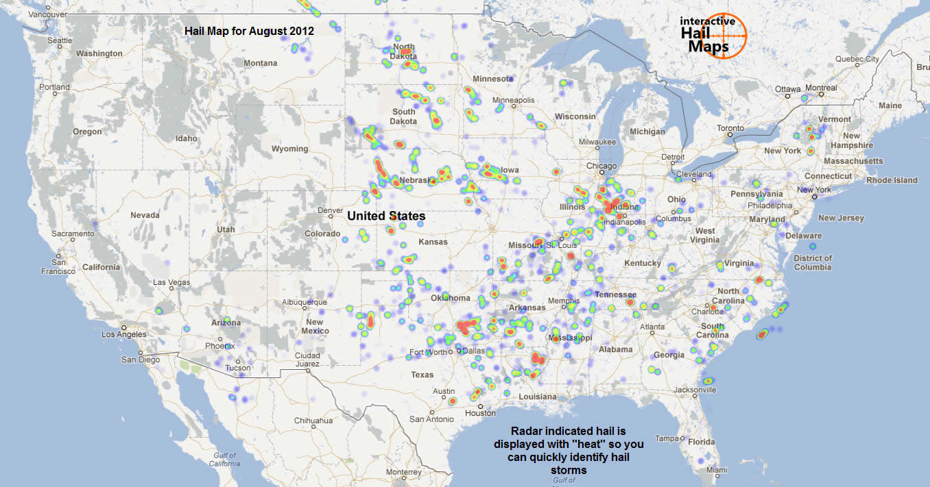
Hail Map for August 2012
Here is a map for all the hail that fell in the US in August 2012. The hail is displayed with “heat” so you can quickly identify the areas that had the most intense hail storms. When you subscribe to Interactive Hail Maps, you receive real time, unlimited access to every day’s map. You can […]
Hail Map Berwick, PA July 26, 2012
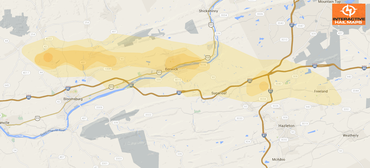
Hail Map Berwick, PA July 26, 2012
Here is a map for a hail storm that hit Berwick, PA on July 26, 2012. The green marker is a 1.00″ hail report. Use Interactive Hail Maps to pinpoint hail locations live. Find the smaller hail storms others are missing. Subscribe to Interactive Hail Maps to receive […]
Hail Map Northern Suburbs of Louisville, KY July 24, 2012
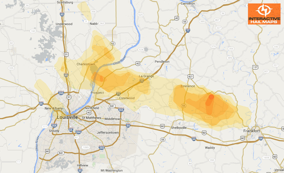
Hail Map Northern Suburbs of Louisville, KY July 24, 2012
Here is the hail map of the hail storm that hit just north of Louisville, KY on July 24, 2012. There were several reports of hail ranging from 1.00″ to 1.75″. Use Interactive Hail Maps to pinpoint hail nationwide and zoom all the way to street […]
Hail Map Rome, NY July 23, 2012
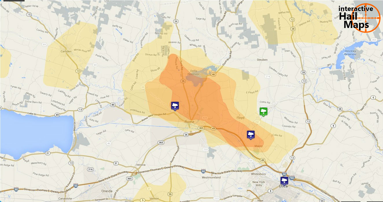
Hail Map Rome, NY July 23, 2012
Here is the hail map for Rome, New York on July 23, 2012. Use Interactive Hail Maps to pinpoint hail locations throughout the US and zoom all the way to street view.
Hail Map Lewiston, Idaho July 20, 2012
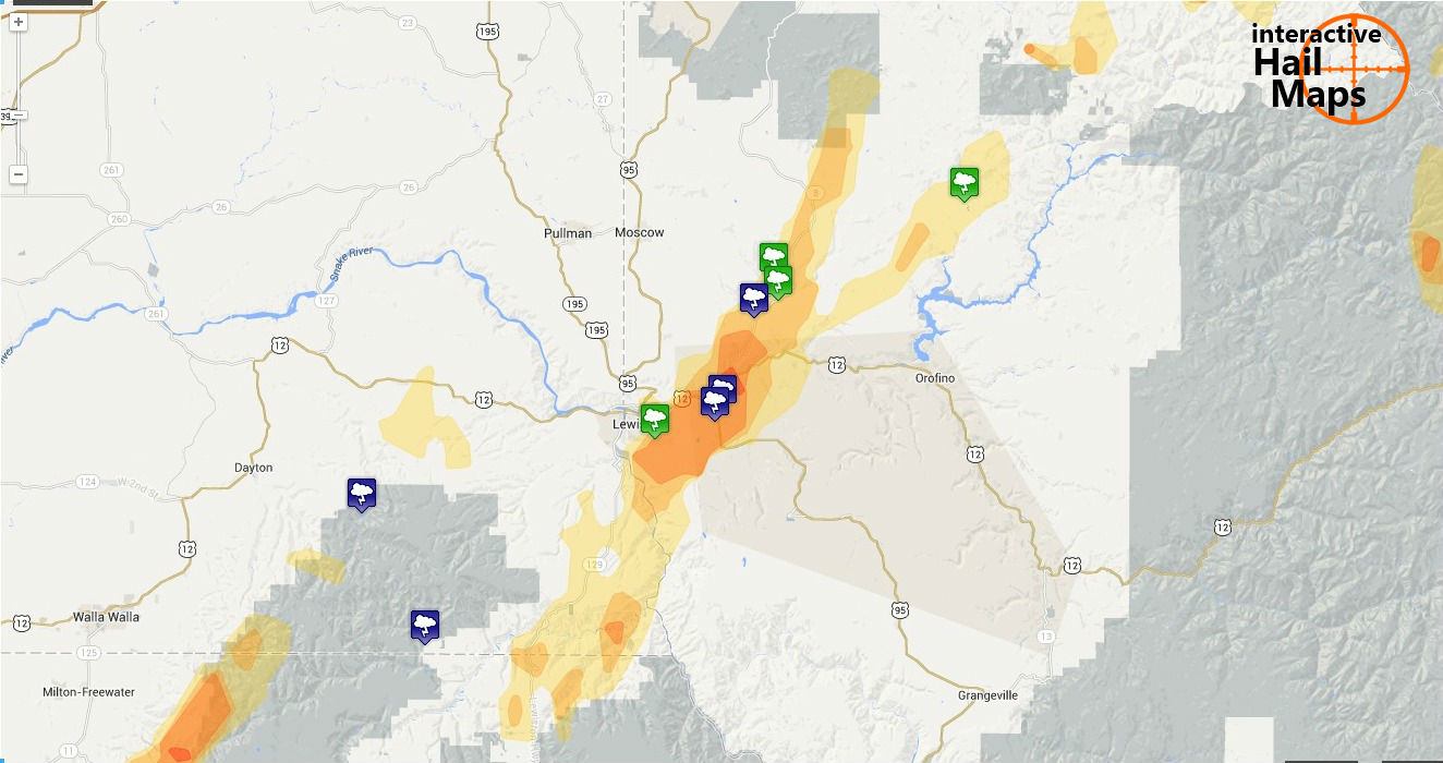
Hail Map Lewiston, Idaho July 20, 2012
Here is the maps of the hail that fell in Lewiston, Idaho July 20, 2012. Most of the hail was just east of the city. The largest and most intense hail is displayed in shades of yellow to help you zero in and pinpoint the hardest hit areas. Use […]
Hail Map Boston, MA and Providence, RI, July 18, 2012
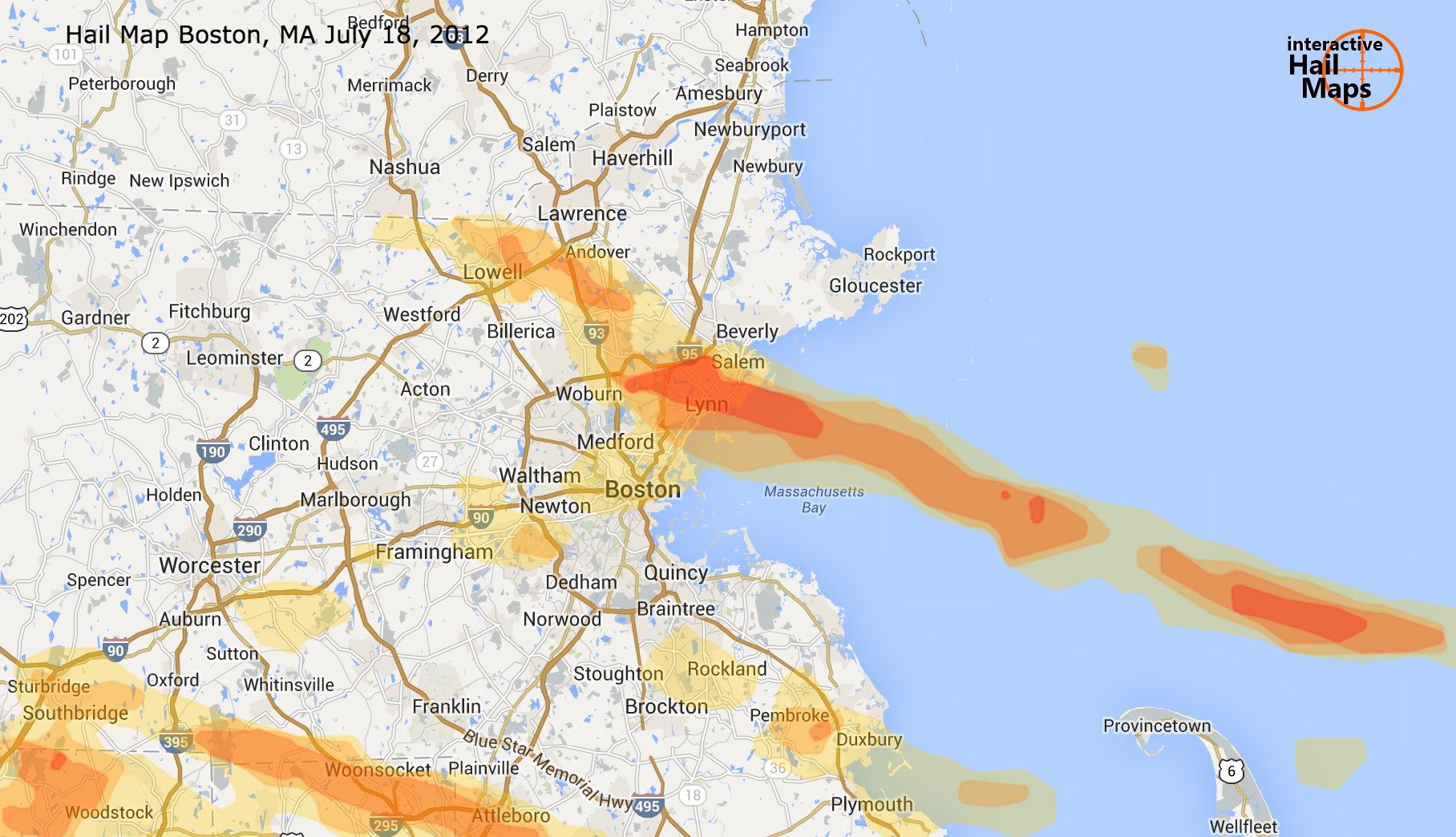
Hail Map Boston, MA and Providence, RI, July 18, 2012
Here is a map for the hail that fell near Boston, MA and Providence, RI on July 18, 2012. The large hail fell north of Boston in Lynn and mostly North of Providence. Click on the map for a larger view. Use […]
Hail Map Southern St. Louis July 8, 2012
Hail Map Southern St. Louis July 8, 2012
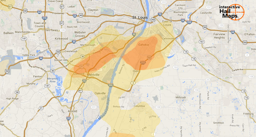
Here is a map for the hail that fell in southern St. Louis on July 8, 2012. The Blue markers are reports of 1.75 inch hail and the green marker is reported 1.00 inch hail. The blue hail swath is radar indicated severe hail. Use Interactive hail maps […]
Hail Map for Cary, North Carolina July 6, 2012
Hail Map for Cary, North Carolina July 6, 2012
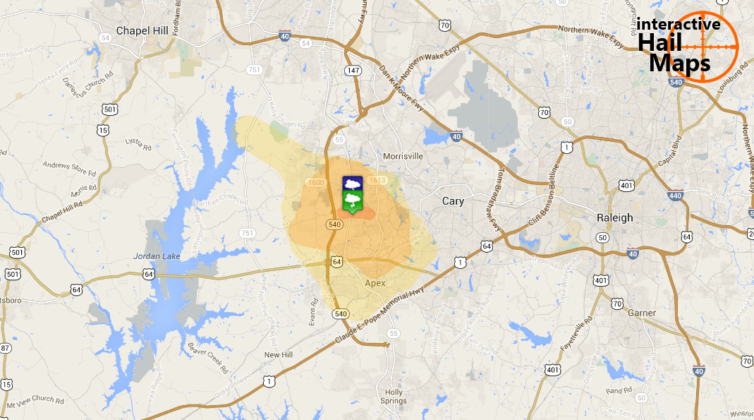
Here is the hail map for the hail that fell near Cary, NC on July 6, 2012. The green marker is quarter size hail reported and the blue marker is golfball hail reported. Use Interactive Hail Maps to find hail storms throughout the US.


